Search
You Searched For
Search Results
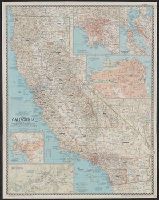
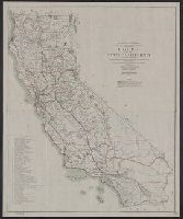
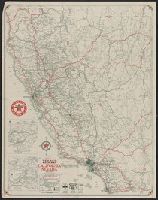
- Creator:
- National Geographic Society (U.S.). Cartographic Section
- Published / Created:
- 1954
- Call Number:
- 844 1954
- Container / Volume:
- BRBL_00603
- Image Count:
- 1
- Resource Type:
- Maps, Atlases & Globes
- Found in:
- Beinecke Rare Book and Manuscript Library > A map of California : with descriptive notes / compiled and drawn in the Cartographic Section of the National Geographic Society ; James M. Darley, chief cartographer.
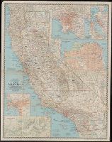
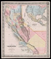
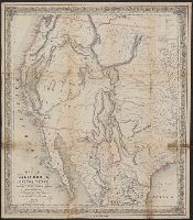
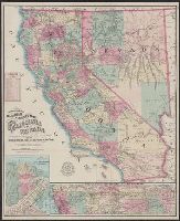
- Creator:
- Gibbes, Charles Drayton
- Published / Created:
- 1852
- Call Number:
- 844 1852A
- Container / Volume:
- BRBL_00601
- Image Count:
- 1
- Resource Type:
- Maps, Atlases & Globes
- Found in:
- Beinecke Rare Book and Manuscript Library > A new map of California / by Charles Drayton Gibbes, from his own and other recent surveys and explorations.
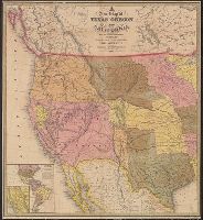
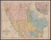
- Published / Created:
- 1849
- Call Number:
- 80 1849D
- Container / Volume:
- BRBL_00533
- Image Count:
- 1
- Resource Type:
- Maps, Atlases & Globes
- Found in:
- Beinecke Rare Book and Manuscript Library > A new map of Texas, Oregon, and California : with the regions adjoining.
- Creator:
- Ransom, Leander, 1800-1874
- Published / Created:
- 1863
- Call Number:
- 844 1863
- Container / Volume:
- BRBL_00602
- Image Count:
- 1
- Resource Type:
- Maps, Atlases & Globes
- Found in:
- Beinecke Rare Book and Manuscript Library > A new map of the state of California and Nevada Territory : exhibiting the rivers, lakes, bays and islands, with the principal towns, roads, railroads, and transit routes to the silver mining districts of Nevada Territory ... / carefully compiled ... by L
- Creator:
- Ransom, Leander, 1800-1874
- Published / Created:
- 1870
- Call Number:
- 844 1870
- Container / Volume:
- BRBL_00602
- Image Count:
- 1
- Resource Type:
- Maps, Atlases & Globes
- Found in:
- Beinecke Rare Book and Manuscript Library > A new map of the states of California and Nevada : exhibiting the rivers, lakes, bays, and islands, with the principal towns, roads, railroads and transit routes to the silver mining districts of Nevada Territory, also meridian, standard, range and townsh
- Creator:
- Ransom, Leander, 1800-1874
- Published / Created:
- 1867
- Call Number:
- 844 1867
- Container / Volume:
- BRBL_00602
- Image Count:
- 1
- Resource Type:
- Maps, Atlases & Globes
- Found in:
- Beinecke Rare Book and Manuscript Library > A new map of the states of California and Nevada : exhibiting the rivers, lakes, bays, and islands, with the principal towns, roads, railroads, and transit routes to the silver mining districts; also meridian, standard, range and township lines as establi
- Creator:
- H.H. Bancroft and Company
- Published / Created:
- 1864
- Call Number:
- 844 1864
- Container / Volume:
- BRBL_00602
- Image Count:
- 1
- Resource Type:
- Maps, Atlases & Globes
- Found in:
- Beinecke Rare Book and Manuscript Library > Bancroft's map of California, Nevada, Utah and Arizona.
- Creator:
- A.L. Bancroft & Company
- Published / Created:
- 1876
- Call Number:
- 844 1876D
- Container / Volume:
- BRBL_00603
- Image Count:
- 1
- Resource Type:
- Maps, Atlases & Globes
- Found in:
- Beinecke Rare Book and Manuscript Library > Bancroft's map of California, Nevada, Utah and Arizona.
- Published / Created:
- [1850?]
- Call Number:
- 844 1850A
- Container / Volume:
- BRBL_00601
- Image Count:
- 1
- Resource Type:
- Maps, Atlases & Globes
- Found in:
- Beinecke Rare Book and Manuscript Library > Californie aurifère : carte officielle, dressée d'aprés les ordres du Sénat, après l'annexion de cette province aux États-Unis / A. Girod, invt. ; Pellée, delt.
- Creator:
- Hartmann, Carl, b. 1796
- Published / Created:
- 1849
- Call Number:
- 844 1849E
- Container / Volume:
- BRBL_00601
- Image Count:
- 2
- Resource Type:
- Maps, Atlases & Globes
- Found in:
- Beinecke Rare Book and Manuscript Library > Californien.
- Creator:
- National Geographic Society (U.S.). Cartographic Division
- Published / Created:
- c1978.
- Call Number:
- 844 1978
- Container / Volume:
- BRBL_00603
- Image Count:
- 2
- Resource Type:
- Maps, Atlases & Globes
- Found in:
- Beinecke Rare Book and Manuscript Library > Close-up: U.S.A., California and Nevada / produced by the Cartographic Division, National Geographic Society ; William T. Peele, chief cartographer, David W. Cook, associate chief cartographer.
- Creator:
- National Geographic Society (U.S.). Cartographic Division
- Published / Created:
- c1974.
- Call Number:
- 844 1974
- Container / Volume:
- BRBL_00603
- Image Count:
- 2
- Resource Type:
- Maps, Atlases & Globes
- Found in:
- Beinecke Rare Book and Manuscript Library > Close-up: U.S.A., California and Nevada. Produced by the Cartographic Division, National Geographic Society. William T. Peele, chief cartographer, David W. Cook, associate chief cartographer.
- Creator:
- Colton, J. H. (Joseph Hutchins), 1800-1893
- Published / Created:
- [1855?]
- Call Number:
- 844 1855B
- Container / Volume:
- BRBL_00601
- Image Count:
- 2
- Resource Type:
- Maps, Atlases & Globes
- Found in:
- Beinecke Rare Book and Manuscript Library > Colton's California.
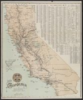
- Creator:
- Board of Railroad Commissioners of the State of California
- Published / Created:
- [1889?]
- Call Number:
- 844gme 1889
- Container / Volume:
- BRBL_00619
- Image Count:
- 1
- Resource Type:
- Maps, Atlases & Globes
- Found in:
- Beinecke Rare Book and Manuscript Library > Commissioners official railway map of California : completed to November 15th, 1889.
- Creator:
- National Geographic Society (U.S.). Cartographic Division
- Published / Created:
- 1984
- Call Number:
- 80 1984
- Container / Volume:
- BRBL_00536
- Image Count:
- 2
- Resource Type:
- Maps, Atlases & Globes
- Found in:
- Beinecke Rare Book and Manuscript Library > Far West / produced by the Cartographic Division, National Geographic Society.
- Creator:
- Johnson, A. J. (Alvin Jewett), 1827-1884
- Published / Created:
- [1866?]
- Call Number:
- 844 1866
- Container / Volume:
- BRBL_00602
- Image Count:
- 2
- Resource Type:
- Maps, Atlases & Globes
- Found in:
- Beinecke Rare Book and Manuscript Library > Johnson's California : with territories of Utah, Nevada, Colorado, New Mexico and Arizona.
- Creator:
- Eld, Henry, 1814-1850
- Published / Created:
- 1841 September 6 - October 29
- Call Number:
- WA MSS 161-162
- Collection Title:
- Henry Eld papers
- Container / Volume:
- Box 1 | Folder 1
- Image Count:
- 48
- Resource Type:
- Archives or Manuscripts
- Found in:
- Beinecke Rare Book and Manuscript Library > Journal of the overland expedition from the Willamette Mission, south of Vancouver, to San Francisco. Illustrated with 43 manuscript maps. Journal of the expedition to survey Gray’s Harbor and Shoalwater Bay.
- Call Number:
- Zc56 859so
- Collection Title:
- Charter and by-laws of the Sopori Land and Mining Company, incorporated by the state of Rhode
- Image Count:
- 1
- Resource Type:
- Maps, Atlases & Globes
- Found in:
- Beinecke Rare Book and Manuscript Library > Map of Arizona or the Gadsen Purchase with the position of its silver mines as now worked 1859
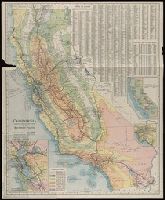
- Creator:
- Southern Pacific Company
- Published / Created:
- [1899?]
- Call Number:
- 844gme 1899
- Container / Volume:
- BRBL_00619
- Image Count:
- 2
- Resource Type:
- Maps, Atlases & Globes
- Found in:
- Beinecke Rare Book and Manuscript Library > Map of California / compiled from latest, official & authentic information, by the Southern Pacific Company.
- Creator:
- Southern Pacific Company
- Published / Created:
- [1913]
- Call Number:
- 844gme 1913
- Container / Volume:
- BRBL_00619
- Image Count:
- 2
- Resource Type:
- Maps, Atlases & Globes
- Found in:
- Beinecke Rare Book and Manuscript Library > Map of California : compiled from official and authentic sources / by the Southern Pacific.
- Creator:
- Leicht, F. von (Ferdinand von)
- Published / Created:
- 1874
- Call Number:
- 844 1874
- Container / Volume:
- BRBL_00602
- Image Count:
- 2
- Resource Type:
- Maps, Atlases & Globes
- Found in:
- Beinecke Rare Book and Manuscript Library > Map of California and Nevada / State Geological Survey of California ; drawn by F.v. Leicht and A. Craven.
- Creator:
- Tanner, Henry Schenck, 1786-1858
- Published / Created:
- 1849
- Call Number:
- 844 1849D
- Container / Volume:
- BRBL_00601
- Image Count:
- 1
- Resource Type:
- Maps, Atlases & Globes
- Found in:
- Beinecke Rare Book and Manuscript Library > Map of California, New Mexico, Texas &c.
- Creator:
- Colton, J. H. (Joseph Hutchins), 1800-1893
- Published / Created:
- 1849
- Call Number:
- 844 1849G
- Container / Volume:
- BRBL_00601
- Image Count:
- 1
- Resource Type:
- Maps, Atlases & Globes
- Found in:
- Beinecke Rare Book and Manuscript Library > Map of California, Oregon, Texas, and the territories adjoining, with routes &c.
- Creator:
- Hutawa, Julius
- Published / Created:
- 1863
- Call Number:
- 88 1863
- Container / Volume:
- BRBL_00646
- Image Count:
- 1
- Resource Type:
- Maps, Atlases & Globes
- Found in:
- Beinecke Rare Book and Manuscript Library > Map of Mexico & California / compiled from the latest authorities by Juls. Hutawa.
- Creator:
- House & Brown
- Published / Created:
- 1851
- Call Number:
- 88 1851
- Container / Volume:
- BRBL_00646
- Image Count:
- 1
- Resource Type:
- Maps, Atlases & Globes
- Found in:
- Beinecke Rare Book and Manuscript Library > Map of Mexico, Texas, old and new California, and Yucatan : showing the principal cities and towns, travelling routes, &c.
- Creator:
- House & Brown
- Published / Created:
- 1847?]
- Call Number:
- 88 1847J
- Container / Volume:
- BRBL_00645
- Image Count:
- 1
- Resource Type:
- Maps, Atlases & Globes
- Found in:
- Beinecke Rare Book and Manuscript Library > Map of Mexico, Texas, old and new California, and Yucatan : showing the principal cities and towns, travelling routes, &c.
- Creator:
- United States. General Land Office
- Published / Created:
- 1866
- Call Number:
- 844fcm 1866
- Container / Volume:
- BRBL_00615
- Image Count:
- 1
- Resource Type:
- Maps, Atlases & Globes
- Found in:
- Beinecke Rare Book and Manuscript Library > Map of public surveys in California & Nevada : to accompany report of Commissioner of the General Land Office, 1866.
- Creator:
- United States. Surveyor General
- Published / Created:
- 1854]
- Call Number:
- 844 1854
- Container / Volume:
- BRBL_00601
- Image Count:
- 1
- Resource Type:
- Maps, Atlases & Globes
- Found in:
- Beinecke Rare Book and Manuscript Library > Map of public surveys in California : to accompany report of Surveyor Genl., 1854.
- Creator:
- United States. Surveyor General
- Published / Created:
- 1855]
- Call Number:
- 844 1855
- Container / Volume:
- BRBL_00601
- Image Count:
- 1
- Resource Type:
- Maps, Atlases & Globes
- Found in:
- Beinecke Rare Book and Manuscript Library > Map of public surveys in California : to accompany report of Surveyor Genl., 1855.
- Creator:
- United States. Surveyor General
- Published / Created:
- 1858]
- Call Number:
- 844 1858B
- Container / Volume:
- BRBL_00601
- Image Count:
- 1
- Resource Type:
- Maps, Atlases & Globes
- Found in:
- Beinecke Rare Book and Manuscript Library > Map of public surveys in California : to accompany report of Surveyor Genl., 1858.
- Creator:
- United States. Surveyor General
- Published / Created:
- 1860
- Call Number:
- 844fcm 1860
- Container / Volume:
- BRBL_00614
- Image Count:
- 1
- Resource Type:
- Maps, Atlases & Globes
- Found in:
- Beinecke Rare Book and Manuscript Library > Map of public surveys in California : to accompany report of Surveyor Genl., 1860.
- Creator:
- Butler, Benjamin F. (Benjamin Franklin), 1795-1858
- Published / Created:
- 1851
- Call Number:
- 844 1851
- Container / Volume:
- BRBL_00601
- Image Count:
- 1
- Resource Type:
- Maps, Atlases & Globes
- Found in:
- Beinecke Rare Book and Manuscript Library > Map of the state of California : compiled from the most recent surveys and explorations, and comprising an accurate description of the county boundaries, according to an act passed by the Legislature, April 25th, 1851, also a complete delineation of the g
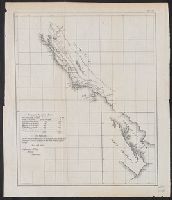
- Creator:
- Lindenkohl, A.
McMurtrie, W. B. (William Birch)
- Published / Created:
- 1854
- Call Number:
- WA MSS S-2369
- Collection Title:
- Franz R. and Kathryn M. Stenzel Research Files on Western American Art
- Container / Volume:
- bsd | Folder 1612
- Image Count:
- 1
- Resource Type:
- Maps, Atlases & Globes
- Found in:
- Beinecke Rare Book and Manuscript Library > McMurtrie, William B. "Reconnaissance of the Western Coast of the United States. Middle Sheet From San Francisco to Umpquah River." Engraving (in Series I)
- Creator:
- Ransom, Leander, 1800-1874
- Published / Created:
- 1862
- Call Number:
- 844 1862
- Container / Volume:
- BRBL_00602
- Image Count:
- 1
- Resource Type:
- Maps, Atlases & Globes
- Found in:
- Beinecke Rare Book and Manuscript Library > New map of the state of California : exhibiting the rivers, lakes, bays, and islands, with the principal towns, roads, railroads, and transit routes to the silver mining distrts. of Nevada Territory; also the established meridian, standard, range and town
- Creator:
- H.M. Gousha Company
- Published / Created:
- [1940]
- Call Number:
- 844gmb 1940
- Container / Volume:
- BRBL_00615
- Image Count:
- 2
- Resource Type:
- Maps, Atlases & Globes
- Found in:
- Beinecke Rare Book and Manuscript Library > Official road map of California / [prepared for] Shell.
- Creator:
- Grayson, James H
- Published / Created:
- 1942?]
- Call Number:
- 844gmb 1942
- Container / Volume:
- BRBL_00615
- Image Count:
- 2
- Resource Type:
- Maps, Atlases & Globes
- Found in:
- Beinecke Rare Book and Manuscript Library > Pathfinder map : California, Arizona, New Mexico, Utah, Nevada / [Prepared for] Pathfinder Petroleum Company, Los Angeles.
- Creator:
- Rand McNally and Company
- Published / Created:
- [1951?]
- Call Number:
- 844gmb 1951
- Container / Volume:
- BRBL_00616
- Image Count:
- 2
- Resource Type:
- Maps, Atlases & Globes
- Found in:
- Beinecke Rare Book and Manuscript Library > Rand McNally road map, California / issued by Randall Motor Club, Inc., affiliated with E. Broox Randall & Sons, Inc.
- Creator:
- Rand McNally and Company
- Published / Created:
- [1939]
- Call Number:
- 844gmb 1939A
- Container / Volume:
- BRBL_00615
- Image Count:
- 2
- Resource Type:
- Maps, Atlases & Globes
- Found in:
- Beinecke Rare Book and Manuscript Library > Road map of California, Nevada.
- Creator:
- Borgnis, Franklin P
- Published / Created:
- 1920
- Call Number:
- 844gmb 1920
- Container / Volume:
- BRBL_00615
- Image Count:
- 1
- Resource Type:
- Maps, Atlases & Globes
- Found in:
- Beinecke Rare Book and Manuscript Library > Road map of the State of California : compiled from maps by the United States government and from various county maps / under the direction of Austin B. Fletcher, highway engineer ; State of California, Dept. of Engineering, California Highway Commission
- Creator:
- Eld, Henry, 1814-1850
- Published / Created:
- 1838-1842
- Call Number:
- WA MSS 161-162
- Collection Title:
- Henry Eld papers
- Container / Volume:
- Box 2 | Folder 1
- Image Count:
- 18
- Resource Type:
- Paintings & Drawings
- Found in:
- Beinecke Rare Book and Manuscript Library > Sketchbook 1
- Creator:
- Eld, Henry, 1814-1850
- Published / Created:
- 1838-1842
- Call Number:
- WA MSS 161-162
- Collection Title:
- Henry Eld papers
- Container / Volume:
- Box 2 | Folder 2
- Image Count:
- 21
- Resource Type:
- Paintings & Drawings
- Found in:
- Beinecke Rare Book and Manuscript Library > Sketchbook 2
- Creator:
- Eld, Henry, 1814-1850
- Published / Created:
- 1838-1842
- Call Number:
- WA MSS 161-162
- Collection Title:
- Henry Eld papers
- Container / Volume:
- Box 2 | Folder 3
- Image Count:
- 21
- Resource Type:
- Paintings & Drawings
- Found in:
- Beinecke Rare Book and Manuscript Library > Sketchbook 3
- Creator:
- Strum, G. P. (Gustave P.)
- Published / Created:
- 1885
- Call Number:
- 844 1885
- Container / Volume:
- BRBL_00603
- Image Count:
- 2
- Resource Type:
- Maps, Atlases & Globes
- Found in:
- Beinecke Rare Book and Manuscript Library > State of California / Department of the Interior, General Land Office ; compiled ... under supervision of G.P. Strum, principal draughtsman G.L.O. ; drawn by G.P. Strum.
- Creator:
- Rand McNally and Company
- Published / Created:
- 1931
- Call Number:
- 844gmb 1931
- Container / Volume:
- BRBL_00615
- Image Count:
- 2
- Resource Type:
- Maps, Atlases & Globes
- Found in:
- Beinecke Rare Book and Manuscript Library > Texaco road map, California, Nevada.
- Creator:
- Nell, Louis
- Published / Created:
- 1868
- Call Number:
- 844gme 1868
- Container / Volume:
- BRBL_00619
- Image Count:
- 1
- Resource Type:
- Maps, Atlases & Globes
- Found in:
- Beinecke Rare Book and Manuscript Library > Topographical railroad & county map of the states of California and Nevada : compiled from the latest explorations and other official information / by L. Nell.
- Creator:
- Ord, Edward Otho Cresap, 1818-1883
- Published / Created:
- 1848
- Call Number:
- 844gbc 1848
- Container / Volume:
- BRBL_00615
- Image Count:
- 1
- Resource Type:
- Maps, Atlases & Globes
- Found in:
- Beinecke Rare Book and Manuscript Library > Topographical sketch of the gold & quicksilver district of California.
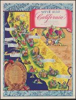
- Creator:
- California. Wine Advisory Board
- Published / Created:
- [between 1941 and 1950?]
- Call Number:
- 844am 1941
- Container / Volume:
- BRBL_00612
- Image Count:
- 1
- Resource Type:
- Maps, Atlases & Globes
- Found in:
- Beinecke Rare Book and Manuscript Library > Wine map of California / limned by Ruth Taylor.
- Published / Created:
- [1847]
- Call Number:
- 844 1847
- Container / Volume:
- BRBL_00601
- Image Count:
- 1
- Resource Type:
- Maps, Atlases & Globes
- Found in:
- Beinecke Rare Book and Manuscript Library > [Occupation of California map : disposal of U.S. Army, June 19th, 1847].
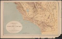
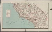
- Published / Created:
- 1873?]
- Call Number:
- 844cbf 1873A
- Container / Volume:
- BRBL_00613
- Image Count:
- 1
- Resource Type:
- Maps, Atlases & Globes
- Found in:
- Beinecke Rare Book and Manuscript Library > [Topographical map of central California].