Search
You Searched For
Search Results
- Published / Created:
- 1632
- Call Number:
- BrSides Folio 2008 15
- Collection Title:
- Les voyages de la Novvelle France occidentale, dicte Canada / faits par le Sr. de Champlain
- Image Count:
- 1
- Found in:
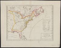
- Beinecke Rare Book and Manuscript Library > Carte de la Nouuelle France, augmentee depuis la derniere, seruant a la nauigation faicte en son vray Meridien, par le Sr. de Champlain pour le Roy en la Marine; lequel depuis l'an 1603 jusques en l'année 1629; a descouuert plusieurs costes, terres, lacs, ruineres, et Nations de Sauuages, par cy deuant incognuës, comme il se voit en ses relations quil a faict Imprimer en 1632, ou il se uoit cette marque [image of a flag] ce sont habitations qu'ont faict les françois. Faicte l'an 1632 par le sieur de Champlain. Scale [ca. 1:1,000,000].
- Creator:
- Morse, Jedidiah, 1761-1826
- Published / Created:
- 1797
- Call Number:
- GA405 +W44 (LC)
- Collection Title:
- Mapping the transmississippi West, 1540-1861
- Image Count:
- 1
- Found in:
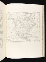
- Beinecke Rare Book and Manuscript Library > A new map of North America shewing all the new discoveries [facsimile]
- Creator:
- Mackenzie, Alexander, 1764-1820
- Published / Created:
- 1801
- Call Number:
- 73 1801
- Container / Volume:
- BRBL_00374
- Image Count:
- 1
- Resource Type:
- Maps, Atlases & Globes
- Found in:
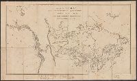
- Beinecke Rare Book and Manuscript Library > A map of America between latitudes 40 and 70 north and longitudes 45 and 180 west exhibiting Mackenzie's track from Montreal to Fort Chipewyan & from thence to the north sea in 1789 & to the west Pacific Ocean in 1793.
- Creator:
- Mackenzie, Alexander, 1764-1820
- Published / Created:
- 1801
- Call Number:
- 73 1801
- Container / Volume:
- BRBL_00374
- Image Count:
- 1
- Resource Type:
- Maps, Atlases & Globes
- Found in:
- Beinecke Rare Book and Manuscript Library > A map of America between latitudes 40 and 70 north and longitudes 45 and 180 west exhibiting Mackenzie's track from Montreal to Fort Chipewyan & from thence to the north sea in 1789 & to the west Pacific Ocean in 1793.
- Published / Created:
- 1805
- Call Number:
- 755 1805B
- Container / Volume:
- BRBL_00437
- Image Count:
- 1
- Resource Type:
- Maps, Atlases & Globes
- Found in:
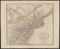
- Beinecke Rare Book and Manuscript Library > A new map of the United States of North America ... with Upper and Lower Canada &c ... by John Cary, Engraver.
- Published / Created:
- 1805
- Call Number:
- 755 1805B
- Container / Volume:
- BRBL_00437
- Image Count:
- 1
- Resource Type:
- Maps, Atlases & Globes
- Found in:
- Beinecke Rare Book and Manuscript Library > A new map of the United States of North America ... with Upper and Lower Canada &c ... by John Cary, Engraver.
- Published / Created:
- [1805?]
- Call Number:
- 755 1805A
- Container / Volume:
- BRBL_00437
- Image Count:
- 1
- Resource Type:
- Maps, Atlases & Globes
- Found in:
- Beinecke Rare Book and Manuscript Library > Carta delle Provinciae Settentrionli degli Stati Uniti.
- Published / Created:
- [1806?]
- Call Number:
- 755 1806C
- Container / Volume:
- BRBL_00438
- Image Count:
- 1
- Resource Type:
- Maps, Atlases & Globes
- Found in:
- Beinecke Rare Book and Manuscript Library > Carte Générale des États-Unis de L'Amerique Septentrionale, rensemant aussi, quelquis Provinces Angloises adjacentes. André Scrip. Tardieu Sculp.
- Published / Created:
- 1806
- Call Number:
- 755 1806B
- Container / Volume:
- BRBL_00438
- Image Count:
- 1
- Resource Type:
- Maps, Atlases & Globes
- Found in:
- Beinecke Rare Book and Manuscript Library > A new map of the United States of America ... by John Cary, Engraver.
- Published / Created:
- 1806
- Call Number:
- 755 1806A
- Container / Volume:
- BRBL_00438
- Image Count:
- 1
- Resource Type:
- Maps, Atlases & Globes
- Found in:
- Beinecke Rare Book and Manuscript Library > A new map of part of the United States of North America ... by John Cary, Engraver.