Search
You Searched For
Search Results
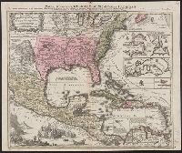
- Creator:
- Seutter, Matthaeus, 1678-1756
- Published / Created:
- [after 1741]
- Call Number:
- 71 1737
- Container / Volume:
- BRBL_00725
- Image Count:
- 1
- Resource Type:
- Maps, Atlases & Globes
- Found in:
- Beinecke Rare Book and Manuscript Library > Mappa geographica regionem Mexicanam et Floridam : terrasque adjacentes, ut et Anteriores Americae insulas cursus itedem et reditus navigantium versus flumen Missisipi et alias colonias ob oculas ponens / cura et sumptibus Matthaei Seutteri, S. Caes. et Reg. Cath. Maj. Geographi et Chalcograph ; Tob. Con. Lotter, sculps.
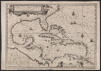
- Creator:
- Blaeu, Willem Janszoon, 1571-1638
- Published / Created:
- 1667?]
- Call Number:
- 85 1667
- Container / Volume:
- BRBL_00636
- Image Count:
- 1
- Resource Type:
- Maps, Atlases & Globes
- Found in:
- Beinecke Rare Book and Manuscript Library > Insulae Americanae in Oceano Septentrionali cum terris adiacentibus.
- Creator:
- Speer, Joseph Smith
- Published / Created:
- May 20th, 1774.
- Call Number:
- 85 1774A
- Container / Volume:
- BRBL_00637
- Image Count:
- 1
- Resource Type:
- Maps, Atlases & Globes
- Found in:
- Beinecke Rare Book and Manuscript Library > To His Royal Highness. George Augustus Frederick. Prince of Wales &c. &c. &c. this chart of the West Indies is humbly inscribed by His Royal Highness faithful & obedient servant Joseph Smith Speer, Thos. Bowen sculpt.
- Creator:
- Blaeu, Willem Janszoon, 1571-1638
- Published / Created:
- 1667?]
- Call Number:
- 85 1667
- Container / Volume:
- BRBL_00636
- Image Count:
- 1
- Resource Type:
- Maps, Atlases & Globes
- Found in:
- Beinecke Rare Book and Manuscript Library > Insulae Americanae in Oceano Septentrionali cum terris adiacentibus.
- Creator:
- Moll, Herman, d. 1732
- Call Number:
- 85 1745A
- Container / Volume:
- BRBL_00636
- Image Count:
- 1
- Resource Type:
- Maps, Atlases & Globes
- Found in:
- Beinecke Rare Book and Manuscript Library > A chart of ye West-Indies or the islands of America in the North Sea &c., being ye present seat of war / by Herman Moll, geographer.
- Creator:
- Jansson, Jan, 1588-1664
- Published / Created:
- [1660?]
- Call Number:
- 85 1660
- Container / Volume:
- BRBL_00636
- Image Count:
- 1
- Resource Type:
- Maps, Atlases & Globes
- Found in:
- Beinecke Rare Book and Manuscript Library > Insulae Americanae in Oceano Septentrionali cum terris adiacentibus [cartographic material].
- Creator:
- Chatelain, Henri Abraham
- Published / Created:
- 1719?]
- Call Number:
- 71 1770
- Container / Volume:
- BRBL_00687
- Image Count:
- 1
- Resource Type:
- Maps, Atlases & Globes
- Found in:
- Beinecke Rare Book and Manuscript Library > Carte qui contient une description des iles & terres que les Anglois possedent dans l'Amerique Septentrionale [cartographic material] : et en particulier de la Jamaique, des iles Barbades, de la Nouvelle Angleterre, des Barmudes, de la Caroline, de la Pen
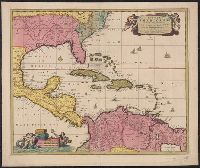
- Creator:
- Visscher, Nicolaes, 1649-1702
- Published / Created:
- [ca. 1720]
- Call Number:
- 85 1710
- Container / Volume:
- BRBL_00692
- Image Count:
- 1
- Resource Type:
- Maps, Atlases & Globes
- Found in:
- Beinecke Rare Book and Manuscript Library > Insulae Americanae in Oceano Septentrionali ac regiones adiacentes : a C. de May usque ad Lineam Aequinoctialem / per Nicolaum Visscher.
- Creator:
- Delarochette, L. (Louis), 1731-1802
- Published / Created:
- September 22d, 1796.
- Call Number:
- 85 1796A
- Container / Volume:
- BRBL_00693
- Image Count:
- 1
- Resource Type:
- Maps, Atlases & Globes
- Found in:
- Beinecke Rare Book and Manuscript Library > A general chart of the West India Islands with the adjacent coasts of the Spanish continent [cartographic material] / by L.S. de la Rochette.
- Published / Created:
- 1780]
- Call Number:
- 85 1740
- Container / Volume:
- BRBL_00693
- Image Count:
- 1
- Resource Type:
- Maps, Atlases & Globes
- Found in:
- Beinecke Rare Book and Manuscript Library > West Indies [cartographic material] : with the harbour & fort of Omoa from the best authorities.