Search
You Searched For
Search Results
- Creator:
- Geological Survey of Canada
- Published / Created:
- [1886?]
- Call Number:
- 739GBC C19 1886I
- Container / Volume:
- BRBL_00392
- Image Count:
- 1
- Resource Type:
- Maps, Atlases & Globes
- Found in:
- Beinecke Rare Book and Manuscript Library > Map of placer mines & quartz locations in the vicinity of Williams Creek, Cariboo District, B.C. / surveyed and drawn by Amos Bowman, mining engineer ; assisted by James McEvoy ; drawn for photolithography by L.N. Richard.
- Creator:
- Geological and Natural History Survey of Canada
- Published / Created:
- [1886?]
- Call Number:
- 739GBC C19 1886H
- Container / Volume:
- BRBL_00392
- Image Count:
- 1
- Resource Type:
- Maps, Atlases & Globes
- Found in:
- Beinecke Rare Book and Manuscript Library > Veins & placer mines of Sugar Creek, Hardscrabble, Slough Creek, Nelson Creek, Willow River and Dragon Creek, Cariboo District, British Columbia / surveyed and drawn by Amos Bowman, assisted by James McEvoy.
- Creator:
- Geological Survey of Canada
- Published / Created:
- [1886]
- Call Number:
- 739GBC C19 1886F
- Container / Volume:
- BRBL_00392
- Image Count:
- 1
- Resource Type:
- Maps, Atlases & Globes
- Found in:
- Beinecke Rare Book and Manuscript Library > Map of placer mines & quartz veins in the vicinity of Lightning Creek / by Amos Bowman, mining engineer ; drawn by James McEvoy ; drawn for photolithography by L.N. Richard and Is. Marion.
- Creator:
- Geological and Natural History Survey of Canada
- Published / Created:
- [1886?]
- Call Number:
- 739GBC C19 1886G
- Container / Volume:
- BRBL_00392
- Image Count:
- 1
- Resource Type:
- Maps, Atlases & Globes
- Found in:
- Beinecke Rare Book and Manuscript Library > Quartz veins & placer mines of Little Snowshoe and Keithley Creeks, Cariboo District, British Columbia / surveyed and drawn by Amos Bowman, mining engineer, assisted by James McEvoy.
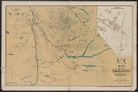
- Creator:
- Province Publishing Company, Ld. Lty
- Published / Created:
- 1898].
- Call Number:
- 739G C19 1898
- Container / Volume:
- BRBL_00392
- Image Count:
- 1
- Resource Type:
- Maps, Atlases & Globes
- Found in:
- Beinecke Rare Book and Manuscript Library > Map of central district of Cariboo / [cartographic material] compiled and prepared, and published under the authority of the provincial government, Victoria, B. C., C. A. Semlin, Chief Commissioner of Lands and Works, by the Province Publishing Company, L
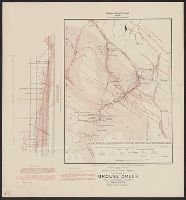
- Creator:
- Geological Survey of Canada
- Published / Created:
- [1886?]
- Call Number:
- 739GBC C19 1886C
- Container / Volume:
- BRBL_00392
- Image Count:
- 1
- Resource Type:
- Maps, Atlases & Globes
- Found in:
- Beinecke Rare Book and Manuscript Library > Quartz veins & placer diggings in the vicinity of Grouse Creek, Cariboo District, British Columbia / surveyed and drawn by Amos Bowman, mining engineer, assisted by James McEvoy.
- Creator:
- Geological and Natural History Survey of Canada
- Published / Created:
- [1886?]
- Call Number:
- 739GBC C19 1886D
- Container / Volume:
- BRBL_00392
- Image Count:
- 1
- Resource Type:
- Maps, Atlases & Globes
- Found in:
- Beinecke Rare Book and Manuscript Library > Placer mines of Harvey Creek in Cariboo District, British Columbia / surveyed and drawn by Amos Bowman, mining engineer, assisted by James McEvoy.
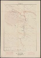
- Creator:
- Geological Survey of Canada
- Published / Created:
- [1886?]
- Call Number:
- 739GBC C19 1886A
- Container / Volume:
- BRBL_00392
- Image Count:
- 1
- Resource Type:
- Maps, Atlases & Globes
- Found in:
- Beinecke Rare Book and Manuscript Library > Placer mines of Antler Creek in Cariboo District, B.C. / surveyed and drawn by Amos Bowman, mining engineer, assisted by James McEvoy.
- Creator:
- Geological Survey of Canada
- Published / Created:
- [1886?]
- Call Number:
- 739GBC C19 1886B
- Container / Volume:
- BRBL_00392
- Image Count:
- 1
- Resource Type:
- Maps, Atlases & Globes
- Found in:
- Beinecke Rare Book and Manuscript Library > Placer mines of Cunningham Creek / surveyed and drawn by Amos Bowman, mining engineer, assisted by James McEvoy.
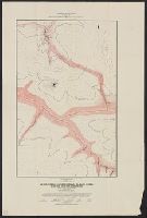
- Published / Created:
- [1886?]
- Call Number:
- 739GBC C19 1886E
- Container / Volume:
- BRBL_00392
- Image Count:
- 1
- Resource Type:
- Maps, Atlases & Globes
- Found in:
- Beinecke Rare Book and Manuscript Library > Section along Harvey Ck. : Showing explorations of Deep Channel.