Search
You Searched For
Search Results
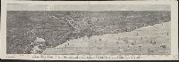
- Published / Created:
- 1874
- Call Number:
- 806am C43 1874
- Container / Volume:
- BRBL_00549
- Image Count:
- 1
- Resource Type:
- Maps, Atlases & Globes
- Found in:
- Beinecke Rare Book and Manuscript Library > Bird's-eye view of Chicago and its environs : showing a distance of 45 miles on Lake Michigan, and 26 miles westward / drawn by R.W. Wallis.
- Published / Created:
- 1906
- Call Number:
- 806 C43 1906
- Container / Volume:
- BRBL_00548
- Image Count:
- 2
- Resource Type:
- Maps, Atlases & Globes
- Found in:
- Beinecke Rare Book and Manuscript Library > Blanchard's map of Chicago : with the new street names.
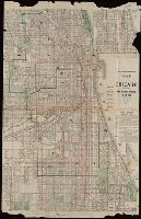
- Published / Created:
- 1887
- Call Number:
- 806 C43 1887
- Container / Volume:
- BRBL_00548
- Image Count:
- 1
- Resource Type:
- Maps, Atlases & Globes
- Found in:
- Beinecke Rare Book and Manuscript Library > Blanchard's map of Chicago and environs.
- Published / Created:
- 1910
- Call Number:
- 806 C43 1910
- Container / Volume:
- BRBL_00548
- Image Count:
- 1
- Resource Type:
- Maps, Atlases & Globes
- Found in:
- Beinecke Rare Book and Manuscript Library > Business portion of the city of Chicago.
- Published / Created:
- 1904
- Call Number:
- 806 C43 1904
- Container / Volume:
- BRBL_00548
- Image Count:
- 1
- Resource Type:
- Maps, Atlases & Globes
- Found in:
- Beinecke Rare Book and Manuscript Library > Chicago and suburbs : Street names and street car lines.
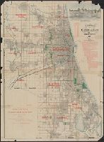
- Published / Created:
- 1893
- Call Number:
- 806gmb C43 1893
- Container / Volume:
- BRBL_00549
- Image Count:
- 1
- Resource Type:
- Maps, Atlases & Globes
- Found in:
- Beinecke Rare Book and Manuscript Library > Chicago.
- Published / Created:
- 1892
- Call Number:
- 806 C43 1892A
- Container / Volume:
- BRBL_00548
- Image Count:
- 2
- Resource Type:
- Maps, Atlases & Globes
- Found in:
- Beinecke Rare Book and Manuscript Library > Handy small edition of A.N. Marquis & Co's Official map of Chicago.
- Published / Created:
- 1920
- Call Number:
- 806 C43 1920A
- Container / Volume:
- BRBL_00548
- Image Count:
- 2
- Resource Type:
- Maps, Atlases & Globes
- Found in:
- Beinecke Rare Book and Manuscript Library > Lloyd's guide map of Chicago. Loop section, showing the location of...
- Published / Created:
- 1907
- Call Number:
- 806 C43 1907
- Container / Volume:
- BRBL_00548
- Image Count:
- 1
- Resource Type:
- Maps, Atlases & Globes
- Found in:
- Beinecke Rare Book and Manuscript Library > Map of Chicago / presented by the Commercial Hotel C.W. Babb & Co., proprietors.
- Published / Created:
- 1870
- Call Number:
- 806 C43 1870
- Container / Volume:
- BRBL_00548
- Image Count:
- 1
- Resource Type:
- Maps, Atlases & Globes
- Found in:
- Beinecke Rare Book and Manuscript Library > Map of Chicago and environs.
- Published / Created:
- 1857
- Call Number:
- 806 C43 1857
- Container / Volume:
- BRBL_00548
- Image Count:
- 1
- Resource Type:
- Maps, Atlases & Globes
- Found in:
- Beinecke Rare Book and Manuscript Library > Map of Chicago.
- Published / Created:
- 1857
- Call Number:
- 806 C43 1857B
- Container / Volume:
- BRBL_00548
- Image Count:
- 1
- Resource Type:
- Maps, Atlases & Globes
- Found in:
- Beinecke Rare Book and Manuscript Library > Map of Chicago.
- Published / Created:
- 1887
- Call Number:
- 806 C772 1887
- Container / Volume:
- BRBL_00548
- Image Count:
- 1
- Resource Type:
- Maps, Atlases & Globes
- Found in:
- Beinecke Rare Book and Manuscript Library > Map of Cook and DuPage Counties, Illinois : with part of Lake County, Indiana.
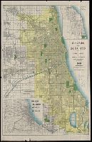
- Published / Created:
- 1884
- Call Number:
- 806 C43 1884
- Container / Volume:
- BRBL_00548
- Image Count:
- 1
- Resource Type:
- Maps, Atlases & Globes
- Found in:
- Beinecke Rare Book and Manuscript Library > Map showing the boulevards and park system : and twelve miles of lake frontage of the City of Chicago.
- Published / Created:
- 1887
- Call Number:
- 806 C43 1887A
- Container / Volume:
- BRBL_00548
- Image Count:
- 1
- Resource Type:
- Maps, Atlases & Globes
- Found in:
- Beinecke Rare Book and Manuscript Library > Map showing the boulevards and park system : and twelve miles of lake frontage of the City of Chicago.
- Published / Created:
- 1858
- Call Number:
- 806 C43 1858
- Container / Volume:
- BRBL_00548
- Image Count:
- 1
- Resource Type:
- Maps, Atlases & Globes
- Found in:
- Beinecke Rare Book and Manuscript Library > New map of Chicago : comprising the whole city, taken from Lowe's map, with all the recent additions, subdivisions & extentions.
- Published / Created:
- 1910
- Call Number:
- 806 C43 1910A
- Container / Volume:
- BRBL_00548
- Image Count:
- 2
- Resource Type:
- Maps, Atlases & Globes
- Found in:
- Beinecke Rare Book and Manuscript Library > Rand McNally & Co.'s street number guide map of the principal part of Chicago.
- Published / Created:
- 1892
- Call Number:
- 806 C43 1892
- Container / Volume:
- BRBL_00548
- Image Count:
- 1
- Resource Type:
- Maps, Atlases & Globes
- Found in:
- Beinecke Rare Book and Manuscript Library > Rand McNally and Co.'s new map of Chicago and suburbs / showing the location of the World's Columbian Exposition, streets, parks, boulevards, railroads, street car lines, etc.
- Published / Created:
- 1889
- Call Number:
- 806 C43 1889
- Container / Volume:
- BRBL_00548
- Image Count:
- 1
- Resource Type:
- Maps, Atlases & Globes
- Found in:
- Beinecke Rare Book and Manuscript Library > Rand, McNally and Co.'s Standard Map of Chicago No. 3.
- Published / Created:
- 1909]
- Call Number:
- 806 C43 1909
- Container / Volume:
- BRBL_00548
- Image Count:
- 1
- Resource Type:
- Maps, Atlases & Globes
- Found in:
- Beinecke Rare Book and Manuscript Library > [Map of Chicago]