
- None4
You Searched For
1 - 10 of 10
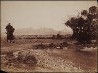
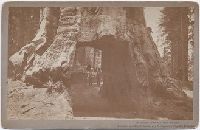
Search Results
2.

- Creator:
- Clark, William, 1770-1838
Lewis, Samuel, 1753 or 4-1822 - Published / Created:
- [ca. 1814]
- Call Number:
- Zc10 814Le
- Collection Title:
- History of the expedition under the command of Captains Lewis and Clark, to the sources of the
- Image Count:
- 2
- Resource Type:
- Maps, Atlases & Globes
- Description:
- Verso blank.
- Subject (Geographic):
- Columbia River, Missouri River, and West (U.S.)
- Subject (Topic):
- Lewis and Clark Expedition (1804-1806)
- Collection Created:
- Philadelphia : Bradford & Inskeep ; New York : A.H. Inskeep : J. Maxwell, Printer, 1814
- Found in:
- Beinecke Rare Book and Manuscript Library > A map of Lewis and Clark's track, across the western portion of North America fom the Mississippi to the Pacific Ocean; by order of the Executive of the United States . In 1804, 5 & 6
3.
- Published / Created:
- 1874-1898.
- Call Number:
- WA Photos Folio 1
- Container / Volume:
- Box 1
- Image Count:
- 32
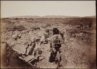
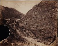
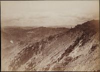
- Abstract:
- Photographs created from mammoth plate negatives primarily by photographers Carleton E. Watkins and William Henry Jackson of various locations in the American West, primarily in the states of California, Colorado, and Oregon, as well as Arizona, Monta...
- Description:
- A mammoth plate is a photographic negative plate, 18 by 21 inches (53.5 x 45.7 cm.) or larger, from which photographic prints are made through contact printing.
- Subject (Geographic):
- Wyoming, Montana, West (U.S.), Arizona, Arkansas River, Austin Bluffs (Colo.), Black Canyon of the Gunnison (Colo.), Blue Lakes (Calif.), Bridal Veil Falls (Utah), California, Cathedral Rocks (Calif.), Cathedral Spires (El Paso County, Colo.), Cathedral Spires (Jefferson County, Colo.), Clear Creek Canyon (Colo.), Clear Creek County (Colo.), Cochise Stronghold (Ariz.), Colorado, Columbia River, Costilla County (Colo.), Curecanti Needle (Colo.), Dalles (Or.), Dragoon Mountains (Ariz.), Drumlummon Mine (Mont.), Eagle Creek (Or.), Echo (Utah), El Capitan (Calif.), El Paso County (Colo.), Fountain Creek (Colo.), Fremont County (Colo.), Garden of the Gods (Colorado Springs, Colo.), Garfield County (Colo.), Gate Rock (El Paso County, Colo.), Giant Geyser (Wyo.), Glenwood Springs (Colo.), Grotto Geyser (Wyo.), Gunnison County (Colo.), Gunnison River (Colo.), Half Dome (Calif.), Jefferson County (Colo.), Jerome County (Idaho), Lake Vineyard (San Gabriel, Calif.), Marysville (Lewis and Clark County, Mont.), Mokelumne River (Calif.), Monument Park (El Paso County, Colo.), Multnomah County (Or.), Multnomah Creek (Or.), Multnomah Falls (Or.), North Cheyenne Canyon (Colo.), North Cheyenne Creek (Colo.), North Fork American River (Calif.), Old Faithful Geyser (Wyo.), Oregon, Palisades Falls, Pikes Peak (Colo.), Platte Canyon (Colo.), Port Ludlow (Wash.), Port Madison (Bainbridge Island, Wash.), Provo Canyon (Utah), Provo River (Utah), Pulpit Rock (Utah), Pulpit Terrace (Wyo.), Rainbow Falls (Colo.), Rio Arriba County (N.M.), Rio de los Pinos (Colo. and N.M.), Round Top Mountain (Calif.), Royal Gorge (Colo.), San Gabriel (Calif.), Sentinel Rock (Calif.), Seven Falls (Colo.), Sierra Blanca (Colo.), Snake River (Wyo.-Wash.), Soda Springs (Calif.), South Cheyenne Canyon (Colo.), South Cheyenne Creek (Colo.), South Platte River (Colo. and Neb.), Spokane (Wash.), Spokane River (Idaho and Wash.), Teller County (Colo.), Toltec Gorge (N.M.), Tombstone (Ariz.), Tombstone Region (Ariz.), Twin Creek (Colo.), Twin Falls (Idaho : Waterfalls), Utah, Ute Pass (Teller County, Colo.), Washington (State), Yampah Hot Springs (Colo.), Yellowstone National Park, Yosemite National Park (Calif.), and Yosemite Valley (Calif.)
- Subject (Name):
- Haynes, F. Jay 1853-1921. (Frank Jay),, Jackson, William Henry, 1843-1942., Meeker, Ezra, 1830-1928., Watkins, Carleton E., 1829-1916., Colorado Central Railroad Company, Denver and Rio Grande Railroad Company, Denver, South Park, and Pacific Railroad Company, Mission San Gabriel Arcangel (San Gabriel, Calif.), and Tough Nut Mine
- Subject (Topic):
- Geysers, Landscape photography, Mineral industries, and Railroads
- Found in:
- Beinecke Rare Book and Manuscript Library > Mammoth plate photographs of the North American West
4.
- Published / Created:
- 1874-1898.
- Call Number:
- WA Photos Folio 1
- Container / Volume:
- Box 3
- Image Count:
- 28
- Abstract:
- Photographs created from mammoth plate negatives primarily by photographers Carleton E. Watkins and William Henry Jackson of various locations in the American West, primarily in the states of California, Colorado, and Oregon, as well as Arizona, Monta...
- Description:
- A mammoth plate is a photographic negative plate, 18 by 21 inches (53.5 x 45.7 cm.) or larger, from which photographic prints are made through contact printing.
- Subject (Geographic):
- Wyoming, Montana, West (U.S.), Arizona, Arkansas River, Austin Bluffs (Colo.), Black Canyon of the Gunnison (Colo.), Blue Lakes (Calif.), Bridal Veil Falls (Utah), California, Cathedral Rocks (Calif.), Cathedral Spires (El Paso County, Colo.), Cathedral Spires (Jefferson County, Colo.), Clear Creek Canyon (Colo.), Clear Creek County (Colo.), Cochise Stronghold (Ariz.), Colorado, Columbia River, Costilla County (Colo.), Curecanti Needle (Colo.), Dalles (Or.), Dragoon Mountains (Ariz.), Drumlummon Mine (Mont.), Eagle Creek (Or.), Echo (Utah), El Capitan (Calif.), El Paso County (Colo.), Fountain Creek (Colo.), Fremont County (Colo.), Garden of the Gods (Colorado Springs, Colo.), Garfield County (Colo.), Gate Rock (El Paso County, Colo.), Giant Geyser (Wyo.), Glenwood Springs (Colo.), Grotto Geyser (Wyo.), Gunnison County (Colo.), Gunnison River (Colo.), Half Dome (Calif.), Jefferson County (Colo.), Jerome County (Idaho), Lake Vineyard (San Gabriel, Calif.), Marysville (Lewis and Clark County, Mont.), Mokelumne River (Calif.), Monument Park (El Paso County, Colo.), Multnomah County (Or.), Multnomah Creek (Or.), Multnomah Falls (Or.), North Cheyenne Canyon (Colo.), North Cheyenne Creek (Colo.), North Fork American River (Calif.), Old Faithful Geyser (Wyo.), Oregon, Palisades Falls, Pikes Peak (Colo.), Platte Canyon (Colo.), Port Ludlow (Wash.), Port Madison (Bainbridge Island, Wash.), Provo Canyon (Utah), Provo River (Utah), Pulpit Rock (Utah), Pulpit Terrace (Wyo.), Rainbow Falls (Colo.), Rio Arriba County (N.M.), Rio de los Pinos (Colo. and N.M.), Round Top Mountain (Calif.), Royal Gorge (Colo.), San Gabriel (Calif.), Sentinel Rock (Calif.), Seven Falls (Colo.), Sierra Blanca (Colo.), Snake River (Wyo.-Wash.), Soda Springs (Calif.), South Cheyenne Canyon (Colo.), South Cheyenne Creek (Colo.), South Platte River (Colo. and Neb.), Spokane (Wash.), Spokane River (Idaho and Wash.), Teller County (Colo.), Toltec Gorge (N.M.), Tombstone (Ariz.), Tombstone Region (Ariz.), Twin Creek (Colo.), Twin Falls (Idaho : Waterfalls), Utah, Ute Pass (Teller County, Colo.), Washington (State), Yampah Hot Springs (Colo.), Yellowstone National Park, Yosemite National Park (Calif.), and Yosemite Valley (Calif.)
- Subject (Name):
- Haynes, F. Jay 1853-1921. (Frank Jay),, Jackson, William Henry, 1843-1942., Meeker, Ezra, 1830-1928., Watkins, Carleton E., 1829-1916., Colorado Central Railroad Company, Denver and Rio Grande Railroad Company, Denver, South Park, and Pacific Railroad Company, Mission San Gabriel Arcangel (San Gabriel, Calif.), and Tough Nut Mine
- Subject (Topic):
- Geysers, Landscape photography, Mineral industries, and Railroads
- Found in:
- Beinecke Rare Book and Manuscript Library > Mammoth plate photographs of the North American West
5.
- Published / Created:
- 1874-1898.
- Call Number:
- WA Photos Folio 1
- Container / Volume:
- Box 2
- Image Count:
- 26
- Abstract:
- Photographs created from mammoth plate negatives primarily by photographers Carleton E. Watkins and William Henry Jackson of various locations in the American West, primarily in the states of California, Colorado, and Oregon, as well as Arizona, Monta...
- Description:
- A mammoth plate is a photographic negative plate, 18 by 21 inches (53.5 x 45.7 cm.) or larger, from which photographic prints are made through contact printing.
- Subject (Geographic):
- Wyoming, Montana, West (U.S.), Arizona, Arkansas River, Austin Bluffs (Colo.), Black Canyon of the Gunnison (Colo.), Blue Lakes (Calif.), Bridal Veil Falls (Utah), California, Cathedral Rocks (Calif.), Cathedral Spires (El Paso County, Colo.), Cathedral Spires (Jefferson County, Colo.), Clear Creek Canyon (Colo.), Clear Creek County (Colo.), Cochise Stronghold (Ariz.), Colorado, Columbia River, Costilla County (Colo.), Curecanti Needle (Colo.), Dalles (Or.), Dragoon Mountains (Ariz.), Drumlummon Mine (Mont.), Eagle Creek (Or.), Echo (Utah), El Capitan (Calif.), El Paso County (Colo.), Fountain Creek (Colo.), Fremont County (Colo.), Garden of the Gods (Colorado Springs, Colo.), Garfield County (Colo.), Gate Rock (El Paso County, Colo.), Giant Geyser (Wyo.), Glenwood Springs (Colo.), Grotto Geyser (Wyo.), Gunnison County (Colo.), Gunnison River (Colo.), Half Dome (Calif.), Jefferson County (Colo.), Jerome County (Idaho), Lake Vineyard (San Gabriel, Calif.), Marysville (Lewis and Clark County, Mont.), Mokelumne River (Calif.), Monument Park (El Paso County, Colo.), Multnomah County (Or.), Multnomah Creek (Or.), Multnomah Falls (Or.), North Cheyenne Canyon (Colo.), North Cheyenne Creek (Colo.), North Fork American River (Calif.), Old Faithful Geyser (Wyo.), Oregon, Palisades Falls, Pikes Peak (Colo.), Platte Canyon (Colo.), Port Ludlow (Wash.), Port Madison (Bainbridge Island, Wash.), Provo Canyon (Utah), Provo River (Utah), Pulpit Rock (Utah), Pulpit Terrace (Wyo.), Rainbow Falls (Colo.), Rio Arriba County (N.M.), Rio de los Pinos (Colo. and N.M.), Round Top Mountain (Calif.), Royal Gorge (Colo.), San Gabriel (Calif.), Sentinel Rock (Calif.), Seven Falls (Colo.), Sierra Blanca (Colo.), Snake River (Wyo.-Wash.), Soda Springs (Calif.), South Cheyenne Canyon (Colo.), South Cheyenne Creek (Colo.), South Platte River (Colo. and Neb.), Spokane (Wash.), Spokane River (Idaho and Wash.), Teller County (Colo.), Toltec Gorge (N.M.), Tombstone (Ariz.), Tombstone Region (Ariz.), Twin Creek (Colo.), Twin Falls (Idaho : Waterfalls), Utah, Ute Pass (Teller County, Colo.), Washington (State), Yampah Hot Springs (Colo.), Yellowstone National Park, Yosemite National Park (Calif.), and Yosemite Valley (Calif.)
- Subject (Name):
- Haynes, F. Jay 1853-1921. (Frank Jay),, Jackson, William Henry, 1843-1942., Meeker, Ezra, 1830-1928., Watkins, Carleton E., 1829-1916., Colorado Central Railroad Company, Denver and Rio Grande Railroad Company, Denver, South Park, and Pacific Railroad Company, Mission San Gabriel Arcangel (San Gabriel, Calif.), and Tough Nut Mine
- Subject (Topic):
- Geysers, Landscape photography, Mineral industries, and Railroads
- Found in:
- Beinecke Rare Book and Manuscript Library > Mammoth plate photographs of the North American West
6.
- Published / Created:
- 1874-1898.
- Call Number:
- WA Photos Folio 1
- Container / Volume:
- Box 4
- Image Count:
- 28
- Abstract:
- Photographs created from mammoth plate negatives primarily by photographers Carleton E. Watkins and William Henry Jackson of various locations in the American West, primarily in the states of California, Colorado, and Oregon, as well as Arizona, Monta...
- Description:
- A mammoth plate is a photographic negative plate, 18 by 21 inches (53.5 x 45.7 cm.) or larger, from which photographic prints are made through contact printing.
- Subject (Geographic):
- Wyoming, Montana, West (U.S.), Arizona, Arkansas River, Austin Bluffs (Colo.), Black Canyon of the Gunnison (Colo.), Blue Lakes (Calif.), Bridal Veil Falls (Utah), California, Cathedral Rocks (Calif.), Cathedral Spires (El Paso County, Colo.), Cathedral Spires (Jefferson County, Colo.), Clear Creek Canyon (Colo.), Clear Creek County (Colo.), Cochise Stronghold (Ariz.), Colorado, Columbia River, Costilla County (Colo.), Curecanti Needle (Colo.), Dalles (Or.), Dragoon Mountains (Ariz.), Drumlummon Mine (Mont.), Eagle Creek (Or.), Echo (Utah), El Capitan (Calif.), El Paso County (Colo.), Fountain Creek (Colo.), Fremont County (Colo.), Garden of the Gods (Colorado Springs, Colo.), Garfield County (Colo.), Gate Rock (El Paso County, Colo.), Giant Geyser (Wyo.), Glenwood Springs (Colo.), Grotto Geyser (Wyo.), Gunnison County (Colo.), Gunnison River (Colo.), Half Dome (Calif.), Jefferson County (Colo.), Jerome County (Idaho), Lake Vineyard (San Gabriel, Calif.), Marysville (Lewis and Clark County, Mont.), Mokelumne River (Calif.), Monument Park (El Paso County, Colo.), Multnomah County (Or.), Multnomah Creek (Or.), Multnomah Falls (Or.), North Cheyenne Canyon (Colo.), North Cheyenne Creek (Colo.), North Fork American River (Calif.), Old Faithful Geyser (Wyo.), Oregon, Palisades Falls, Pikes Peak (Colo.), Platte Canyon (Colo.), Port Ludlow (Wash.), Port Madison (Bainbridge Island, Wash.), Provo Canyon (Utah), Provo River (Utah), Pulpit Rock (Utah), Pulpit Terrace (Wyo.), Rainbow Falls (Colo.), Rio Arriba County (N.M.), Rio de los Pinos (Colo. and N.M.), Round Top Mountain (Calif.), Royal Gorge (Colo.), San Gabriel (Calif.), Sentinel Rock (Calif.), Seven Falls (Colo.), Sierra Blanca (Colo.), Snake River (Wyo.-Wash.), Soda Springs (Calif.), South Cheyenne Canyon (Colo.), South Cheyenne Creek (Colo.), South Platte River (Colo. and Neb.), Spokane (Wash.), Spokane River (Idaho and Wash.), Teller County (Colo.), Toltec Gorge (N.M.), Tombstone (Ariz.), Tombstone Region (Ariz.), Twin Creek (Colo.), Twin Falls (Idaho : Waterfalls), Utah, Ute Pass (Teller County, Colo.), Washington (State), Yampah Hot Springs (Colo.), Yellowstone National Park, Yosemite National Park (Calif.), and Yosemite Valley (Calif.)
- Subject (Name):
- Haynes, F. Jay 1853-1921. (Frank Jay),, Jackson, William Henry, 1843-1942., Meeker, Ezra, 1830-1928., Watkins, Carleton E., 1829-1916., Colorado Central Railroad Company, Denver and Rio Grande Railroad Company, Denver, South Park, and Pacific Railroad Company, Mission San Gabriel Arcangel (San Gabriel, Calif.), and Tough Nut Mine
- Subject (Topic):
- Geysers, Landscape photography, Mineral industries, and Railroads
- Found in:
- Beinecke Rare Book and Manuscript Library > Mammoth plate photographs of the North American West
7.

- Creator:
- Davidson, I. G. (Isaac Grundy), 1845-1922
- Published / Created:
- ca. 1879.
- Call Number:
- WA Photos 400
- Container / Volume:
- Volume B
- Image Count:
- 44
- Abstract:
- Two versions of a viewbook, each with a different binding, that consist of photographs along the Columbia River, as well as images of Idaho, Oregon, and Washington, created by Isaac Grundy Davidson and compiled by printer George H. Himes, both from Po...
- Description:
- The complete title of the volume is “Oregon and the Pacific Northwest. Glimpses of pretty spots along the valley of the Columbia River from Northern Montana to the Pacific Ocean. Scenery along the line of the Northern Pacific Railroad, showing the n...
- Subject (Geographic):
- Northwest, Pacific, Astoria (Or.), Beacon Rock (Wash.), Bradford Island (Or.), Bridal Veil Falls (Or.), Cabinet (Idaho), Cape Disappointment State Park (Wash.), Clark Fork (Idaho : Town), Clark Fork (Mont. and Idaho), Coeur d'Alene Lake (Idaho), Columbia River, Fort Sherman (Idaho), Idaho, Latourell Falls (Or.), Meacham Creek (Or.), Meacham Creek Canyon (Or.), Multnomah Falls (Or.), Oregon, Portland (Or.), Puget Sound (Wash.), Puyallup River (Wash.), Rainier, Mount (Wash.), Riparia (Wash.), Seattle (Wash.), Snake River (Wyo.-Wash.), Spokane Falls (Wash. : Waterfall), Umatilla River (Or.), and Washington (State)
- Subject (Name):
- Davidson, I. G. 1845-1922. (Isaac Grundy),, Himes, George H., 1844-1940., Rockwell, Cleveland, 1837-1907., Northern Pacific Railway Company, Oregon Furniture Manufacturing Company., and Oregon Railway and Navigation Company
- Subject (Topic):
- Railroads
- Found in:
- Beinecke Rare Book and Manuscript Library > Oregon and the Pacific Northwest
8.
- Creator:
- Watkins, Carleton E., 1829-1916
- Published / Created:
- ca. 1870s.
- Call Number:
- WA Photos 11
- Image Count:
- 44
- Abstract:
- Photographs of California, Oregon, and Arizona, including views in San Francisco of the Palace Hotel, the residence of Mrs. Mark Hopkins, Golden Gate Park, Cliff House, Sutro Heights, the Seal Rocks, and the New City Hall, and views of Lake Tahoe, San...
- Description:
- Accompanied by a box list.
- Publisher:
- Watkins
- Subject (Geographic):
- Yosemite National Park (Calif.), San Francisco (Calif.), California, and Columbia River
- Found in:
- Beinecke Rare Book and Manuscript Library > Photographs of California, Oregon, and Arizona [graphic].
9.

- Creator:
- Talbot, Charles B., b. ca. 1841-1900
- Published / Created:
- 1886-1900.
- Call Number:
- WA Photos 470
- Container / Volume:
- Box 1
- Image Count:
- 37
- Abstract:
- Album of photographs and loose photographic prints created by Charles B. Talbot that document locations in Washington and Alaska, 1886-1894. His widow, Caroline A. Talbot compiled the album as a Christmas gift for his brother and sister in 1900
- Description:
- Charles B. Talbot (circa 1841-August 13, 1900) was a civil engineer and architect with the Northern Pacific Railroad Company, as well as an amateur photographer. He designed the Northern Pacific Railway Headquarters Building in Tacoma, Washington, 188...
- Subject (Geographic):
- Alaska, Carbon Glacier (Wash.), Columbia River, Hood, Mount (Or.), Kalama (Wash.), Lynn Canal (Alaska), Northwest, Pacific, Olympic Mountains (Wash.), Rainier, Mount (Wash.), Saint Mary's (Alaska), Skagway (Alaska), Washington (State), and Wrangell (Alaska)
- Subject (Name):
- Talbot, Caroline A., b. ca. 1845., Talbot, Charles B., b. ca. 1841-1900., and Northern Pacific Railway Company
- Subject (Topic):
- Indians of North America, Railroads, and Rowing
- Found in:
- Beinecke Rare Book and Manuscript Library > Photographs of Washington state and Alaska
10.
- Call Number:
- Zc10 +814Leb
- Collection Title:
- Travels to the source of the Missouri River and across the American continent to the Pacific Ocean
- Image Count:
- 1
- Subject (Geographic):
- Columbia River, Missouri River, and West (U.S.) --Description and travel
- Subject (Name):
- Allen, Paul, 1775-1826, Biddle, Nicholas, 1786-1844, Clark, William, 1770-1838, Lewis and Clark Expedition (1804-1806), and Rees, Thomas, 1777-1864
- Collection Created:
- London, Longman, Hurst, Rees, Orme and Brown, 1814
- Found in:
- Beinecke Rare Book and Manuscript Library > Travels to the source of the Missouri River and across the American continent to the Pacific Ocean ...