Search
You Searched For
Search Results
- Published / Created:
- [1822?]
- Call Number:
- 767CA 1822
- Container / Volume:
- BRBL_00476
- Image Count:
- 1
- Resource Type:
- Maps, Atlases & Globes
- Found in:
- Beinecke Rare Book and Manuscript Library > A Geological Map of the Connecticut.
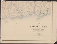
- Published / Created:
- 1876
- Call Number:
- 766 1876A
- Container / Volume:
- BRBL_00466
- Image Count:
- 1
- Resource Type:
- Maps, Atlases & Globes
- Found in:
- Beinecke Rare Book and Manuscript Library > Asher & Adams' Connecticut
- Creator:
- G.W. & C.B. Colton & Co
- Published / Created:
- 1878, c1855.
- Call Number:
- 766 1878
- Container / Volume:
- BRBL_00466
- Image Count:
- 1
- Resource Type:
- Maps, Atlases & Globes
- Found in:
- Beinecke Rare Book and Manuscript Library > Colton's Connecticut : with portions of New York & Rhode Island.
- Creator:
- G.W. & C.B. Colton & Co
- Published / Created:
- 1868
- Call Number:
- 766 1868
- Container / Volume:
- BRBL_00466
- Image Count:
- 1
- Resource Type:
- Maps, Atlases & Globes
- Found in:
- Beinecke Rare Book and Manuscript Library > Colton's Connecticut : with portions of New York & Rhode Island.
- Creator:
- G.W. & C.B. Colton & Co
- Published / Created:
- 1879
- Call Number:
- 766 1879C
- Container / Volume:
- BRBL_00467
- Image Count:
- 1
- Resource Type:
- Maps, Atlases & Globes
- Found in:
- Beinecke Rare Book and Manuscript Library > Colton's new township map of the state of Connecticut / G.W. & C.B. Colton & Co.
- Published / Created:
- 1825
- Call Number:
- 766 1825
- Container / Volume:
- BRBL_00465
- Image Count:
- 1
- Resource Type:
- Maps, Atlases & Globes
- Found in:
- Beinecke Rare Book and Manuscript Library > Connecticut - Geographisch - statistische und historische Charte von Connecticut.
- Creator:
- Warren, Moses, 1762-1835
- Published / Created:
- 1833
- Call Number:
- 766 1833
- Container / Volume:
- BRBL_00465
- Image Count:
- 1
- Resource Type:
- Maps, Atlases & Globes
- Found in:
- Beinecke Rare Book and Manuscript Library > Connecticut : from the actual surveys of Warren & Gillet / with the addition of new towns, turnpike roads, &c by George Gillet Esq.r.
- Published / Created:
- 1842
- Call Number:
- 766 1842
- Container / Volume:
- BRBL_00466
- Image Count:
- 1
- Resource Type:
- Maps, Atlases & Globes
- Found in:
- Beinecke Rare Book and Manuscript Library > Connecticut from actual surveys of Warren & Gillet, with the addition of new towns turnpike roads &C by George Gillet Esq.
- Published / Created:
- 1829
- Call Number:
- 766 1829A
- Container / Volume:
- BRBL_00465
- Image Count:
- 1
- Resource Type:
- Maps, Atlases & Globes
- Found in:
- Beinecke Rare Book and Manuscript Library > Connecticut from actual surveys of Warren & Gillet, with the addition of new towns turnpike roads &C by George Gillet Esq. 1829.
- Published / Created:
- 1847
- Call Number:
- 766 1847
- Container / Volume:
- BRBL_00466
- Image Count:
- 1
- Resource Type:
- Maps, Atlases & Globes
- Found in:
- Beinecke Rare Book and Manuscript Library > Connecticut from actual surveys of Warren & Gillet, with the addition of new towns turnpike roads &C by George Gillet Esq. 1847
- Published / Created:
- 1920
- Call Number:
- 766fb 1920
- Container / Volume:
- BRBL_00475
- Image Count:
- 1
- Resource Type:
- Maps, Atlases & Globes
- Found in:
- Beinecke Rare Book and Manuscript Library > Connecticut.
- Published / Created:
- 1838
- Call Number:
- 766 1838
- Container / Volume:
- BRBL_00466
- Image Count:
- 1
- Resource Type:
- Maps, Atlases & Globes
- Found in:
- Beinecke Rare Book and Manuscript Library > Connecticut.
- Published / Created:
- 1842
- Call Number:
- 766 1842A
- Container / Volume:
- BRBL_00466
- Image Count:
- 1
- Resource Type:
- Maps, Atlases & Globes
- Found in:
- Beinecke Rare Book and Manuscript Library > Connecticut.
- Published / Created:
- [c1910?]
- Call Number:
- 766 1910
- Container / Volume:
- BRBL_00467
- Image Count:
- 1
- Resource Type:
- Maps, Atlases & Globes
- Found in:
- Beinecke Rare Book and Manuscript Library > Connecticut.
- Published / Created:
- [c1910?].
- Call Number:
- 766 1910R
- Container / Volume:
- BRBL_00467
- Image Count:
- 2
- Resource Type:
- Maps, Atlases & Globes
- Found in:
- Beinecke Rare Book and Manuscript Library > Connecticut.
- Published / Created:
- 1853
- Call Number:
- 766gme 1853
- Container / Volume:
- BRBL_00475A
- Image Count:
- 1
- Resource Type:
- Maps, Atlases & Globes
- Found in:
- Beinecke Rare Book and Manuscript Library > General map accompanying the report on surveys : For extension of the Hartford, Providence & Fishkill Rail Road.
- Call Number:
- 766 1827
- Container / Volume:
- BRBL_00465
- Image Count:
- 1
- Resource Type:
- Maps, Atlases & Globes
- Found in:
- Beinecke Rare Book and Manuscript Library > Geographical, statistical and historical map of Connecticut.
- Creator:
- C.S. Hammond & Company
- Published / Created:
- c1916.
- Call Number:
- 766gmb 1916H
- Container / Volume:
- BRBL_00475
- Image Count:
- 1
- Resource Type:
- Maps, Atlases & Globes
- Found in:
- Beinecke Rare Book and Manuscript Library > Hammond's new road map of Connecticut (Eastern part) / based on the surveys of the United States Geological Survey, United States Coast and Geodetic Survey and the various local surveys, revised and corrected ... C.S. Hammond & Company.
- Creator:
- C.S. Hammond & Company
- Published / Created:
- 1916
- Call Number:
- 766gmb 1916H
- Container / Volume:
- BRBL_00475
- Image Count:
- 1
- Resource Type:
- Maps, Atlases & Globes
- Found in:
- Beinecke Rare Book and Manuscript Library > Hammond's new road map of Connecticut (Western part) / based on the surveys of the United States Geological Survey, United States Coast and Geodetic Survey and the various local surveys, revised and corrected ... C.S. Hammond & Company.
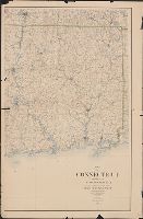
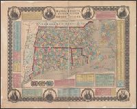
- Call Number:
- 767 1857
- Container / Volume:
- BRBL_00476
- Image Count:
- 1
- Resource Type:
- Maps, Atlases & Globes
- Found in:
- Beinecke Rare Book and Manuscript Library > Ichnogeological map of the Connecticut Valley.
- Published / Created:
- 1893
- Call Number:
- 766 1893J
- Container / Volume:
- BRBL_00467
- Image Count:
- 2
- Resource Type:
- Maps, Atlases & Globes
- Found in:
- Beinecke Rare Book and Manuscript Library > Latest map and index of Connecticut.
- Published / Created:
- 1893
- Call Number:
- 766 1893W
- Container / Volume:
- BRBL_00467
- Image Count:
- 1
- Resource Type:
- Maps, Atlases & Globes
- Found in:
- Beinecke Rare Book and Manuscript Library > Latest map and index of Eastern Connecticut.
- Creator:
- American Automobile Association
- Published / Created:
- c1917.
- Call Number:
- 76gmb 1917A
- Container / Volume:
- BRBL_00446
- Image Count:
- 2
- Resource Type:
- Maps, Atlases & Globes
- Found in:
- Beinecke Rare Book and Manuscript Library > Lower New England / prepared by Touring Information Board American Automobile Association.
- Creator:
- Hamersley & Co
- Published / Created:
- 1875].
- Call Number:
- 766 1860
- Container / Volume:
- BRBL_00466
- Image Count:
- 1
- Resource Type:
- Maps, Atlases & Globes
- Found in:
- Beinecke Rare Book and Manuscript Library > Map of Connecticut / by Hamersley & Co.
- Creator:
- Geological Survey (U.S.)
- Published / Created:
- 1893
- Call Number:
- 766 1893
- Container / Volume:
- BRBL_00467
- Image Count:
- 4
- Resource Type:
- Maps, Atlases & Globes
- Found in:
- Beinecke Rare Book and Manuscript Library > Map of Connecticut / prepared by the U.S. Geological Survey in co-operation with the State of Connecticut.
- Creator:
- Geological Survey (U.S.)
- Published / Created:
- 1893 (1899 printing)
- Call Number:
- 766 1893C
- Container / Volume:
- BRBL_00467
- Image Count:
- 2
- Resource Type:
- Maps, Atlases & Globes
- Found in:
- Beinecke Rare Book and Manuscript Library > Map of Connecticut / prepared by the U.S. Geological Survey in co-operation with the State of Connecticut.
- Creator:
- Geological Survey (U.S.)
- Published / Created:
- 1893 (1899 printing)
- Call Number:
- 766 1893C
- Container / Volume:
- BRBL_00467
- Image Count:
- 3
- Resource Type:
- Maps, Atlases & Globes
- Found in:
- Beinecke Rare Book and Manuscript Library > Map of Connecticut / prepared by the U.S. Geological Survey in co-operation with the State of Connecticut.
- Creator:
- Thrall, Willis
- Published / Created:
- 1831
- Call Number:
- 766 1831
- Container / Volume:
- BRBL_00465
- Image Count:
- 1
- Resource Type:
- Maps, Atlases & Globes
- Found in:
- Beinecke Rare Book and Manuscript Library > Map of Connecticut from actual survey / published by Willis Thrall ; engraved by Daggett & Ely.
- Published / Created:
- 1829
- Call Number:
- 766 1829D
- Container / Volume:
- BRBL_00465
- Image Count:
- 1
- Resource Type:
- Maps, Atlases & Globes
- Found in:
- Beinecke Rare Book and Manuscript Library > Map of Connecticut from actual survey.
- Published / Created:
- 1837
- Call Number:
- 766 1837
- Container / Volume:
- BRBL_00466
- Image Count:
- 1
- Resource Type:
- Maps, Atlases & Globes
- Found in:
- Beinecke Rare Book and Manuscript Library > Map of Connecticut from actual survey.
- Published / Created:
- [1827?]
- Call Number:
- 766 1827
- Container / Volume:
- BRBL_00465
- Image Count:
- 1
- Resource Type:
- Maps, Atlases & Globes
- Found in:
- Beinecke Rare Book and Manuscript Library > Map of Connecticut from actual survey.
- Creator:
- Barnes, Oliver W
- Published / Created:
- 1868
- Call Number:
- 771 1868A
- Container / Volume:
- BRBL_00479
- Image Count:
- 1
- Resource Type:
- Maps, Atlases & Globes
- Found in:
- Beinecke Rare Book and Manuscript Library > Map of portions of New York and New England showing the routes of the Dutchess and Columbia & Connecticut Western Rail Roads / Oliver W. Barnes.
- Published / Created:
- 1900
- Call Number:
- 766gme 1900
- Container / Volume:
- BRBL_00475A
- Image Count:
- 1
- Resource Type:
- Maps, Atlases & Globes
- Found in:
- Beinecke Rare Book and Manuscript Library > Map of the Railroads of Connecticut : to accompany the report of the Railroad Commissioners.
- Published / Created:
- 1902
- Call Number:
- 766gme 1902
- Container / Volume:
- BRBL_00475A
- Image Count:
- 1
- Resource Type:
- Maps, Atlases & Globes
- Found in:
- Beinecke Rare Book and Manuscript Library > Map of the street railways of Connecticut : to accompany the report of the Railroad Commissioners / prepared by Frederick L. Ford, Hartford, Conn.
- Published / Created:
- 1911
- Call Number:
- 766gme 1911
- Container / Volume:
- BRBL_00475A
- Image Count:
- 1
- Resource Type:
- Maps, Atlases & Globes
- Found in:
- Beinecke Rare Book and Manuscript Library > Map of the street railways of Connecticut : to accompany the report of the Railroad Commissioners / prepared by Frederick L. Ford, Hartford, Conn.
- Published / Created:
- 1910
- Call Number:
- 766gme 1910
- Container / Volume:
- BRBL_00475A
- Image Count:
- 1
- Resource Type:
- Maps, Atlases & Globes
- Found in:
- Beinecke Rare Book and Manuscript Library > Map of the street railways of Connecticut : to accompany the report of the Railroad Commissioners / prepared by Frederick L. Ford, Hartford, Conn.
- Published / Created:
- 1913
- Call Number:
- 766gme 1913
- Container / Volume:
- BRBL_00475A
- Image Count:
- 1
- Resource Type:
- Maps, Atlases & Globes
- Found in:
- Beinecke Rare Book and Manuscript Library > Map of the street railways of Connecticut : to accompany the report of the Railroad Commissioners / prepared by Frederick L. Ford, Hartford, Conn.
- Published / Created:
- 1912
- Call Number:
- 766gme 1912
- Container / Volume:
- BRBL_00475A
- Image Count:
- 1
- Resource Type:
- Maps, Atlases & Globes
- Found in:
- Beinecke Rare Book and Manuscript Library > Map of the street railways of Connecticut : to accompany the report of the Railroad Commissioners / prepared by Frederick L. Ford, Hartford, Conn.
- Published / Created:
- 1887
- Call Number:
- 766fab 1887
- Container / Volume:
- BRBL_00475
- Image Count:
- 1
- Resource Type:
- Maps, Atlases & Globes
- Found in:
- Beinecke Rare Book and Manuscript Library > Maps referred to in the agreement between the State of Connecticut on the one part and the State of Rhode Island and Providence Plantations on the other part. : Pertaining to certain boundary lines between said States.
- Published / Created:
- 1886
- Call Number:
- 767cea 1886
- Container / Volume:
- BRBL_00476
- Image Count:
- 1
- Resource Type:
- Maps, Atlases & Globes
- Found in:
- Beinecke Rare Book and Manuscript Library > Mouth of the Connecticut River.
- Published / Created:
- 1841
- Call Number:
- 773 1841
- Container / Volume:
- BRBL_00495
- Image Count:
- 2
- Resource Type:
- Maps, Atlases & Globes
- Found in:
- Beinecke Rare Book and Manuscript Library > New Jersey.
- Published / Created:
- 1870
- Call Number:
- 766 1870
- Container / Volume:
- BRBL_00466
- Image Count:
- 1
- Resource Type:
- Maps, Atlases & Globes
- Found in:
- Beinecke Rare Book and Manuscript Library > New map of Connecticut.
- Creator:
- Horace Thayer & Co
- Published / Created:
- 1853
- Call Number:
- 76 1853
- Container / Volume:
- BRBL_00445
- Image Count:
- 1
- Resource Type:
- Maps, Atlases & Globes
- Found in:
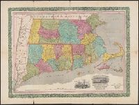
- Beinecke Rare Book and Manuscript Library > Rail-road & township map of Massachusetts, Connecticut and Rhode Island.
- Creator:
- Rand McNally and Company
- Published / Created:
- c1898.
- Call Number:
- 766 1898
- Container / Volume:
- BRBL_00467
- Image Count:
- 3
- Resource Type:
- Maps, Atlases & Globes
- Found in:
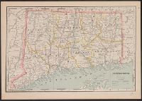
- Beinecke Rare Book and Manuscript Library > Rand, McNally & Co.'s Connecticut and Rhode Island.
- Published / Created:
- 1888
- Call Number:
- 766 1888
- Container / Volume:
- BRBL_00467
- Image Count:
- 1
- Resource Type:
- Maps, Atlases & Globes
- Found in:
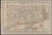
- Beinecke Rare Book and Manuscript Library > Rand, McNally & Co.'s Connecticut.
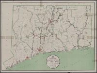
- Published / Created:
- 1912
- Call Number:
- 766 1912
- Container / Volume:
- BRBL_00467
- Image Count:
- 2
- Resource Type:
- Maps, Atlases & Globes
- Found in:
- Beinecke Rare Book and Manuscript Library > State map of Connecticut, engraved expressly for the Standard World Atlas.
- Creator:
- Bien, Joseph R
- Published / Created:
- 1902
- Call Number:
- 766 1902
- Container / Volume:
- BRBL_00467
- Image Count:
- 4
- Resource Type:
- Maps, Atlases & Globes
- Found in:
- Beinecke Rare Book and Manuscript Library > The standard map of Connecticut / prepared under the direction of Joseph R. Bien, E.M., from original surveys and the triangulations and surveys of the U.S. Geological Survey and U.S. Coast and Geodetic Survey.
- Creator:
- Ensign, Bridgman & Fanning
- Published / Created:
- 1855
- Call Number:
- 76 1855
- Container / Volume:
- BRBL_00445
- Image Count:
- 1
- Resource Type:
- Maps, Atlases & Globes
- Found in:
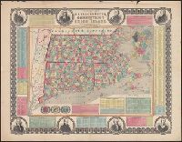
- Beinecke Rare Book and Manuscript Library > Township map of Massachusetts, Connecticut and Rhode Island.
- Creator:
- Ensign, Bridgman & Fanning
- Published / Created:
- 1855
- Call Number:
- 76 1855
- Container / Volume:
- BRBL_00445
- Image Count:
- 1
- Resource Type:
- Maps, Atlases & Globes
- Found in:
- Beinecke Rare Book and Manuscript Library > Township map of Massachusetts, Connecticut and Rhode Island.