Search
You Searched For
Search Results
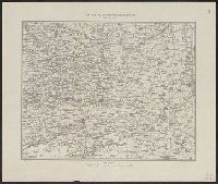
- Published / Created:
- 1919?]
- Call Number:
- 11hcf 1919B-43
- Image Count:
- 1
- Resource Type:
- Maps, Atlases & Globes
- Description:
- Lower left: 584a.
- Publisher:
- s.n.,
- Subject (Geographic):
- Croatia--Maps
- Found in:
- Beinecke Rare Book and Manuscript Library > Areas and population of Dalmatian Islands in 1900 : Official Austrian census.
- Published / Created:
- 191-.
- Call Number:
- 11hcf 1919-36
- Container / Volume:
- BRBL_00010K
- Image Count:
- 1
- Resource Type:
- Maps, Atlases & Globes
- Description:
- Shows languages spoken in cities noted within map area.
- Publisher:
- Istituto Geografico de Agostini,
- Subject (Geographic):
- Croatia--Maps and Italy--Maps
- Found in:
- Beinecke Rare Book and Manuscript Library > Linguistic map of Venezia Tridentia, Venezia Giulia and Dalmatia.
- Published / Created:
- 1919?]
- Call Number:
- 11hcf 1919B-44
- Image Count:
- 1
- Resource Type:
- Maps, Atlases & Globes
- Description:
- Lower left: 675.
- Publisher:
- s.n.,
- Subject (Geographic):
- Croatia--Maps
- Found in:
- Beinecke Rare Book and Manuscript Library > Numbers speaking various languages in Istrian-Dalmatian Islands.
- Published / Created:
- 1896
- Call Number:
- 41hc 1896
- Container / Volume:
- BRBL_00243
- Image Count:
- 1
- Resource Type:
- Maps, Atlases & Globes
- Publisher:
- The Norris-Peters Co.,
- Subject (Geographic):
- Austria--Maps, Croatia--Maps, and Slovenia--Maps
- Found in:
- Beinecke Rare Book and Manuscript Library > The Austro-Hungarian Maneuvers : September, 1896 / C.H. Ourand.
- Creator:
- Ordnance Survey of Great Britain and Ireland
Royal Geographical Society (Great Britain). Geographical Section
- Published / Created:
- 1915
- Call Number:
- 11hcf 1919E-11
- Image Count:
- 1
- Resource Type:
- Maps, Atlases & Globes
- Alternative Title:
- Europe 1:1,000,000, G.S.G.S. ; no. 2758, and GSGS (Series) ; no. 2758.
- Description:
- Elevation above sea level indicated by colored shading.
- Publisher:
- Ordnance Survey,
- Subject (Geographic):
- Croatia--Maps, Italy--Maps, and Yugoslavia--Maps
- Subject (Topic):
- World War, 1914-1918--Maps
- Found in:
- Beinecke Rare Book and Manuscript Library > Triest : North L 33. / compiled at the Royal Geographical Society under the direction of the Geographical Section; drawn and printed by Ordnance Survey.
- Creator:
- Ordnance Survey of Great Britain and Ireland
Royal Geographical Society (Great Britain). Geographical Section
- Published / Created:
- 1915
- Call Number:
- 11hcf 1919E-10
- Container / Volume:
- BRBL_00010Z
- Image Count:
- 1
- Resource Type:
- Maps, Atlases & Globes
- Alternative Title:
- Europe 1:1,000,000, G.S.G.S. ; no. 2758, and GSGS (Series) ; no. 2758.
- Description:
- Copy 2 imperfect. Mutilated. Browned. Inscription: Charles Seymour.
- Publisher:
- Ordnance Survey,
- Subject (Geographic):
- Croatia--Maps, Italy--Maps, and Yugoslavia--Maps
- Subject (Name):
- Seymour, Charles,--1885-1963--Autograph
- Subject (Topic):
- World War, 1914-1918--Maps
- Found in:
- Beinecke Rare Book and Manuscript Library > Triest : North L 33. / compiled at the Royal Geographical Society under the direction of the Geographical Section; drawn and printed by Ordnance Survey.
- Creator:
- Ordnance Survey of Great Britain and Ireland
Royal Geographical Society (Great Britain). Geographical Section
- Published / Created:
- 1915
- Call Number:
- 11hcf 1919E-10
- Image Count:
- 1
- Resource Type:
- Maps, Atlases & Globes
- Alternative Title:
- Europe 1:1,000,000, G.S.G.S. ; no. 2758, and GSGS (Series) ; no. 2758.
- Description:
- Includes index to adjoining sheets, index to boundaries, and pronunciation glossary.
- Publisher:
- Ordnance Survey,
- Subject (Geographic):
- Croatia--Maps, Italy--Maps, and Yugoslavia--Maps
- Subject (Name):
- Seymour, Charles,--1885-1963--Autograph
- Subject (Topic):
- World War, 1914-1918--Maps
- Found in:
- Beinecke Rare Book and Manuscript Library > Triest : North L 33. / compiled at the Royal Geographical Society under the direction of the Geographical Section; drawn and printed by Ordnance Survey.
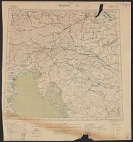
- Published / Created:
- 1919
- Call Number:
- 11hcf 1919E-3
- Container / Volume:
- BRBL_00010ZA
- Image Count:
- 1
- Resource Type:
- Maps, Atlases & Globes
- Description:
- "2 November 1919."
- Publisher:
- s.n.,
- Subject (Geographic):
- Croatia--Maps and Italy--Maps
- Found in:
- Beinecke Rare Book and Manuscript Library > [Map showing the Trieste-Isonzo region, including Fiume.]
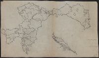
- Published / Created:
- 191-.
- Call Number:
- 11hcf 1919E-2
- Container / Volume:
- BRBL_00010ZA
- Image Count:
- 1
- Resource Type:
- Maps, Atlases & Globes
- Description:
- Shows "race majority boundary."
- Publisher:
- s.n.,
- Subject (Geographic):
- Croatia--Maps
- Found in:
- Beinecke Rare Book and Manuscript Library > [Outline map of Dalmatia and surrounding area.]
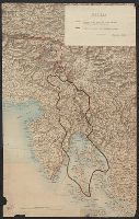
- Published / Created:
- [1915?]
- Call Number:
- 11hcf 1919A-32
- Container / Volume:
- BRBL_00010N
- Image Count:
- 1
- Resource Type:
- Maps, Atlases & Globes
- Alternative Title:
- Pola, Zara, Comacchio
- Description:
- "B.4." in upper left margin.
- Publisher:
- K.u.K. Militär geographisches Institut,
- Subject (Geographic):
- Croatia--Maps and Italy--Maps
- Subject (Topic):
- World War, 1914-1918--Maps
- Found in:
- Beinecke Rare Book and Manuscript Library > [Regional map of the area around the Adriatic Sea : showing the cities of Pola, Zara, Comacchio] / K.u.K. Militärgeographisches Institut.