Search
You Searched For
Search Results
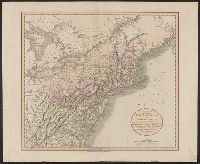
- Published / Created:
- 1809
- Call Number:
- 755 1809A
- Container / Volume:
- BRBL_00438
- Image Count:
- 1
- Resource Type:
- Maps, Atlases & Globes
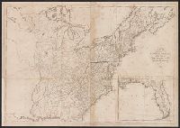
- Description:
- Inset: Florida.
- Publisher:
- Engraved for and sold by Matthew Carey,
- Subject (Geographic):
- Canada--Maps and East (U.S.)--Maps
- Found in:
- Beinecke Rare Book and Manuscript Library > A Map of the United States: compiled chiefly from the State Maps, and other Authentic Information, by Saml. Lewis.
- Published / Created:
- 1835
- Call Number:
- 755 1835A
- Container / Volume:
- BRBL_00440
- Image Count:
- 1
- Resource Type:
- Maps, Atlases & Globes
- Subject (Geographic):
- East (U.S.)--Maps
- Found in:
- Beinecke Rare Book and Manuscript Library > A map of a portion of the Indian Country lying east and west of the Mississippi river to the forty sixth degree of north latitude from ... observation ... 1835 ... U.S. Top. Bureau.
- Published / Created:
- 1836
- Call Number:
- 755gme 1836
- Container / Volume:
- BRBL_00442
- Image Count:
- 1
- Resource Type:
- Maps, Atlases & Globes
- Description:
- Preliminary record.
- Subject (Geographic):
- East (U.S.)--Maps
- Found in:
- Beinecke Rare Book and Manuscript Library > A map of part of Alabama & Florida, showing the route of the proposed Columbus & Pensacola R.R.
- Published / Created:
- 1806
- Call Number:
- 755 1806
- Container / Volume:
- BRBL_00438
- Image Count:
- 1
- Resource Type:
- Maps, Atlases & Globes
- Publisher:
- P.A.F. Tardieu,
- Subject (Geographic):
- Canada--Maps and East (U.S.)--Maps
- Found in:
- Beinecke Rare Book and Manuscript Library > A map of the United States and Canada, New Scotland, New Brunswick and Newfoundland. Dresée par Lapie ... Gravée par P.A.F. Tardieu. Ecrit par J.J. Pachoux.
- Published / Created:
- 1796
- Call Number:
- 755 1802
- Container / Volume:
- BRBL_00437
- Image Count:
- 4
- Resource Type:
- Maps, Atlases & Globes
- Description:
- Boundaries communicated by Chalmers Esqr., text in margin. and Preliminary record.
- Publisher:
- A. Arrowsmith,
- Subject (Geographic):
- East (U.S.)--Maps
- Found in:
- Beinecke Rare Book and Manuscript Library > A map of the United States of North America ...
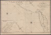
- Published / Created:
- [1815].
- Call Number:
- 755cea 1815
- Container / Volume:
- BRBL_00442
- Image Count:
- 1
- Resource Type:
- Maps, Atlases & Globes
- Description:
- Inset: Delaware Bay 1:360,000.
- Publisher:
- Cushing & Appleton,
- Subject (Geographic):
- East (U.S.)--Maps
- Found in:
- Beinecke Rare Book and Manuscript Library > A new chart of the coast of Connecticut. New York, New Jersey and the Delaware ... by Samuel Lambert, Salem. Wightman Sculpsit.
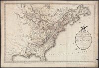
- Published / Created:
- Sept. 1. 1806.
- Call Number:
- 759 1806
- Container / Volume:
- BRBL_00728
- Image Count:
- 1
- Resource Type:
- Maps, Atlases & Globes
- Description:
- From: Cary's New Universal Atlas [London, 1808], no. 55.
- Publisher:
- Published by J. Cary ... ,
- Subject (Geographic):
- East (U.S.)--Maps
- Found in:
- Beinecke Rare Book and Manuscript Library > A new map of part of the United States of North America ... / by John Cary, engraver, 1806.
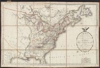
- Published / Created:
- 1806
- Call Number:
- 755 1806A
- Container / Volume:
- BRBL_00438
- Image Count:
- 1
- Resource Type:
- Maps, Atlases & Globes
- Publisher:
- J. Cary,
- Subject (Geographic):
- Canada--Maps and East (U.S.)--Maps
- Found in:
- Beinecke Rare Book and Manuscript Library > A new map of part of the United States of North America ... by John Cary, Engraver.
- Published / Created:
- 1819
- Call Number:
- 755 1819
- Container / Volume:
- BRBL_00439
- Image Count:
- 1
- Resource Type:
- Maps, Atlases & Globes
- Publisher:
- John Cary,
- Subject (Geographic):
- East (U.S.)--Maps
- Found in:
- Beinecke Rare Book and Manuscript Library > A new map of part of the United States, exhibiting the North West, Michigan, Indiana, and Illinois territory the States of Kentucky, Ohio, Virginia, Maryland and Pennsylvania ... John Cary, Engraver.