Search
You Searched For
Search Results
- Creator:
- Wyld, James, 1812-1887, cartographer
- Call Number:
- 13 1873A
- Container / Volume:
- BRBL_00011
- Image Count:
- 1
- Resource Type:
- Maps, Atlases & Globes
- Found in:
- Beinecke Rare Book and Manuscript Library > Map of the countries between England & India : designed to shew the over-land and sea-routes to the east, and the relative position of Russia to England & Hindostan / by James Wyld.
- Creator:
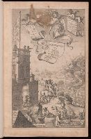
- Ogilby, John, 1600-1676
- Published / Created:
- 1675
- Call Number:
- EEdea 675P
- Image Count:
- 2
- Found in:
- Beinecke Rare Book and Manuscript Library > Britannia, volume the first, or, An illustration of the kingdom of England and dominion of Wales : by a geographical and historical description of the principal roads thereof : actually admeasured and delineated in a century of whole-sheet copper-sculps : accomodated with the ichnography of the several cities and capital towns : and compleated by an accurate account of the more remarkable passages of antiquity, together with a novel discourse of the present state
- Published / Created:
- 1804
- Call Number:
- 32 1804
- Container / Volume:
- BRBL_00044
- Image Count:
- 1
- Resource Type:
- Maps, Atlases & Globes
- Found in:
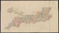
- Beinecke Rare Book and Manuscript Library > A complete representation of the Coast of England ... intended for the invasion of England, By John Luffman Geog.
- Published / Created:
- 1807
- Call Number:
- 32 1807
- Container / Volume:
- BRBL_00044
- Image Count:
- 1
- Resource Type:
- Maps, Atlases & Globes
- Found in:
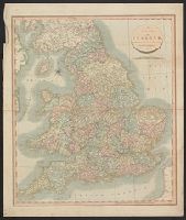
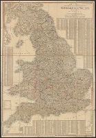
- Beinecke Rare Book and Manuscript Library > A new map of England ... By John Cary, Engraver.
- Published / Created:
- 1811
- Call Number:
- 3247 1811
- Container / Volume:
- BRBL_00066
- Image Count:
- 1
- Resource Type:
- Maps, Atlases & Globes
- Found in:
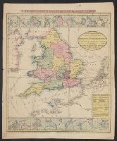
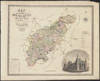
- Beinecke Rare Book and Manuscript Library > A New Map of Northamptonshire, Divided Into Hundreds ... by John Cary.
- Published / Created:
- 1811
- Call Number:
- 32 1811A
- Container / Volume:
- BRBL_00044
- Image Count:
- 1
- Resource Type:
- Maps, Atlases & Globes
- Found in:
- Beinecke Rare Book and Manuscript Library > A new map of England ... by John Cary, Engraver.
- Published / Created:
- 1811
- Call Number:
- 32 1811
- Container / Volume:
- BRBL_00044
- Image Count:
- 1
- Resource Type:
- Maps, Atlases & Globes
- Found in:
- Beinecke Rare Book and Manuscript Library > A new map of England ... By John Cary.
- Published / Created:
- 1814?]
- Call Number:
- 32gmb 1814A
- Container / Volume:
- BRBL_00076
- Image Count:
- 1
- Resource Type:
- Maps, Atlases & Globes
- Found in:
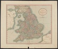
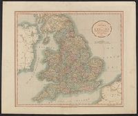
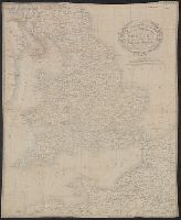
- Beinecke Rare Book and Manuscript Library > An accurate map of England and Wales with the principal roads from the best authorities.
- Published / Created:
- 1814
- Call Number:
- 32 1814
- Container / Volume:
- BRBL_00044
- Image Count:
- 1
- Resource Type:
- Maps, Atlases & Globes
- Found in:
- Beinecke Rare Book and Manuscript Library > England, Neele Sculpt.
- Published / Created:
- 1815?]
- Call Number:
- 32 1815
- Container / Volume:
- BRBL_00044
- Image Count:
- 1
- Resource Type:
- Maps, Atlases & Globes
- Found in:
- Beinecke Rare Book and Manuscript Library > Wallis's new travelling map of England and Wales with part of Scotland ... A Findlay del et sculp.
- Published / Created:
- [1820?]
- Call Number:
- 32am L84 1563
- Container / Volume:
- BRBL_00075
- Image Count:
- 1
- Resource Type:
- Maps, Atlases & Globes
- Found in:
- Beinecke Rare Book and Manuscript Library > London and Westminster in the Reign of Queen Elizabeth, Anno Dom. 1563.
- Published / Created:
- [1820].
- Call Number:
- 32 1820
- Container / Volume:
- BRBL_00045
- Image Count:
- 2
- Resource Type:
- Maps, Atlases & Globes
- Found in:
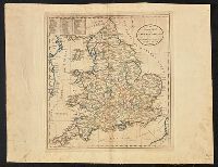
- Beinecke Rare Book and Manuscript Library > A new map of England & Wales, drawn from the latest surveys, 1820.
- Published / Created:
- 1823
- Call Number:
- 32 1823
- Container / Volume:
- BRBL_00045
- Image Count:
- 1
- Resource Type:
- Maps, Atlases & Globes
- Found in:
- Beinecke Rare Book and Manuscript Library > New and Improved map of England and Wales including the principal part of Scotland ... by W.R. Gardner, Engraved by W.R. Gardner.
- Published / Created:
- 1828
- Call Number:
- 32 1828
- Container / Volume:
- BRBL_00045
- Image Count:
- 1
- Resource Type:
- Maps, Atlases & Globes
- Found in:
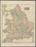
- Beinecke Rare Book and Manuscript Library > Cary's ... map of England and Wales with part of Scotland ... John Cary.
- Published / Created:
- 1830
- Call Number:
- 3247 1830
- Container / Volume:
- BRBL_00066
- Image Count:
- 1
- Resource Type:
- Maps, Atlases & Globes
- Found in:
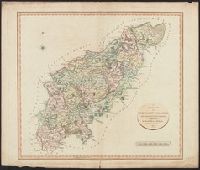
- Beinecke Rare Book and Manuscript Library > Map of the County of Northhampton ... by C. & J. Greenwood. Engraved by J. & C. Walker.
- Published / Created:
- 1830
- Call Number:
- 32 1830
- Container / Volume:
- BRBL_00045
- Image Count:
- 1
- Resource Type:
- Maps, Atlases & Globes
- Found in:
- Beinecke Rare Book and Manuscript Library > Cruchley's improved Geographical Companion throughout England & Wales including part of Scotland ...
- Published / Created:
- 1831
- Call Number:
- 32 1831
- Container / Volume:
- BRBL_00045
- Image Count:
- 1
- Resource Type:
- Maps, Atlases & Globes
- Found in:
- Beinecke Rare Book and Manuscript Library > Cruchley's new travelling map and itinerary comprising the whole of England ...
- Creator:
- Great Britain. Ordnance Survey
- Published / Created:
- Novr. 9th, 1843 [i.e. ca. 1853-1874?]
- Call Number:
- 32 1873
- Container / Volume:
- BRBL_00744
- Image Count:
- 8
- Resource Type:
- Maps, Atlases & Globes
- Found in:
- Beinecke Rare Book and Manuscript Library > [Old series Ordnance Survey maps of England and Wales] / engraved at the Ordnance Map Office, Southampton ...
- Creator:
- Great Britain. Ordnance Survey
- Published / Created:
- Novr. 9th, 1843 [i.e. ca. 1853-1874?]
- Call Number:
- 32 1873
- Container / Volume:
- BRBL_00743
- Image Count:
- 35
- Resource Type:
- Maps, Atlases & Globes
- Found in:
- Beinecke Rare Book and Manuscript Library > [Old series Ordnance Survey maps of England and Wales] / engraved at the Ordnance Map Office, Southampton ...
- Published / Created:
- 1845
- Call Number:
- 32gme 1845
- Container / Volume:
- BRBL_00076
- Image Count:
- 2
- Resource Type:
- Maps, Atlases & Globes
- Found in:
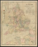
- Beinecke Rare Book and Manuscript Library > Map of the Railways of England & Wales ...