Search
You Searched For
Search Results
- Creator:
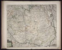
- Jaillot, Alexis Hubert, 1632-1712
Mortier, Pierre
Sanson, Guillaume
- Published / Created:
- 1691
- Call Number:
- Folio 469
- Collection Title:
- [Atlas factice of 13 maps by Nicolaes Visscher I, Nicolaes Visscher II, Guillaume Sanson, and
- Image Count:
- 1
- Found in:
- Beinecke Rare Book and Manuscript Library > Les Provinces des Pays-Bas catholiques [cartographic material] : distinguees suivant qu’elles sont presentement partagees entre le Roy de France, le Roy d’Espagne et les Estats Generaux des Provinces-Unies / presentees au Roy par ... Guillaume Sanson Geog
- Creator:
- Danckerts, Cornelis, ca. 1603-1656
- Published / Created:
- 1643
- Call Number:
- 1983 Folio 19
- Collection Title:
- [Atlas factice of 96 maps by Blaeu, Visscher, Jansson, Hondius and others]
- Image Count:
- 1
- Found in:
- Beinecke Rare Book and Manuscript Library > Nova Europae descriptio / auctore Cornelio Dankertz
- Creator:
- Visscher, Claes Jansz., 1586 or 7-1652
- Published / Created:
- ao. 1652
- Call Number:
- 1983 Folio 19
- Collection Title:
- [Atlas factice of 96 maps by Blaeu, Visscher, Jansson, Hondius and others]
- Image Count:
- 1
- Found in:
- Beinecke Rare Book and Manuscript Library > Nova Europae descriptio / auctore N. Visscher
- Creator:
- Deur, Abraham Jansz
Visscher, Nicolaes, 1649-1702
- Published / Created:
- [ca. 1684]
- Call Number:
- Folio 469
- Collection Title:
- [Atlas factice of 13 maps by Nicolaes Visscher I, Nicolaes Visscher II, Guillaume Sanson, and
- Image Count:
- 1
- Found in:
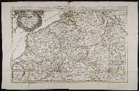
- Beinecke Rare Book and Manuscript Library > Novissima et accuratissima XVII provinciarum Germanae Inferiores delineatio [cartographic material]
- Creator:
- Visscher, Nicolaes, 1649-1702
- Published / Created:
- ca. 1684
- Call Number:
- Folio 469
- Collection Title:
- [Atlas factice of 13 maps by Nicolaes Visscher I, Nicolaes Visscher II, Guillaume Sanson, and
- Image Count:
- 1
- Found in:
- Beinecke Rare Book and Manuscript Library > Tabula ducatus Brabantiae continens Marchionatum sacri imperii et dominium Mechliniense / [cartographic material] / de novo accurate emendata et in lucem edita per Nicolaum Visscher
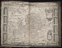
- Creator:
- Waghenaer, Lucas Janszoon, 1534 or 5-1606
- Published / Created:
- ann. 1605.
- Call Number:
- 1976 Folio 46
- Image Count:
- 125
- Resource Type:
- Books, Journals & Pamphlets
- Found in:
- Beinecke Rare Book and Manuscript Library > The mariners mirrovr wherin may playnly be seen the courses, heights, distances, depths, sounding, flouds and ebs, risings of lands, rocks ... of the harbouroughs, havens and ports of the greatest part of Europe: ... together w.th the rules and instrumeíÄ
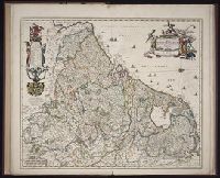
- Creator:
- Visscher, Nicolaes, 1649-1702
- Published / Created:
- ca. 1689
- Call Number:
- Folio 469
- Collection Title:
- [Atlas factice of 13 maps by Nicolaes Visscher I, Nicolaes Visscher II, Guillaume Sanson, and
- Image Count:
- 1
- Found in:
- Beinecke Rare Book and Manuscript Library > Totius Fluminis Rheni novissma descriptio / [cartographic material] / per Nic. Vischer
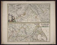
- Call Number:
- Folio 469
- Collection Title:
- [Atlas factice of 13 maps by Nicolaes Visscher I, Nicolaes Visscher II, Guillaume Sanson, and
- Image Count:
- 2
- Found in:
- Beinecke Rare Book and Manuscript Library > [Atlas factice of 13 maps by Nicolaes Visscher I, Nicolaes Visscher II, Guillaume Sanson, and Justus Danckerts]
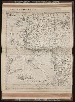
- Published / Created:
- MDCI [1601]
- Call Number:
- Taylor 193 3
- Collection Title:
- Tertia pars Indiae Orientalis ... / de Germanico in Latinum translata, & bono ordine disposita a
- Image Count:
- 1
- Found in:
- Beinecke Rare Book and Manuscript Library > [Descriptio Hydrograrhica sheet 2]