Search
You Searched For
Search Results
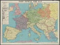
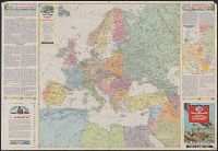
- Creator:
- George Philip & Son
London Geographical Institute
- Published / Created:
- [1941?]
- Call Number:
- 11hd 1939B
- Image Count:
- 1
- Resource Type:
- Maps, Atlases & Globes
- Found in:
- Beinecke Rare Book and Manuscript Library > Daily Express war map [cartographic material] / the London Geographical Institute KCL.
- Creator:
- George Philip & Son
London Geographical Institute
- Published / Created:
- 1941
- Call Number:
- 11hd 1941
- Image Count:
- 1
- Resource Type:
- Maps, Atlases & Globes
- Found in:
- Beinecke Rare Book and Manuscript Library > Daily Telegraph war map of the Russian Front [cartographic material] / London Geographical Institute.
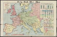
- Creator:
- George Philip & Son
London Geographical Institute
- Published / Created:
- [1918?]
- Call Number:
- 11hc 1914P
- Image Count:
- 1
- Resource Type:
- Maps, Atlases & Globes
- Found in:
- Beinecke Rare Book and Manuscript Library > Daily mail war map [cartographic material].
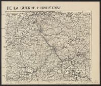
- Published / Created:
- 1915
- Call Number:
- 11hc 1915D
- Image Count:
- 1
- Resource Type:
- Maps, Atlases & Globes
- Found in:
- Beinecke Rare Book and Manuscript Library > De la guerre européenne : feuille nord-est.
- Published / Created:
- 1916.]
- Call Number:
- 11hc 1916D
- Container / Volume:
- BRBL_00010C
- Image Count:
- 2
- Resource Type:
- Maps, Atlases & Globes
- Found in:
- Beinecke Rare Book and Manuscript Library > Die militärischen ereignisse vom 23, bis 30. October 1916 : Wochentliche Kriegsschauplatzkarte.
- Creator:
- General Drafting Company
- Published / Created:
- [1943]
- Call Number:
- 30 1942B
- Container / Volume:
- BRBL_00032B
- Image Count:
- 2
- Resource Type:
- Maps, Atlases & Globes
- Found in:
- Beinecke Rare Book and Manuscript Library > Esso war map II featuring the world island [and] fortress Europe. A second war map edited, drafted and printed by the makers of the well-known Esso road maps.
- Published / Created:
- 1919
- Call Number:
- 30ed 1919A
- Container / Volume:
- BRBL_00037B
- Image Count:
- 1
- Resource Type:
- Maps, Atlases & Globes
- Found in:
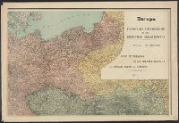
- Beinecke Rare Book and Manuscript Library > Ethnographic Map of Europe.
- Creator:
- Berghaus, Heinrich Karl Wilhelm, 1797-1884
Perthes, Justus, publisher
Stülpnagel, Johann Friedrich von, 1786-1865
- Published / Created:
- 1852
- Call Number:
- 30ed 1852
- Container / Volume:
- BRBL_00037B
- Image Count:
- 1
- Resource Type:
- Maps, Atlases & Globes
- Found in:
- Beinecke Rare Book and Manuscript Library > Ethnographische karte von Eüropa Auf F.V. Stülpnagel's geogr. zeichnung, zusammengestellt von HBgs. Potsdam, im märz 1845. Verbessernd durchgesehen in den monaten april-juli 1851 ...
- Published / Created:
- 1878
- Call Number:
- 30 1878
- Container / Volume:
- BRBL_00032
- Image Count:
- 1
- Resource Type:
- Maps, Atlases & Globes
- Found in:
- Beinecke Rare Book and Manuscript Library > Europa / Von A. Pertermann.
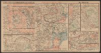
- Creator:
- Argentina. Ejército. Estado Mayor General
- Published / Created:
- 1914
- Call Number:
- 11hc 1914B
- Container / Volume:
- BRBL_00010A
- Image Count:
- 4
- Resource Type:
- Maps, Atlases & Globes
- Found in:
- Beinecke Rare Book and Manuscript Library > Europa [cartographic material] : teatro de operaciones de los ejercitos beligerantes.