Search
You Searched For
Search Results
- Creator:
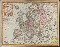
- Bankes, Thomas, b. 1744. New, royal, and authentic system of universal geography
Bowen, Thomas
- Published / Created:
- 1790?]
- Call Number:
- 30 1790
- Container / Volume:
- BRBL_00030
- Image Count:
- 1
- Resource Type:
- Maps, Atlases & Globes
- Found in:
- Beinecke Rare Book and Manuscript Library > A new and accurate map of Europe : drawn from the best authorities / by Thos. Bowen.
- Published / Created:
- 1795
- Call Number:
- 30 1795
- Container / Volume:
- BRBL_00030
- Image Count:
- 1
- Resource Type:
- Maps, Atlases & Globes
- Found in:
- Beinecke Rare Book and Manuscript Library > An accurate map of Europe from the best authorities. Engrav'd by S. Hill, Boston.
- Published / Created:
- 1795
- Call Number:
- 30 1795
- Container / Volume:
- BRBL_00030
- Image Count:
- 1
- Resource Type:
- Maps, Atlases & Globes
- Found in:
- Beinecke Rare Book and Manuscript Library > An accurate map of Europe from the best authorities. Engrav'd by S. Hill, Boston.
- Published / Created:
- 1793
- Call Number:
- 30 1793
- Container / Volume:
- BRBL_00030
- Image Count:
- 1
- Resource Type:
- Maps, Atlases & Globes
- Found in:
- Beinecke Rare Book and Manuscript Library > Carte Itineraire de L'Europe ... Mr. Reichard, Mr. Gussefeld.
- Published / Created:
- 1640
- Call Number:
- 30 1640
- Container / Volume:
- BRBL_00029
- Image Count:
- 2
- Resource Type:
- Maps, Atlases & Globes
- Found in:
- Beinecke Rare Book and Manuscript Library > Carte de l'Europe - corrigée et Augmenteè dessus toutes les aultres cy devant faictes par P. Bertius Cosmographe et Bertius du Roy.
- Creator:
- L'Isle, Guillaume de, 1675-1726
Lotter, Tobias Conrad, 1717-1777
- Published / Created:
- 176-?]
- Call Number:
- 30 1720A
- Container / Volume:
- BRBL_00029
- Image Count:
- 1
- Resource Type:
- Maps, Atlases & Globes
- Found in:
- Beinecke Rare Book and Manuscript Library > Europa [cartographic material] : delineata juxta observationes excellorum virorum Academiae regalis scientiarum et nonnullorum alioru[m] et juxta recentis[si]mas annotationes / per G. de L'Isle, geographum Parisiis prostat nunc in officina ; Tobiae Conrad
- Creator:
- Münster, Sebastian, 1489-1552
Münster, Sebastian, 1489-1552. Geographia universalis
Petri, Heinrich, 1508-1579
- Published / Created:
- 1540]
- Call Number:
- 30 1545
- Container / Volume:
- BRBL_00029
- Image Count:
- 2
- Resource Type:
- Maps, Atlases & Globes
- Found in:
- Beinecke Rare Book and Manuscript Library > Europa prima nova tabula.
- Creator:
- Mercator, Gerhard, 1512-1594
Mercator, Rumold, ca. 1545-1599
- Call Number:
- 30 1610
- Container / Volume:
- BRBL_00029
- Image Count:
- 1
- Resource Type:
- Maps, Atlases & Globes
- Found in:
- Beinecke Rare Book and Manuscript Library > Europa, ad magnae Europae Gerardi Mercatoris P. imitationem / Rumoldi Mercatoris F. cura, edita ...
- Creator:
- Münster, Sebastian, 1489-1552
- Published / Created:
- 1544]
- Call Number:
- 30 1544
- Container / Volume:
- BRBL_00732
- Image Count:
- 2
- Resource Type:
- Maps, Atlases & Globes
- Found in:
- Beinecke Rare Book and Manuscript Library > Europa, das ein Drittheil der Erden nach Gelegenheit unsern Zeiten.
- Published / Created:
- 1587
- Call Number:
- 30an 1587
- Container / Volume:
- BRBL_00037
- Image Count:
- 1
- Resource Type:
- Maps, Atlases & Globes
- Found in:
- Beinecke Rare Book and Manuscript Library > Europae Descriptio ...
- Creator:
- Ortelius, Abraham, 1527-1598
- Published / Created:
- 1630?]
- Call Number:
- 30 1630
- Container / Volume:
- BRBL_00029
- Image Count:
- 1
- Resource Type:
- Maps, Atlases & Globes
- Found in:
- Beinecke Rare Book and Manuscript Library > Europam, sive Celticam veterem, sic describere conabar Abrahahamus Ortelius / Evert Sijmons z. Hamers veldt sculpsit.
- Published / Created:
- 1815
- Call Number:
- 30hc 1815
- Container / Volume:
- BRBL_00038
- Image Count:
- 2
- Resource Type:
- Maps, Atlases & Globes
- Found in:
- Beinecke Rare Book and Manuscript Library > Europe (1715-1815) illustrating the wars of the French Revolution and Napoleon's wars.
- Published / Created:
- 1787
- Call Number:
- 30 1787
- Container / Volume:
- BRBL_00029
- Image Count:
- 1
- Resource Type:
- Maps, Atlases & Globes
- Found in:
- Beinecke Rare Book and Manuscript Library > Europe divided into its Empires, Kingdoms, States, Republics, etc. By Thos. Kitchin ...
- Published / Created:
- [1795?]
- Call Number:
- 30 1795A
- Container / Volume:
- BRBL_00030
- Image Count:
- 1
- Resource Type:
- Maps, Atlases & Globes
- Found in:
- Beinecke Rare Book and Manuscript Library > Europe.
- Published / Created:
- 1788
- Call Number:
- 30 1788
- Container / Volume:
- BRBL_00029
- Image Count:
- 1
- Resource Type:
- Maps, Atlases & Globes
- Found in:
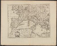
- Beinecke Rare Book and Manuscript Library > Itinéraire de L'Europe ou Apercu des differentes Routes ... Par Mr. Brion de la Tour ...
- Published / Created:
- 1747
- Call Number:
- 30 1747
- Container / Volume:
- BRBL_00029
- Image Count:
- 1
- Resource Type:
- Maps, Atlases & Globes
- Found in:
- Beinecke Rare Book and Manuscript Library > L'Europe ... de Mr. de Cassini et de Mr. Hass.
- Published / Created:
- [1710?]
- Call Number:
- 30 1710
- Container / Volume:
- BRBL_00029
- Image Count:
- 1
- Resource Type:
- Maps, Atlases & Globes
- Found in:
- Beinecke Rare Book and Manuscript Library > L'Europe Representée par la Geographie Naturelle et Historique et Par le Blazon ... Pierre Husson...
- Creator:
- Jaillot, Alexis Hubert, 1632?-1712
Mortier, Pierre, publisher
Sanson, Nicolas, 1600-1667
- Published / Created:
- [1690?]
- Call Number:
- 30 1690A
- Container / Volume:
- BRBL_00029
- Image Count:
- 1
- Resource Type:
- Maps, Atlases & Globes
- Found in:
- Beinecke Rare Book and Manuscript Library > L'Europe divisée suivant l'estendüe de ses principaux estats, subdivisés en leurs principales provinces / par le Sr. Sanson, Geographe ordinaire du Roy.
- Creator:
- Haraeus, Franciscus, d. 1632
Jansson, Jan, 1588-1664. Atlas novus
- Published / Created:
- 1680?]
- Call Number:
- 30 1680
- Container / Volume:
- BRBL_00029
- Image Count:
- 1
- Resource Type:
- Maps, Atlases & Globes
- Found in:
- Beinecke Rare Book and Manuscript Library > Lumen historiarum per occidentem / ex conatibus Fran. Haraei Antverpiae.
- Published / Created:
- 1700?]
- Call Number:
- 314 1700
- Container / Volume:
- BRBL_00038
- Image Count:
- 1
- Resource Type:
- Maps, Atlases & Globes
- Found in:
- Beinecke Rare Book and Manuscript Library > Lumen historiarum per occidentem / ex conatibus Fran. Haraet, antverpiae.