Search
You Searched For
Search Results
- Published / Created:
- 1828
- Call Number:
- 38GMD 1828
- Container / Volume:
- BRBL_00171
- Image Count:
- 1
- Resource Type:
- Maps, Atlases & Globes
- Found in:
- Beinecke Rare Book and Manuscript Library > A Physical and Topographical map of France ... the post Roads & Relays ... inland Navigation &c. Pickett Sculp. J. Smith Delin.
- Published / Created:
- 1806
- Call Number:
- 38 1806
- Container / Volume:
- BRBL_00154
- Image Count:
- 1
- Resource Type:
- Maps, Atlases & Globes
- Found in:
- Beinecke Rare Book and Manuscript Library > A new map of France ... division into Provinces as previous to the Revolution ... by John Cary, Engraver.
- Published / Created:
- 1811
- Call Number:
- 38 1811
- Container / Volume:
- BRBL_00154
- Image Count:
- 1
- Resource Type:
- Maps, Atlases & Globes
- Found in:
- Beinecke Rare Book and Manuscript Library > A new map of France ... divison into provinces as previous to the revolution ... John Cary, Engraver.
- Published / Created:
- 1799
- Call Number:
- 38 1799A
- Container / Volume:
- BRBL_00154
- Image Count:
- 1
- Resource Type:
- Maps, Atlases & Globes
- Found in:
- Beinecke Rare Book and Manuscript Library > A new map of France divided into departments as decreed by the National Assembly, 1790 ... John Cary, Engraver.
- Creator:
- Germany. Heer. Generalstab
- Published / Created:
- 1940
- Call Number:
- 11hd 1942D-54
- Container / Volume:
- BRBL_00010ZE
- Image Count:
- 1
- Resource Type:
- Maps, Atlases & Globes
- Found in:
- Beinecke Rare Book and Manuscript Library > Befestigungskarte Frankreich 1:25000 : St. Amand, Nr. 1-2, XXVI-5/1-2.
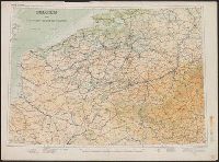
- Creator:
- Great Britain. War Office. General Staff. Geographical Section
- Published / Created:
- 1910
- Call Number:
- 335 1910
- Container / Volume:
- BRBL_00086
- Image Count:
- 1
- Resource Type:
- Maps, Atlases & Globes
- Found in:
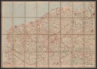
- Beinecke Rare Book and Manuscript Library > Belgium and the north east of France G.S.G.S. 2517 [cartographic material].
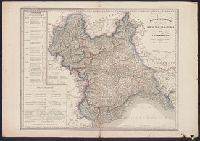
- Published / Created:
- [1844?]
- Call Number:
- 401 1844
- Container / Volume:
- BRBL_00233
- Image Count:
- 1
- Resource Type:
- Maps, Atlases & Globes
- Found in:
- Beinecke Rare Book and Manuscript Library > Carta moderna degli State Sarde di Terraferma [cartographic material] / V. Stanghi e G. Maina Inc. ; G Pozzi scrisse.
- Published / Created:
- 1859
- Call Number:
- 401 1859
- Container / Volume:
- BRBL_00233
- Image Count:
- 1
- Resource Type:
- Maps, Atlases & Globes
- Found in:
- Beinecke Rare Book and Manuscript Library > Carta politico-amministativa degli State Sarde di Terraferma / V. Stanghi e G. Maina Inc. ; G Pozzi scrisse.
- Published / Created:
- 1855?]
- Call Number:
- 38 1855A
- Container / Volume:
- BRBL_00154
- Image Count:
- 1
- Resource Type:
- Maps, Atlases & Globes
- Found in:
- Beinecke Rare Book and Manuscript Library > Carte Générale des Routes de France : et d'une partie des États limitrophes... / Dressée par A.R. Fremin, Géographe.
- Published / Created:
- [1898?]
- Call Number:
- 38 1898
- Container / Volume:
- BRBL_00155
- Image Count:
- 1
- Resource Type:
- Maps, Atlases & Globes
- Found in:
- Beinecke Rare Book and Manuscript Library > Carte Physique, Politique et Administrative de la France, avec le tracé des Chemins de Fer, sous la direction de L. Bonnefont ... Dressée par A. Vuillemin.
- Published / Created:
- 191-?]
- Call Number:
- 11hcf 1919D-44
- Container / Volume:
- BRBL_00010X
- Image Count:
- 1
- Resource Type:
- Maps, Atlases & Globes
- Found in:
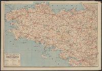
- Beinecke Rare Book and Manuscript Library > Carte Routière Kilométrique du Morbihan : avec indication des principales pentes.
- Published / Created:
- 1820
- Call Number:
- 38 1820
- Container / Volume:
- BRBL_00154
- Image Count:
- 1
- Resource Type:
- Maps, Atlases & Globes
- Found in:
- Beinecke Rare Book and Manuscript Library > Carte de France par A.H. Brue ... Paris. Gravée sous la direction de l'auteur.
- Creator:
- France. Ministère de l'intérieur
- Published / Created:
- [1891?-1910?]
- Call Number:
- 3814 1905
- Container / Volume:
- BRBL_00174
- Image Count:
- 1
- Resource Type:
- Maps, Atlases & Globes
- Found in:
- Beinecke Rare Book and Manuscript Library > Carte de la France [cartographic material] / dressée par ordre du Ministre de l'intérieur ; gravée et imprimée par Erhard.
- Published / Created:
- 1918?]
- Call Number:
- 11hc 1918
- Container / Volume:
- BRBL_00010E
- Image Count:
- 3
- Resource Type:
- Maps, Atlases & Globes
- Found in:
- Beinecke Rare Book and Manuscript Library > Carte de la France et des Frontieres a 1:200,000.
- Published / Created:
- [1801]
- Call Number:
- 38hc 1801
- Container / Volume:
- BRBL_00172
- Image Count:
- 1
- Resource Type:
- Maps, Atlases & Globes
- Found in:
- Beinecke Rare Book and Manuscript Library > Carte des Routes d'Etapes de la République Francaise Dressée au Dépôt Général de la Guerre. en l'An 1X (1801) Gravér par P.F. Tardieu. Ecrite par L. Aubert.
- Published / Created:
- [1871?]
- Call Number:
- 38hc 1871
- Container / Volume:
- BRBL_00172
- Image Count:
- 1
- Resource Type:
- Maps, Atlases & Globes
- Found in:
- Beinecke Rare Book and Manuscript Library > Carte des frontières : France et Prusse / J. Roussel, graveur.
- Creator:
- Taride, A
- Published / Created:
- 191-
- Call Number:
- 383 1917
- Container / Volume:
- BRBL_00177
- Image Count:
- 1
- Resource Type:
- Maps, Atlases & Globes
- Found in:
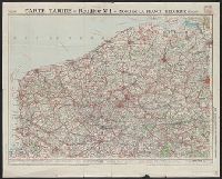
- Beinecke Rare Book and Manuscript Library > Carte du front Français [cartographic material] / A. Taride, editeur.
- Creator:
- Taride, A
- Published / Created:
- 191-
- Call Number:
- 383 1917
- Container / Volume:
- BRBL_00177
- Image Count:
- 1
- Resource Type:
- Maps, Atlases & Globes
- Found in:
- Beinecke Rare Book and Manuscript Library > Carte du front Français [cartographic material] / A. Taride, editeur.
- Published / Created:
- 1811]
- Call Number:
- 38 1811A
- Container / Volume:
- BRBL_00154
- Image Count:
- 1
- Resource Type:
- Maps, Atlases & Globes
- Found in:
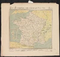
- Beinecke Rare Book and Manuscript Library > Carte e l'empire Francais et du royaume d'Italie... / par che. Picquet, 1811.
- Published / Created:
- 1843]
- Call Number:
- 38 1843
- Container / Volume:
- BRBL_00154
- Image Count:
- 1
- Resource Type:
- Maps, Atlases & Globes
- Found in:
- Beinecke Rare Book and Manuscript Library > Carte itineraire de la France / dressee par Monin...1843.
- Creator:
- France. Ministère des travaux publics
- Published / Created:
- 1911
- Call Number:
- 38gma 1911
- Container / Volume:
- BRBL_00170
- Image Count:
- 1
- Resource Type:
- Maps, Atlases & Globes
- Found in:
- Beinecke Rare Book and Manuscript Library > Carte itinéraire des voies navigables de la France [cartographic material] : d'après le Guide officiel de la navigation intérieure 1911.
- Creator:
- Leuzinger, R
- Published / Created:
- [1880]
- Call Number:
- 38CBF 1880
- Container / Volume:
- BRBL_00168
- Image Count:
- 1
- Resource Type:
- Maps, Atlases & Globes
- Found in:
- Beinecke Rare Book and Manuscript Library > Carte physique et géographique de la France [cartographic material] / par R. Leuzinger ; étab., top., & lith. de Wurster, Randegger & co.
- Published / Created:
- [1920?].
- Call Number:
- 38gmb 1920A
- Container / Volume:
- BRBL_00170
- Image Count:
- 4
- Resource Type:
- Maps, Atlases & Globes
- Found in:
- Beinecke Rare Book and Manuscript Library > Carte routière de France de Dion-Bouton : spéciale pour automobiles / Dressée au Service Cartographique de Dion-Bouton.
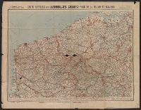
- Creator:
- Cartes Taride (Firm)
- Published / Created:
- [191-?]
- Call Number:
- 38 191XA
- Container / Volume:
- BRBL_00155
- Image Count:
- 1
- Resource Type:
- Maps, Atlases & Globes
- Found in:
- Beinecke Rare Book and Manuscript Library > Carte routière pour automobilistes & cyclistes [cartographic material] : Nord-est de la France.
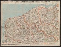
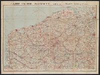
- Creator:
- Cartes Taride (Firm)
- Published / Created:
- 1901-
- Call Number:
- Series 38gmb 1920
- Container / Volume:
- BRBL_00038B
- Image Count:
- 12
- Resource Type:
- Maps, Atlases & Globes
- Found in:
- Beinecke Rare Book and Manuscript Library > Carte routière pour automobilistes & cyclistes [cartographic material] : [France].
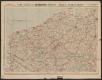
- Creator:
- Cartes Taride (Firm)
- Published / Created:
- 1901-
- Call Number:
- Series 38gmb 1920
- Container / Volume:
- BRBL_00038A
- Image Count:
- 20
- Resource Type:
- Maps, Atlases & Globes
- Found in:
- Beinecke Rare Book and Manuscript Library > Carte routière pour automobilistes & cyclistes [cartographic material] : [France].
- Creator:
- Cartes Taride (Firm)
- Published / Created:
- 1901-
- Call Number:
- Series 38gmb 1920
- Container / Volume:
- BRBL_00038B
- Image Count:
- 8
- Resource Type:
- Maps, Atlases & Globes
- Found in:
- Beinecke Rare Book and Manuscript Library > Carte routière pour automobilistes & cyclistes [cartographic material] : [France].
- Creator:
- Cartes Taride (Firm)
- Published / Created:
- 1901-
- Call Number:
- Series 38gmb 1920
- Container / Volume:
- BRBL_00038A
- Image Count:
- 25
- Resource Type:
- Maps, Atlases & Globes
- Found in:
- Beinecke Rare Book and Manuscript Library > Carte routière pour automobilistes & cyclistes [cartographic material] : [France].
- Creator:
- Cartes Taride (Firm)
- Published / Created:
- 1901-
- Call Number:
- Series 38gmb 1920
- Container / Volume:
- BRBL_00038B
- Image Count:
- 5
- Resource Type:
- Maps, Atlases & Globes
- Found in:
- Beinecke Rare Book and Manuscript Library > Carte routière pour automobilistes & cyclistes [cartographic material] : [France].
- Creator:
- Cartes Taride (Firm)
- Published / Created:
- 1901-
- Call Number:
- Series 38gmb 1920
- Container / Volume:
- BRBL_00038B
- Image Count:
- 6
- Resource Type:
- Maps, Atlases & Globes
- Found in:
- Beinecke Rare Book and Manuscript Library > Carte routière pour automobilistes & cyclistes [cartographic material] : [France].
- Published / Created:
- 191-.
- Call Number:
- 11hcf 1919D-45
- Image Count:
- 1
- Resource Type:
- Maps, Atlases & Globes
- Found in:
- Beinecke Rare Book and Manuscript Library > Carte-Guide Campbell No. 4 : Bretagne / publiées sous le patronage de la Fédération des Automobile-Clubs régionaux de France.
- Published / Created:
- [1915?]
- Call Number:
- 11hc 1915AA
- Image Count:
- 1
- Resource Type:
- Maps, Atlases & Globes
- Found in:
- Beinecke Rare Book and Manuscript Library > Carte-Guide Campbell No.2 : Nord / Publiée sous le patronage de la Fédération des Automobile-Clubs régionaux de France.
- Published / Created:
- [1915?]
- Call Number:
- 11hc 1915
- Image Count:
- 1
- Resource Type:
- Maps, Atlases & Globes
- Found in:
- Beinecke Rare Book and Manuscript Library > Carte-Guide Campbell No.7 : Vosges / Publiée sous le patronage de la Fédération des Automobile-Clubs régionaux de France.
- Creator:
- Didot, Firmin, 1764-1836
- Published / Created:
- [1823?]
- Call Number:
- 38 1823
- Container / Volume:
- BRBL_00154
- Image Count:
- 1
- Resource Type:
- Maps, Atlases & Globes
- Found in:
- Beinecke Rare Book and Manuscript Library > Cartes typo-géographiques, inventées et imprimées par Firmin Didot, France [cartographic material] / Jos. Langlois, delin. ; Barbié du Bocage, dir.
- Published / Created:
- 1809
- Call Number:
- 38 1809
- Container / Volume:
- BRBL_00154
- Image Count:
- 1
- Resource Type:
- Maps, Atlases & Globes
- Found in:
- Beinecke Rare Book and Manuscript Library > Charte von Frankreich, in departements eingetheilt ...
- Published / Created:
- 1918
- Call Number:
- 11hc 1918-Z5
- Container / Volume:
- BRBL_00010H
- Image Count:
- 2
- Resource Type:
- Maps, Atlases & Globes
- Found in:
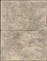
- Beinecke Rare Book and Manuscript Library > Clermont-Noyon.
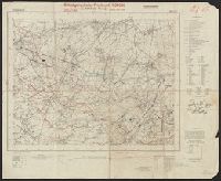
- Published / Created:
- 1918
- Call Number:
- 11hc 1918-Z12
- Container / Volume:
- BRBL_00010G
- Image Count:
- 2
- Resource Type:
- Maps, Atlases & Globes
- Found in:
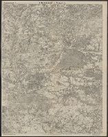
- Beinecke Rare Book and Manuscript Library > Clermont-Noyon.
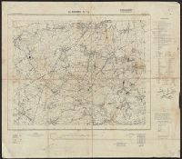
- Published / Created:
- 1901
- Call Number:
- 11hcf 1919-11
- Container / Volume:
- BRBL_00010I
- Image Count:
- 1
- Resource Type:
- Maps, Atlases & Globes
- Found in:
- Beinecke Rare Book and Manuscript Library > Côte Ouest de France : De Quiberon à Penerf. Baie de Quiberon et Morbihan / carte levée en 1819 et 1820, par les Ingénieurs Hydrographes de la Marine, sous la direction de Beautemps-Beaupré, Ingénieur Hydrographe en Chef ... 1894.
- Creator:
- Philip, George, 1870-1937
- Published / Created:
- [1914.]
- Call Number:
- 11hc 1915B
- Image Count:
- 2
- Resource Type:
- Maps, Atlases & Globes
- Found in:
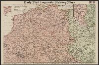
- Beinecke Rare Book and Manuscript Library > Daily Mail large-scale Military maps No. 3. : The Franco-Belgian Theatre of War / edited by George Philip, F.R.G.S., in conjunction with Military experts.
- Published / Created:
- 1916
- Call Number:
- 11hc 1916HA
- Container / Volume:
- BRBL_00010C
- Image Count:
- 1
- Resource Type:
- Maps, Atlases & Globes
- Found in:
- Beinecke Rare Book and Manuscript Library > De L'Yser a L'Aisne / dressé et dessiné́ par G. Peltier.
- Published / Created:
- 1941
- Call Number:
- 38hc 1940
- Container / Volume:
- BRBL_00172
- Image Count:
- 1
- Resource Type:
- Maps, Atlases & Globes
- Found in:
- Beinecke Rare Book and Manuscript Library > Der Sieg im Westen / nach einem Original von G. Amelung.
- Creator:
- Spruner von Merz, Karl, 1803-1892
- Published / Created:
- 1872-1876.
- Call Number:
- 38j
- Container / Volume:
- BRBL_00173
- Image Count:
- 7
- Resource Type:
- Maps, Atlases & Globes
- Found in:
- Beinecke Rare Book and Manuscript Library > Dr. K. v. Spruner's Hand-Atlas für die Geschichte des Mittelalters und der neueren Zeit. Frankreich.
- Published / Created:
- 1931
- Call Number:
- 11hc 1918E
- Container / Volume:
- BRBL_00010E
- Image Count:
- 2
- Resource Type:
- Maps, Atlases & Globes
- Found in:
- Beinecke Rare Book and Manuscript Library > Earl Haig's war map refutes General Pershing.
- Published / Created:
- 1918
- Call Number:
- 11hc 1918-Z18
- Container / Volume:
- BRBL_00010G
- Image Count:
- 1
- Resource Type:
- Maps, Atlases & Globes
- Found in:
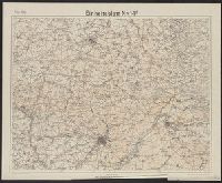
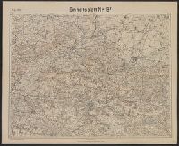
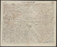
- Beinecke Rare Book and Manuscript Library > Einheitsblatt Nr.14F.
- Published / Created:
- 1918
- Call Number:
- 11hc 1918-Z19
- Container / Volume:
- BRBL_00010G
- Image Count:
- 1
- Resource Type:
- Maps, Atlases & Globes
- Found in:
- Beinecke Rare Book and Manuscript Library > Einheitsblatt Nr.18F.
- Published / Created:
- 1918
- Call Number:
- 11hc 1918-Z17
- Container / Volume:
- BRBL_00010G
- Image Count:
- 1
- Resource Type:
- Maps, Atlases & Globes
- Found in:
- Beinecke Rare Book and Manuscript Library > Einheitsblatt Nr.22F.
- Creator:
- France. Armée. Service géographique
- Published / Created:
- 1887
- Call Number:
- 38 V61 1887
- Container / Volume:
- BRBL_00167
- Image Count:
- 1
- Resource Type:
- Maps, Atlases & Globes
- Found in:
- Beinecke Rare Book and Manuscript Library > Environs de Paris a 1/20.000. Flle. 20, Versailles / dressé, gravé sur xinc et publié par le Service géographique de l'armée [cartographic material].
- Published / Created:
- 1943
- Call Number:
- 11hd 1943C
- Container / Volume:
- BRBL_00010ZE
- Image Count:
- 1
- Resource Type:
- Maps, Atlases & Globes
- Found in:
- Beinecke Rare Book and Manuscript Library > Europe, Scale 1:1,000,000. Marseilles - Nice, North K 31. & Part K 32.