Skip to search
Skip to main content
Skip to first result
Search
You Searched For
Subject (Geographic)
Great Britain--Maps
Search Results
Published / Created:
1801
Call Number:
3191 1801
Container / Volume:
BRBL_00041
Image Count:
1
Resource Type:
Maps, Atlases & Globes
Description:
Preliminary record.
Publisher:
Jones & Smith Se.,
Subject (Geographic):
Great Britain--Maps
Found in:
Beinecke Rare Book and Manuscript Library > A Map of England, Wales, & Scotland ... by W. Faden ...
Creator:
Published / Created:
1657
Call Number:
E1808 D5 1657
Image Count:
1
Alternative Title:
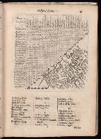
Direction for the English traveler
Description:
Signatures: [A]-Aa4Bb2.
Publisher:
Printed by M.S. for Tho.: Jenner, at the South-entrance of the Royall Exchange,
Subject (Geographic):
Great Britain--Gazetteers and Great Britain--Maps
Subject (Topic):
Roads --Great Britain --Maps --Early works to 1800
Found in:
Beinecke Rare Book and Manuscript Library > A book of the names of all parishes, market towns, villages, hamlets, and smallest places : in England and Wales : alphabetically set down ...
Published / Created:
[1845?]
Call Number:
3191 1845
Container / Volume:
BRBL_00041
Image Count:
1
Resource Type:
Maps, Atlases & Globes
Description:
Preliminary record.
Publisher:
James Wyld,
Subject (Geographic):
Great Britain--Maps
Found in:
Beinecke Rare Book and Manuscript Library > A map of England, Wales, & Scotland ...
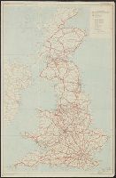
Creator:
Published / Created:
1872
Call Number:
319gme 1872
Container / Volume:
BRBL_00042
Image Count:
2
Resource Type:
Maps, Atlases & Globes
Description:
Inset: London and environs.
Publisher:
Bradshaw & Blacklock, London,
Subject (Geographic):
Great Britain--Maps and Ireland--Maps
Subject (Topic):
Railroads--Great Britain--Maps and Railroads--Ireland--Maps
Found in:
Beinecke Rare Book and Manuscript Library > Bradshaw's railway map of Great Britain and Ireland.
Creator:
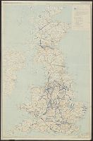
Published / Created:
[1940]
Call Number:
3191gfb 1940
Container / Volume:
BRBL_00041
Image Count:
2
Resource Type:
Maps, Atlases & Globes
Alternative Title:
Elektrizitätsversorgung von England und Schottland and Kraftnetz des CEB (Central Electricity Board=Elektrizitätsamt)
Description:
"Anlage zu [i.e. appendix to] Mil. geo. Angaben England"--Upper left margin.
Publisher:
Gen. St. d.H., Abt. für Kriegskarten u. Vermessungswesen,
Subject (Geographic):
Great Britain--Maps
Subject (Name):
Great Britain.--Central Electricity Board--Maps
Subject (Topic):
Electric lines--Great Britain--Maps, Electric power distribution--Great Britain--Maps, Electric power production--Great Britain--Maps, and Electric utilities--Great Britain--Maps
Found in:
Beinecke Rare Book and Manuscript Library > Das Kraftnetz des C.E.B. (Central Electricity Board=Elektrizitätsamt).
Creator:
Published / Created:
[1945?]
Call Number:
3191g 1945
Container / Volume:
BRBL_00041
Image Count:
1
Resource Type:
Maps, Atlases & Globes
Publisher:
Distributed by British Information Services,
Subject (Geographic):
Great Britain--Maps
Subject (Topic):
Industries--Great Britain--Maps and Natural resources--Great Britain--Maps
Found in:
Beinecke Rare Book and Manuscript Library > Great Britain, her natural & industrial resources.
Creator:
Published / Created:
1940
Call Number:
3191gma 1940
Container / Volume:
BRBL_00041
Image Count:
1
Resource Type:
Maps, Atlases & Globes
Alternative Title:
Great Britain :
Description:
Copy 2: Red ms. markings.
Publisher:
Mil. Geo. Angaben England
Subject (Geographic):
Great Britain--Maps
Found in:
Beinecke Rare Book and Manuscript Library > Grossbritannien : Übersicht der gewässer.
Creator:
Published / Created:
1940
Call Number:
3191gma 1940
Container / Volume:
BRBL_00041
Image Count:
1
Resource Type:
Maps, Atlases & Globes
Alternative Title:
Great Britain :
Description:
Copy 1: Blue ms. markings.
Publisher:
Mil. Geo. Angaben England
Subject (Geographic):
Great Britain--Maps
Found in:
Beinecke Rare Book and Manuscript Library > Grossbritannien : Übersicht der gewässer.
Creator:
Published / Created:
[1911]
Call Number:
32gme 1911
Container / Volume:
BRBL_00076
Image Count:
2
Resource Type:
Maps, Atlases & Globes
Description:
Includes ill. of station hotels and 2 insets.
Publisher:
McCorquodale & Co.,
Subject (Geographic):
Great Britain--Maps
Subject (Name):
Caledonian Railway Company and London and North-Western Railway
Subject (Topic):
Railroads--Great Britain--Maps
Found in:
Beinecke Rare Book and Manuscript Library > London & North Western and Caledonian Railways map of England & Wales / McCorquodale & Co., Ltd.
Published / Created:
1817
Call Number:
3191 1817
Container / Volume:
BRBL_00041
Image Count:
1
Resource Type:
Maps, Atlases & Globes
Description:
Preliminary record.
Publisher:
J. Harris,
Subject (Geographic):
Great Britain--Maps
Found in:
Beinecke Rare Book and Manuscript Library > Map of the Roman Roads in Britain ... Hewitt, Se.