Search
You Searched For
Search Results
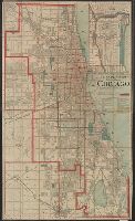
- Published / Created:
- 1890
- Call Number:
- 806gmb C43 1890
- Container / Volume:
- BRBL_00549
- Image Count:
- 1
- Resource Type:
- Maps, Atlases & Globes
- Found in:
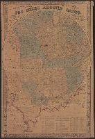
- Beinecke Rare Book and Manuscript Library > A.N. Marquis & Co's official map of Chicago / engraved by Matthews, Northrup & Co.
- Creator:
- Chapman, Silas
- Published / Created:
- c1856.
- Call Number:
- 806 1856
- Container / Volume:
- BRBL_00547
- Image Count:
- 1
- Resource Type:
- Maps, Atlases & Globes
- Found in:
- Beinecke Rare Book and Manuscript Library > Chapman's sectional map of Illinois.
- Creator:
- Colton, G. Woolworth (George Woolworth), 1827-1901
- Published / Created:
- 1862
- Call Number:
- 754gme 1860A
- Container / Volume:
- BRBL_00420
- Image Count:
- 1
- Resource Type:
- Maps, Atlases & Globes
- Found in:
- Beinecke Rare Book and Manuscript Library > Colton's county and township rail road map of Wisconsin, Illinois, Missouri, & Iowa / Drawn, engraved & published by G. Woolworth Colton
- Creator:
- Colton, J. H. (Joseph Hutchins), 1800-1893
- Published / Created:
- 1868
- Call Number:
- 805 1868
- Container / Volume:
- BRBL_00546
- Image Count:
- 1
- Resource Type:
- Maps, Atlases & Globes
- Found in:
- Beinecke Rare Book and Manuscript Library > Colton's map of the state of Indiana : compiled from the United States surveys and other authentic sources. Exhibiting sections, fractional sections, railroads, canals, etc.
- Published / Created:
- 1859
- Call Number:
- 805fcm 1859
- Container / Volume:
- BRBL_00546
- Image Count:
- 1
- Resource Type:
- Maps, Atlases & Globes
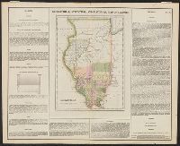
- Found in:
- Beinecke Rare Book and Manuscript Library > Counties bordering on state line between Illinois and Indiana / Wm. S. Peckham, real estate agent, Lafayette Ind.
- Published / Created:
- 1848
- Call Number:
- 806fcm 1848
- Container / Volume:
- BRBL_00549
- Image Count:
- 1
- Resource Type:
- Maps, Atlases & Globes
- Found in:
- Beinecke Rare Book and Manuscript Library > Diagram of the State of Illinois, accompanying the report of the 20th of October,1848; [by] F.R. Conway.
- Creator:
- Colton, G. Woolworth (George Woolworth), 1827-1901
- Published / Created:
- 1861
- Call Number:
- 754 1861A
- Container / Volume:
- BRBL_00416
- Image Count:
- 1
- Resource Type:
- Maps, Atlases & Globes
- Found in:
- Beinecke Rare Book and Manuscript Library > G. Woolworth Colton's map of the country 500 miles around Cairo : showing the seat of the war in the west / Drawn, engraved & published by G. Woolworth Colton.
- Creator:
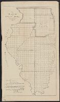
- Yeager, Joseph, approximately 1792-1859
- Published / Created:
- [1822]
- Call Number:
- 806 1822
- Container / Volume:
- BRBL_00547
- Image Count:
- 1
- Resource Type:
- Maps, Atlases & Globes
- Found in:
- Beinecke Rare Book and Manuscript Library > Geographical, statistical, and historical map of Illinois [cartographic material] / J. Yeager sculp.
- Published / Created:
- 1905
- Call Number:
- 754gme 1905
- Container / Volume:
- BRBL_00420
- Image Count:
- 1
- Resource Type:
- Maps, Atlases & Globes
- Found in:
- Beinecke Rare Book and Manuscript Library > Illinois Central Railroad and Yazoo & Mississippi Valley Railroad. June 30th, 1905.
- Creator:
- Johnson and Ward
- Published / Created:
- c1864.
- Call Number:
- 806 1864
- Container / Volume:
- BRBL_00547
- Image Count:
- 2
- Resource Type:
- Maps, Atlases & Globes
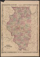
- Found in:
- Beinecke Rare Book and Manuscript Library > Johnson's Illinois / by Johnson and Ward.
- Creator:
- Johnson, A. J. (Alvin Jewett), 1827-1884
- Published / Created:
- [1866]
- Call Number:
- 806 1866
- Container / Volume:
- BRBL_00547
- Image Count:
- 2
- Resource Type:
- Maps, Atlases & Globes
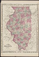
- Found in:
- Beinecke Rare Book and Manuscript Library > Johnson's Illinois.
- Published / Created:
- [1840?]
- Call Number:
- 806 1840
- Container / Volume:
- BRBL_00547
- Image Count:
- 1
- Resource Type:
- Maps, Atlases & Globes
- Found in:
- Beinecke Rare Book and Manuscript Library > Map of Northern part of Illinois and the surveyed part of Wisconsin Territory.
- Creator:
- Bouvé, Ephraim W., 1817-1897
- Published / Created:
- [185-?]
- Call Number:
- 754gme 1850A
- Container / Volume:
- BRBL_00419
- Image Count:
- 1
- Resource Type:
- Maps, Atlases & Globes
- Found in:
- Beinecke Rare Book and Manuscript Library > Map of the Alton & Springfield railroad, in Illinois : showing its connection with other roads and proposed roads leading to the eastern cities / lith. of E.W. Bouvé.
- Published / Created:
- 1898
- Call Number:
- 806gme C43 1898
- Container / Volume:
- BRBL_00549
- Image Count:
- 1
- Resource Type:
- Maps, Atlases & Globes
- Found in:
- Beinecke Rare Book and Manuscript Library > Map of the Chicago terminal transfer railroad company : and connecting lines / F.E. Paradis, chief engineer.
- Published / Created:
- 1860
- Call Number:
- 806gme 1860B
- Container / Volume:
- BRBL_00549
- Image Count:
- 1
- Resource Type:
- Maps, Atlases & Globes
- Found in:
- Beinecke Rare Book and Manuscript Library > Map of the Illinois River Railroad / W.G. Wheaton, civil engineer.
- Published / Created:
- 1860]
- Call Number:
- 806gme 1860A
- Container / Volume:
- BRBL_00549
- Image Count:
- 1
- Resource Type:
- Maps, Atlases & Globes
- Found in:
- Beinecke Rare Book and Manuscript Library > Map of the Jacksonville & Carrollton Rail Road : showing its connection with St. Louis & Alton and with Iowa, Wisconsin & the northern parts of Illinois and Missouri / drawn & compiled by F.L. Hillebrand, Civ. Engineer.
- Published / Created:
- 1860
- Call Number:
- 806gme 1860
- Container / Volume:
- BRBL_00549
- Image Count:
- 1
- Resource Type:
- Maps, Atlases & Globes
- Found in:
- Beinecke Rare Book and Manuscript Library > Map of the Warsaw and Rockford R.R. and its connections.
- Published / Created:
- 1860
- Call Number:
- 806gme 1860
- Container / Volume:
- BRBL_00549
- Image Count:
- 1
- Resource Type:
- Maps, Atlases & Globes
- Found in:
- Beinecke Rare Book and Manuscript Library > Map of the Warsaw and Rockford R.R. and its connections.
- Published / Created:
- [1815?]
- Call Number:
- 806 1815
- Container / Volume:
- BRBL_00547
- Image Count:
- 1
- Resource Type:
- Maps, Atlases & Globes
- Found in:
- Beinecke Rare Book and Manuscript Library > Map of the abounty Lands in Illinois Territory by John Gardiner.
- Creator:
- United States. General Land Office
- Published / Created:
- 1866
- Call Number:
- 806gbc 1866
- Container / Volume:
- BRBL_00549
- Image Count:
- 1
- Resource Type:
- Maps, Atlases & Globes
- Found in:
- Beinecke Rare Book and Manuscript Library > Map of the state of Illinois [cartographic material].