Search
You Searched For
Search Results
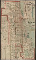
- Published / Created:
- 1890
- Call Number:
- 806gmb C43 1890
- Container / Volume:
- BRBL_00549
- Image Count:
- 1
- Resource Type:
- Maps, Atlases & Globes
- Found in:
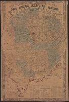
- Beinecke Rare Book and Manuscript Library > A.N. Marquis & Co's official map of Chicago / engraved by Matthews, Northrup & Co.
- Creator:
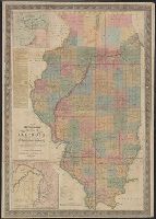
- Chapman, Silas
- Published / Created:
- c1856.
- Call Number:
- 806 1856
- Container / Volume:
- BRBL_00547
- Image Count:
- 1
- Resource Type:
- Maps, Atlases & Globes
- Found in:
- Beinecke Rare Book and Manuscript Library > Chapman's sectional map of Illinois.
- Creator:
- Colton, G. Woolworth (George Woolworth), 1827-1901
- Published / Created:
- 1862
- Call Number:
- 754gme 1860A
- Container / Volume:
- BRBL_00420
- Image Count:
- 1
- Resource Type:
- Maps, Atlases & Globes
- Found in:
- Beinecke Rare Book and Manuscript Library > Colton's county and township rail road map of Wisconsin, Illinois, Missouri, & Iowa / Drawn, engraved & published by G. Woolworth Colton
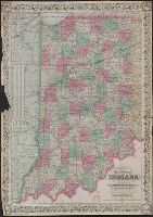
- Creator:
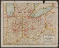
- Colton, J. H. (Joseph Hutchins), 1800-1893
- Published / Created:
- 1868
- Call Number:
- 805 1868
- Container / Volume:
- BRBL_00546
- Image Count:
- 1
- Resource Type:
- Maps, Atlases & Globes
- Found in:
- Beinecke Rare Book and Manuscript Library > Colton's map of the state of Indiana : compiled from the United States surveys and other authentic sources. Exhibiting sections, fractional sections, railroads, canals, etc.
- Published / Created:
- 1859
- Call Number:
- 805fcm 1859
- Container / Volume:
- BRBL_00546
- Image Count:
- 1
- Resource Type:
- Maps, Atlases & Globes
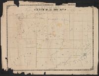
- Found in:
- Beinecke Rare Book and Manuscript Library > Counties bordering on state line between Illinois and Indiana / Wm. S. Peckham, real estate agent, Lafayette Ind.
- Published / Created:
- 1848
- Call Number:
- 806fcm 1848
- Container / Volume:
- BRBL_00549
- Image Count:
- 1
- Resource Type:
- Maps, Atlases & Globes
- Found in:
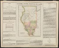
- Beinecke Rare Book and Manuscript Library > Diagram of the State of Illinois, accompanying the report of the 20th of October,1848; [by] F.R. Conway.
- Creator:
- Colton, G. Woolworth (George Woolworth), 1827-1901
- Published / Created:
- 1861
- Call Number:
- 754 1861A
- Container / Volume:
- BRBL_00416
- Image Count:
- 1
- Resource Type:
- Maps, Atlases & Globes
- Found in:
- Beinecke Rare Book and Manuscript Library > G. Woolworth Colton's map of the country 500 miles around Cairo : showing the seat of the war in the west / Drawn, engraved & published by G. Woolworth Colton.
- Creator:
- Yeager, Joseph, approximately 1792-1859
- Published / Created:
- [1822]
- Call Number:
- 806 1822
- Container / Volume:
- BRBL_00547
- Image Count:
- 1
- Resource Type:
- Maps, Atlases & Globes
- Found in:
- Beinecke Rare Book and Manuscript Library > Geographical, statistical, and historical map of Illinois [cartographic material] / J. Yeager sculp.
- Published / Created:
- 1905
- Call Number:
- 754gme 1905
- Container / Volume:
- BRBL_00420
- Image Count:
- 1
- Resource Type:
- Maps, Atlases & Globes
- Found in:
- Beinecke Rare Book and Manuscript Library > Illinois Central Railroad and Yazoo & Mississippi Valley Railroad. June 30th, 1905.
- Creator:
- Johnson and Ward
- Published / Created:
- c1864.
- Call Number:
- 806 1864
- Container / Volume:
- BRBL_00547
- Image Count:
- 2
- Resource Type:
- Maps, Atlases & Globes
- Found in:
- Beinecke Rare Book and Manuscript Library > Johnson's Illinois / by Johnson and Ward.
- Creator:
- Johnson, A. J. (Alvin Jewett), 1827-1884
- Published / Created:
- [1866]
- Call Number:
- 806 1866
- Container / Volume:
- BRBL_00547
- Image Count:
- 2
- Resource Type:
- Maps, Atlases & Globes
- Found in:
- Beinecke Rare Book and Manuscript Library > Johnson's Illinois.
- Published / Created:
- [1840?]
- Call Number:
- 806 1840
- Container / Volume:
- BRBL_00547
- Image Count:
- 1
- Resource Type:
- Maps, Atlases & Globes
- Found in:
- Beinecke Rare Book and Manuscript Library > Map of Northern part of Illinois and the surveyed part of Wisconsin Territory.
- Creator:
- Bouvé, Ephraim W., 1817-1897
- Published / Created:
- [185-?]
- Call Number:
- 754gme 1850A
- Container / Volume:
- BRBL_00419
- Image Count:
- 1
- Resource Type:
- Maps, Atlases & Globes
- Found in:
- Beinecke Rare Book and Manuscript Library > Map of the Alton & Springfield railroad, in Illinois : showing its connection with other roads and proposed roads leading to the eastern cities / lith. of E.W. Bouvé.
- Published / Created:
- 1898
- Call Number:
- 806gme C43 1898
- Container / Volume:
- BRBL_00549
- Image Count:
- 1
- Resource Type:
- Maps, Atlases & Globes
- Found in:
- Beinecke Rare Book and Manuscript Library > Map of the Chicago terminal transfer railroad company : and connecting lines / F.E. Paradis, chief engineer.
- Published / Created:
- 1860
- Call Number:
- 806gme 1860B
- Container / Volume:
- BRBL_00549
- Image Count:
- 1
- Resource Type:
- Maps, Atlases & Globes
- Found in:
- Beinecke Rare Book and Manuscript Library > Map of the Illinois River Railroad / W.G. Wheaton, civil engineer.
- Published / Created:
- 1860]
- Call Number:
- 806gme 1860A
- Container / Volume:
- BRBL_00549
- Image Count:
- 1
- Resource Type:
- Maps, Atlases & Globes
- Found in:
- Beinecke Rare Book and Manuscript Library > Map of the Jacksonville & Carrollton Rail Road : showing its connection with St. Louis & Alton and with Iowa, Wisconsin & the northern parts of Illinois and Missouri / drawn & compiled by F.L. Hillebrand, Civ. Engineer.
- Published / Created:
- 1860
- Call Number:
- 806gme 1860
- Container / Volume:
- BRBL_00549
- Image Count:
- 1
- Resource Type:
- Maps, Atlases & Globes
- Found in:
- Beinecke Rare Book and Manuscript Library > Map of the Warsaw and Rockford R.R. and its connections.
- Published / Created:
- 1860
- Call Number:
- 806gme 1860
- Container / Volume:
- BRBL_00549
- Image Count:
- 1
- Resource Type:
- Maps, Atlases & Globes
- Found in:
- Beinecke Rare Book and Manuscript Library > Map of the Warsaw and Rockford R.R. and its connections.
- Published / Created:
- [1815?]
- Call Number:
- 806 1815
- Container / Volume:
- BRBL_00547
- Image Count:
- 1
- Resource Type:
- Maps, Atlases & Globes
- Found in:
- Beinecke Rare Book and Manuscript Library > Map of the abounty Lands in Illinois Territory by John Gardiner.
- Creator:
- United States. General Land Office
- Published / Created:
- 1866
- Call Number:
- 806gbc 1866
- Container / Volume:
- BRBL_00549
- Image Count:
- 1
- Resource Type:
- Maps, Atlases & Globes
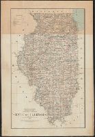
- Found in:
- Beinecke Rare Book and Manuscript Library > Map of the state of Illinois [cartographic material].
- Published / Created:
- April 15, 1832.
- Call Number:
- 816 1832
- Container / Volume:
- BRBL_00561
- Image Count:
- 1
- Resource Type:
- Maps, Atlases & Globes
- Found in:
- Beinecke Rare Book and Manuscript Library > Map of the states of Missouri and Illinois / engraved & printed by Fenner Sears & Co.
- Published / Created:
- 1852
- Call Number:
- 806cfp G562 1852
- Container / Volume:
- BRBL_00549
- Image Count:
- 1
- Resource Type:
- Maps, Atlases & Globes
- Found in:
- Beinecke Rare Book and Manuscript Library > Map of the track of the tornado of April 30th 1852. : from Golconda Illinois, to Wabash River across Indiana & the Ohio River to Georgetown Kentucky, U.S. / by John Chapplesmith.
- Published / Created:
- 1887
- Call Number:
- 806gme C43 1887
- Container / Volume:
- BRBL_00549
- Image Count:
- 1
- Resource Type:
- Maps, Atlases & Globes
- Found in:
- Beinecke Rare Book and Manuscript Library > Map showing location of the Chicago and Calumet terminal railway : around Chicago, Illinois 1887 / Office of chief engineer, C. & C.T. Ry. Co. Hammond Ind.
- Published / Created:
- 1853
- Call Number:
- 806gme G132 1853A
- Container / Volume:
- BRBL_00549
- Image Count:
- 1
- Resource Type:
- Maps, Atlases & Globes
- Found in:
- Beinecke Rare Book and Manuscript Library > Map showing the Galena & Chicago Union Railroad and its connections.
- Published / Created:
- 1838 [1837?]
- Call Number:
- 806 1838
- Container / Volume:
- BRBL_00547
- Image Count:
- 1
- Resource Type:
- Maps, Atlases & Globes
- Found in:
- Beinecke Rare Book and Manuscript Library > Mitchell's Map of Illinois Exhibiting its Internal Improvements, Counties, Towns, Roads &c.
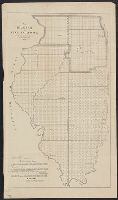
- Published / Created:
- 1836
- Call Number:
- 806 1836A
- Container / Volume:
- BRBL_00547
- Image Count:
- 1
- Resource Type:
- Maps, Atlases & Globes
- Found in:
- Beinecke Rare Book and Manuscript Library > New SectionalMap of the State of Illinois. Compiled from the United States Surveys. Also exhibiting the Internal Improvements distances between Town Villages Post Offices, the outlines of Prairies. Woodlands Marshe. By J.M. Peck and John Messinger
- Creator:
- Society for the Diffusion of Useful Knowledge (Great Britain)
- Published / Created:
- July. 1st 1833.
- Call Number:
- 806 1833
- Container / Volume:
- BRBL_00547
- Image Count:
- 1
- Resource Type:
- Maps, Atlases & Globes
- Found in:
- Beinecke Rare Book and Manuscript Library > North America sheet IX : Parts of Missouri, Illinois and Indiana.
- Published / Created:
- 1915
- Call Number:
- 754gme 1915
- Container / Volume:
- BRBL_00420
- Image Count:
- 2
- Resource Type:
- Maps, Atlases & Globes
- Found in:
- Beinecke Rare Book and Manuscript Library > Official Interurban map issued by the Terre Haute, Indianapolis & Eastern Traction Company : 425 miles in Indiana and Illinois, connecting with interurban railways in Indiana, Ohio, and Michigan.
- Published / Created:
- 1860
- Call Number:
- 806gme C43 1860
- Container / Volume:
- BRBL_00549
- Image Count:
- 1
- Resource Type:
- Maps, Atlases & Globes
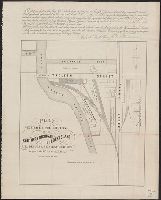
- Found in:
- Beinecke Rare Book and Manuscript Library > Plat exhibiting the location of the Southern Michigan and Rock Island R.R. depots and adjacent grounds. / lithographed by Ed Mendel.
- Creator:
- Roeser, C. (Charles)
- Published / Created:
- 1878
- Call Number:
- 806 1878
- Container / Volume:
- BRBL_00547
- Image Count:
- 1
- Resource Type:
- Maps, Atlases & Globes
- Found in:
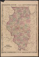
- Beinecke Rare Book and Manuscript Library > State of Illinois / [cartographic material] / compiled from the official records of the General Land Office and other sources by C. Roeser, principal draughtsman G.L.O.
- Creator:
- Rand McNally and Company
- Published / Created:
- 1914, c1902.
- Call Number:
- 806 1914
- Container / Volume:
- BRBL_00547
- Image Count:
- 1
- Resource Type:
- Maps, Atlases & Globes
- Found in:
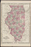
- Beinecke Rare Book and Manuscript Library > The Rand McNally new commercial atlas map of Illinois [cartographic material].