Search
You Searched For
Search Results
- Published / Created:
- [ca. 1870]
- Call Number:
- 428 1870
- Container / Volume:
- BRBL_00248
- Image Count:
- 6
- Resource Type:
- Maps, Atlases & Globes
- Found in:
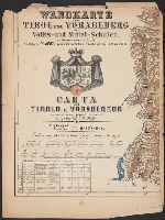
- Beinecke Rare Book and Manuscript Library > Wandkarte von Tirol und Vorarlberg für Volks-und Mittel-Schulen = Carta del Tirolo e Vorarlberg ad uso di scuole popolari e medie / Gezeichnet von G.v. Kaler.
- Creator:
- Woerl, Joseph Edmund
- Published / Created:
- [1840]
- Call Number:
- 40 1840C
- Image Count:
- 5
- Resource Type:
- Maps, Atlases & Globes
- Found in:
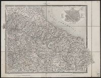
- Beinecke Rare Book and Manuscript Library > Karte von Ober-Italien in 6 Blättern : mit roth eingedruckten Strassen, Ortspositionen und Grenzen / entworfen und bearbeitet im Maasstabe van 1.500,000 von Professor Dr. J.E. Woerl.
- Published / Created:
- [ca. 1850]
- Call Number:
- 40gme 1850
- Container / Volume:
- BRBL_00230
- Image Count:
- 8
- Resource Type:
- Maps, Atlases & Globes
- Found in:
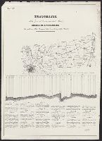
- Beinecke Rare Book and Manuscript Library > Topografia della zona di terrano corsa della strada : Profilo di livellazione delle pendenze della Strada, e della linea battuta della Strada.
- Published / Created:
- [between 1840 and 1849?]
- Call Number:
- BrSides Folio 2018 146
- Image Count:
- 1
- Resource Type:
- Maps, Atlases & Globes
- Found in:
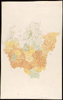
- Beinecke Rare Book and Manuscript Library > [Manuscript map of the regions in northern Italy].
- Creator:
- Hewitt, N. R., cartographer
- Call Number:
- 4037 1816
- Container / Volume:
- BRBL_00234A
- Image Count:
- 1
- Resource Type:
- Maps, Atlases & Globes
- Found in:
- Beinecke Rare Book and Manuscript Library > Venetian States [cartographic material] / drawn & engraved by N.R. Hewitt, Charlotte Strt., Fitzroy Square ; drawn and engraved for Thomson's New general atlas, 1816.
- Call Number:
- 403cb Ad45 1840
- Container / Volume:
- BRBL_00234
- Image Count:
- 1
- Resource Type:
- Maps, Atlases & Globes
- Found in:
- Beinecke Rare Book and Manuscript Library > Corso generale delle acque fra Adige, la r. strada da Venezia a Treviso, i monte, ed il mare / Pietro Zuliani inci.
- Published / Created:
- [approximately 1800?]
- Call Number:
- 400 1800
- Container / Volume:
- BRBL_00233
- Image Count:
- 1
- Resource Type:
- Maps, Atlases & Globes
- Found in:
- Beinecke Rare Book and Manuscript Library > Vindelicia, Rhaetia, Noricum, Gallia Togata ; Italia media, sive Propria / Frentzel sc.
- Creator:
- Woerl, Joseph Edmund
- Published / Created:
- [1840]
- Call Number:
- 40 1840C
- Container / Volume:
- BRBL_00200
- Image Count:
- 4
- Resource Type:
- Maps, Atlases & Globes
- Found in:
- Beinecke Rare Book and Manuscript Library > Karte von Ober-Italien in 6 Blättern : mit roth eingedruckten Strassen, Ortspositionen und Grenzen / entworfen und bearbeitet im Maasstabe van 1.500,000 von Professor Dr. J.E. Woerl.
- Published / Created:
- 1892?]
- Call Number:
- 40 1892
- Container / Volume:
- BRBL_00202
- Image Count:
- 2
- Resource Type:
- Maps, Atlases & Globes
- Found in:
- Beinecke Rare Book and Manuscript Library > [Northern Italy].
- Creator:
- Taride, A
- Published / Created:
- 1907
- Call Number:
- 40gmb 1907
- Container / Volume:
- BRBL_00229
- Image Count:
- 1
- Resource Type:
- Maps, Atlases & Globes
- Found in:
- Beinecke Rare Book and Manuscript Library > Italie. 30, Section Nord / P. Bineteau, del.
- Published / Created:
- [1918?]
- Call Number:
- 40 1918
- Container / Volume:
- BRBL_00202
- Image Count:
- 1
- Resource Type:
- Maps, Atlases & Globes
- Found in:
- Beinecke Rare Book and Manuscript Library > [New Boundaries of Italy in the Northeast].
- Creator:
- Taride, A
- Published / Created:
- 1907
- Call Number:
- 40gmb 1907
- Container / Volume:
- BRBL_00229
- Image Count:
- 1
- Resource Type:
- Maps, Atlases & Globes
- Found in:
- Beinecke Rare Book and Manuscript Library > Italie. 30, Section Nord / P. Bineteau, del.
- Creator:
- Great Britain. War Office. General Staff. Geographical Section
- Published / Created:
- 1918
- Call Number:
- 36ed 1918
- Container / Volume:
- BRBL_00127
- Image Count:
- 2
- Resource Type:
- Maps, Atlases & Globes
- Found in:
- Beinecke Rare Book and Manuscript Library > Ethnographical map [cartographic material].
- Published / Created:
- [1876?]
- Call Number:
- 40CBF 1876
- Container / Volume:
- BRBL_00228
- Image Count:
- 3
- Resource Type:
- Maps, Atlases & Globes
- Found in:
- Beinecke Rare Book and Manuscript Library > Carta oro-idrografica dell'Italia settentrionale / F. Carabelli.
- Creator:
- United States. Office of Strategic Services. Research and Analysis Branch
- Published / Created:
- 1944
- Call Number:
- 38gm 1944B
- Container / Volume:
- BRBL_00170
- Image Count:
- 1
- Resource Type:
- Maps, Atlases & Globes
- Found in:
- Beinecke Rare Book and Manuscript Library > Southern France and northern Italy [cartographic material] / compiled and drawn in the Branch of Research and Analysis, OSS.
- Published / Created:
- 1834
- Call Number:
- 40 1832
- Container / Volume:
- BRBL_00199
- Image Count:
- 1
- Resource Type:
- Maps, Atlases & Globes
- Found in:
- Beinecke Rare Book and Manuscript Library > North Italy &c. and the passes of the Alps & Apennines / by J. Arrowsmith.
- Published / Created:
- 1803
- Call Number:
- 40 1803
- Container / Volume:
- BRBL_00199
- Image Count:
- 1
- Resource Type:
- Maps, Atlases & Globes
- Found in:
- Beinecke Rare Book and Manuscript Library > Charte vom noerdlichen Italien oder der Lombardie ... / von Conrad Mannert.
- Published / Created:
- 1915].
- Call Number:
- 40 1915
- Container / Volume:
- BRBL_00202
- Image Count:
- 1
- Resource Type:
- Maps, Atlases & Globes
- Found in:
- Beinecke Rare Book and Manuscript Library > Le Front Italien / Dressé & dessiné par G. Peltier.
- Creator:
- Arrowsmith, John, 1790-1873
- Published / Created:
- 1858 February 15
- Call Number:
- 40 1858A
- Container / Volume:
- BRBL_00201
- Image Count:
- 1
- Resource Type:
- Maps, Atlases & Globes
- Found in:
- Beinecke Rare Book and Manuscript Library > North Italy &c. and the passes of the Alps & Apennines [cartographic material] / by J. Arrowsmith.
- Creator:
- Andriveau-Goujon, E. (Eugène), 1832-1897
- Published / Created:
- 1859
- Call Number:
- 40 1859F
- Container / Volume:
- BRBL_00201
- Image Count:
- 1
- Resource Type:
- Maps, Atlases & Globes
- Found in:
- Beinecke Rare Book and Manuscript Library > Carte strategique de L'Italie septentrionale [cartographic material] / Imp. Lemercier, Paris.
- Published / Created:
- 1850?]
- Call Number:
- 40 1850A
- Container / Volume:
- BRBL_00200
- Image Count:
- 1
- Resource Type:
- Maps, Atlases & Globes
- Found in:
- Beinecke Rare Book and Manuscript Library > Gegend zwischen Verona, Peschiera, und Mantova.
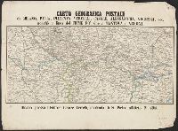
- Published / Created:
- [1858?]
- Call Number:
- 40 M59 1858
- Container / Volume:
- BRBL_00211
- Image Count:
- 1
- Resource Type:
- Maps, Atlases & Globes
- Found in:
- Beinecke Rare Book and Manuscript Library > Carta geografica postale da Milano, Pavia, Piacenza, Vercelli, Casale, Alessandria, Voghera, ecc. : nonchè la linea del fiume po' sino a Mantova e Verona.
- Creator:
- Woerl, Joseph Edmund
- Published / Created:
- [1840]
- Call Number:
- 40 1840C
- Container / Volume:
- BRBL_00200
- Image Count:
- 1
- Resource Type:
- Maps, Atlases & Globes
- Found in:
- Beinecke Rare Book and Manuscript Library > Karte von Ober-Italien in 6 Blättern : mit roth eingedruckten Strassen, Ortspositionen und Grenzen / entworfen und bearbeitet im Maasstabe van 1.500,000 von Professor Dr. J.E. Woerl.
- Published / Created:
- 1856
- Call Number:
- 40EF 1856
- Container / Volume:
- BRBL_00229
- Image Count:
- 1
- Resource Type:
- Maps, Atlases & Globes
- Found in:
- Beinecke Rare Book and Manuscript Library > Topografia dei dialetti dell'alta Italia tratta dall'opera saggio sui dialetti Gallo Italici di B. Biondelli.
- Published / Created:
- 1858
- Call Number:
- 40gme 1858
- Container / Volume:
- BRBL_00230
- Image Count:
- 1
- Resource Type:
- Maps, Atlases & Globes
- Found in:
- Beinecke Rare Book and Manuscript Library > Strade Ferrate dell'alta Italia.
- Published / Created:
- 1856
- Call Number:
- 40EF 1856A
- Container / Volume:
- BRBL_00229
- Image Count:
- 1
- Resource Type:
- Maps, Atlases & Globes
- Found in:
- Beinecke Rare Book and Manuscript Library > Topografia dei dialetti Gallo Italici da B. Biondelli.
- Published / Created:
- [1850?]
- Call Number:
- 403 1850A
- Container / Volume:
- BRBL_00234
- Image Count:
- 1
- Resource Type:
- Maps, Atlases & Globes
- Found in:
- Beinecke Rare Book and Manuscript Library > Contorni di Venezia, Viceza, Padova, Treviso, Udine, Palmanova, Legnago, Rovigo, Ferrara e Trieste.
- Published / Created:
- 1856
- Call Number:
- 40EF 1856A
- Container / Volume:
- BRBL_00229
- Image Count:
- 1
- Resource Type:
- Maps, Atlases & Globes
- Found in:
- Beinecke Rare Book and Manuscript Library > Topografia dei dialetti Gallo Italici da B. Biondelli.
- Published / Created:
- 1859
- Call Number:
- 40hc 1859A
- Container / Volume:
- BRBL_00231
- Image Count:
- 1
- Resource Type:
- Maps, Atlases & Globes
- Found in:
- Beinecke Rare Book and Manuscript Library > Carte du Nord de l'Italie : Piémont et Lombardie & des Etats limitrophes pour suivre les opérations militaires.
- Published / Created:
- [1859]
- Call Number:
- 40hc 1859F
- Container / Volume:
- BRBL_00231
- Image Count:
- 1
- Resource Type:
- Maps, Atlases & Globes
- Found in:
- Beinecke Rare Book and Manuscript Library > Théâtre de la guerre en Italie : Vue prise a vol d'oiseau au dessus de Grenoble / Dessiné par Ph. Benoist ; Lith. par Eug. Cicéri.
- Published / Created:
- [1859]
- Call Number:
- 40hc SA53 1859
- Container / Volume:
- BRBL_00232
- Image Count:
- 1
- Resource Type:
- Maps, Atlases & Globes
- Found in:
- Beinecke Rare Book and Manuscript Library > Piano della battaglia di S. Martino e Solferino seguita il 24. Giugno 1859 / M.M. Cellai.
- Published / Created:
- [1859]
- Call Number:
- 40hc 1859K
- Container / Volume:
- BRBL_00231
- Image Count:
- 1
- Resource Type:
- Maps, Atlases & Globes
- Found in:
- Beinecke Rare Book and Manuscript Library > Plan topografique de la bataille de Solferino Quadrilatère stratègique. Détails des quatre places fortes. Supplément no. 8.
- Published / Created:
- 1859
- Call Number:
- 40hc 1859E
- Container / Volume:
- BRBL_00231
- Image Count:
- 1
- Resource Type:
- Maps, Atlases & Globes
- Found in:
- Beinecke Rare Book and Manuscript Library > Read's authentic panoramic view of the theatre of war in Italy, showing the cities, fortresses, strategic defences, military positions, harbours, railways, telegraphs &c. in Piedmont, Savoy, Tuscany, Modena, Parma, the Austrian-Lombardovenetian Kingdom &c
- Published / Created:
- [1859]
- Call Number:
- 40hc 1859I
- Container / Volume:
- BRBL_00231
- Image Count:
- 1
- Resource Type:
- Maps, Atlases & Globes
- Found in:
- Beinecke Rare Book and Manuscript Library > Plan a vol d'oiseau du théâtre circonscrit de la guerre en Italie, 1859 / Lith. Stanislas Petit.
- Published / Created:
- [ca. 1864]
- Call Number:
- 40hc 1864
- Container / Volume:
- BRBL_00231
- Image Count:
- 1
- Resource Type:
- Maps, Atlases & Globes
- Found in:
- Beinecke Rare Book and Manuscript Library > Carta topografica della guerra.
- Creator:
- Woerl, Joseph Edmund
- Call Number:
- 42 1830
- Container / Volume:
- BRBL_00244
- Image Count:
- 1
- Resource Type:
- Maps, Atlases & Globes
- Found in:
- Beinecke Rare Book and Manuscript Library > Salzburg.
- Call Number:
- 40 1845
- Container / Volume:
- BRBL_00200
- Image Count:
- 1
- Resource Type:
- Maps, Atlases & Globes
- Found in:
- Beinecke Rare Book and Manuscript Library > Abtheilung II. Das Lombardisch-Venezianische Königreich.