Search
You Searched For
Search Results
- Published / Created:
- 1879
- Call Number:
- 40 R66 1879
- Container / Volume:
- BRBL_00218
- Image Count:
- 8
- Resource Type:
- Maps, Atlases & Globes
- Description:
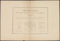
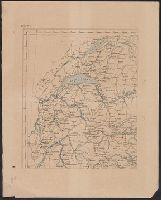
- [1.] Title page -- [2.] Arsoli -- [3.] Palo -- [4.] Roma -- [5.] Subiaco -- [6.] Nettuno -- [7.] Civita-Castellana -- [8.] Civita-Vecchia -- [9.] Cisterna.
- Publisher:
- Lit. Virano e Teano,
- Subject (Geographic):
- Italy--Maps
- Found in:
- Beinecke Rare Book and Manuscript Library > Carta Topografica dell'agro Romano Territori Limitrofi.
- Published / Created:
- [1870?]
- Call Number:
- 404 1870
- Container / Volume:
- BRBL_00235
- Image Count:
- 1
- Resource Type:
- Maps, Atlases & Globes
- Publisher:
- Francesco Vallardi, Tipografo-Editore,
- Subject (Geographic):
- Italy--Maps
- Found in:
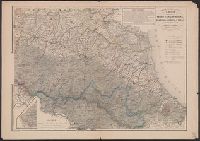
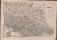
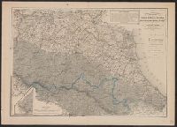
- Beinecke Rare Book and Manuscript Library > Carta corografica dell'Emilia : Provincie di Reggio d'Emilia, Modena, Bologna, Ravenna e Forlì con gran parte delle limitrofe di Firenze e Ferrara / Geometra Enrico Bonatti, dis. ; P. Allodi e filgio inc.
- Published / Created:
- [1870?]
- Call Number:
- 404 1870
- Container / Volume:
- BRBL_00235
- Image Count:
- 1
- Resource Type:
- Maps, Atlases & Globes
- Publisher:
- Francesco Vallardi, Tipografo-Editore,
- Subject (Geographic):
- Italy--Maps
- Found in:
- Beinecke Rare Book and Manuscript Library > Carta corografica dell'Emilia : Provincie di Reggio d'Emilia, Modena, Bologna, Ravenna e Forlì con gran parte delle limitrofe di Firenze e Ferrara / Geometra Enrico Bonatti, dis. ; P. Allodi e filgio inc.
- Published / Created:
- ca. 1860?]
- Call Number:
- 40 1858
- Container / Volume:
- BRBL_00201
- Image Count:
- 8
- Resource Type:
- Maps, Atlases & Globes
- Description:
- Legend appears in lower left of sheet 5.
- Publisher:
- s.n.,
- Subject (Geographic):
- Italy--Maps
- Found in:
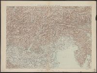
- Beinecke Rare Book and Manuscript Library > Carta corografica strategica dell' alta Italia alla scala di 1 a 600000.
- Published / Created:
- [1850?]
- Call Number:
- 400 1850
- Container / Volume:
- BRBL_00233
- Image Count:
- 1
- Resource Type:
- Maps, Atlases & Globes
- Subject (Geographic):
- Italy--Maps
- Found in:
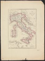
- Beinecke Rare Book and Manuscript Library > Carta dell' Italia antica / G. Bonatti diso. ed incise. Torino.
- Published / Created:
- [1918].
- Call Number:
- 11hcf 1919D-27
- Container / Volume:
- BRBL_00010X
- Image Count:
- 1
- Resource Type:
- Maps, Atlases & Globes
- Description:
- "Legge 19 Sett. 1882, No. 1012."
- Publisher:
- Istituto Geografico militare,
- Subject (Geographic):
- Italy--Maps
- Found in:
- Beinecke Rare Book and Manuscript Library > Carta della Zona di Guerra.
- Published / Created:
- 1865
- Call Number:
- 401 1865
- Container / Volume:
- BRBL_00233
- Image Count:
- 1
- Resource Type:
- Maps, Atlases & Globes
- Publisher:
- Casa editrice, Dott. Francesco Vallardi,
- Subject (Geographic):
- Italy--Maps
- Found in:
- Beinecke Rare Book and Manuscript Library > Carta delle provincie di Torino, Cuneo, Novara, Alessandria e Pavia.
- Published / Created:
- [ca. 1920].
- Call Number:
- 40gme 1920
- Container / Volume:
- BRBL_00230
- Image Count:
- 2
- Resource Type:
- Maps, Atlases & Globes
- Alternative Title:
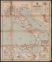
- Carta delle comunicazioni principale di Europa
- Description:
- Includes 8 insets.
- Publisher:
- Fratelli Pozzo,
- Subject (Geographic):
- Europe--Maps and Italy--Maps
- Subject (Topic):
- Railroads--Europe--Maps and Railroads--Italy--Maps
- Found in:
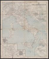
- Beinecke Rare Book and Manuscript Library > Carta ferroviaria d'Italia e linee di navigazione / Prof. Giovanni de Agostini e figli.
- Published / Created:
- [1910?]
- Call Number:
- 40gm 1910
- Container / Volume:
- BRBL_00229
- Image Count:
- 2
- Resource Type:
- Maps, Atlases & Globes
- Alternative Title:
- Carta delle ferrovie principali di Europa della Colonia Eritrea e della Libia
- Description:
- Includes 10 inset maps, each showing a close-up view of a city or region.
- Publisher:
- Fratelli Pozzo,
- Subject (Geographic):
- Europe--Maps and Italy--Maps
- Subject (Topic):
- Ocean travel--Adriatic Sea--Maps, Ocean travel--Western Mediterranean--Maps, and Railroads--Italy--Maps
- Found in:
- Beinecke Rare Book and Manuscript Library > Carta generale delle strade ferrate Italiane e linee di navigazione.