Search
You Searched For
Search Results
- Published / Created:
- [1780?]
- Call Number:
- 40 1780A
- Container / Volume:
- BRBL_00198
- Image Count:
- 1
- Resource Type:
- Maps, Atlases & Globes
- Found in:
- Beinecke Rare Book and Manuscript Library > Bowles's new pocket map of Italy ... / by J. Palairet ... ; lately revised and improved ... by L. Delarochette.
- Creator:
- Tirion, Isaak
- Published / Created:
- 1750]
- Call Number:
- 40 1760A
- Container / Volume:
- BRBL_00197
- Image Count:
- 1
- Resource Type:
- Maps, Atlases & Globes
- Found in:
- Beinecke Rare Book and Manuscript Library > Carta geografica generale dell' Italia.
- Published / Created:
- [1800?]
- Call Number:
- 40hc 1800
- Container / Volume:
- BRBL_00231
- Image Count:
- 1
- Resource Type:
- Maps, Atlases & Globes
- Found in:
- Beinecke Rare Book and Manuscript Library > Carte Genérale des Marches Positions, Combats et Batailles de l'Armée de Réserve depuis le passage du Grand St. Barnard ... Présentée au Général Bonaparte ... Par le Géneral P. Dupont ... Gravé par P.F. Tardieu Ecrit par Giraldon.
- Published / Created:
- 1755?]
- Call Number:
- 40 1755
- Container / Volume:
- BRBL_00197
- Image Count:
- 1
- Resource Type:
- Maps, Atlases & Globes
- Found in:
- Beinecke Rare Book and Manuscript Library > Carte de l'Italie dans laquelle sont tracées les routes des postes / par le Sr. Robert.
- Published / Created:
- 1643
- Call Number:
- 40 1643
- Container / Volume:
- BRBL_00196
- Image Count:
- 2
- Resource Type:
- Maps, Atlases & Globes
- Found in:
- Beinecke Rare Book and Manuscript Library > Carte generale de l'Italie et des isles et pays circonvoisins ... / par N. Sanson ...
- Published / Created:
- 1575
- Call Number:
- 40AM F586 1575
- Container / Volume:
- BRBL_00227
- Image Count:
- 1
- Resource Type:
- Maps, Atlases & Globes
- Found in:
- Beinecke Rare Book and Manuscript Library > Claudii et Trajani impp. admirabilium portuum ostiensium orthographia per Stephanum du Perach architectum iuxta antiqua vestigia accuratissime delineata. Ant. Lafrer. exc. Romae.
- Creator:
- Berlinghieri, Francesco, 1440-1501
- Published / Created:
- before Sept. 1482]
- Call Number:
- 1978 Folio 136
- Image Count:
- 2
- Resource Type:
- Maps, Atlases & Globes
- Found in:
- Beinecke Rare Book and Manuscript Library > Geographia
- Creator:
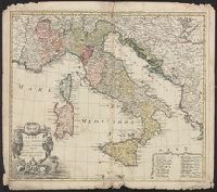
- Homann Erben (Firm)
- Published / Created:
- [1742?]
- Call Number:
- 40 1742
- Container / Volume:
- BRBL_00197
- Image Count:
- 1
- Resource Type:
- Maps, Atlases & Globes
- Found in:
- Beinecke Rare Book and Manuscript Library > Italia : in suos status divisa et ex prototypo del Isliano desumta, elementis insuper Geographiae Schazianis accom[m]odata.
- Published / Created:
- [1540]
- Call Number:
- E33 +540P
- Collection Title:
- Geographia vniversalis, vetvs et nova complectens Clavdii Ptolemaei Alexandrini enarrationis libros
- Image Count:
- 1
- Resource Type:
- Books, Journals & Pamphlets
- Found in:
- Beinecke Rare Book and Manuscript Library > Italia XIIII, Nova tabvla
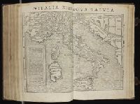
- Published / Created:
- 1617
- Call Number:
- 40 1617
- Container / Volume:
- BRBL_00196
- Image Count:
- 4
- Resource Type:
- Maps, Atlases & Globes
- Found in:
- Beinecke Rare Book and Manuscript Library > Italia, nuouamente piu perfetta ... / dal ... Hesselo Gherardo.