Search
You Searched For
Search Results
- Creator:
- State Highway Commission of Kansas
- Published / Created:
- [1971]
- Call Number:
- 825 1971
- Container / Volume:
- BRBL_00573
- Image Count:
- 2
- Resource Type:
- Maps, Atlases & Globes
- Found in:
- Beinecke Rare Book and Manuscript Library > 1971 Kansas official highway map.
- Creator:
- Holmes, William Henry, 1846-1933
- Published / Created:
- [1859?]
- Call Number:
- 825 1859A
- Container / Volume:
- BRBL_00573
- Image Count:
- 1
- Resource Type:
- Maps, Atlases & Globes
- Found in:
- Beinecke Rare Book and Manuscript Library > A new map of Kansas / by W.H. Holmes.
- Published / Created:
- 1873?]
- Call Number:
- 825gme 1873
- Container / Volume:
- BRBL_00576
- Image Count:
- 2
- Resource Type:
- Maps, Atlases & Globes
- Found in:
- Beinecke Rare Book and Manuscript Library > Atchison, Topeka & Santa-Fe Railroad and connections : with 3,000,000 acres land for sale on eleven years credit & seven percent interest / Fisk & Russell, N.Y. Map of Kansas / Atchison, Topeka & Santa-Fe Railroad ; Bogart & Stillman, engravers, Cin. O.
- Creator:
- Gunn, O. B. (Otis Berthoude), 1828-1901
- Published / Created:
- 1866
- Call Number:
- 825 1866
- Container / Volume:
- BRBL_00573
- Image Count:
- 1
- Resource Type:
- Maps, Atlases & Globes
- Found in:
- Beinecke Rare Book and Manuscript Library > Gunn & Mitchell's new map of Kansas and the gold mines : embracing all the public surveys up to 1866, principal meridian / compiled from the original field notes by O.B. Gunn & D.T. Mitchell.
- Creator:
- Gunn, O.B. (Otis Berthoude), 1828-1901
- Published / Created:
- 1862
- Call Number:
- 825 1862
- Container / Volume:
- BRBL_00573
- Image Count:
- 1
- Resource Type:
- Maps, Atlases & Globes
- Found in:
- Beinecke Rare Book and Manuscript Library > Gunn & Mitchell's new map of Kansas and the gold mines embracing all the public surveys up to 1862 / compiled from the original field notes by O.B. Gunn & D.T. Mitchell, LeCompton, K., 1862.
- Creator:
- Johnson, A. J. (Alvin Jewett), 1827-1884
- Published / Created:
- 1866]
- Call Number:
- 816 1866
- Container / Volume:
- BRBL_00561
- Image Count:
- 2
- Resource Type:
- Maps, Atlases & Globes
- Found in:
- Beinecke Rare Book and Manuscript Library > Johnson's Missouri and Kansas.
- Creator:
- Johnson, A. J. (Alvin Jewett), 1827-1884
- Published / Created:
- 1858
- Call Number:
- 825fb 1858
- Container / Volume:
- BRBL_00575
- Image Count:
- 1
- Resource Type:
- Maps, Atlases & Globes
- Found in:
- Beinecke Rare Book and Manuscript Library > Johnson's county, township, and sectional Kansas and Nebraska.
- Creator:
- Johnson, A. J. (Alvin Jewett), 1827-1884
- Published / Created:
- 1859
- Call Number:
- 825 1859
- Container / Volume:
- BRBL_00573
- Image Count:
- 1
- Resource Type:
- Maps, Atlases & Globes
- Found in:
- Beinecke Rare Book and Manuscript Library > Johnson's new rail road and county copper plate map of Kansas gold region and the Great West, from the latest and best authorities.
- Creator:
- Wells, John G. (John Gaylord), 1821-1880
- Published / Created:
- 1857
- Call Number:
- 825 1857B
- Container / Volume:
- BRBL_00573
- Image Count:
- 1
- Resource Type:
- Maps, Atlases & Globes
- Found in:
- Beinecke Rare Book and Manuscript Library > Kansas & Nebraska.
- Creator:
- Morse & Gaston (Firm)
- Published / Created:
- 1856
- Call Number:
- 80 1856A
- Container / Volume:
- BRBL_00534
- Image Count:
- 1
- Resource Type:
- Maps, Atlases & Globes
- Found in:
- Beinecke Rare Book and Manuscript Library > Kansas & Nebraska.
- Creator:
- Rand McNally and Company
- Published / Created:
- 1911
- Call Number:
- 825 1911
- Container / Volume:
- BRBL_00573
- Image Count:
- 1
- Resource Type:
- Maps, Atlases & Globes
- Found in:
- Beinecke Rare Book and Manuscript Library > Kansas / Rand-McNally & Co.
- Creator:
- Rand McNally and Company
- Published / Created:
- 1911
- Call Number:
- 825gbc 1911
- Container / Volume:
- BRBL_00576
- Image Count:
- 2
- Resource Type:
- Maps, Atlases & Globes
- Found in:
- Beinecke Rare Book and Manuscript Library > Kansas / Rand-McNally & Co.
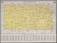
- Creator:
- State Highway Commission of Kansas
- Published / Created:
- 1941
- Call Number:
- 825gmb 1941
- Container / Volume:
- BRBL_00576
- Image Count:
- 2
- Resource Type:
- Maps, Atlases & Globes
- Found in:
- Beinecke Rare Book and Manuscript Library > Kansas state highway system / issued 1941, State Highway Commission of Kansas.
- Creator:
- State Highway Commission of Kansas
- Published / Created:
- 1934
- Call Number:
- 825gmb 1934
- Container / Volume:
- BRBL_00576
- Image Count:
- 2
- Resource Type:
- Maps, Atlases & Globes
- Found in:
- Beinecke Rare Book and Manuscript Library > Kansas state highway system : showing route numbers and construction progress / issued by State Highway Commission of Kansas, January 1, 1934.
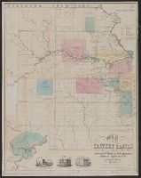
- Creator:
- Whitman, E. B. (Edmund Burke), 1812-1883
- Published / Created:
- 1856
- Call Number:
- 825 1856
- Container / Volume:
- BRBL_00573
- Image Count:
- 1
- Resource Type:
- Maps, Atlases & Globes
- Found in:
- Beinecke Rare Book and Manuscript Library > Map of Eastern Kansas / by E.B. Whitman & A.D. Searl.
- Published / Created:
- c1888.
- Call Number:
- 825gme 1888
- Container / Volume:
- BRBL_00576
- Image Count:
- 1
- Resource Type:
- Maps, Atlases & Globes
- Found in:
- Beinecke Rare Book and Manuscript Library > Map of Kansas / issued by the State Board of Railroad Commissioners.
- Creator:
- United States. General Land Office
- Published / Created:
- 1866
- Call Number:
- 825fcm 1866
- Container / Volume:
- BRBL_00575
- Image Count:
- 1
- Resource Type:
- Maps, Atlases & Globes
- Found in:
- Beinecke Rare Book and Manuscript Library > Map showing the progress of the public surveys in Kansas and Nebraska / Surveyor General's Office ; Department of the Interior, General Land Office, Oct. 2nd, 1866.
- Creator:
- United States. Surveyor General
- Published / Created:
- 1862?]
- Call Number:
- 825fcm 1862
- Container / Volume:
- BRBL_00575
- Image Count:
- 1
- Resource Type:
- Maps, Atlases & Globes
- Found in:
- Beinecke Rare Book and Manuscript Library > Map showing the progress of the public surveys in Kansas and Nebraska : to accompany annual report of the Surveyor General, 1862 / Surveyor General's Office, Leavenworth, Kansas.
- Creator:
- United States. General Land Office
- Published / Created:
- 1860?
- Call Number:
- 825fcm 1860
- Container / Volume:
- BRBL_00575
- Image Count:
- 1
- Resource Type:
- Maps, Atlases & Globes
- Found in:
- Beinecke Rare Book and Manuscript Library > Map showing the progress of the public surveys in the territories of Kansas and Nebraska : to accompany annual report of the Surveyor General, 1860.
- Creator:
- J.H. Colton & Co
- Published / Created:
- [1855?]
- Call Number:
- 824 1855A
- Container / Volume:
- BRBL_00570
- Image Count:
- 1
- Resource Type:
- Maps, Atlases & Globes
- Found in:
- Beinecke Rare Book and Manuscript Library > Nebraska and Kansas.
- Creator:
- J.H. Colton & Co
- Published / Created:
- 1857
- Call Number:
- 824 1857D
- Container / Volume:
- BRBL_00570
- Image Count:
- 1
- Resource Type:
- Maps, Atlases & Globes
- Found in:
- Beinecke Rare Book and Manuscript Library > Nebraska and Kansas.
- Creator:
- J.H. Colton & Co
- Published / Created:
- [1854?]
- Call Number:
- 824 1854A
- Container / Volume:
- BRBL_00570
- Image Count:
- 1
- Resource Type:
- Maps, Atlases & Globes
- Found in:
- Beinecke Rare Book and Manuscript Library > Nebraska and Kansas.
- Creator:
- J.H. Colton & Co
- Published / Created:
- 19--?]
- Call Number:
- 824 1854B
- Container / Volume:
- BRBL_00570
- Image Count:
- 1
- Resource Type:
- Maps, Atlases & Globes
- Found in:
- Beinecke Rare Book and Manuscript Library > Nebraska and Kansas.
- Creator:
- J.H. Colton & Co
- Published / Created:
- 1857
- Call Number:
- 824 1857D
- Container / Volume:
- BRBL_00570
- Image Count:
- 1
- Resource Type:
- Maps, Atlases & Globes
- Found in:
- Beinecke Rare Book and Manuscript Library > Nebraska and Kansas.
- Creator:
- H.M. Gousha Company
- Published / Created:
- [1936?]
- Call Number:
- 825gmb 1936
- Container / Volume:
- BRBL_00576
- Image Count:
- 2
- Resource Type:
- Maps, Atlases & Globes
- Found in:
- Beinecke Rare Book and Manuscript Library > Official road map of Kansas / [Prepared for] Conoco Travel Bureau.
- Creator:
- H.M. Gousha Company
- Published / Created:
- 1938
- Call Number:
- 825gmb 1938
- Container / Volume:
- BRBL_00576
- Image Count:
- 2
- Resource Type:
- Maps, Atlases & Globes
- Found in:
- Beinecke Rare Book and Manuscript Library > Official road map of Kansas / [prepared for] Conoco Travel Bureau.
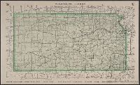
- Creator:
- Everts, L. H. (Louis H.)
- Published / Created:
- [between 1877 and 1883?]
- Call Number:
- 825fac 1883
- Container / Volume:
- BRBL_00575
- Image Count:
- 1
- Resource Type:
- Maps, Atlases & Globes
- Found in:
- Beinecke Rare Book and Manuscript Library > Official topographical map of Kansas / compiled from government surveys, official records, and personal investigations.
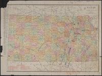
- Creator:
- Rand McNally and Company
- Published / Created:
- 1891
- Call Number:
- 825 1891
- Container / Volume:
- BRBL_00573
- Image Count:
- 1
- Resource Type:
- Maps, Atlases & Globes
- Found in:
- Beinecke Rare Book and Manuscript Library > Rand McNally & Co.'s Kansas.
- Published / Created:
- 1874?]
- Call Number:
- 825 1874
- Container / Volume:
- BRBL_00573
- Image Count:
- 1
- Resource Type:
- Maps, Atlases & Globes
- Found in:
- Beinecke Rare Book and Manuscript Library > Sectional map of the Pottawattomie Reserve lands : remaining unsold July 1st 1874.
- Creator:
- United States. Surveyor General
- Published / Created:
- [1856]
- Call Number:
- 825 1856B
- Container / Volume:
- BRBL_00573
- Image Count:
- 1
- Resource Type:
- Maps, Atlases & Globes
- Found in:
- Beinecke Rare Book and Manuscript Library > Sketch of the public surveys in Kansas & Nebraska.
- Creator:
- United States. General Land Office
- Published / Created:
- 1879
- Call Number:
- 825 1879
- Container / Volume:
- BRBL_00573
- Image Count:
- 1
- Resource Type:
- Maps, Atlases & Globes
- Found in:
- Beinecke Rare Book and Manuscript Library > State of Kansas / compiled from the official records of the General Land Office and other sources by C. Roeser ; photo lith. & print. by Julius Bien.
- Creator:
- Berthrong, I. P
- Published / Created:
- 1898
- Call Number:
- 825 1898
- Container / Volume:
- BRBL_00573
- Image Count:
- 1
- Resource Type:
- Maps, Atlases & Globes
- Found in:
- Beinecke Rare Book and Manuscript Library > State of Kansas / compiled from the official records of the General Land Office and other sources under the direction of Harry King ; compiled and drawn by I.P. Berthrong ; revised and corrected to May 1898 by M. Hendges.
- Creator:
- Rogers, Henry D. (Henry Darwin), 1808-1866
- Published / Created:
- [1857?]
- Call Number:
- 825 1857A
- Container / Volume:
- BRBL_00573
- Image Count:
- 1
- Resource Type:
- Maps, Atlases & Globes
- Found in:
- Beinecke Rare Book and Manuscript Library > Territory of Kansas and Indian Territory / by H.D. Rogers & A. Keith Johnston ; engraved by W. & A.K. Johnston, Edinburgh.
- Creator:
- Rand McNally and Company
- Published / Created:
- 1914
- Call Number:
- 825gbc 1914
- Container / Volume:
- BRBL_00576
- Image Count:
- 2
- Resource Type:
- Maps, Atlases & Globes
- Found in:
- Beinecke Rare Book and Manuscript Library > The Rand-McNally new commercial atlas map of Kansas.
- Creator:
- Rand McNally and Company
- Published / Created:
- [1914?]
- Call Number:
- 825gbc 1914A
- Container / Volume:
- BRBL_00576
- Image Count:
- 2
- Resource Type:
- Maps, Atlases & Globes
- Found in:
- Beinecke Rare Book and Manuscript Library > The Rand-McNally new commercial atlas map of Kansas.