Skip to search
Skip to main content
Skip to first result
Search
You Searched For
Subject (Geographic)
Kentucky--Maps
Search Results
Creator:
Published / Created:
1886
Call Number:
802gca J135 1886
Container / Volume:
BRBL_00542
Image Count:
1
Resource Type:
Maps, Atlases & Globes
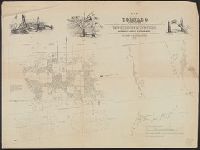
Description:
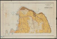
John R. Procter, Director.
Subject (Geographic):
Kentucky--Maps
Subject (Name):
Loughridge, R. H. (Robert Hills), 1843-1917
Found in:
Beinecke Rare Book and Manuscript Library > Agricultural Map of the Jackson Purchase. R.H. Loughridge, Geologist. J.B. Hoeing, Topographer.
Published / Created:
1890
Call Number:
802 1890
Container / Volume:
BRBL_00542
Image Count:
1
Resource Type:
Maps, Atlases & Globes
Publisher:
Geo. F. Cram,
Subject (Geographic):
Kentucky--Maps and Tennessee--Maps
Found in:
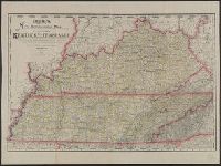
Beinecke Rare Book and Manuscript Library > Cram's new commerical map of the states of Kentucky and Tennessee. : compiled from the most recent United States and state surveys, official maps and records, railroad surveys, and other authentic and reliable sources.
Creator:
Published / Created:
[between 1866 and 1879]
Call Number:
802 1866
Container / Volume:
BRBL_00542
Image Count:
2
Resource Type:
Maps, Atlases & Globes
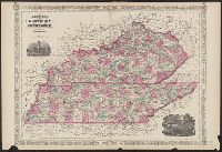
Alternative Title:
Kentucky and Tennessee
Description:
"Entered according to Act of Congress in the Year 1865 by A.J. Johnson in the Clerks Office of the District Court of the United States for the Southern District of New York."
Publisher:
A.J. Johnson,
Subject (Geographic):
Kentucky--Maps and Tennessee--Maps
Subject (Topic):
Cities and towns--Kentucky--Maps, Cities and towns--Tennessee--Maps, Counties--Kentucky--Maps, Counties--Tennessee--Maps, Railroads--Kentucky--Maps, Railroads--Tennessee--Maps, and Roads--Kentu
Found in:
Beinecke Rare Book and Manuscript Library > Johnson's Kentucky and Tennessee / published by A. J. Johnson.
Published / Created:
1896
Call Number:
802 1896
Container / Volume:
BRBL_00542
Image Count:
2
Resource Type:
Maps, Atlases & Globes
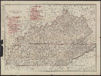
Description:
Indexes in red of railroads in Kentucky, Tennessee.
Publisher:
Rand McNally & Co.,
Subject (Geographic):
Kentucky--Maps and Tennessee--Maps
Found in:
Beinecke Rare Book and Manuscript Library > Kentucky, Tennessee.
Published / Created:
1911
Call Number:
802gbc 1911
Container / Volume:
BRBL_00717
Image Count:
1
Resource Type:
Maps, Atlases & Globes
Description:
Annotations: oil well drillings.
Publisher:
Rand McNally & Co. ,
Subject (Geographic):
Kentucky--Maps
Found in:
Beinecke Rare Book and Manuscript Library > Kentucky.
Published / Created:
1852
Call Number:
806cfp G562 1852
Container / Volume:
BRBL_00549
Image Count:
1
Resource Type:
Maps, Atlases & Globes
Description:
Arrow in center of map labeled "Direction of the tornado a little north of east".
Publisher:
T. Sinclair's Lith.,
Subject (Geographic):
Illinois--Maps, Indiana--Maps, and Kentucky--Maps
Found in:
Beinecke Rare Book and Manuscript Library > Map of the track of the tornado of April 30th 1852. : from Golconda Illinois, to Wabash River across Indiana & the Ohio River to Georgetown Kentucky, U.S. / by John Chapplesmith.
Creator:
Published / Created:
1887
Call Number:
802 1887
Container / Volume:
BRBL_00542
Image Count:
1
Resource Type:
Maps, Atlases & Globes
Description:
At head of title: "Prepared by the Kentucky Railroad Commissioners by the Kentucky Geological Survey, John R. Procter, director".
Publisher:
The Survey].
Subject (Geographic):
Kentucky--Maps
Subject (Name):
Kentucky Geological Survey and Procter, John Robert, 1844-1903
Found in:
Beinecke Rare Book and Manuscript Library > Preliminary county map of Kentucky / by J.B. Hoeing.
Creator:
Published / Created:
c1903.
Call Number:
802 1903
Container / Volume:
BRBL_00542
Image Count:
2
Resource Type:
Maps, Atlases & Globes
Publisher:
Rand, McNally & Co.,
Subject (Geographic):
Kentucky--Maps and Tennessee--Maps
Subject (Topic):
Railroads--Kentucky--Maps and Railroads--Tennessee--Maps
Found in:
Beinecke Rare Book and Manuscript Library > Rand McNally & Co.'s indexed county and railroad pocket map and shipper's guide of Kentucky : accompanied by a new and original compilation and ready reference index showing in detail the entire railroad system, the express company doing business over eac
Published / Created:
1894
Call Number:
801 1894
Container / Volume:
BRBL_00541
Image Count:
1
Resource Type:
Maps, Atlases & Globes
Alternative Title:
Rand McNally & Co.'s new business atlas map of Kentucky & Tennessee
Description:
Printed upper right corner below scale "Rand McNally & Co.'s new business atlas map of Kentucky & Tennessee copyright 1889".
Publisher:
Rand, McNally & Co.,
Subject (Geographic):
Kentucky--Maps and Tennessee--Maps
Found in:
Beinecke Rare Book and Manuscript Library > Rand, McNally & Co.'s Tennessee.