Skip to search
Skip to main content
Skip to first result
Search
You Searched For
Subject (Geographic)
Louisiana--Maps
Search Results
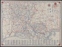
Creator:
Published / Created:
[1934]
Call Number:
795gmb 1934
Container / Volume:
BRBL_00523
Image Count:
2
Resource Type:
Maps, Atlases & Globes
Alternative Title:
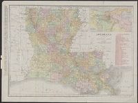
1934 road map, Louisiana and Louisiana
Description:
"P.15."
Publisher:
Rand McNally,
Subject (Geographic):
Louisiana--Maps
Subject (Name):
Gulf Refining Company
Subject (Topic):
Roads--Louisiana--Maps
Found in:
Beinecke Rare Book and Manuscript Library > 1934 official road map, Louisiana / [prepared for] Gulf Refining Co.
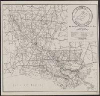
Creator:
Published / Created:
1945
Call Number:
795gmb 1945
Container / Volume:
BRBL_00523
Image Count:
1
Resource Type:
Maps, Atlases & Globes
Alternative Title:
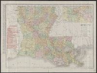
Department of Highways official road map and Official road map
Description:
At head of title above legend: Department of Highways.
Publisher:
Dept. of Highways,
Subject (Geographic):
Louisiana--Maps
Subject (Topic):
Roads--Louisiana--Maps
Found in:
Beinecke Rare Book and Manuscript Library > 1945 road map : [Louisiana] / State of Louisiana, Department of Highways.
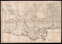
Creator:
Published / Created:
1810
Call Number:
GA405 +W44 (LC)
Collection Title:
Mapping the transmississippi West, 1540-1861
Image Count:
1
Description:
Bound in between p. 24-25.
Publisher:
C. & A. Conrad, & Co
Subject (Geographic):
Louisiana--Maps, New Mexico--Maps, North America--Maps, and West (U.S.)--Maps
Collection Created:
San Francisco, Institute of Historical Cartography, 1957-63
Found in:
Beinecke Rare Book and Manuscript Library > A Chart of the Internal Part of Louisiana, Including all the hitherto unexplored Countries, lying between the River La Platte of the Missouri on the N: and the Red River on the S: the Mississippi East and the Mountains of Mexico West; with a Part of New M
Creator:
Published / Created:
[1806]
Call Number:
795 Or5 1806
Container / Volume:
BRBL_00522
Image Count:
1
Resource Type:
Maps, Atlases & Globes
Description:
In bottom margin: Copy right secured.
Publisher:
s.n.,
Subject (Geographic):
Louisiana--Maps, Mississippi--Maps, and West Florida--Maps
Found in:
Beinecke Rare Book and Manuscript Library > Carte générale du territoire d'Orléans comprenant aussi la Floride Occidentale et une portion du territoire du Mississipi : dresée d'après les observations les plus récentes / par Bmi. Lafon ... 1806.
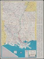
Creator:
Published / Created:
[1940]
Call Number:
818gmb 1940
Container / Volume:
BRBL_00565
Image Count:
2
Resource Type:
Maps, Atlases & Globes
Alternative Title:
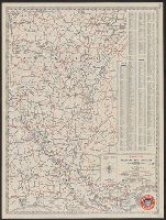
Arkansas, Louisiana, and Mississippi, 1940, Happy motoring in the South Central States, 1940., and Pictorial guide to happy motoring in Arkansas and Louisiana.
Description:
Includes indexes, distance table, and list of radio stations.
Publisher:
General Drafting Co.,
Subject (Geographic):
Arkansas--Maps, Louisiana--Maps, Mississippi--Maps, and Southwestern States--Maps
Subject (Name):
Standard Oil Company of Louisiana
Subject (Topic):
Roads--Arkansas--Maps, Roads--Louisiana--Maps, Roads--Mississippi--Maps, and Roads--Southwestern States--Maps
Found in:
Beinecke Rare Book and Manuscript Library > Happy motoring in Arkansas, Louisiana, and Mississippi / [prepared for] Standard Oil Company of Louisiana.
Creator:
Published / Created:
[186-?]
Call Number:
818 1866B
Container / Volume:
BRBL_00565
Image Count:
2
Resource Type:
Maps, Atlases & Globes
Alternative Title:
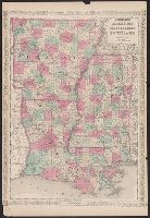
Arkansas, Mississippi, and Louisiana
Description:
"56" and "57 on verso.
Publisher:
Johnson and Ward,
Subject (Geographic):
Arkansas--Maps, Louisiana--Maps, and Mississippi--Maps
Subject (Name):
Johnson, A. J. (Alvin Jewett), 1827-1884
Found in:
Beinecke Rare Book and Manuscript Library > Johnson's Arkansas, Mississippi, and Louisiana / by Johnson and Ward.
Creator:
Published / Created:
1911
Call Number:
795 1911
Container / Volume:
BRBL_00521
Image Count:
1
Resource Type:
Maps, Atlases & Globes
Abstract:
Shows railroads overprinted in red.
Description:
Includes index and inset of "Vicinity of New Orleans" (scale [ca. 1:300,000]).
Publisher:
Rand McNally,
Subject (Geographic):
Louisiana--Maps
Subject (Topic):
Railroads--Louisiana--Maps
Found in:
Beinecke Rare Book and Manuscript Library > Louisiana.
Creator:
Published / Created:
1908
Call Number:
795 1908
Container / Volume:
BRBL_00521
Image Count:
2
Resource Type:
Maps, Atlases & Globes
Abstract:
Shows railroads overprinted in red.
Description:
Includes index and inset of "Vicinity of New Orleans" (scale [ca. 1:300,000]).
Publisher:
Rand McNally,
Subject (Geographic):
Louisiana--Maps
Subject (Topic):
Railroads--Louisiana--Maps
Found in:
Beinecke Rare Book and Manuscript Library > Louisiana.
Creator:
Published / Created:
[1931]
Call Number:
818gmb 1931
Container / Volume:
BRBL_00565
Image Count:
2
Resource Type:
Maps, Atlases & Globes
Alternative Title:
Arkansas and Louisiana, 1931, Principal highways of the Southwest., and Road map of Arkansas and Louisiana
Description:
"Copyright General Drafting Co. Inc".
Publisher:
Magnolia Petroleum Company,
Subject (Geographic):
Arkansas--Maps and Louisiana--Maps
Subject (Name):
Magnolia Petroleum Company
Subject (Topic):
Roads--Arkansas--Maps, Roads--Louisiana--Maps, and Roads--Southwestern States--Maps
Found in:
Beinecke Rare Book and Manuscript Library > Magnolia road map of Arkansas and Louisiana / General Drafting Co. Inc.
Creator:
Published / Created:
1880?]
Call Number:
795 N47 1880
Container / Volume:
BRBL_00522
Image Count:
1
Resource Type:
Maps, Atlases & Globes
Description:
Also shows township and range grid, railroad routes, and property ownership along Mississippi.
Publisher:
s.n.,
Subject (Geographic):
Gulf Coast (La.)--Maps and Louisiana--Maps
Subject (Name):
Jones, Joseph, 1833-1896
Subject (Topic):
Gulf Coast (Miss.)--Maps
Found in:
Beinecke Rare Book and Manuscript Library > Map illustrating the topography of New Orleans and of the coast of Louisiana and Mississippi / prepared for Joseph Jones, M.D., by T.S. Hardee, civil engineer.