Search
You Searched For
Search Results
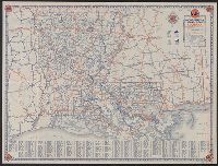
- Creator:
- Rand McNally and Company
- Published / Created:
- [1934]
- Call Number:
- 795gmb 1934
- Container / Volume:
- BRBL_00523
- Image Count:
- 2
- Resource Type:
- Maps, Atlases & Globes
- Found in:
- Beinecke Rare Book and Manuscript Library > 1934 official road map, Louisiana / [prepared for] Gulf Refining Co.
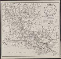
- Creator:
- Louisiana. Dept. of Highways
- Published / Created:
- 1945
- Call Number:
- 795gmb 1945
- Container / Volume:
- BRBL_00523
- Image Count:
- 1
- Resource Type:
- Maps, Atlases & Globes
- Found in:
- Beinecke Rare Book and Manuscript Library > 1945 road map : [Louisiana] / State of Louisiana, Department of Highways.
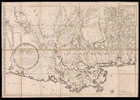
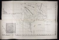
- Creator:
- Pike, Zebulon Montgomery, 1779-1813
- Published / Created:
- 1810
- Call Number:
- GA405 +W44 (LC)
- Collection Title:
- Mapping the transmississippi West, 1540-1861
- Image Count:
- 1
- Found in:
- Beinecke Rare Book and Manuscript Library > A Chart of the Internal Part of Louisiana, Including all the hitherto unexplored Countries, lying between the River La Platte of the Missouri on the N: and the Red River on the S: the Mississippi East and the Mountains of Mexico West; with a Part of New M
- Creator:
- Lafon, Barthélémy, 1769-1820
- Published / Created:
- [1806]
- Call Number:
- 795 Or5 1806
- Container / Volume:
- BRBL_00522
- Image Count:
- 1
- Resource Type:
- Maps, Atlases & Globes
- Found in:
- Beinecke Rare Book and Manuscript Library > Carte générale du territoire d'Orléans comprenant aussi la Floride Occidentale et une portion du territoire du Mississipi : dresée d'après les observations les plus récentes / par Bmi. Lafon ... 1806.
- Creator:
- General Drafting Company, inc
- Published / Created:
- [1940]
- Call Number:
- 818gmb 1940
- Container / Volume:
- BRBL_00565
- Image Count:
- 2
- Resource Type:
- Maps, Atlases & Globes
- Found in:
- Beinecke Rare Book and Manuscript Library > Happy motoring in Arkansas, Louisiana, and Mississippi / [prepared for] Standard Oil Company of Louisiana.
- Creator:
- Johnson and Ward
- Published / Created:
- [186-?]
- Call Number:
- 818 1866B
- Container / Volume:
- BRBL_00565
- Image Count:
- 2
- Resource Type:
- Maps, Atlases & Globes
- Found in:
- Beinecke Rare Book and Manuscript Library > Johnson's Arkansas, Mississippi, and Louisiana / by Johnson and Ward.
- Creator:
- Rand McNally and Company
- Published / Created:
- 1911
- Call Number:
- 795 1911
- Container / Volume:
- BRBL_00521
- Image Count:
- 1
- Resource Type:
- Maps, Atlases & Globes
- Found in:
- Beinecke Rare Book and Manuscript Library > Louisiana.
- Creator:
- Rand McNally and Company
- Published / Created:
- 1908
- Call Number:
- 795 1908
- Container / Volume:
- BRBL_00521
- Image Count:
- 2
- Resource Type:
- Maps, Atlases & Globes
- Found in:
- Beinecke Rare Book and Manuscript Library > Louisiana.
- Creator:
- General Drafting Company, inc
- Published / Created:
- [1931]
- Call Number:
- 818gmb 1931
- Container / Volume:
- BRBL_00565
- Image Count:
- 2
- Resource Type:
- Maps, Atlases & Globes
- Found in:
- Beinecke Rare Book and Manuscript Library > Magnolia road map of Arkansas and Louisiana / General Drafting Co. Inc.
- Creator:
- Hardee, T. S
- Published / Created:
- 1880?]
- Call Number:
- 795 N47 1880
- Container / Volume:
- BRBL_00522
- Image Count:
- 1
- Resource Type:
- Maps, Atlases & Globes
- Found in:
- Beinecke Rare Book and Manuscript Library > Map illustrating the topography of New Orleans and of the coast of Louisiana and Mississippi / prepared for Joseph Jones, M.D., by T.S. Hardee, civil engineer.
- Creator:
- McCulloh, William J
- Published / Created:
- Oct. 1st, 1855.
- Call Number:
- 795 1855A
- Container / Volume:
- BRBL_00521
- Image Count:
- 1
- Resource Type:
- Maps, Atlases & Globes
- Found in:
- Beinecke Rare Book and Manuscript Library > Map of Louisiana representing the several land districts / prepared to accompany the Surveyor General's annual report, Wm. J. McCulloh, Sur., Gen.
- Published / Created:
- 1850?]
- Call Number:
- 795fcm 1850
- Container / Volume:
- BRBL_00523
- Image Count:
- 1
- Resource Type:
- Maps, Atlases & Globes
- Found in:
- Beinecke Rare Book and Manuscript Library > Map of Louisiana representing the several land districts : prepared to accompany the Surveyor General's report.
- Published / Created:
- 1847?]
- Call Number:
- 795fcm 1847
- Container / Volume:
- BRBL_00523
- Image Count:
- 1
- Resource Type:
- Maps, Atlases & Globes
- Found in:
- Beinecke Rare Book and Manuscript Library > Map of Louisiana representing the several land districts : prepared to accompany the Surveyor General's report.
- Published / Created:
- 1860
- Call Number:
- 795fcm 1860
- Container / Volume:
- BRBL_00523
- Image Count:
- 1
- Resource Type:
- Maps, Atlases & Globes
- Found in:
- Beinecke Rare Book and Manuscript Library > Map of Louisiana representing the several land districts prepared to accompany the Surveyor General's annual report.
- Creator:
- Citizens' Bank of Louisiana
- Published / Created:
- [1875]
- Call Number:
- 795fcm 1875
- Container / Volume:
- BRBL_00523
- Image Count:
- 1
- Resource Type:
- Maps, Atlases & Globes
- Found in:
- Beinecke Rare Book and Manuscript Library > Map of Louisiana showing lands belonging to Citizens Bank.
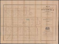
- Published / Created:
- 1860
- Call Number:
- 795 C35 1860
- Container / Volume:
- BRBL_00522
- Image Count:
- 1
- Resource Type:
- Maps, Atlases & Globes
- Found in:
- Beinecke Rare Book and Manuscript Library > Map of the parish of Caldwell, Louisiana, from United States surveys.
- Published / Created:
- 1845?]
- Call Number:
- 818fb 1845
- Container / Volume:
- BRBL_00565
- Image Count:
- 1
- Resource Type:
- Maps, Atlases & Globes
- Found in:
- Beinecke Rare Book and Manuscript Library > Map of the south western district, Louisiana ; South eastern district, Louisiana ; Map of the district north of Red River and part of N.W. District, LA. / Surveyor Generals Office, Donaldson, Oct. 29th 1845, P.T. Landry, Sur. Genl. La. Arkansas / Wm. Pel
- Creator:
- O'Hare, Daniel
- Published / Created:
- 1896
- Call Number:
- 795 1896
- Container / Volume:
- BRBL_00521
- Image Count:
- 1
- Resource Type:
- Maps, Atlases & Globes
- Found in:
- Beinecke Rare Book and Manuscript Library > Map of the state of Louisiana / compiled from the official records of the General Land Office and other sources under the direction of Harry King ; revised and drawn by Daniel O'Hare.
- Creator:
- Darby, William, 1775-1854
- Published / Created:
- May the 1st, 1816.
- Call Number:
- 795 1816B
- Container / Volume:
- BRBL_00521
- Image Count:
- 1
- Resource Type:
- Maps, Atlases & Globes
- Found in:
- Beinecke Rare Book and Manuscript Library > Map of the state of Louisiana : with part of the Mississippi Territory, from actual survey / by Wm. Darby ; Saml. Harrison sct. Philaa.
- Creator:
- Bayley, G. W. R
- Published / Created:
- 1853
- Call Number:
- 795 1853
- Container / Volume:
- BRBL_00521
- Image Count:
- 1
- Resource Type:
- Maps, Atlases & Globes
- Found in:
- Beinecke Rare Book and Manuscript Library > New and improved map of Louisiana / compiled from the latest and most authentic surveys, both public & private, by G.W.R. Bayley, civil engineer.
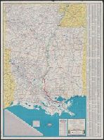
- Creator:
- Bourg, Hal M
- Published / Created:
- 1937
- Call Number:
- 795gmb 1937
- Container / Volume:
- BRBL_00523
- Image Count:
- 2
- Resource Type:
- Maps, Atlases & Globes
- Found in:
- Beinecke Rare Book and Manuscript Library > Official road map of Louisiana / compiled and drawn by Hal M. Bourg, 1936 ; compliments of Louisiana Highway Commission.
- Published / Created:
- 1870
- Call Number:
- 795 AT81 1870
- Container / Volume:
- BRBL_00522
- Image Count:
- 2
- Resource Type:
- Maps, Atlases & Globes
- Found in:
- Beinecke Rare Book and Manuscript Library > Outline extract from Hardee's new map of Louisiana : now in course of publication, A.D. 1870, showing the Attakapas Region and parish of St. Landry / engraved and electrotyped for D. Dennett.
- Creator:
- United States. Post Office Dept
- Published / Created:
- [1881?]
- Call Number:
- 795 1881
- Container / Volume:
- BRBL_00521
- Image Count:
- 2
- Resource Type:
- Maps, Atlases & Globes
- Found in:
- Beinecke Rare Book and Manuscript Library > Post route map of the state of Louisiana : with adjacent parts of Mississippi, Arkansas and Texas, showing post offices / designed and constructed under the orders of Postmaster General David M. Key by W.L. Nicholson, topographer, P.O. Dept.
- Call Number:
- Zc20 931pi
- Collection Title:
- Pichardo’s treatise on the limits of Louisiana and Texas : an argumentative historical treatise
- Image Count:
- 1
- Found in:
- Beinecke Rare Book and Manuscript Library > Section of Pichardo's map of New Mexico and adjacent regions, drawn in 1811 to assist in the determination of the boundaries between the Spanish dominions and the United States.
- Creator:
- United States. General Land Office
- Published / Created:
- 1879
- Call Number:
- 795 1879
- Container / Volume:
- BRBL_00521
- Image Count:
- 1
- Resource Type:
- Maps, Atlases & Globes
- Found in:
- Beinecke Rare Book and Manuscript Library > State of Louisiana / compiled from the official records of the General Land Office and other sources by C. Roeser, Principal Draughtsman, G.L.O.
- Published / Created:
- [192-?]
- Call Number:
- 795 192X
- Container / Volume:
- BRBL_00521
- Image Count:
- 2
- Resource Type:
- Maps, Atlases & Globes
- Found in:
- Beinecke Rare Book and Manuscript Library > The Department of Agriculture and Immigration's map of Louisiana : showing parishes, parish seats, cities, towns, villages, etc., railroads, with distances between stations, the state highway system - improved and proposed improved roads.
- Creator:
- Louisiana State Board of Agriculture and Immigration
- Published / Created:
- c1910.
- Call Number:
- 795 1910
- Container / Volume:
- BRBL_00521
- Image Count:
- 2
- Resource Type:
- Maps, Atlases & Globes
- Found in:
- Beinecke Rare Book and Manuscript Library > The Louisiana State Board of Agriculture and Immigration's map of Louisiana : a phytogeographic map showing the principal vegetation areas, all principal commercial points, town populations and railway distances / issued by Hon. E.O. Bruner, Commissioner,