Search
You Searched For
Search Results
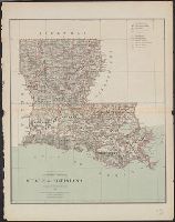
- Creator:
- United States. General Land Office
- Published / Created:
- 1879
- Call Number:
- 795 1879
- Container / Volume:
- BRBL_00521
- Image Count:
- 1
- Resource Type:
- Maps, Atlases & Globes
- Found in:
- Beinecke Rare Book and Manuscript Library > State of Louisiana / compiled from the official records of the General Land Office and other sources by C. Roeser, Principal Draughtsman, G.L.O.
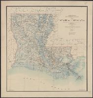
- Creator:
- O'Hare, Daniel
- Published / Created:
- 1896
- Call Number:
- 795 1896
- Container / Volume:
- BRBL_00521
- Image Count:
- 1
- Resource Type:
- Maps, Atlases & Globes
- Found in:
- Beinecke Rare Book and Manuscript Library > Map of the state of Louisiana / compiled from the official records of the General Land Office and other sources under the direction of Harry King ; revised and drawn by Daniel O'Hare.
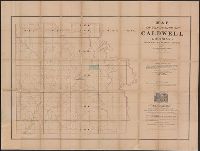
- Published / Created:
- 1860
- Call Number:
- 795 C35 1860
- Container / Volume:
- BRBL_00522
- Image Count:
- 1
- Resource Type:
- Maps, Atlases & Globes
- Found in:
- Beinecke Rare Book and Manuscript Library > Map of the parish of Caldwell, Louisiana, from United States surveys.
- Creator:
- Citizens' Bank of Louisiana
- Published / Created:
- [1875]
- Call Number:
- 795fcm 1875
- Container / Volume:
- BRBL_00523
- Image Count:
- 1
- Resource Type:
- Maps, Atlases & Globes
- Found in:
- Beinecke Rare Book and Manuscript Library > Map of Louisiana showing lands belonging to Citizens Bank.
- Published / Created:
- 1850?]
- Call Number:
- 795fcm 1850
- Container / Volume:
- BRBL_00523
- Image Count:
- 1
- Resource Type:
- Maps, Atlases & Globes
- Found in:
- Beinecke Rare Book and Manuscript Library > Map of Louisiana representing the several land districts : prepared to accompany the Surveyor General's report.
- Published / Created:
- 1847?]
- Call Number:
- 795fcm 1847
- Container / Volume:
- BRBL_00523
- Image Count:
- 1
- Resource Type:
- Maps, Atlases & Globes
- Found in:
- Beinecke Rare Book and Manuscript Library > Map of Louisiana representing the several land districts : prepared to accompany the Surveyor General's report.
- Published / Created:
- 1860
- Call Number:
- 795fcm 1860
- Container / Volume:
- BRBL_00523
- Image Count:
- 1
- Resource Type:
- Maps, Atlases & Globes
- Found in:
- Beinecke Rare Book and Manuscript Library > Map of Louisiana representing the several land districts prepared to accompany the Surveyor General's annual report.
- Creator:
- Darby, William, 1775-1854
- Published / Created:
- May the 1st, 1816.
- Call Number:
- 795 1816B
- Container / Volume:
- BRBL_00521
- Image Count:
- 1
- Resource Type:
- Maps, Atlases & Globes
- Found in:
- Beinecke Rare Book and Manuscript Library > Map of the state of Louisiana : with part of the Mississippi Territory, from actual survey / by Wm. Darby ; Saml. Harrison sct. Philaa.
- Creator:
- Hardee, T. S
- Published / Created:
- 1880?]
- Call Number:
- 795 N47 1880
- Container / Volume:
- BRBL_00522
- Image Count:
- 1
- Resource Type:
- Maps, Atlases & Globes
- Found in:
- Beinecke Rare Book and Manuscript Library > Map illustrating the topography of New Orleans and of the coast of Louisiana and Mississippi / prepared for Joseph Jones, M.D., by T.S. Hardee, civil engineer.
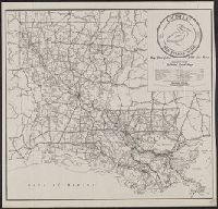
- Creator:
- Louisiana. Dept. of Highways
- Published / Created:
- 1945
- Call Number:
- 795gmb 1945
- Container / Volume:
- BRBL_00523
- Image Count:
- 1
- Resource Type:
- Maps, Atlases & Globes
- Found in:
- Beinecke Rare Book and Manuscript Library > 1945 road map : [Louisiana] / State of Louisiana, Department of Highways.