Search
You Searched For
Search Results
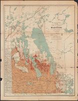
- Creator:
- Canada. Railway Lands Branch
- Published / Created:
- 1916
- Call Number:
- 736gck 1915
- Container / Volume:
- BRBL_00383
- Image Count:
- 1
- Resource Type:
- Maps, Atlases & Globes
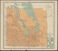
- Description:
- "Base map from plates of Geographer's Branch, Dept. of the Interior."
- Publisher:
- Dept. of the Interior,
- Subject (Geographic):
- Manitoba--Maps
- Subject (Topic):
- Grain--Manitoba--Maps
- Found in:
- Beinecke Rare Book and Manuscript Library > Cereal map of Manitoba [cartographic material] : showing acreage under crop in each township in wheat, oats, barley and flax during 1915 / prepared in the Railway Lands Branch under the direction of F.C.C. Lynch, Superintendent from data supplied by the P
- Creator:
- National Geographic Society (U.S.). Cartographic Division
- Published / Created:
- 1979
- Call Number:
- 738 1979
- Container / Volume:
- BRBL_00387
- Image Count:
- 2
- Resource Type:
- Maps, Atlases & Globes
- Description:
- "Lambert conformal conic projection, standard parallels 51⁰25ʹ and 60⁰55ʹ."
- Publisher:
- The Society,
- Subject (Geographic):
- Manitoba--Maps and Saskatchewan--Maps
- Subject (Name):
- Darley, Richard J and Shupe, John F
- Found in:
- Beinecke Rare Book and Manuscript Library > Close-up, Canada, Saskatchewan and Manitoba / produced by the Cartographic Division, National Geographic Society ; Richard J. Darley, chief cartographer ; John F. Shupe, associate chief cartographer.
- Published / Created:
- 1858
- Call Number:
- 736 1858
- Container / Volume:
- BRBL_00382
- Image Count:
- 1
- Resource Type:
- Maps, Atlases & Globes
- Description:
- Notes: From Great Britain. Parliament. Accounts and Papers, 1859. Session 2, 31 May - 13 Aug, Vol. XXII.
- Publisher:
- J. Arrowsmith,
- Subject (Geographic):
- Manitoba--Maps
- Found in:
- Beinecke Rare Book and Manuscript Library > Copy of Sketch shewing the Region Explored by S.J. Dawson & his party, between Red River and the Great Saskatchewan.
- Creator:
- Canada. Dept. of the Interior
- Published / Created:
- 1902
- Call Number:
- 736 1902
- Container / Volume:
- BRBL_00382
- Image Count:
- 1
- Resource Type:
- Maps, Atlases & Globes
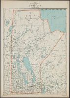
- Description:
- Land districts outlined in red.
- Publisher:
- The Department,
- Subject (Geographic):
- Manitoba--Maps
- Subject (Name):
- White, James, 1863-1928
- Found in:
- Beinecke Rare Book and Manuscript Library > Manitoba / Department of the Interior ; James White, F.R.G.S. Geogrpaher.
- Published / Created:
- 1909
- Call Number:
- 736gme 1909
- Container / Volume:
- BRBL_00383
- Image Count:
- 1
- Resource Type:
- Maps, Atlases & Globes
- Description:
- "Rand, McNally & Co.'s New Business Atlas Map of Manitoba."
- Publisher:
- Rand McNally & Co., Map Publishers and Engravers,
- Subject (Geographic):
- Manitoba--Maps
- Found in:
- Beinecke Rare Book and Manuscript Library > Manitoba [Railroads].
- Creator:
- Manitoba. Surveys Branch
- Published / Created:
- 1939
- Call Number:
- 736 1939
- Container / Volume:
- BRBL_00382
- Image Count:
- 1
- Resource Type:
- Maps, Atlases & Globes
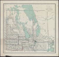
- Description:
- Survey grid; parks; forest reserves; railroads.
- Publisher:
- Surveys Branch, Manitoba Dept. of Mines and Natural Resources,
- Subject (Geographic):
- Manitoba--Maps
- Subject (Topic):
- Railroads--Manitoba--Maps
- Found in:
- Beinecke Rare Book and Manuscript Library > Manitoba [cartographic material] / prepared by the Surveys Branch, Department of Mines and Natural Resources.
- Creator:
- Manitoba. Dept. of Tourism, Recreation and Cultural Affairs. Tourist Branch
- Published / Created:
- 1972
- Call Number:
- 736 1972
- Container / Volume:
- BRBL_00382
- Image Count:
- 2
- Resource Type:
- Maps, Atlases & Globes
- Alternative Title:
- Manitoba highways 1972
- Description:
- Includes index to cities, towns and villages, distance chart, radio stations chart, col. illustrations and tourist information on verso.
- Publisher:
- The Branch,
- Subject (Geographic):
- Manitoba--Maps
- Subject (Topic):
- Roads--Manitoba--Maps
- Found in:
- Beinecke Rare Book and Manuscript Library > Manitoba [cartographic material] : official highway map / Department of Tourism, Recreation & Cultural Affairs, Tourist Branch.
- Creator:
- Canada. Department of the Interior
- Published / Created:
- 1908
- Call Number:
- 736 1908
- Container / Volume:
- BRBL_00382
- Image Count:
- 1
- Resource Type:
- Maps, Atlases & Globes
- Description:
- Manitoba.
- Publisher:
- Dept. of the Interior,
- Subject (Geographic):
- Manitoba--Maps
- Found in:
- Beinecke Rare Book and Manuscript Library > Manitoba [cartographic material].
- Creator:
- Canada. Natural Resources Intelligence Branch
- Published / Created:
- 1924
- Call Number:
- 736FCM 1924
- Container / Volume:
- BRBL_00383
- Image Count:
- 1
- Resource Type:
- Maps, Atlases & Globes
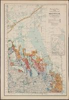
- Description:
- Inset: "Map of Manitoba showing Dominion Land Agencies."
- Publisher:
- The Branch,
- Subject (Geographic):
- Manitoba--Maps
- Subject (Topic):
- Land tenure--Manitoba--Maps
- Found in:
- Beinecke Rare Book and Manuscript Library > Manitoba, map showing disposition of lands / prepared in the Natural Resources Intelligence Branch, F.C.C. Lynch, director.
- Creator:
- Canada. Natural Resources Intelligence Branch
- Published / Created:
- 1918
- Call Number:
- 736FCM 1918
- Container / Volume:
- BRBL_00383
- Image Count:
- 1
- Resource Type:
- Maps, Atlases & Globes
- Abstract:
- Map shows ownership of lands.
- Publisher:
- The Branch,
- Subject (Geographic):
- Manitoba--Maps
- Subject (Topic):
- Land tenure--Manitoba--Maps
- Found in:
- Beinecke Rare Book and Manuscript Library > Manitoba, map showing disposition of lands / prepared in the Natural Resources Intelligence Branch.