Search
You Searched For
Search Results
- Published / Created:
- June 1st. 1805.
- Call Number:
- 75 1805
- Container / Volume:
- BRBL_00727
- Image Count:
- 1
- Resource Type:
- Maps, Atlases & Globes
- Found in:
- Beinecke Rare Book and Manuscript Library > A new map of part of the United States of North America ... / by John Cary, engraver.
- Creator:
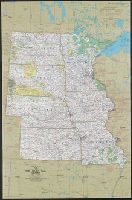
- Beadle, E. F
- Published / Created:
- [1856?]
- Call Number:
- 80gme 1856B
- Container / Volume:
- BRBL_00538
- Image Count:
- 1
- Resource Type:
- Maps, Atlases & Globes
- Found in:
- Beinecke Rare Book and Manuscript Library > A new map of the Great West.
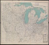
- Creator:
- National Geographic Society (U.S.). Cartographic Division
- Published / Created:
- c1974.
- Call Number:
- 8101 1974
- Container / Volume:
- BRBL_00552
- Image Count:
- 2
- Resource Type:
- Maps, Atlases & Globes
- Found in:
- Beinecke Rare Book and Manuscript Library > Close-up: U.S.A., the North Central States. Produced by the Cartographic Division, National Geographic Society. William T. Peele, chief cartographer; David W. Cook, associate chief cartographer.
- Creator:
- National Geographic Society (U.S.). Cartographic Division
- Published / Created:
- c1978.
- Call Number:
- 8101 1978A
- Container / Volume:
- BRBL_00552
- Image Count:
- 2
- Resource Type:
- Maps, Atlases & Globes
- Found in:
- Beinecke Rare Book and Manuscript Library > Close-up: U.S.A., the North Central States. Produced by the Cartographic Division, National Geographic Society. William T. Peele, chief cartographer; Richard K. Rogers, associate chief cartographer.
- Creator:
- Automobile Blue Books, Inc
- Published / Created:
- [1921?]
- Call Number:
- 754gmb 1920
- Container / Volume:
- BRBL_00419
- Image Count:
- 2
- Resource Type:
- Maps, Atlases & Globes
- Found in:
- Beinecke Rare Book and Manuscript Library > General index map of Automobile blue book, volume 3.
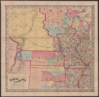
- Creator:
- Morse & Gaston (Firm)
- Published / Created:
- 1856
- Call Number:
- 80 1856A
- Container / Volume:
- BRBL_00534
- Image Count:
- 1
- Resource Type:
- Maps, Atlases & Globes
- Found in:
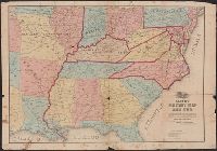
- Beinecke Rare Book and Manuscript Library > Kansas & Nebraska.
- Published / Created:
- [1862?].
- Call Number:
- 754 1862A
- Container / Volume:
- BRBL_00416
- Image Count:
- 1
- Resource Type:
- Maps, Atlases & Globes
- Found in:
- Beinecke Rare Book and Manuscript Library > Lloyd's Military Map of the United States : showing the Grand Divisions of the Military Departments of the Army of the United States ...
- Creator:
- Middleton, Strobridge & Co
- Published / Created:
- [1857].
- Call Number:
- 753gme 1858
- Container / Volume:
- BRBL_00415
- Image Count:
- 1
- Resource Type:
- Maps, Atlases & Globes
- Found in:
- Beinecke Rare Book and Manuscript Library > Map illustrating the Canada Pacific and Northern Pacific and other proposed Railroads, connecting at Straits of Mackinaw : Also showing the position of Mackinaw City.
- Creator:
- Wheaton, W. G
- Published / Created:
- [186-]
- Call Number:
- 754gme 1853B
- Container / Volume:
- BRBL_00419
- Image Count:
- 1
- Resource Type:
- Maps, Atlases & Globes
- Found in:
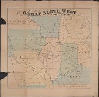
- Beinecke Rare Book and Manuscript Library > Map of the great north west : showing Peoria, Illinois the geographigal [sic] centre / W.G. Wheaton, Civil Engineer Peoria, Ill.
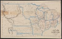
- Creator:
- Drake, Ira S
- Published / Created:
- 1850, c1849.
- Call Number:
- 754 1850
- Container / Volume:
- BRBL_00416
- Image Count:
- 1
- Resource Type:
- Maps, Atlases & Globes
- Found in:
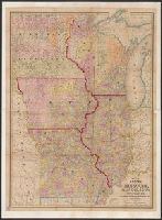
- Beinecke Rare Book and Manuscript Library > Map of the states of Missouri, Illinois, Iowa and Wisconsin : the territory of Minnesota, and the mineral lands of Lake Superior / compiled by I.S. Drake ; engraved by Ira S. Drake and J.L. Hazzard.