Twenty four new and accurate maps of the several parts of Europe ... : all (except the last) new
Image Count:
1
Alternative Title:
The English Channel; with the coasts of England, France, and Holland
Description:
In pencil on verso: 20. and Table of contents for maps 20-24 misnumbered.
Subject (Geographic):
Cevennes Mountains (France) --Maps, Dauphine´ Alps (France), England --Maps --To 1800, France --Maps --Early works to 1800, Lombardy (Italy) --Maps --Early works to 1800, Netherlands --Maps --Early works to 1800, and Provence-Alpes-Cote d'Azur (France) --Maps
Subject (Name):
Barker, B. (Benjamin), d. 1764, bookseller, Clements, Henry, d. 1719, bookseller, King, Charles, d. 1735, bookseller, Nicholson, John, d. ca. 1717, bookseller, Parker, Richard, fl. 1692-1725, bookseller, and Tooke, Benjamin, d. 1716, bookseller
Subject (Topic):
Atlases --Early works to 1800
Collection Created:
[London] : Sold by J. Nicholson at the King’s-Arms in Little Britain, Benj. Barker and Charles King ..., Benj. Tooke ..., Hen. Clements ..., R. Parker and Ralph Smith under the Royal-Exchange ..., [1715?]
Also appeared in Faden's [General atlas. London : William Faden, 1811?]., No. 10 of 43 maps bound together in composite atlas., Relief shown pictorially., and Scale [1: 510,000].
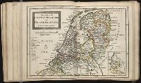
Twenty four new and accurate maps of the several parts of Europe ... : all (except the last) new
Image Count:
1
Alternative Title:
The United-Provinces, or Netherlands
Description:
In pencil on verso: 13.
Subject (Geographic):
Netherlands --Maps --Early works to 1800
Subject (Name):
Barker, B. (Benjamin), d. 1764, bookseller, Clements, Henry, d. 1719, bookseller, King, Charles, d. 1735, bookseller, Nicholson, John, d. ca. 1717, bookseller, Parker, Richard, fl. 1692-1725, bookseller, and Tooke, Benjamin, d. 1716, bookseller
Subject (Topic):
Atlases --Early works to 1800
Collection Created:
[London] : Sold by J. Nicholson at the King’s-Arms in Little Britain, Benj. Barker and Charles King ..., Benj. Tooke ..., Hen. Clements ..., R. Parker and Ralph Smith under the Royal-Exchange ..., [1715?]
Homann Erben (Firm) Mayer, Tobias, 1723-1762 Schneider, R. A.
Published / Created:
1747 [i.e. 1748?]
Call Number:
1975 Folio 31
Collection Title:
[Atlas factice of 42 maps, produced by the Homann Erben firm]
Image Count:
1
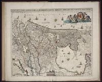
Alternative Title:
Carte des XVII. provinces ou de l’Allemagne inferievre, dressee suivant la projection stereographique, et appueyee par les mesures faites de Mess. Cassini, Snellius et Mouschenbrok, par Mr. Tob. Majer de la Societe geographique, et publiee par les Heritiers de Homann, l’An 1748
Publisher:
Cura et Studio Homannianorum Heredum
Subject (Geographic):
Belgium --Maps --Early works to 1800, Benelux countries --Maps --Early works to 1800, Luxembourg --Maps --Early works to 1800, and Netherlands --Maps --Early works to 1800
[Atlas factice of 32 maps and 1 distance table, produced by the Homann Erben firm]
Image Count:
2
Alternative Title:
Carte des XVII. provinces ou de l’Allemagne inferievre, dressee suivant la projection stereographique, et appueyee par les mesures faites de Mess. Cassini, Snellius et Mouschenbrok, par Mr. Tob. Majer de la Societe geographique, et publiee par les Heritiers de Homann, l’An 1748
Publisher:
Cura et Studio Homannianorum Heredum
Subject (Geographic):
Belgium --Maps --Early works to 1800, Benelux countries --Maps --Early works to 1800, Luxembourg --Maps --Early works to 1800, and Netherlands --Maps --Early works to 1800
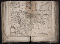
[Atlas factice of 96 maps by Blaeu, Visscher, Jansson, Hondius and others]
Image Count:
1
Description:
Imperfect: hole along folds, with some loss of text. Sheet measures 39.5 x 52 cm. Reinforced along edges with paper. No. 52 of 92 maps bound together. and Numbered 56 on verso.
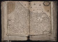
[Atlas factice of 96 maps by Blaeu, Visscher, Jansson, Hondius and others]
Image Count:
1
Description:
Date in imprint has been altered to read "1656". Without watermarks. Reinforced along lower edges with manuscript waste. Sheet measures 39.4 x 50.3 cm. No. 60 of 92 maps bound together. and Numbered 65 on verso.
Duetecum, Baptista, engraver Hondius, Hendrik, 1597-1651 Wit, Frederik de
Published / Created:
1652
Call Number:
1983 Folio 19
Collection Title:
[Atlas factice of 96 maps by Blaeu, Visscher, Jansson, Hondius and others]
Image Count:
1
Description:
Imperfect: torn and repaired along folds and in corners, with some loss of text. Sheet measures 38.8 x 54.8 cm. Reinforced along edges with manuscript waste. No. 50 of 92 maps bound together. and Numbered 54 on verso.