Search
You Searched For
Search Results
- Creator:
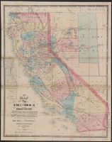
- Ransom, Leander, 1800-1874
- Published / Created:
- 1863
- Call Number:
- 844 1863
- Container / Volume:
- BRBL_00602
- Image Count:
- 1
- Resource Type:
- Maps, Atlases & Globes
- Found in:
- Beinecke Rare Book and Manuscript Library > A new map of the state of California and Nevada Territory : exhibiting the rivers, lakes, bays and islands, with the principal towns, roads, railroads, and transit routes to the silver mining districts of Nevada Territory ... / carefully compiled ... by L
- Creator:
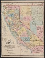
- Ransom, Leander, 1800-1874
- Published / Created:
- 1870
- Call Number:
- 844 1870
- Container / Volume:
- BRBL_00602
- Image Count:
- 1
- Resource Type:
- Maps, Atlases & Globes
- Found in:
- Beinecke Rare Book and Manuscript Library > A new map of the states of California and Nevada : exhibiting the rivers, lakes, bays, and islands, with the principal towns, roads, railroads and transit routes to the silver mining districts of Nevada Territory, also meridian, standard, range and townsh
- Creator:
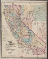
- Ransom, Leander, 1800-1874
- Published / Created:
- 1867
- Call Number:
- 844 1867
- Container / Volume:
- BRBL_00602
- Image Count:
- 1
- Resource Type:
- Maps, Atlases & Globes
- Found in:
- Beinecke Rare Book and Manuscript Library > A new map of the states of California and Nevada : exhibiting the rivers, lakes, bays, and islands, with the principal towns, roads, railroads, and transit routes to the silver mining districts; also meridian, standard, range and township lines as establi
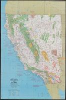
- Creator:
- National Geographic Society (U.S.). Cartographic Division
- Published / Created:
- c1978.
- Call Number:
- 844 1978
- Container / Volume:
- BRBL_00603
- Image Count:
- 2
- Resource Type:
- Maps, Atlases & Globes
- Found in:
- Beinecke Rare Book and Manuscript Library > Close-up: U.S.A., California and Nevada / produced by the Cartographic Division, National Geographic Society ; William T. Peele, chief cartographer, David W. Cook, associate chief cartographer.
- Creator:
- National Geographic Society (U.S.). Cartographic Division
- Published / Created:
- c1974.
- Call Number:
- 844 1974
- Container / Volume:
- BRBL_00603
- Image Count:
- 2
- Resource Type:
- Maps, Atlases & Globes
- Found in:
- Beinecke Rare Book and Manuscript Library > Close-up: U.S.A., California and Nevada. Produced by the Cartographic Division, National Geographic Society. William T. Peele, chief cartographer, David W. Cook, associate chief cartographer.
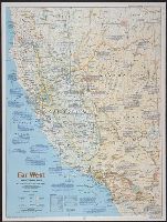
- Creator:
- National Geographic Society (U.S.). Cartographic Division
- Published / Created:
- 1984
- Call Number:
- 80 1984
- Container / Volume:
- BRBL_00536
- Image Count:
- 2
- Resource Type:
- Maps, Atlases & Globes
- Found in:
- Beinecke Rare Book and Manuscript Library > Far West / produced by the Cartographic Division, National Geographic Society.
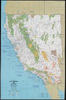
- Creator:
- Leicht, F. von (Ferdinand von)
- Published / Created:
- 1874
- Call Number:
- 844 1874
- Container / Volume:
- BRBL_00602
- Image Count:
- 2
- Resource Type:
- Maps, Atlases & Globes
- Found in:
- Beinecke Rare Book and Manuscript Library > Map of California and Nevada / State Geological Survey of California ; drawn by F.v. Leicht and A. Craven.
- Creator:
- Southern Pacific Company
- Published / Created:
- 1914
- Call Number:
- 837 1914
- Container / Volume:
- BRBL_00594
- Image Count:
- 2
- Resource Type:
- Maps, Atlases & Globes
- Found in:
- Beinecke Rare Book and Manuscript Library > Map of Nevada : with a brief description of its resources, development, topography, and climate.
- Published / Created:
- 1862
- Call Number:
- 837fcm 1862
- Container / Volume:
- BRBL_00594
- Image Count:
- 1
- Resource Type:
- Maps, Atlases & Globes
- Found in:
- Beinecke Rare Book and Manuscript Library > Map of public surveys in Nevada territory to accompany report of Surveyor Gen'l.
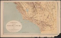
- Creator:
- Butler, Benjamin F. (Benjamin Franklin), 1795-1858
- Published / Created:
- 1851
- Call Number:
- 844 1851
- Container / Volume:
- BRBL_00601
- Image Count:
- 1
- Resource Type:
- Maps, Atlases & Globes
- Found in:
- Beinecke Rare Book and Manuscript Library > Map of the state of California : compiled from the most recent surveys and explorations, and comprising an accurate description of the county boundaries, according to an act passed by the Legislature, April 25th, 1851, also a complete delineation of the g
- Creator:
- United States. General Land Office
- Published / Created:
- 1866
- Call Number:
- 837gbc 1866
- Container / Volume:
- BRBL_00594
- Image Count:
- 1
- Resource Type:
- Maps, Atlases & Globes
- Found in:
- Beinecke Rare Book and Manuscript Library > Map of the state of Nevada : to accompany the annual report of the Commr. Genl. Land Office.
- Creator:
- Wheeler, George M. (George Montague), 1842-1905
- Published / Created:
- 1872
- Call Number:
- 836 1872
- Container / Volume:
- BRBL_00592
- Image Count:
- 1
- Resource Type:
- Maps, Atlases & Globes
- Found in:
- Beinecke Rare Book and Manuscript Library > Map prepared to accompany the lists of distances, camps, etc. : [in Nevada, Utah, and Arizona] / 1st Lieut. Geo. M. Wheeler, Corps of Engineers, in charge.
- Creator:
- United States. Army. Corps of Engineers. Engineer Office
- Published / Created:
- [1870]
- Call Number:
- 837 1870
- Container / Volume:
- BRBL_00594
- Image Count:
- 1
- Resource Type:
- Maps, Atlases & Globes
- Found in:
- Beinecke Rare Book and Manuscript Library > Map showing detailed topography of the country traversed by the reconnaissance expedition through southern & southeastern Nevada / in charge of Lieut. Geo. M. Wheeler, U.S. Engineers ; assisted by Lieut. D.W. Lockwood, Corps of Engineers, U.S.A., 1869 ; P
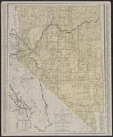
- Creator:
- Ransom, Leander, 1800-1874
- Published / Created:
- 1862
- Call Number:
- 844 1862
- Container / Volume:
- BRBL_00602
- Image Count:
- 1
- Resource Type:
- Maps, Atlases & Globes
- Found in:
- Beinecke Rare Book and Manuscript Library > New map of the state of California : exhibiting the rivers, lakes, bays, and islands, with the principal towns, roads, railroads, and transit routes to the silver mining distrts. of Nevada Territory; also the established meridian, standard, range and town
- Published / Created:
- 1883?]
- Call Number:
- 837 1883
- Container / Volume:
- BRBL_00594
- Image Count:
- 1
- Resource Type:
- Maps, Atlases & Globes
- Found in:
- Beinecke Rare Book and Manuscript Library > Railroad & township map of Nevada.
- Creator:
- Rand McNally and Company
- Published / Created:
- 1911
- Call Number:
- 837 1911
- Container / Volume:
- BRBL_00594
- Image Count:
- 1
- Resource Type:
- Maps, Atlases & Globes
- Found in:
- Beinecke Rare Book and Manuscript Library > Rand McNally & Co.'s Nevada.
- Creator:
- Rand McNally and Company
- Published / Created:
- [1939]
- Call Number:
- 844gmb 1939A
- Container / Volume:
- BRBL_00615
- Image Count:
- 2
- Resource Type:
- Maps, Atlases & Globes
- Found in:
- Beinecke Rare Book and Manuscript Library > Road map of California, Nevada.
- Creator:
- Clason Map Co
- Published / Created:
- c1906.
- Call Number:
- 837 1906
- Container / Volume:
- BRBL_00594
- Image Count:
- 1
- Resource Type:
- Maps, Atlases & Globes
- Found in:
- Beinecke Rare Book and Manuscript Library > Sketch map of Nevada, and the southeastern portion of California / compliments of The Patrick Investment Co. ... Denver, Colorado.
- Creator:
- United States. General Land Office
- Published / Created:
- 1879
- Call Number:
- 837 1879
- Container / Volume:
- BRBL_00594
- Image Count:
- 1
- Resource Type:
- Maps, Atlases & Globes
- Found in:
- Beinecke Rare Book and Manuscript Library > State of Nevada / compiled from the official records of the General Land Office and other sources by C. Roeser, Principal Draughtsman, G.L.O.
- Creator:
- United States. General Land Office
- Published / Created:
- 1914
- Call Number:
- 837 1914A
- Container / Volume:
- BRBL_00594
- Image Count:
- 1
- Resource Type:
- Maps, Atlases & Globes
- Found in:
- Beinecke Rare Book and Manuscript Library > State of Nevada / compiled from the official records of the General Land Office and other sources under the direction of I.P. Berthrong.
- Creator:
- Rand McNally and Company
- Published / Created:
- 1931
- Call Number:
- 844gmb 1931
- Container / Volume:
- BRBL_00615
- Image Count:
- 2
- Resource Type:
- Maps, Atlases & Globes
- Found in:
- Beinecke Rare Book and Manuscript Library > Texaco road map, California, Nevada.
- Creator:
- Nell, Louis
- Published / Created:
- 1868
- Call Number:
- 844gme 1868
- Container / Volume:
- BRBL_00619
- Image Count:
- 1
- Resource Type:
- Maps, Atlases & Globes
- Found in:
- Beinecke Rare Book and Manuscript Library > Topographical railroad & county map of the states of California and Nevada : compiled from the latest explorations and other official information / by L. Nell.