Search
You Searched For
Search Results
- Creator:
- H.M. Gousha Company
- Published / Created:
- [1931]
- Call Number:
- 822gmb 1931
- Container / Volume:
- BRBL_00567
- Image Count:
- 2
- Resource Type:
- Maps, Atlases & Globes
- Found in:
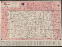
- Beinecke Rare Book and Manuscript Library > 1931 official road map, North Dakota / this map showing main trunk and highways is distributed with the compliments of Standard Oil Company (Indiana).
- Creator:
- H.M. Gousha Company
- Published / Created:
- [1934]
- Call Number:
- 822gmb 1934
- Container / Volume:
- BRBL_00567
- Image Count:
- 2
- Resource Type:
- Maps, Atlases & Globes
- Found in:
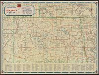
- Beinecke Rare Book and Manuscript Library > 1934 official road map, North Dakota / compliments of Phillips Petroleum Company.
- Creator:
- H.M. Gousha Company
- Published / Created:
- [1938]
- Call Number:
- 822gmb 1938
- Container / Volume:
- BRBL_00567
- Image Count:
- 2
- Resource Type:
- Maps, Atlases & Globes
- Found in:
- Beinecke Rare Book and Manuscript Library > 1938 official road map, North Dakota, South Dakota / [prepared for] Phillips Petroleum Company.
- Creator:
- Rakowicz, E. H
- Published / Created:
- 1886
- Call Number:
- 821 1886A
- Container / Volume:
- BRBL_00566
- Image Count:
- 2
- Resource Type:
- Maps, Atlases & Globes
- Found in:
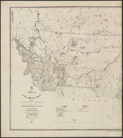
- Beinecke Rare Book and Manuscript Library > Map of the Department of Dakota : including Minnesota, Dakota and Montana / compiled and drawn under the direction of John Biddle by E.H. Rakowicz.
- Creator:
- United States. General Land Office
- Published / Created:
- 1903
- Call Number:
- 822 1903
- Container / Volume:
- BRBL_00567
- Image Count:
- 1
- Resource Type:
- Maps, Atlases & Globes
- Found in:
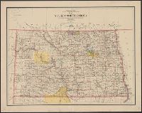
- Beinecke Rare Book and Manuscript Library > Map of the state of North Dakota / compiled from the official records of the General Land Office and other sources under the direction of Frank Bond ; compiled and drawn by M. Hendges ; lettered by Wm. Bauman, Jr.
- Creator:
- J.H. Colton & Co
- Published / Created:
- [1855 or 1856?]
- Call Number:
- 814 1855H
- Container / Volume:
- BRBL_00557
- Image Count:
- 1
- Resource Type:
- Maps, Atlases & Globes
- Found in:
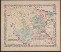
- Beinecke Rare Book and Manuscript Library > Minnesota.
- Creator:
- J.H. Colton & Co
- Published / Created:
- [1855 or 1856?]
- Call Number:
- 814 1855F
- Container / Volume:
- BRBL_00557
- Image Count:
- 1
- Resource Type:
- Maps, Atlases & Globes
- Found in:
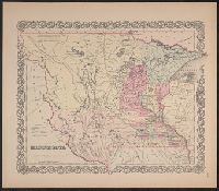
- Beinecke Rare Book and Manuscript Library > Minnesota.
- Creator:
- J.H. Colton & Co
- Published / Created:
- [1855 or 1856?]
- Call Number:
- 814 1855G
- Container / Volume:
- BRBL_00557
- Image Count:
- 1
- Resource Type:
- Maps, Atlases & Globes
- Found in:
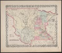
- Beinecke Rare Book and Manuscript Library > Minnesota.
- Creator:
- J.H. Colton & Co
- Published / Created:
- [1855 or 1856?]
- Call Number:
- 814 1855E
- Container / Volume:
- BRBL_00557
- Image Count:
- 2
- Resource Type:
- Maps, Atlases & Globes
- Found in:
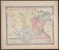
- Beinecke Rare Book and Manuscript Library > Minnesota.
- Creator:
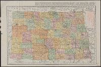
- Rand McNally and Company
- Published / Created:
- 1911
- Call Number:
- 822 1911
- Container / Volume:
- BRBL_00567
- Image Count:
- 1
- Resource Type:
- Maps, Atlases & Globes
- Found in:
- Beinecke Rare Book and Manuscript Library > North Dakota.
- Published / Created:
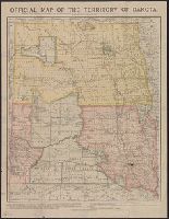
- [1889?]
- Call Number:
- 822 1889
- Container / Volume:
- BRBL_00567
- Image Count:
- 1
- Resource Type:
- Maps, Atlases & Globes
- Found in:
- Beinecke Rare Book and Manuscript Library > Official map of North Dakota / issued by the Department of Immigration and Statistics.
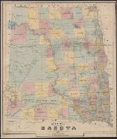
- Creator:
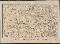
- Rand McNally and Company
- Published / Created:
- c1887.
- Call Number:
- 821 1887
- Container / Volume:
- BRBL_00566
- Image Count:
- 1
- Resource Type:
- Maps, Atlases & Globes
- Found in:
- Beinecke Rare Book and Manuscript Library > Official map of the territory of Dakota.
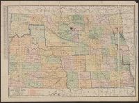
- Creator:
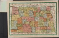
- Geographical Publishing Co
- Published / Created:
- 1911
- Call Number:
- 822 1911A
- Container / Volume:
- BRBL_00567
- Image Count:
- 2
- Resource Type:
- Maps, Atlases & Globes
- Found in:
- Beinecke Rare Book and Manuscript Library > Premier series North Dakota / edited, engraved, and published by The Geographical Publishing Co.
- Creator:
- Rand McNally and Company
- Published / Created:
- 1890
- Call Number:
- 822 1890
- Container / Volume:
- BRBL_00567
- Image Count:
- 1
- Resource Type:
- Maps, Atlases & Globes
- Found in:
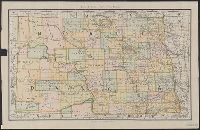
- Beinecke Rare Book and Manuscript Library > Rand McNally & Co.'s North Dakota.
- Creator:
- Rand McNally and Company
- Published / Created:
- [1932]
- Call Number:
- 822 1932
- Container / Volume:
- BRBL_00567
- Image Count:
- 1
- Resource Type:
- Maps, Atlases & Globes
- Found in:
- Beinecke Rare Book and Manuscript Library > Rand McNally standard map of North Dakota with air trails ; Rand McNally standard map of North Dakota.
- Published / Created:
- 1876
- Call Number:
- 821 1876A
- Container / Volume:
- BRBL_00566
- Image Count:
- 1
- Resource Type:
- Maps, Atlases & Globes
- Found in:
- Beinecke Rare Book and Manuscript Library > Rice's sectional map of Dakota.
- Creator:
- Rand McNally and Company
- Published / Created:
- 1914
- Call Number:
- 822 1914
- Container / Volume:
- BRBL_00567
- Image Count:
- 1
- Resource Type:
- Maps, Atlases & Globes
- Found in:
- Beinecke Rare Book and Manuscript Library > The Rand-McNally new commercial atlas map of North Dakota.