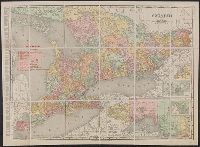
Search
You Searched For
Search Results
- Creator:
- Rand McNally and Company
- Published / Created:
- 1909
- Call Number:
- 735gme 1909
- Container / Volume:
- BRBL_00382
- Image Count:
- 1
- Resource Type:
- Maps, Atlases & Globes
- Found in:
- Beinecke Rare Book and Manuscript Library > Ontario.
- Published / Created:
- 1907
- Call Number:
- 735ad C677 1907
- Container / Volume:
- BRBL_00382
- Image Count:
- 1
- Resource Type:
- Maps, Atlases & Globes
- Found in:
- Beinecke Rare Book and Manuscript Library > Coleman : District of Nipissing.
- Published / Created:
- 1913
- Call Number:
- 735 1913
- Container / Volume:
- BRBL_00382
- Image Count:
- 1
- Resource Type:
- Maps, Atlases & Globes
- Found in:
- Beinecke Rare Book and Manuscript Library > The Rand-McNally new commercial atlas map of Ontario.
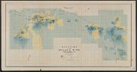
- Creator:
- Canada. Dept. of the Interior
- Published / Created:
- 1905]
- Call Number:
- 735gfc W642 1905
- Container / Volume:
- BRBL_00382
- Image Count:
- 1
- Resource Type:
- Maps, Atlases & Globes
- Found in:
- Beinecke Rare Book and Manuscript Library > Magnetic survey of the Wilbur mine : Lanark County, Ont. Township of Lavant / Department of the Interior.
- Published / Created:
- 1913
- Call Number:
- 735 Sa22 1913
- Container / Volume:
- BRBL_00382
- Image Count:
- 1
- Resource Type:
- Maps, Atlases & Globes
- Found in:
- Beinecke Rare Book and Manuscript Library > St.-Catharines-Merriton & Thorold / Drawn by J. Daw, Archt.
- Published / Created:
- [1900?]
- Call Number:
- 735GFC M314 1900
- Container / Volume:
- BRBL_00382
- Image Count:
- 2
- Resource Type:
- Maps, Atlases & Globes
- Found in:
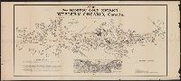
- Beinecke Rare Book and Manuscript Library > Map of the Manitou gold district, Western Ontario, Canada / compiled by H.W. Selby, O.L.S., Dinorwic, Ontario.
- Published / Created:
- [1827?]
- Call Number:
- 735 1827
- Container / Volume:
- BRBL_00382
- Image Count:
- 3
- Resource Type:
- Maps, Atlases & Globes
- Found in:
- Beinecke Rare Book and Manuscript Library > A map of the Province of Upper Canada and the adjacent territories in North American compiled by James G. Chewett ...
- Creator:
- Cary, John, ca. 1754-1835
- Published / Created:
- Dec. 1st 1807.
- Call Number:
- 73 1807
- Container / Volume:
- BRBL_00374
- Image Count:
- 1
- Resource Type:
- Maps, Atlases & Globes
- Found in:
- Beinecke Rare Book and Manuscript Library > A new map of Upper & Lower Canada / from the latest authorities by John Cary, engraver.
- Creator:
- Arrowsmith, John, 1790-1873, cartographer
- Published / Created:
- 1834 February 15
- Call Number:
- 73 1834A
- Container / Volume:
- BRBL_00374
- Image Count:
- 1
- Resource Type:
- Maps, Atlases & Globes
- Found in:
- Beinecke Rare Book and Manuscript Library > Upper Canada &c [cartographic material] / by J. Arrowsmith.
- Published / Created:
- 1837
- Call Number:
- 735gme 1837
- Container / Volume:
- BRBL_00382
- Image Count:
- 1
- Resource Type:
- Maps, Atlases & Globes
- Found in:
- Beinecke Rare Book and Manuscript Library > Map of Upper Canada shewing the proposed Routes of Rail Roads for the purpose of extending the Trade of the Province. Dedicated to his excelency, Sir Francis Bond Head ... James Hamilton, Del. N. Currier's Lith. N.Y.