Search
You Searched For
Search Results
- Published / Created:
- 1821
- Call Number:
- 51 1821
- Container / Volume:
- BRBL_00279
- Image Count:
- 1
- Resource Type:
- Maps, Atlases & Globes
- Found in:
- Beinecke Rare Book and Manuscript Library > A new map of Palestine and the adjacent countries ... Drawn & Engraved by Richard Palmer, Somerstown.
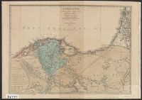
- Creator:
- Kiepert, Heinrich, 1818-1899
- Published / Created:
- 1856?]
- Call Number:
- 51 1856
- Container / Volume:
- BRBL_00279
- Image Count:
- 1
- Resource Type:
- Maps, Atlases & Globes
- Found in:
- Beinecke Rare Book and Manuscript Library > A new map of Palestine including also Phoenicia and Coelesyria / Constructed principally from unpublished materials furnished by Ed. Robinson and Eli Smith and J.L. Porter, by Henry Kiepert, 1856.
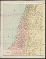
- Creator:
- Edinburgh Geographical Institute
- Published / Created:
- [ca. 1910].
- Call Number:
- 51 1910
- Container / Volume:
- BRBL_00280
- Image Count:
- 1
- Resource Type:
- Maps, Atlases & Globes
- Found in:
- Beinecke Rare Book and Manuscript Library > General map of Palestine, Ancient and Modern / J.G. Bartholomew.
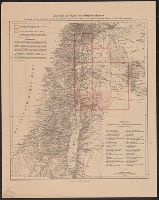
- Creator:
- Schumacher, Gottlieb
- Published / Created:
- [1908?-]
- Call Number:
- 51 1908
- Container / Volume:
- BRBL_00279
- Image Count:
- 3
- Resource Type:
- Maps, Atlases & Globes
- Found in:
- Beinecke Rare Book and Manuscript Library > Karte des Ostjordanlandes [cartographic material] / aufgen. von Dr. G. Schumacher ; herausgeg. vom Deutschen Verein zur Erforschung Palästinas.
- Published / Created:
- 1842
- Call Number:
- 51 1842
- Container / Volume:
- BRBL_00279
- Image Count:
- 1
- Resource Type:
- Maps, Atlases & Globes
- Found in:
- Beinecke Rare Book and Manuscript Library > Karte von Palaestina ... Robinson ... von H. Kiepert ... Prof. Dr. Carl Ritter ... Lith. H. Mahlmann.
- Creator:
- Delarochette, L. (Louis), 1731-1802, cartographer
- Call Number:
- 61 1833
- Container / Volume:
- BRBL_00330
- Image Count:
- 1
- Resource Type:
- Maps, Atlases & Globes
- Found in:
- Beinecke Rare Book and Manuscript Library > Lower Egypt and the adjacent deserts, with a part of Palestine : to which has been added the nomenclature of the Roman age / by L.S. De La Rochette.
- Published / Created:
- 1841
- Call Number:
- 51 1841
- Container / Volume:
- BRBL_00279
- Image Count:
- 1
- Resource Type:
- Maps, Atlases & Globes
- Found in:
- Beinecke Rare Book and Manuscript Library > Map of Palestine ... E. Robinson and E. Smith. Constructed and drawn by H. Kiepert 1840. Engraved by H. Mahlmann, Berlin.
- Published / Created:
- 1925
- Call Number:
- 51 1925
- Container / Volume:
- BRBL_00280
- Image Count:
- 1
- Resource Type:
- Maps, Atlases & Globes
- Found in:
- Beinecke Rare Book and Manuscript Library > Palestine / Alexander Gross, F.R.G.S.
- Published / Created:
- 1942-1960.
- Call Number:
- 508cbf 1944
- Container / Volume:
- BRBL_00277
- Image Count:
- 1
- Resource Type:
- Maps, Atlases & Globes
- Found in:
- Beinecke Rare Book and Manuscript Library > Palestine / compiled, drawn, & reproduced by Survey of Palestine.