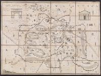
Search
You Searched For
Search Results
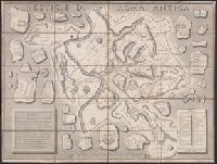
- Creator:
- Cookesley, William Gifford
- Published / Created:
- [1851]
- Call Number:
- 400am R66 1851
- Container / Volume:
- BRBL_00233
- Image Count:
- 1
- Resource Type:
- Maps, Atlases & Globes
- Found in:
- Beinecke Rare Book and Manuscript Library > Romae Antiquae Charta [cartographic material] / engraved by E. Radclyffe.
- Creator:
- Bigot, Paul-Marie-Arsène, 1870-1942, cartographer
- Published / Created:
- [between 1920 and 1940?]
- Call Number:
- 400 R66 1920
- Container / Volume:
- BRBL_00233
- Image Count:
- 1
- Resource Type:
- Maps, Atlases & Globes
- Found in:
- Beinecke Rare Book and Manuscript Library > Rome imperiale (IVe siècle ap. J.C.) / par P. Bigot.
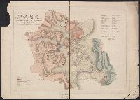
- Creator:
- Brocchi, Giambattista, 1772-1826, cartographer
- Published / Created:
- 1820]
- Call Number:
- 400cb R66 1820
- Container / Volume:
- BRBL_00233
- Image Count:
- 1
- Resource Type:
- Maps, Atlases & Globes
- Found in:
- Beinecke Rare Book and Manuscript Library > Carta fisica del suolo di Roma ne' primi tempi della fondazione di questa città [cartographic material] / di G. Brocchi ; Campi dis. ; Pietro Ruga inc.
- Creator:
- Manazzale, Andrea, cartographer
- Published / Created:
- 1805
- Call Number:
- 400am R66 1805
- Container / Volume:
- BRBL_00233
- Image Count:
- 1
- Resource Type:
- Maps, Atlases & Globes
- Found in:
- Beinecke Rare Book and Manuscript Library > Carta topografica dell'antichità di Roma [cartographic material] / Andrea Manazzale inv. ; D. Pronti inc.
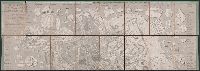
- Creator:
- Acquaroni, Giovanni, active 1816-approximately 1837, cartographer
- Published / Created:
- 1826
- Call Number:
- 400am R66 1826
- Container / Volume:
- BRBL_00233
- Image Count:
- 1
- Resource Type:
- Maps, Atlases & Globes
- Found in:
- Beinecke Rare Book and Manuscript Library > Pianta delle vestigia di Roma [cartographic material] : secondo le osservazioni di Antonio de Romanis ... / Gio Acquaroni dis. e inc.
- Creator:
- Müller, Karl, of Paris, cartographer
- Published / Created:
- [1874]
- Call Number:
- 400 R66 1874
- Container / Volume:
- BRBL_00233
- Image Count:
- 1
- Resource Type:
- Maps, Atlases & Globes
- Found in:
- Beinecke Rare Book and Manuscript Library > Rome in the time of the emperors ; the Forum Romanum under the empire and the Imperial Fora ; Rome during the Republic ; The Forum before the time of Julius Cæsar ; Environs of Rome [cartographic material] / drawn by Dr. Charles Müller ; engraved by Edwd
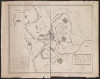
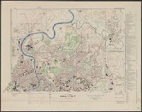
- Creator:
- Great Britain. Royal Air Force. Central Interpretation Unit
- Published / Created:
- 1944
- Call Number:
- 40 R66 1944
- Container / Volume:
- BRBL_00219
- Image Count:
- 2
- Resource Type:
- Maps, Atlases & Globes
- Found in:
- Beinecke Rare Book and Manuscript Library > Town plan of Roma (Rome) [cartographic material] / drawn by C.I.U. and War Office.
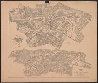
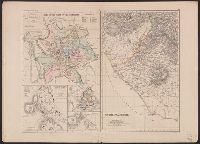
- Published / Created:
- [1890?]
- Call Number:
- 40AM R66 1890
- Container / Volume:
- BRBL_00228
- Image Count:
- 2
- Resource Type:
- Maps, Atlases & Globes
- Found in:
- Beinecke Rare Book and Manuscript Library > Plan - Panorama de Rome = Roḿs Panoramischer Plan = Pianta - Panorama di Roma = Plan - Panorama de Roma.
- Published / Created:
- [1920?]
- Call Number:
- 40 R66 1920
- Container / Volume:
- BRBL_00219
- Image Count:
- 1
- Resource Type:
- Maps, Atlases & Globes
- Found in:
- Beinecke Rare Book and Manuscript Library > Pianta della città di Roma e dintorni.
- Published / Created:
- [1851?]
- Call Number:
- 400 R66 1851
- Container / Volume:
- BRBL_00233
- Image Count:
- 2
- Resource Type:
- Maps, Atlases & Globes
- Found in:
- Beinecke Rare Book and Manuscript Library > Pianta topografica di Roma antica : con i principali monumenti ...