Search
You Searched For
Search Results
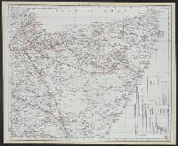
- Creator:
- Pollacchi, P. (Paul), 1862-
- Published / Created:
- 1935
- Call Number:
- 62 1935D
- Container / Volume:
- BRBL_00333
- Image Count:
- 1
- Resource Type:
- Maps, Atlases & Globes
- Alternative Title:
- Illustration (Paris, France)
- Description:
- "Supplément au numéro de L'Illustration du 2 novembre 1935."
- Publisher:
- L'Illustration,
- Subject (Geographic):
- Ethiopia--Maps and Somalia--Maps
- Found in:
- Beinecke Rare Book and Manuscript Library > Carte de l'Afrique orientale [cartographic material] : (Erythrée, Côte Française des Somalis, Somalie Britannique, Somalie Italienne, Kenya, Ouganda, Soudan Anglo-Egyptien) / dressée et dessinée par le Commandant P. Pollachi.
- Published / Created:
- January 1957.
- Call Number:
- 628fa 1957
- Container / Volume:
- BRBL_00334
- Image Count:
- 1
- Resource Type:
- Maps, Atlases & Globes
- Description:
- "Document A/3502, Annex V" -- "N. 702 - 1931 - IX."
- Publisher:
- United Nations,
- Subject (Geographic):
- Somalia--Maps
- Found in:
- Beinecke Rare Book and Manuscript Library > I territori della Somalia : con l' indicazione di luoghi e di limiti politici ad illustrazione dell' azione svolta contro Mullah e Dervisc / I. Zappieri, dis.
- Creator:
- Italy. Ministero delle colonie
- Published / Created:
- 1924
- Call Number:
- 628 1924
- Container / Volume:
- BRBL_00334
- Image Count:
- 1
- Resource Type:
- Maps, Atlases & Globes
- Description:
- "N. 651".
- Publisher:
- Ministero delle Colonie,
- Subject (Geographic):
- Somalia--Maps
- Found in:
- Beinecke Rare Book and Manuscript Library > Oltre Giuba [cartographic material] / tipolitografia del Serv. Cartografico del Ministero della Colonie.
- Creator:
- Edward Stanford Ltd
- Published / Created:
- [1905?]
- Call Number:
- 626 1905
- Container / Volume:
- BRBL_00334
- Image Count:
- 1
- Resource Type:
- Maps, Atlases & Globes
- Alternative Title:
- Somali Protectorate
- Description:
- Includes location map.
- Publisher:
- E. Stanford,
- Subject (Geographic):
- Somalia--Maps
- Found in:
- Beinecke Rare Book and Manuscript Library > Part of the Somali Protectorate.
- Published / Created:
- January 1957.
- Call Number:
- 628 1957A
- Container / Volume:
- BRBL_00334
- Image Count:
- 1
- Resource Type:
- Maps, Atlases & Globes
- Alternative Title:
- Governo della Somalia Italiana.
- Description:
- "Document A/3502, Annex V" -- "N. 119 - 1912".
- Publisher:
- United Nations,
- Subject (Geographic):
- Somalia--Maps
- Found in:
- Beinecke Rare Book and Manuscript Library > Somalia Italiana : zona d'influenza commerciale / compilata da M. Checchi ed A. Marconi.
- Published / Created:
- January 1957.
- Call Number:
- 628 1957
- Container / Volume:
- BRBL_00334
- Image Count:
- 1
- Resource Type:
- Maps, Atlases & Globes
- Alternative Title:
- Governo della Somalia Italiana.
- Description:
- "Annex V" -- "N. 119 - 1912".
- Publisher:
- United Nations,
- Subject (Geographic):
- Somalia--Maps
- Found in:
- Beinecke Rare Book and Manuscript Library > Somalia Italiana : zona d'influenza commerciale / compilata da M. Checchi ed A. Marconi.
- Published / Created:
- 1957
- Call Number:
- 625 1957
- Container / Volume:
- BRBL_00333
- Image Count:
- 1
- Resource Type:
- Maps, Atlases & Globes
- Description:
- "Document A/3502, Annex V" -- "N. 491 - 1918".
- Publisher:
- United Nations,
- Subject (Geographic):
- Somalia--Maps
- Found in:
- Beinecke Rare Book and Manuscript Library > Somalia e paesi limitrofi / tipolitografia del Ministero delle Colonie ; C. Salussolia, autografo.
- Creator:
- Great Britain. MI9
- Published / Created:
- 1944?]
- Call Number:
- 625 1941
- Container / Volume:
- BRBL_00333
- Image Count:
- 2
- Resource Type:
- Maps, Atlases & Globes
- Alternative Title:
- Kenya Colony & Juba River. and Kenya Colony and Juba River.
- Description:
- Cloth map.
- Publisher:
- MI9,
- Subject (Geographic):
- Juba River Valley (Ethiopia and Somalia)--Maps, Kenya--Maps, and Somalia--Maps
- Subject (Topic):
- Maps, Military
- Found in:
- Beinecke Rare Book and Manuscript Library > Somaliland ; Kenya Colony & Juba River.