Search
You Searched For
Search Results
- Creator:
- Wyld, James, 1812-1887
- Published / Created:
- 1874
- Call Number:
- 642GBC 1874
- Container / Volume:
- BRBL_00339
- Image Count:
- 1
- Resource Type:
- Maps, Atlases & Globes
- Found in:
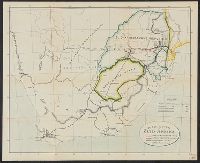
- Beinecke Rare Book and Manuscript Library > Adamantia, the diamond and gold fields of South Africa / by James Wyld.
- Creator:
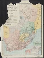
- G.W. Bacon & Co
- Published / Created:
- [1900?]
- Call Number:
- 642AM 1900
- Container / Volume:
- BRBL_00339
- Image Count:
- 1
- Resource Type:
- Maps, Atlases & Globes
- Found in:
- Beinecke Rare Book and Manuscript Library > Bacon's bird's eye view of South Africa.
- Creator:
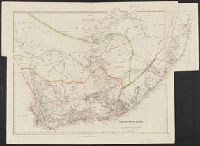
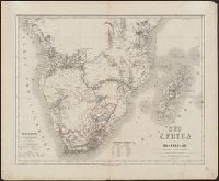
- Arrowsmith, John, 1790-1873
- Published / Created:
- 1840
- Call Number:
- 648 1840
- Container / Volume:
- BRBL_00340
- Image Count:
- 1
- Resource Type:
- Maps, Atlases & Globes
- Found in:
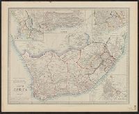
- Beinecke Rare Book and Manuscript Library > Cape of Good Hope / by J. Arrowsmith.
- Creator:
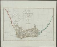
- Reinecke, I. C. M
- Published / Created:
- 1817
- Call Number:
- 642 1817
- Container / Volume:
- BRBL_00338
- Image Count:
- 1
- Resource Type:
- Maps, Atlases & Globes
- Found in:
- Beinecke Rare Book and Manuscript Library > Charte der Sudspitze Africa's und der Colonie vom Vorgebirge der guten Hoffnung : hauptsächlich nach Barrow's neuesten Reisen entworfen und nach astronomischen Ortsbestim̄ungen berichtiget / von I.C.M. Reinecke.
- Creator:
- Petermann, A. (August Heinrich), 1822-1878
- Published / Created:
- 1868
- Call Number:
- 643 1868
- Container / Volume:
- BRBL_00339
- Image Count:
- 1
- Resource Type:
- Maps, Atlases & Globes
- Found in:
- Beinecke Rare Book and Manuscript Library > Original map of the Transvaal or South-African Republik / reconstructed and augmented with data from various exploring travellers &c. by A. Petermann.
- Published / Created:
- 1911
- Call Number:
- 642gmd 1911
- Container / Volume:
- BRBL_00339
- Image Count:
- 2
- Resource Type:
- Maps, Atlases & Globes
- Found in:
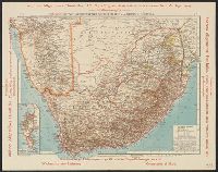
- Beinecke Rare Book and Manuscript Library > Postal route map : of the Union of South Africa / compiled from the most recent information, G.P.O. Cape Town. December 1911.
- Published / Created:
- 1905
- Call Number:
- 642 1905
- Container / Volume:
- BRBL_00339
- Image Count:
- 2
- Resource Type:
- Maps, Atlases & Globes
- Found in:
- Beinecke Rare Book and Manuscript Library > Probekarte: Deutsch-Südwestafrika, südlicher Teil, und Britisch-Südafrika / bearb. v. G. Jungk, K. Tänzler u. E. Umbreit ; Lithogr. v. W. Ketterer u. G. Kirchner.
- Creator:
- Rand McNally and Company
- Published / Created:
- 1899
- Call Number:
- 642 1899A
- Container / Volume:
- BRBL_00339
- Image Count:
- 2
- Resource Type:
- Maps, Atlases & Globes
- Found in:
- Beinecke Rare Book and Manuscript Library > Rand, McNally and Co[mpany]'s indexed atlas of the world. Map of South Africa.
- Creator:
- J. & C. Walker (Firm)
- Published / Created:
- [1874?]
- Call Number:
- 642 1874A
- Container / Volume:
- BRBL_00339
- Image Count:
- 1
- Resource Type:
- Maps, Atlases & Globes
- Found in:
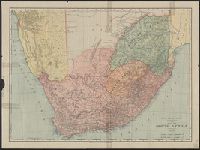
- Beinecke Rare Book and Manuscript Library > South Africa / J. & C. Walker, sculpt.
- Creator:
- Bartholomew, John, 1831-1893
- Published / Created:
- [1853?]
- Call Number:
- 642 1853
- Container / Volume:
- BRBL_00338
- Image Count:
- 1
- Resource Type:
- Maps, Atlases & Globes
- Found in:
- Beinecke Rare Book and Manuscript Library > South Africa / J. Bartholomew ; [engraved by] Schenck & McFarlane.
- Creator:
- Geo. H. Walker & Co
- Published / Created:
- c1899.
- Call Number:
- 642 1899B
- Container / Volume:
- BRBL_00339
- Image Count:
- 1
- Resource Type:
- Maps, Atlases & Globes
- Found in:
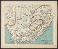
- Beinecke Rare Book and Manuscript Library > South Africa [cartographic material].
- Published / Created:
- 1872
- Call Number:
- 642 1872
- Container / Volume:
- BRBL_00339
- Image Count:
- 1
- Resource Type:
- Maps, Atlases & Globes
- Found in:
- Beinecke Rare Book and Manuscript Library > South Africa by Jas. Wyld ...
- Published / Created:
- 191-.
- Call Number:
- 11hcf 1919-32
- Container / Volume:
- BRBL_00010K
- Image Count:
- 1
- Resource Type:
- Maps, Atlases & Globes
- Found in:
- Beinecke Rare Book and Manuscript Library > South Africa.
- Creator:
- Edward Stanford Ltd
- Published / Created:
- Mar. 1, 1900.
- Call Number:
- 642 1900B
- Container / Volume:
- BRBL_00339
- Image Count:
- 1
- Resource Type:
- Maps, Atlases & Globes
- Found in:
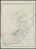
- Beinecke Rare Book and Manuscript Library > Southern extension of Stanford's new map of the Orange Free State and the southern part of the South African Republic / Stanford's Geographical Establishment, London.
- Published / Created:
- 1890?]
- Call Number:
- 642gme 1890
- Container / Volume:
- BRBL_00339
- Image Count:
- 1
- Resource Type:
- Maps, Atlases & Globes
- Found in:
- Beinecke Rare Book and Manuscript Library > Spoorwegen in Zuid Afrika [cartographic material] / J.H. de Bussy, Amst.
- Published / Created:
- 1895?]
- Call Number:
- 642gme 1895
- Container / Volume:
- BRBL_00339
- Image Count:
- 1
- Resource Type:
- Maps, Atlases & Globes
- Found in:
- Beinecke Rare Book and Manuscript Library > Spoorwegen in Zuid Afrika [cartographic material].
- Creator:
- South Africa. Surveyor-General
- Published / Created:
- 1908
- Call Number:
- 642gme 1908
- Container / Volume:
- BRBL_00339
- Image Count:
- 1
- Resource Type:
- Maps, Atlases & Globes
- Found in:
- Beinecke Rare Book and Manuscript Library > Standard railway map of South Africa / compiled and lithographed under the direction of the Surveyor-General.
- Creator:
- South African Railways
- Published / Created:
- [1920]
- Call Number:
- 642gme 1920
- Container / Volume:
- BRBL_00339
- Image Count:
- 1
- Resource Type:
- Maps, Atlases & Globes
- Found in:
- Beinecke Rare Book and Manuscript Library > Standard railway map of South Africa / drawn in the office of the Chief Civil Engineer, S.A.R., Johannesburg.
- Creator:
- Edward Stanford Ltd
- Published / Created:
- August 1st, 1901.
- Call Number:
- 642 1901A
- Container / Volume:
- BRBL_00339
- Image Count:
- 1
- Resource Type:
- Maps, Atlases & Globes
- Found in:
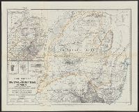
- Beinecke Rare Book and Manuscript Library > Stanford's new map of the Orange River Colony, the southern part of the Transvaal, the northern frontier of Cape Colony, Natal, Basutoland, and Delagoa Bay in Portuguese East Africa / Stanford's Geographical Establishment, London.
- Published / Created:
- [1857]
- Call Number:
- 642 1857
- Container / Volume:
- BRBL_00338
- Image Count:
- 1
- Resource Type:
- Maps, Atlases & Globes
- Found in:
- Beinecke Rare Book and Manuscript Library > Sud-Africa mit Madagascar ... / Bearbeitet von Adolf Gräf.