Search
You Searched For
Search Results
- Published / Created:
- 1811
- Call Number:
- 90 1819
- Container / Volume:
- BRBL_00662
- Image Count:
- 6
- Resource Type:
- Maps, Atlases & Globes
- Found in:
- Beinecke Rare Book and Manuscript Library > Outlines of the Physical and Political Divisions of South America: delineated by A. Arrowsmith partly from scarse and Original Documents, published before the year 1806 corrected from accurate Astronomical observations to 1810.
- Published / Created:
- .
- Call Number:
- 90 1892
- Container / Volume:
- BRBL_00664
- Image Count:
- 1
- Resource Type:
- Maps, Atlases & Globes
- Found in:
- Beinecke Rare Book and Manuscript Library > Plano General de la America del Sud.
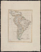
- Published / Created:
- 1843
- Call Number:
- 90 1843
- Container / Volume:
- BRBL_00663
- Image Count:
- 1
- Resource Type:
- Maps, Atlases & Globes
- Found in:
- Beinecke Rare Book and Manuscript Library > Carte Générale du Perou, du Haut-Perou, du Chili et de la Plata dresse par A. Brué Geographé du Roi. Augmenteé et revus pour les limites par Ch. Picquet ... Paris, 1843.
- Published / Created:
- 1861
- Call Number:
- 90cea 1861
- Container / Volume:
- BRBL_00664
- Image Count:
- 1
- Resource Type:
- Maps, Atlases & Globes
- Found in:
- Beinecke Rare Book and Manuscript Library > River La Plata : from the English, French, and Spanish Surveys.
- Published / Created:
- 1807
- Call Number:
- 91 1807
- Container / Volume:
- BRBL_00668
- Image Count:
- 1
- Resource Type:
- Maps, Atlases & Globes
- Found in:
- Beinecke Rare Book and Manuscript Library > Carte de la capitainerie generale de Caracas comprenant les provinces de Venezuela, Maracaibo, Varinas, Cumana, La Guianect Isle de La Marguerita ... par F. de Pons ... Dressée par J.B. Poiron ... en 1805.
- Published / Created:
- 1848
- Call Number:
- 91cea 1848
- Container / Volume:
- BRBL_00668
- Image Count:
- 1
- Resource Type:
- Maps, Atlases & Globes
- Found in:
- Beinecke Rare Book and Manuscript Library > The Coast of South America, from Latitide 2° South to 9° North, Long. 45° to 61° West. E & G.W. Blunt ... N. York.1848. Drawn & Engraved by Charles Copley.
- Published / Created:
- 1805
- Call Number:
- 91 1805
- Container / Volume:
- BRBL_00668
- Image Count:
- 1
- Resource Type:
- Maps, Atlases & Globes
- Found in:
- Beinecke Rare Book and Manuscript Library > Carte de la capitanerie generale de Caracas comprenant les provinces de Venezuela, Maracaibo, Varinas, Cumana, La Guiane et Isle de La Marguerite ... par F. de Pons ... dressée par J.B. Poiron ...
- Published / Created:
- 1820
- Call Number:
- 90 1820P
- Container / Volume:
- BRBL_00663
- Image Count:
- 1
- Resource Type:
- Maps, Atlases & Globes
- Found in:
- Beinecke Rare Book and Manuscript Library > Charte von Süd-America : nach den neuesten und besten Hülfsmitteln entworfen.
- Published / Created:
- 1824
- Call Number:
- 90 1824
- Container / Volume:
- BRBL_00663
- Image Count:
- 1
- Resource Type:
- Maps, Atlases & Globes
- Found in:
- Beinecke Rare Book and Manuscript Library > Neueste Carte von Süd America ... nebst dem betraechtlichsten Thelie von Westindien.
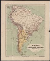
- Published / Created:
- 1891
- Call Number:
- 90 1891
- Container / Volume:
- BRBL_00664
- Image Count:
- 1
- Resource Type:
- Maps, Atlases & Globes
- Found in:
- Beinecke Rare Book and Manuscript Library > Rand, McNally & Co.'s indexed atlas of the world map of South America.