Search
You Searched For
Search Results
- Creator:
- Herder, Bartholomä, 1774-1839, lithographer
Woerl, Joseph Edmund
Woerl, Joseph Edmund. Atlas von Central-Europa
- Call Number:
- 30 1840B
- Container / Volume:
- BRBL_00031
- Image Count:
- 1
- Resource Type:
- Maps, Atlases & Globes
- Found in:
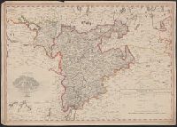
- Beinecke Rare Book and Manuscript Library > Constanz.
- Call Number:
- 4035 1846
- Container / Volume:
- BRBL_00234
- Image Count:
- 1
- Resource Type:
- Maps, Atlases & Globes
- Found in:
- Beinecke Rare Book and Manuscript Library > Contea principesca del Tirolo e Vorarlberg / Gio. Battista Bordiga inc.
- Published / Created:
- 1869
- Call Number:
- 428 1869
- Container / Volume:
- BRBL_00247
- Image Count:
- 2
- Resource Type:
- Maps, Atlases & Globes
- Found in:
- Beinecke Rare Book and Manuscript Library > Generalkarte der Gefürsten Grafschaft Tyrol nebst Vorarlberg und dem Souverainen Fürstenthume Liechtenstein.
- Creator:
- Waltenberger, Anton, 1840-1902
- Published / Created:
- 1875
- Call Number:
- 429CBF SI39 1875
- Container / Volume:
- BRBL_00249
- Image Count:
- 1
- Resource Type:
- Maps, Atlases & Globes
- Found in:
- Beinecke Rare Book and Manuscript Library > Hypsometrische Karte der Oberlechthaler Alpen, Rhätikon Kette und Silvretta Gruppe [cartographic material] / entworfen und gezeichnet von A. Waltenberger.
- Published / Created:
- [1890?]
- Call Number:
- 428 1890
- Container / Volume:
- BRBL_00248
- Image Count:
- 1
- Resource Type:
- Maps, Atlases & Globes
- Found in:
- Beinecke Rare Book and Manuscript Library > Karte von Tirol und Vorarlberg.
- Call Number:
- 4035 1805
- Container / Volume:
- BRBL_00234
- Image Count:
- 1
- Resource Type:
- Maps, Atlases & Globes
- Found in:
- Beinecke Rare Book and Manuscript Library > Karte von Tyrol und Vorarlberg / F. Reisser sculp.
- Published / Created:
- 1918
- Call Number:
- 428gm 1918
- Container / Volume:
- BRBL_00249
- Image Count:
- 1
- Resource Type:
- Maps, Atlases & Globes
- Found in:
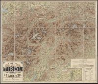
- Beinecke Rare Book and Manuscript Library > Route map of Tirol, Vorarlberg and Liechtenstein giving distances.
- Published / Created:
- [ca. 1870]
- Call Number:
- 428 1870
- Container / Volume:
- BRBL_00248
- Image Count:
- 6
- Resource Type:
- Maps, Atlases & Globes
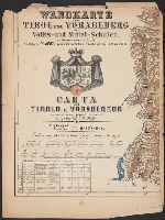
- Found in:
- Beinecke Rare Book and Manuscript Library > Wandkarte von Tirol und Vorarlberg für Volks-und Mittel-Schulen = Carta del Tirolo e Vorarlberg ad uso di scuole popolari e medie / Gezeichnet von G.v. Kaler.