Skip to search
Skip to main content
Skip to first result
Search
You Searched For
Subject (Geographic)
Wales--Maps
Search Results
Published / Created:
1820
Call Number:
329 1820
Container / Volume:
BRBL_00074
Image Count:
1
Resource Type:
Maps, Atlases & Globes
Description:
Preliminary record.
Publisher:
William Darton,
Subject (Geographic):
Wales--Maps
Found in:
Beinecke Rare Book and Manuscript Library > A new map of South Wales ... Thomas Dix Surveyor ...
Creator:
Published / Created:
[1920?]
Call Number:
32 1920
Container / Volume:
BRBL_00045
Image Count:
2
Resource Type:
Maps, Atlases & Globes
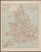
Alternative Title:
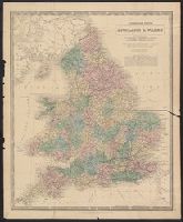
Bartholomew's General map of England and Wales Northern Section., Bartholomew's General map of England and Wales Southern Section., and General map of England & Wales.
Description:
Counties.
Publisher:
Geographic Institute/John Bartholomew & Son,
Subject (Geographic):
England--Administrative and political divisions--Maps, England--Maps, Wales--Administrative and political divisions--Maps, and Wales--Maps
Found in:
Beinecke Rare Book and Manuscript Library > Bartholomew's general map of England & Wales.
Creator:
Published / Created:
1675
Call Number:
EEdea 675P
Image Count:
2
Alternative Title:
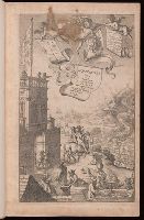
The Road from London to Hith in com. Kent including the road by Maidstone. By John Ogilby Esqr. His Ma.ties Cosmographer
Description:
Added title page engraved, illustrated.
Publisher:
Printed by the author,
Subject (Geographic):
England--Maps, Great Britain--Description and travel, and Wales--Maps
Subject (Topic):
Roads--England and Roads--Wales
Found in:
Beinecke Rare Book and Manuscript Library > Britannia, volume the first, or, An illustration of the kingdom of England and dominion of Wales : by a geographical and historical description of the principal roads thereof : actually admeasured and delineated in a century of whole-sheet copper-sculps : accomodated with the ichnography of the several cities and capital towns : and compleated by an accurate account of the more remarkable passages of antiquity, together with a novel discourse of the present state
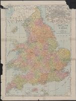
Published / Created:
c1907.
Call Number:
32 1907
Container / Volume:
BRBL_00045
Image Count:
2
Resource Type:
Maps, Atlases & Globes
Description:
Inset: London and Environs 1:150,000.
Publisher:
Rand, McNally & Co.,
Subject (Geographic):
England--Maps and Wales--Maps
Found in:
Beinecke Rare Book and Manuscript Library > England & Wales.
Creator:
Published / Created:
[1915?]
Call Number:
32 1915
Container / Volume:
BRBL_00045
Image Count:
1
Resource Type:
Maps, Atlases & Globes
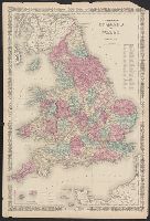
Alternative Title:
England
Publisher:
George Philip & Son,
Subject (Geographic):
England--Maps and Wales--Maps
Found in:
Beinecke Rare Book and Manuscript Library > England and Wales.
Creator:
Published / Created:
[1866]
Call Number:
32 1866
Container / Volume:
BRBL_00045
Image Count:
2
Resource Type:
Maps, Atlases & Globes
Description:
Relief indicated by hachures.
Publisher:
Johnson and Ward,
Subject (Geographic):
England--Maps and Wales--Maps
Found in:
Beinecke Rare Book and Manuscript Library > Johnson's England and Wales.
Published / Created:
[1870?]
Call Number:
32 1870A
Container / Volume:
BRBL_00045
Image Count:
1
Resource Type:
Maps, Atlases & Globes
Publisher:
W. & A.K. Johnston,
Subject (Geographic):
England--Maps and Wales--Maps
Found in:
Beinecke Rare Book and Manuscript Library > Lithographed edition England & Wales by A.K. Johnston, F.R.G.S.
Published / Created:
1918
Call Number:
32gma 1918
Container / Volume:
BRBL_00076
Image Count:
2
Resource Type:
Maps, Atlases & Globes
Description:
Verso: Controlled Canals in Ireland, 1:633,600.
Publisher:
Ordnance Survey,
Subject (Geographic):
England--Maps and Wales--Maps
Found in:
Beinecke Rare Book and Manuscript Library > Map showing controlled canals in England & Wales.
Creator:
Published / Created:
1920-21.
Call Number:
32 1920B
Container / Volume:
BRBL_00745
Image Count:
11
Resource Type:
Maps, Atlases & Globes
Description:
Altitudes given in feet.
Subject (Geographic):
England--Maps and Wales--Maps
Found in:
Beinecke Rare Book and Manuscript Library > Ordnance Survey of Great Britain 1/4 inch to one mile.
Creator:
Published / Created:
1920-21.
Call Number:
32 1920B
Container / Volume:
BRBL_00745
Image Count:
7
Resource Type:
Maps, Atlases & Globes
Description:
Altitudes given in feet.
Subject (Geographic):
England--Maps and Wales--Maps
Found in:
Beinecke Rare Book and Manuscript Library > Ordnance Survey of Great Britain 1/4 inch to one mile.