Search
You Searched For
Search Results
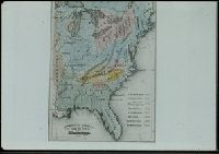
- Creator:
- Erdoes, Richard, 1912-2008
- Published / Created:
- 1976-1983, undated
- Call Number:
- WA MSS S-2609
- Collection Title:
- Richard Erdoes papers
- Container / Volume:
- Box 46 | Plains Indian History II
- Image Count:
- 39
- Found in:
- Beinecke Rare Book and Manuscript Library > 19th Century Maps
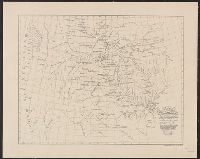
- Creator:
- Pike, Zebulon Montgomery, 1779-1813
- Published / Created:
- 1810
- Call Number:
- GA405 +W44 (LC)
- Collection Title:
- Mapping the transmississippi West, 1540-1861
- Image Count:
- 1
- Found in:
- Beinecke Rare Book and Manuscript Library > A Chart of the Internal Part of Louisiana, Including all the hitherto unexplored Countries, lying between the River La Platte of the Missouri on the N: and the Red River on the S: the Mississippi East and the Mountains of Mexico West; with a Part of New M
- Creator:
- Lewis, Meriwether, 1774-1809
- Published / Created:
- 1887].
- Call Number:
- 71 1806A
- Container / Volume:
- BRBL_00368
- Image Count:
- 1
- Resource Type:
- Maps, Atlases & Globes
- Found in:
- Beinecke Rare Book and Manuscript Library > A map of part of the continent of North America : between the 35th and 51st degrees of north latitude, and extending from 80 degrees of west longitude to the Pacific Ocean / compiled from the authorities of the best informed travellers by M. Lewis ; copie
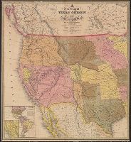
- Published / Created:
- 1849
- Call Number:
- 80 1849D
- Container / Volume:
- BRBL_00533
- Image Count:
- 1
- Resource Type:
- Maps, Atlases & Globes
- Found in:
- Beinecke Rare Book and Manuscript Library > A new map of Texas, Oregon, and California : with the regions adjoining.
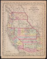
- Creator:
- Desilver, Charles
- Published / Created:
- [1856]
- Call Number:
- 80 1856C
- Container / Volume:
- BRBL_00534
- Image Count:
- 1
- Resource Type:
- Maps, Atlases & Globes
- Found in:
- Beinecke Rare Book and Manuscript Library > A new map of the state of California, the territories of Oregon, Washington, Utah & New Mexico.
- Published / Created:
- 1845]
- Call Number:
- 88 1845D
- Container / Volume:
- BRBL_00645
- Image Count:
- 1
- Resource Type:
- Maps, Atlases & Globes
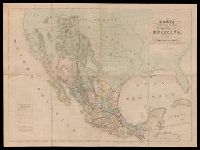
- Found in:
- Beinecke Rare Book and Manuscript Library > Carta geografica general de la republica Mexicana / formada el ano de 1845, con los datos que reunio la seccion de Geografia del Ministerio de la Guerra, por el General de Brigada Pedro Garcia Conde.
- Published / Created:
- 1825
- Call Number:
- 85 1825
- Container / Volume:
- BRBL_00731
- Image Count:
- 1
- Resource Type:
- Maps, Atlases & Globes
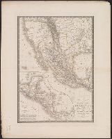
- Found in:
- Beinecke Rare Book and Manuscript Library > Carte générale des États-Unis Mexicains et des Provinces-Unies de l'Amérique Centrale ...
- Creator:
- Colton, J. H. (Joseph Hutchins), 1800-1893
- Published / Created:
- 1864
- Call Number:
- 80 1864B
- Container / Volume:
- BRBL_00535
- Image Count:
- 1
- Resource Type:
- Maps, Atlases & Globes
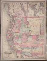
- Found in:
- Beinecke Rare Book and Manuscript Library > Colton's map of the Pacific States, California and Oregon : with the territories of Nevada, Utah, New Mexico, Colorado & Washington, in connection with British Columbia &c., from the latest and best information.
- Creator:
- Colton, J. H. (Joseph Hutchins), 1800-1893
- Published / Created:
- 1862
- Call Number:
- 80 1862A
- Container / Volume:
- BRBL_00535
- Image Count:
- 1
- Resource Type:
- Maps, Atlases & Globes
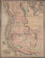
- Found in:
- Beinecke Rare Book and Manuscript Library > Colton's map of the Pacific states, California and Oregon : with the territories of Nevada, Utah, New Mexico, Colorado & Washington in connection with British Columbia &c. from the latest and best information.
- Published / Created:
- 1866
- Call Number:
- 80 1866A
- Container / Volume:
- BRBL_00535
- Image Count:
- 1
- Resource Type:
- Maps, Atlases & Globes
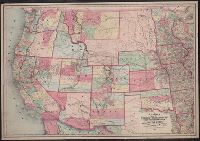
- Found in:
- Beinecke Rare Book and Manuscript Library > Colton's map of the states and territories west of the Mississippi River to the Pacific Ocean : showing the overland routes, projected rail road lines &c.