Skip to search
Skip to main content
Skip to first result
Search
You Searched For
Subject (Geographic)
World--Maps--Early works to 1800
New Search
Search Results
Published / Created:
[1795?]
Call Number:
11 1795A
Container / Volume:
BRBL_00006
Image Count:
1
Resource Type:
Maps, Atlases & Globes
Found in:
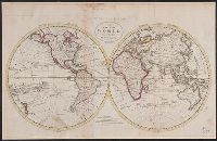
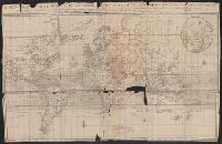
Beinecke Rare Book and Manuscript Library > A Chart of the World, According to Mercator's Projection, showing the latest discoveries of Capt. Cook.
Published / Created:
[1795?]
Call Number:
11 1795A
Container / Volume:
BRBL_00006
Image Count:
1
Resource Type:
Maps, Atlases & Globes
Found in:
Beinecke Rare Book and Manuscript Library > A Chart of the World, According to Mercator's Projection, showing the latest discoveries of Capt. Cook.
Published / Created:
1787
Call Number:
11 1787
Container / Volume:
BRBL_00006
Image Count:
2
Resource Type:
Maps, Atlases & Globes
Found in:
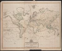
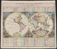
Beinecke Rare Book and Manuscript Library > A General Map of the World or Terraqueous globe with all the new discoveries ... by Sam'l Dunn ...
Published / Created:
1795
Call Number:
11 1795
Container / Volume:
BRBL_00006
Image Count:
1
Resource Type:
Maps, Atlases & Globes
Found in:
Beinecke Rare Book and Manuscript Library > A Map of the World from the best Authorities.
Published / Created:
1794
Call Number:
11 1794A
Container / Volume:
BRBL_00006
Image Count:
1
Resource Type:
Maps, Atlases & Globes
Found in:
Beinecke Rare Book and Manuscript Library > A New Chart of the World ... with the tracks of the British Circumnavigators Bryon, Wallis, Carteret and Cook, &c.
Published / Created:
[1770]
Call Number:
11 1770
Container / Volume:
BRBL_00005
Image Count:
1
Resource Type:
Maps, Atlases & Globes
Found in:
Beinecke Rare Book and Manuscript Library > A map of the World Corrected from the observations communicated to the Royal Societys of London and Paris by John Senex. H. Hulsbergh Sc.
Published / Created:
1719
Call Number:
11 1719A
Container / Volume:
BRBL_00004
Image Count:
1
Resource Type:
Maps, Atlases & Globes
Found in:
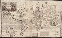
Beinecke Rare Book and Manuscript Library > A new and correct map of the whole world ... / by Herman Moll ...
Published / Created:
1719
Call Number:
11 1719B
Container / Volume:
BRBL_00004
Image Count:
1
Resource Type:
Maps, Atlases & Globes
Found in:
Beinecke Rare Book and Manuscript Library > A new and correct map of the whole world ... / by Herman Moll ...
Published / Created:
[1705]
Call Number:
11 1705B
Container / Volume:
BRBL_00004
Image Count:
1
Resource Type:
Maps, Atlases & Globes
Found in:
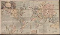
Beinecke Rare Book and Manuscript Library > A new map of the world according to Wrights alias Mercators projection &c. Drawn from the newest and most exact observations ... by Ier. Seller and Cha. Price. H. Moll fecit.
Published / Created:
[1790?]
Call Number:
11 1790A
Container / Volume:
BRBL_00006
Image Count:
1
Resource Type:
Maps, Atlases & Globes
Found in:
Beinecke Rare Book and Manuscript Library > A' Föld két Fél-gloyóbis képe.
Published / Created:
[1778]
Call Number:
11 1778
Container / Volume:
BRBL_00005
Image Count:
1
Resource Type:
Maps, Atlases & Globes
Found in:
Beinecke Rare Book and Manuscript Library > An Accurate Map of the World ... By T. Conder. Engraved for Moore's New and Compleat Collection of Voyages and Travels.
Published / Created:
[1700]
Call Number:
11 1700E
Container / Volume:
BRBL_00004
Image Count:
1
Resource Type:
Maps, Atlases & Globes
Found in:
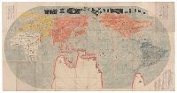
Beinecke Rare Book and Manuscript Library > Bankoku Chikyu Saiken Zenzu. [A Complete Guide to All the Countries of the Globe].
Published / Created:
[1733?]
Call Number:
11 1733
Container / Volume:
BRBL_00004
Image Count:
1
Resource Type:
Maps, Atlases & Globes
Found in:
Beinecke Rare Book and Manuscript Library > Basis geographiæ recentioris astronomica ... a Iohanne Gabrielle Doppelmaiero ... operâ Ioh. Bapt. Homanni ...
Published / Created:
1765
Call Number:
11 1765
Container / Volume:
BRBL_00005
Image Count:
1
Resource Type:
Maps, Atlases & Globes
Found in:
Beinecke Rare Book and Manuscript Library > Carte des variations de la boussole et des vents generaux ... par ordre de Monsieur de Choiseul ... Par le S. Bellin ...
Published / Created:
1879
Call Number:
11 1509
Container / Volume:
BRBL_00002
Image Count:
1
Resource Type:
Maps, Atlases & Globes
Found in:
Beinecke Rare Book and Manuscript Library > Erster gedruckter Globus. Martin Hylacomylus (Waltzemüller). Gehört Warhscheinlich zu seinem 1509 herausgegeben Buche Globus Munde.
Published / Created:
1769
Call Number:
11ba 1769
Container / Volume:
BRBL_00005
Image Count:
1
Resource Type:
Maps, Atlases & Globes
Found in:
Beinecke Rare Book and Manuscript Library > Globe Terrestre [by Fortin] ...
Published / Created:
[19--?]
Call Number:
11 1621
Container / Volume:
BRBL_00003
Image Count:
1
Resource Type:
Maps, Atlases & Globes
Found in:
Beinecke Rare Book and Manuscript Library > Hac iterata delineatione globi hydrographica et geographica ... / Iohannes Ianssonius excudit et Abrahamus Goos Amstelodamensis sculpsit.
Published / Created:
1659
Call Number:
11 1659
Container / Volume:
BRBL_00003
Image Count:
1
Resource Type:
Maps, Atlases & Globes
Found in:
Beinecke Rare Book and Manuscript Library > Harmonie ou Correspondance du globe avecq la sphere par les points, lignes, cerches, &c ... par le S. Sanson d'Abbeville ... Jean Somer Pruthenus, Sculpsit.
Published / Created:
1652
Call Number:
11 1652
Container / Volume:
BRBL_00003
Image Count:
1
Resource Type:
Maps, Atlases & Globes
Found in:
Beinecke Rare Book and Manuscript Library > L'Hydrographe ou description de L'eau ... par le S. Sanson d'Abbeville ...
Published / Created:
[1860]
Call Number:
11 1490
Image Count:
1
Resource Type:
Maps, Atlases & Globes
Found in:
Beinecke Rare Book and Manuscript Library > Map of the World as known to the ancients and sacred writers.
Published / Created:
[1650]
Call Number:
11 1650B
Container / Volume:
BRBL_00003
Image Count:
2
Resource Type:
Maps, Atlases & Globes
Found in:
Beinecke Rare Book and Manuscript Library > Map of the World.
Published / Created:
1746
Call Number:
11 1746
Image Count:
1
Resource Type:
Maps, Atlases & Globes
Found in:
Beinecke Rare Book and Manuscript Library > Mappe - Monde ... dressée par M.G.M. Lowitz.
Published / Created:
[1741?]
Call Number:
11 1741
Image Count:
1
Resource Type:
Maps, Atlases & Globes
Found in:
Beinecke Rare Book and Manuscript Library > Mappe - Monde ... par M. de L'Isle ...
Published / Created:
1755
Call Number:
11 1755
Container / Volume:
BRBL_00005
Image Count:
1
Resource Type:
Maps, Atlases & Globes
Found in:
Beinecke Rare Book and Manuscript Library > Mappe Monde Carte Universelle de la Terre ... par J.B. Nolin ...
Published / Created:
1744
Call Number:
11 1744
Container / Volume:
BRBL_00005
Image Count:
1
Resource Type:
Maps, Atlases & Globes
Found in:
Beinecke Rare Book and Manuscript Library > Mappe Monde Nouvelle ...
Published / Created:
1744
Call Number:
11 1744
Image Count:
1
Resource Type:
Maps, Atlases & Globes
Found in:
Beinecke Rare Book and Manuscript Library > Mappe Monde Nouvelle ...
Published / Created:
1798
Call Number:
11 1798
Container / Volume:
BRBL_00006
Image Count:
1
Resource Type:
Maps, Atlases & Globes
Found in:
Beinecke Rare Book and Manuscript Library > Mappe Monde ou Carte Réduite des Parties connues du Globe pour fervir au voyage de la Pérouse fait dans les années 1785, 86, 87, & 88. Eng. by S.J. Neele.
Published / Created:
1782
Call Number:
11 1782
Container / Volume:
BRBL_00006
Image Count:
1
Resource Type:
Maps, Atlases & Globes
Found in:
Beinecke Rare Book and Manuscript Library > Mappe Monde ou Carte générale de l'Univers ... Dessinée et Gravée par Mathieu Albert Lotter.
Published / Created:
1752
Call Number:
11 1752
Image Count:
1
Resource Type:
Maps, Atlases & Globes
Found in:
Beinecke Rare Book and Manuscript Library > Mappe monde du description du globe terrestre ... par le Sr. Robert de Vaugondy, fils.
Published / Created:
[1780?]
Call Number:
11 1780
Container / Volume:
BRBL_00006
Image Count:
1
Resource Type:
Maps, Atlases & Globes
Found in:
Beinecke Rare Book and Manuscript Library > Mappe-Monde ... par le S. Robert de Vaugondy geog. Corrigée et augmentée des Nouvelles decouvertes du Capiteine Cook par DeLamarche ...
Published / Created:
1719
Call Number:
11 1719
Container / Volume:
BRBL_00004
Image Count:
1
Resource Type:
Maps, Atlases & Globes
Found in:
Beinecke Rare Book and Manuscript Library > Mappe-monde geo-hydrographique, ou description générale du globe terrestre et aquatique en deux plans-Hemispheres ... par le Sr. Sanson, geographe ...
Creator:
Published / Created:
1691
Call Number:
11 1691A
Image Count:
1
Resource Type:
Maps, Atlases & Globes
Found in:
Beinecke Rare Book and Manuscript Library > Mappe-monde geo-hydrographique, ou, Description generale du globe terrestre et aquatique en deux-plans-hemispheres, ou sont exactement remarquées en general toutes les parties de la terre et de l'eau, suivant les relations les plus nouvelles [cartographi
Published / Created:
[1660?]
Call Number:
11 1660
Container / Volume:
BRBL_00003
Image Count:
1
Resource Type:
Maps, Atlases & Globes
Found in:
Beinecke Rare Book and Manuscript Library > Mappe-monde pour connoître les progrés & les conquestes les plus Remarquables des Provinces-Unies, Ainsy que celles des Compagnies d'Orient et d'Occident, Et les Pais quelles possédent dans l'un et dans lautre Hemisphere.
Published / Created:
1705
Call Number:
11 1705
Container / Volume:
BRBL_00004
Image Count:
1
Resource Type:
Maps, Atlases & Globes
Found in:
Beinecke Rare Book and Manuscript Library > Mappe-monde, ou carte generale de la terre ... H. Van Loon fecit.
Published / Created:
1651
Call Number:
11 1651B
Container / Volume:
BRBL_00003
Image Count:
1
Resource Type:
Maps, Atlases & Globes
Found in:
Beinecke Rare Book and Manuscript Library > Mappe-monde, ou carte generale du monde, designée en deux plan-hemispheres / par le Sr. Sanson d'Abbeville ... ; Riuiere sculp.
Published / Created:
1745
Call Number:
11 1720
Container / Volume:
BRBL_00004
Image Count:
1
Resource Type:
Maps, Atlases & Globes
Found in:
Beinecke Rare Book and Manuscript Library > Mappemond a l'usage du Roy / par Guillaume Delisle ...
Creator:
Published / Created:
1695
Call Number:
11 1695A
Container / Volume:
BRBL_00004
Image Count:
1
Resource Type:
Maps, Atlases & Globes
Found in:
Beinecke Rare Book and Manuscript Library > Mappemonde ou carte marine universelle reduite : où sont l'Asie, l'Afrique, l'Europe, l'Amerique septentrionale, l'Amerique meridionale / par Pierre Moullart-Sanson, geographe du Roi.
Published / Created:
1783
Call Number:
11 1783
Container / Volume:
BRBL_00006
Image Count:
1
Resource Type:
Maps, Atlases & Globes
Found in:
Beinecke Rare Book and Manuscript Library > Northern Hemisphere - Southern Hemisphere.
Published / Created:
[1650]
Call Number:
11 1650
Container / Volume:
BRBL_00003
Image Count:
1
Resource Type:
Maps, Atlases & Globes
Found in:
Beinecke Rare Book and Manuscript Library > Nouvelle Methode de Geographie ou Voiage du Monde ... par un Jeu ...
Published / Created:
[1660?]
Call Number:
11 1660A
Container / Volume:
BRBL_00003
Image Count:
1
Resource Type:
Maps, Atlases & Globes
Found in:
Beinecke Rare Book and Manuscript Library > Nova Totius Terrarum orbis tabula.
Published / Created:
[1730?]
Call Number:
11 1730
Container / Volume:
BRBL_00004
Image Count:
1
Resource Type:
Maps, Atlases & Globes
Found in:
Beinecke Rare Book and Manuscript Library > Nova delineatio totius orbis Terrarum per Petrum Vander Aa.
Published / Created:
1663?]
Call Number:
11 1663
Container / Volume:
BRBL_00003
Image Count:
1
Resource Type:
Maps, Atlases & Globes
Found in:
Beinecke Rare Book and Manuscript Library > Nova et accuratissima totius terrarum orbis tabula. Auctore Ioanne Blaeu.
Published / Created:
[19--?]
Call Number:
11 1603
Container / Volume:
BRBL_00003
Image Count:
2
Resource Type:
Maps, Atlases & Globes
Found in:
Beinecke Rare Book and Manuscript Library > Nova et integra universi orbis descriptio.
Creator:
Published / Created:
[between 1635 and 1650]
Call Number:
11 1635
Container / Volume:
BRBL_00003
Image Count:
2
Resource Type:
Maps, Atlases & Globes
Found in:
Beinecke Rare Book and Manuscript Library > Nova totius terrarum orbis geographica ac hydrographica tabula / auct. Guiljelmo Blaeuw ; Ja. van den Ende sculpsit.
Creator:
Published / Created:
1750?]
Call Number:
11 1750
Image Count:
1
Resource Type:
Maps, Atlases & Globes
Found in:
Beinecke Rare Book and Manuscript Library > Orbis vetus in utrâque continente ... / accurante Robert de Vaugondy.
Published / Created:
[1780?]
Call Number:
11 1780A
Container / Volume:
BRBL_00006
Image Count:
1
Resource Type:
Maps, Atlases & Globes
Found in:
Beinecke Rare Book and Manuscript Library > Platte Kaart van de Geheele Waereld om te dienen tot de Nederlandsche Reizen.
Published / Created:
1515
Call Number:
11 1515A
Image Count:
2
Resource Type:
Maps, Atlases & Globes
Found in:
Beinecke Rare Book and Manuscript Library > Schöner Globe. 1515.
Published / Created:
1879
Call Number:
11 1524
Container / Volume:
BRBL_00002
Image Count:
1
Resource Type:
Maps, Atlases & Globes
Found in:
Beinecke Rare Book and Manuscript Library > Totivs Orbis Descriptio Tam Vetervm Qvam Recentivm Geographorvm Traditionibvs Observata Novvm Opvs Ioanis Vespvcci. Florentini Navgieri Regis Hispaniarvm Mira Art. Let. Ingenio. Absolvtvm. Erratisiqd Excvsoris Cvlpa 1524. Phot-lith. im k.k.t.u.a. Militar
Published / Created:
[18--?]
Call Number:
11 1589
Image Count:
1
Resource Type:
Maps, Atlases & Globes
Found in:
Beinecke Rare Book and Manuscript Library > Typus Orbis Terrarum. [Amsterdam] Iudocus Hondius, 1589.
Branch:v1.60.98 ,Deployed:2024-04-24T10:14:37-04:00