Search
You Searched For
Search Results
- Creator:
- Faden, William, 1749-1836
- Published / Created:
- January 1st, 1787.
- Call Number:
- 1982 Folio 10
- Image Count:
- 1
- Description:
- BEIN 1982 Folio 10: Armorial bookplate: Charles Abbot. No. 1 of 42 maps bound together.
- Publisher:
- Published by Wm. Faden, Geographer to the King, Charing Cross
- Subject (Name):
- Cook, James, 1728-1779 and Mulgrave, Constantine John Phipps, Lord, 1744-1792
- Subject (Topic):
- Travel, Discoveries in geography, and World maps
- Found in:
- Beinecke Rare Book and Manuscript Library > A new general chart of the world : exhibiting the whole of the discoveries made by the late Captain James Cook, F.R.S. with the tracks of the ships under his command : also those of Cap'n Phipps (now Lord Mulgrave) in his expedition to the North Pole
- Creator:
- Beaufort, Daniel Augustus, 1739-1821
- Published / Created:
- 1792.
- Call Number:
- 1982 Folio 10
- Image Count:
- 2
- Description:
- BEIN 1982 Folio 10: Armorial bookplate: Charles Abbot. No. 7 of 42 maps bound together.
- Publisher:
- W. Faden & W. Allen
- Subject (Geographic):
- Ireland
- Subject (Topic):
- Parishes
- Found in:
- Beinecke Rare Book and Manuscript Library > A new map of Ireland, civil and ecclesiastical
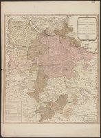
- Creator:
- Faden, William, 1749-1836
- Published / Created:
- June the 24th, 1788.
- Call Number:
- 1982 Folio 10
- Image Count:
- 2
- Description:
- BEIN 1982 Folio 10: Armorial bookplate: Charles Abbot. No. 20 of 42 maps bound together.
- Publisher:
- William Faden
- Subject (Geographic):
- Europe and Germany
- Subject (Topic):
- Administrative and political divisions
- Found in:
- Beinecke Rare Book and Manuscript Library > A new map of the German Empire and the neighbouring states with their principal post roads : originally published by the Royal Academy of Berlin
- Creator:
- Jefferys, Thomas, -1771, cartographer
- Published / Created:
- June 1st, 1789.
- Call Number:
- 1982 Folio 10
- Image Count:
- 1
- Resource Type:
- cartographic image
- Description:
- BEIN 1982 Folio 10: Sheet measures 73 x 55 cm. Armorial bookplate: Charles Abbot. No. 21 of 42 maps bound together.
- Publisher:
- Published by W. Faden, Geographer to the King, Charing Cross
- Subject (Geographic):
- Lower Saxony (Germany)
- Subject (Name):
- Brunswick-Lüneburg, House of.
- Found in:
- Beinecke Rare Book and Manuscript Library > A new map of the King of Great Britain's dominions in Germany or the Electorate of Brunswick-Luneburg and its dependencies
- Creator:
- Jefferys, Thomas, -1771, cartographer
- Published / Created:
- June 1st, 1789.
- Call Number:
- 3635 1789
- Image Count:
- 1
- Resource Type:
- cartographic image
- Description:
- BEIN 1982 Folio 10: Sheet measures 73 x 55 cm. Armorial bookplate: Charles Abbot. No. 21 of 42 maps bound together.
- Publisher:
- Published by W. Faden, Geographer to the King, Charing Cross
- Subject (Geographic):
- Lower Saxony (Germany)
- Subject (Name):
- Brunswick-Lüneburg, House of.
- Found in:
- Beinecke Rare Book and Manuscript Library > A new map of the King of Great Britain's dominions in Germany or the Electorate of Brunswick-Luneburg and its dependencies
- Creator:
- Kitchin, Thomas, 1719-1784
- Published / Created:
- January 1st, 1787.
- Call Number:
- 1982 Folio 10
- Image Count:
- 1
- Description:
- BEIN 356 1787: Sheet measures 54 x 70.7 cm.
- Publisher:
- Robert Sayer
- Subject (Geographic):
- Poland, Lithuania, and Europe, Eastern
- Subject (Topic):
- Boundaries
- Found in:
- Beinecke Rare Book and Manuscript Library > A new map of the Kingdom of Poland with its dismembered provinces
- Creator:
- Sayer, Robert, 1725-1794
- Published / Created:
- October 10th, 1788.
- Call Number:
- 1982 Folio 10
- Image Count:
- 1
- Description:
- BEIN 1982 Folio 10: Armorial bookplate: Charles Abbot. No. 23 of 42 maps bound together.
- Publisher:
- Printed for Robert Sayer
- Subject (Geographic):
- Scandinavia, Russia, and Baltic States
- Found in:
- Beinecke Rare Book and Manuscript Library > A new map of the Northern States containing the Kingdoms of Sweden, Denmark, and Norway, with the western parts of Russia, Livonia, Courland &ca.
- Creator:
- Sayer, Robert, 1725-1794
- Published / Created:
- 1786.
- Call Number:
- 1982 Folio 10
- Image Count:
- 2
- Description:
- BEIN 1982 Folio 10: Not mounted on linen. 102 x 117 cm, on sheets 55 x 64 cm. Armorial bookplate: Charles Abbot. No. 38 of 42 maps bound together.
- Publisher:
- Printed for Robt. Sayer, map, chart & printseller
- Subject (Geographic):
- Western Hemisphere and United States
- Found in:
- Beinecke Rare Book and Manuscript Library > A new map of the whole continent of America : divided into North and South and West Indies wherein are exactly described the United States of North America as well as the several European possessions according to the preliminaries of peace signed at Versailles Jan. 20, 1783
- Creator:
- Boulton, S.
- Published / Created:
- 6 Jany. 1787.
- Call Number:
- 1982 Folio 10
- Image Count:
- 2
- Description:
- BEIN 1982 Folio 10: Armorial bookplate: Charles Abbot. No. 34 of 42 maps bound together.
- Publisher:
- Printed for Robert Sayer
- Subject (Geographic):
- Africa and Ghana
- Found in:
- Beinecke Rare Book and Manuscript Library > Africa : with all its states, kingdoms, republics, regions, islands, & ca., improved and inlarged from D'Anville's map : to which have been added a particular chart of the Gold Coast wherein are distinguished all the European forts and factories
- Creator:
- Kitchin, Thomas, 1719-1784
- Published / Created:
- 6 Jany. 1787.
- Call Number:
- 1982 Folio 10
- Image Count:
- 2
- Description:
- BEIN 50 1787: Sheets measure 54 x 122.5 cm.
- Publisher:
- Printed for Robert Sayer
- Subject (Geographic):
- Asia
- Found in:
- Beinecke Rare Book and Manuscript Library > Asia and its islands according to d'Anville : divided into empires, kingdoms, states, regions, & ca. with the European possessions and settlements in the East Indies and an exact delineation of all the discoveries made in the eastern parts by the English under Captn. Cook