
- None3
You Searched For
« Previous
| 1 - 9 of 12 |
Next »
Search Results

1. 12 photographs [of] Glacier National Park [graphic].
- Published / Created:
- n.d.
- Call Number:
- WA Photos 197
- Image Count:
- 13
- Description:
- With cardboard mailer.
- Publisher:
- Glacier Park Co.
- Subject (Geographic):
- Glacier National Park (Mont.) and Montana
- Found in:
- Beinecke Rare Book and Manuscript Library > 12 photographs [of] Glacier National Park [graphic].

2. Cliff dwellings, pueblo ruins, & Indian life in the South West
- Creator:
- Matteson, Sumner W., 1867-1920
- Published / Created:
- ca. 1899-1903.
- Call Number:
- WA Photos 204
- Container / Volume:
- Box 1 (album)
- Image Count:
- 20
- Abstract:
- Photograph album created by Sumner Matteson from a selection of his photographs of the Southwest, Montana, and Colorado. The photographs, which are captioned in a typed list that accompanies the album, date from 1899 to 1902, and depict a variety of p...
- Description:
- Sumner Matteson, a bicycle salesman in Denver who became a photographer, traveled around the West between 1899 and 1903, photographing the Mesa Verde and Pueblo Bonito cliff-dwellings, Navajo Indians, Penitentes in New Mexico, Hopi Snake and Flute cer...
- Subject (Geographic):
- Southwest, New, Montana, New Mexico, Arizona, Abiquiu (N.M.), Acoma (N.M.), Canyon de Chelly National Monument (Ariz.), Colorado, Isleta (N.M.), Mancos Site (Colo.), Mesa Verde National Park (Colo.), Moenkopi Pueblo (Ariz.), and West (U.S.)
- Subject (Name):
- Klepetko, Frank., Matteson, Sumner W., 1867-1920., and Hermanos Penitentes
- Subject (Topic):
- Hopi Indians, Rites and ceremonies, Indians of North America, Cliff-dwellings, Kivas, Navajo Indians, Pueblo Indians, Snake dance, Mines and mineral resources, Sheep ranches, Wool industry, and Religious life and customs
- Found in:
- Beinecke Rare Book and Manuscript Library > Cliff dwellings, pueblo ruins, & Indian life in the South West
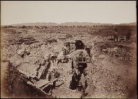
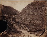
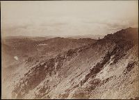
3. Mammoth plate photographs of the North American West
- Published / Created:
- 1874-1898.
- Call Number:
- WA Photos Folio 1
- Container / Volume:
- Box 1
- Image Count:
- 32
- Abstract:
- Photographs created from mammoth plate negatives primarily by photographers Carleton E. Watkins and William Henry Jackson of various locations in the American West, primarily in the states of California, Colorado, and Oregon, as well as Arizona, Monta...
- Description:
- A mammoth plate is a photographic negative plate, 18 by 21 inches (53.5 x 45.7 cm.) or larger, from which photographic prints are made through contact printing.
- Subject (Geographic):
- Wyoming, Montana, West (U.S.), Arizona, Arkansas River, Austin Bluffs (Colo.), Black Canyon of the Gunnison (Colo.), Blue Lakes (Calif.), Bridal Veil Falls (Utah), California, Cathedral Rocks (Calif.), Cathedral Spires (El Paso County, Colo.), Cathedral Spires (Jefferson County, Colo.), Clear Creek Canyon (Colo.), Clear Creek County (Colo.), Cochise Stronghold (Ariz.), Colorado, Columbia River, Costilla County (Colo.), Curecanti Needle (Colo.), Dalles (Or.), Dragoon Mountains (Ariz.), Drumlummon Mine (Mont.), Eagle Creek (Or.), Echo (Utah), El Capitan (Calif.), El Paso County (Colo.), Fountain Creek (Colo.), Fremont County (Colo.), Garden of the Gods (Colorado Springs, Colo.), Garfield County (Colo.), Gate Rock (El Paso County, Colo.), Giant Geyser (Wyo.), Glenwood Springs (Colo.), Grotto Geyser (Wyo.), Gunnison County (Colo.), Gunnison River (Colo.), Half Dome (Calif.), Jefferson County (Colo.), Jerome County (Idaho), Lake Vineyard (San Gabriel, Calif.), Marysville (Lewis and Clark County, Mont.), Mokelumne River (Calif.), Monument Park (El Paso County, Colo.), Multnomah County (Or.), Multnomah Creek (Or.), Multnomah Falls (Or.), North Cheyenne Canyon (Colo.), North Cheyenne Creek (Colo.), North Fork American River (Calif.), Old Faithful Geyser (Wyo.), Oregon, Palisades Falls, Pikes Peak (Colo.), Platte Canyon (Colo.), Port Ludlow (Wash.), Port Madison (Bainbridge Island, Wash.), Provo Canyon (Utah), Provo River (Utah), Pulpit Rock (Utah), Pulpit Terrace (Wyo.), Rainbow Falls (Colo.), Rio Arriba County (N.M.), Rio de los Pinos (Colo. and N.M.), Round Top Mountain (Calif.), Royal Gorge (Colo.), San Gabriel (Calif.), Sentinel Rock (Calif.), Seven Falls (Colo.), Sierra Blanca (Colo.), Snake River (Wyo.-Wash.), Soda Springs (Calif.), South Cheyenne Canyon (Colo.), South Cheyenne Creek (Colo.), South Platte River (Colo. and Neb.), Spokane (Wash.), Spokane River (Idaho and Wash.), Teller County (Colo.), Toltec Gorge (N.M.), Tombstone (Ariz.), Tombstone Region (Ariz.), Twin Creek (Colo.), Twin Falls (Idaho : Waterfalls), Utah, Ute Pass (Teller County, Colo.), Washington (State), Yampah Hot Springs (Colo.), Yellowstone National Park, Yosemite National Park (Calif.), and Yosemite Valley (Calif.)
- Subject (Name):
- Haynes, F. Jay 1853-1921. (Frank Jay),, Jackson, William Henry, 1843-1942., Meeker, Ezra, 1830-1928., Watkins, Carleton E., 1829-1916., Colorado Central Railroad Company, Denver and Rio Grande Railroad Company, Denver, South Park, and Pacific Railroad Company, Mission San Gabriel Arcangel (San Gabriel, Calif.), and Tough Nut Mine
- Subject (Topic):
- Geysers, Landscape photography, Mineral industries, and Railroads
- Found in:
- Beinecke Rare Book and Manuscript Library > Mammoth plate photographs of the North American West
4. Mammoth plate photographs of the North American West
- Published / Created:
- 1874-1898.
- Call Number:
- WA Photos Folio 1
- Container / Volume:
- Box 3
- Image Count:
- 28
- Abstract:
- Photographs created from mammoth plate negatives primarily by photographers Carleton E. Watkins and William Henry Jackson of various locations in the American West, primarily in the states of California, Colorado, and Oregon, as well as Arizona, Monta...
- Description:
- A mammoth plate is a photographic negative plate, 18 by 21 inches (53.5 x 45.7 cm.) or larger, from which photographic prints are made through contact printing.
- Subject (Geographic):
- Wyoming, Montana, West (U.S.), Arizona, Arkansas River, Austin Bluffs (Colo.), Black Canyon of the Gunnison (Colo.), Blue Lakes (Calif.), Bridal Veil Falls (Utah), California, Cathedral Rocks (Calif.), Cathedral Spires (El Paso County, Colo.), Cathedral Spires (Jefferson County, Colo.), Clear Creek Canyon (Colo.), Clear Creek County (Colo.), Cochise Stronghold (Ariz.), Colorado, Columbia River, Costilla County (Colo.), Curecanti Needle (Colo.), Dalles (Or.), Dragoon Mountains (Ariz.), Drumlummon Mine (Mont.), Eagle Creek (Or.), Echo (Utah), El Capitan (Calif.), El Paso County (Colo.), Fountain Creek (Colo.), Fremont County (Colo.), Garden of the Gods (Colorado Springs, Colo.), Garfield County (Colo.), Gate Rock (El Paso County, Colo.), Giant Geyser (Wyo.), Glenwood Springs (Colo.), Grotto Geyser (Wyo.), Gunnison County (Colo.), Gunnison River (Colo.), Half Dome (Calif.), Jefferson County (Colo.), Jerome County (Idaho), Lake Vineyard (San Gabriel, Calif.), Marysville (Lewis and Clark County, Mont.), Mokelumne River (Calif.), Monument Park (El Paso County, Colo.), Multnomah County (Or.), Multnomah Creek (Or.), Multnomah Falls (Or.), North Cheyenne Canyon (Colo.), North Cheyenne Creek (Colo.), North Fork American River (Calif.), Old Faithful Geyser (Wyo.), Oregon, Palisades Falls, Pikes Peak (Colo.), Platte Canyon (Colo.), Port Ludlow (Wash.), Port Madison (Bainbridge Island, Wash.), Provo Canyon (Utah), Provo River (Utah), Pulpit Rock (Utah), Pulpit Terrace (Wyo.), Rainbow Falls (Colo.), Rio Arriba County (N.M.), Rio de los Pinos (Colo. and N.M.), Round Top Mountain (Calif.), Royal Gorge (Colo.), San Gabriel (Calif.), Sentinel Rock (Calif.), Seven Falls (Colo.), Sierra Blanca (Colo.), Snake River (Wyo.-Wash.), Soda Springs (Calif.), South Cheyenne Canyon (Colo.), South Cheyenne Creek (Colo.), South Platte River (Colo. and Neb.), Spokane (Wash.), Spokane River (Idaho and Wash.), Teller County (Colo.), Toltec Gorge (N.M.), Tombstone (Ariz.), Tombstone Region (Ariz.), Twin Creek (Colo.), Twin Falls (Idaho : Waterfalls), Utah, Ute Pass (Teller County, Colo.), Washington (State), Yampah Hot Springs (Colo.), Yellowstone National Park, Yosemite National Park (Calif.), and Yosemite Valley (Calif.)
- Subject (Name):
- Haynes, F. Jay 1853-1921. (Frank Jay),, Jackson, William Henry, 1843-1942., Meeker, Ezra, 1830-1928., Watkins, Carleton E., 1829-1916., Colorado Central Railroad Company, Denver and Rio Grande Railroad Company, Denver, South Park, and Pacific Railroad Company, Mission San Gabriel Arcangel (San Gabriel, Calif.), and Tough Nut Mine
- Subject (Topic):
- Geysers, Landscape photography, Mineral industries, and Railroads
- Found in:
- Beinecke Rare Book and Manuscript Library > Mammoth plate photographs of the North American West
5. Mammoth plate photographs of the North American West
- Published / Created:
- 1874-1898.
- Call Number:
- WA Photos Folio 1
- Container / Volume:
- Box 2
- Image Count:
- 26
- Abstract:
- Photographs created from mammoth plate negatives primarily by photographers Carleton E. Watkins and William Henry Jackson of various locations in the American West, primarily in the states of California, Colorado, and Oregon, as well as Arizona, Monta...
- Description:
- A mammoth plate is a photographic negative plate, 18 by 21 inches (53.5 x 45.7 cm.) or larger, from which photographic prints are made through contact printing.
- Subject (Geographic):
- Wyoming, Montana, West (U.S.), Arizona, Arkansas River, Austin Bluffs (Colo.), Black Canyon of the Gunnison (Colo.), Blue Lakes (Calif.), Bridal Veil Falls (Utah), California, Cathedral Rocks (Calif.), Cathedral Spires (El Paso County, Colo.), Cathedral Spires (Jefferson County, Colo.), Clear Creek Canyon (Colo.), Clear Creek County (Colo.), Cochise Stronghold (Ariz.), Colorado, Columbia River, Costilla County (Colo.), Curecanti Needle (Colo.), Dalles (Or.), Dragoon Mountains (Ariz.), Drumlummon Mine (Mont.), Eagle Creek (Or.), Echo (Utah), El Capitan (Calif.), El Paso County (Colo.), Fountain Creek (Colo.), Fremont County (Colo.), Garden of the Gods (Colorado Springs, Colo.), Garfield County (Colo.), Gate Rock (El Paso County, Colo.), Giant Geyser (Wyo.), Glenwood Springs (Colo.), Grotto Geyser (Wyo.), Gunnison County (Colo.), Gunnison River (Colo.), Half Dome (Calif.), Jefferson County (Colo.), Jerome County (Idaho), Lake Vineyard (San Gabriel, Calif.), Marysville (Lewis and Clark County, Mont.), Mokelumne River (Calif.), Monument Park (El Paso County, Colo.), Multnomah County (Or.), Multnomah Creek (Or.), Multnomah Falls (Or.), North Cheyenne Canyon (Colo.), North Cheyenne Creek (Colo.), North Fork American River (Calif.), Old Faithful Geyser (Wyo.), Oregon, Palisades Falls, Pikes Peak (Colo.), Platte Canyon (Colo.), Port Ludlow (Wash.), Port Madison (Bainbridge Island, Wash.), Provo Canyon (Utah), Provo River (Utah), Pulpit Rock (Utah), Pulpit Terrace (Wyo.), Rainbow Falls (Colo.), Rio Arriba County (N.M.), Rio de los Pinos (Colo. and N.M.), Round Top Mountain (Calif.), Royal Gorge (Colo.), San Gabriel (Calif.), Sentinel Rock (Calif.), Seven Falls (Colo.), Sierra Blanca (Colo.), Snake River (Wyo.-Wash.), Soda Springs (Calif.), South Cheyenne Canyon (Colo.), South Cheyenne Creek (Colo.), South Platte River (Colo. and Neb.), Spokane (Wash.), Spokane River (Idaho and Wash.), Teller County (Colo.), Toltec Gorge (N.M.), Tombstone (Ariz.), Tombstone Region (Ariz.), Twin Creek (Colo.), Twin Falls (Idaho : Waterfalls), Utah, Ute Pass (Teller County, Colo.), Washington (State), Yampah Hot Springs (Colo.), Yellowstone National Park, Yosemite National Park (Calif.), and Yosemite Valley (Calif.)
- Subject (Name):
- Haynes, F. Jay 1853-1921. (Frank Jay),, Jackson, William Henry, 1843-1942., Meeker, Ezra, 1830-1928., Watkins, Carleton E., 1829-1916., Colorado Central Railroad Company, Denver and Rio Grande Railroad Company, Denver, South Park, and Pacific Railroad Company, Mission San Gabriel Arcangel (San Gabriel, Calif.), and Tough Nut Mine
- Subject (Topic):
- Geysers, Landscape photography, Mineral industries, and Railroads
- Found in:
- Beinecke Rare Book and Manuscript Library > Mammoth plate photographs of the North American West
6. Mammoth plate photographs of the North American West
- Published / Created:
- 1874-1898.
- Call Number:
- WA Photos Folio 1
- Container / Volume:
- Box 4
- Image Count:
- 28
- Abstract:
- Photographs created from mammoth plate negatives primarily by photographers Carleton E. Watkins and William Henry Jackson of various locations in the American West, primarily in the states of California, Colorado, and Oregon, as well as Arizona, Monta...
- Description:
- A mammoth plate is a photographic negative plate, 18 by 21 inches (53.5 x 45.7 cm.) or larger, from which photographic prints are made through contact printing.
- Subject (Geographic):
- Wyoming, Montana, West (U.S.), Arizona, Arkansas River, Austin Bluffs (Colo.), Black Canyon of the Gunnison (Colo.), Blue Lakes (Calif.), Bridal Veil Falls (Utah), California, Cathedral Rocks (Calif.), Cathedral Spires (El Paso County, Colo.), Cathedral Spires (Jefferson County, Colo.), Clear Creek Canyon (Colo.), Clear Creek County (Colo.), Cochise Stronghold (Ariz.), Colorado, Columbia River, Costilla County (Colo.), Curecanti Needle (Colo.), Dalles (Or.), Dragoon Mountains (Ariz.), Drumlummon Mine (Mont.), Eagle Creek (Or.), Echo (Utah), El Capitan (Calif.), El Paso County (Colo.), Fountain Creek (Colo.), Fremont County (Colo.), Garden of the Gods (Colorado Springs, Colo.), Garfield County (Colo.), Gate Rock (El Paso County, Colo.), Giant Geyser (Wyo.), Glenwood Springs (Colo.), Grotto Geyser (Wyo.), Gunnison County (Colo.), Gunnison River (Colo.), Half Dome (Calif.), Jefferson County (Colo.), Jerome County (Idaho), Lake Vineyard (San Gabriel, Calif.), Marysville (Lewis and Clark County, Mont.), Mokelumne River (Calif.), Monument Park (El Paso County, Colo.), Multnomah County (Or.), Multnomah Creek (Or.), Multnomah Falls (Or.), North Cheyenne Canyon (Colo.), North Cheyenne Creek (Colo.), North Fork American River (Calif.), Old Faithful Geyser (Wyo.), Oregon, Palisades Falls, Pikes Peak (Colo.), Platte Canyon (Colo.), Port Ludlow (Wash.), Port Madison (Bainbridge Island, Wash.), Provo Canyon (Utah), Provo River (Utah), Pulpit Rock (Utah), Pulpit Terrace (Wyo.), Rainbow Falls (Colo.), Rio Arriba County (N.M.), Rio de los Pinos (Colo. and N.M.), Round Top Mountain (Calif.), Royal Gorge (Colo.), San Gabriel (Calif.), Sentinel Rock (Calif.), Seven Falls (Colo.), Sierra Blanca (Colo.), Snake River (Wyo.-Wash.), Soda Springs (Calif.), South Cheyenne Canyon (Colo.), South Cheyenne Creek (Colo.), South Platte River (Colo. and Neb.), Spokane (Wash.), Spokane River (Idaho and Wash.), Teller County (Colo.), Toltec Gorge (N.M.), Tombstone (Ariz.), Tombstone Region (Ariz.), Twin Creek (Colo.), Twin Falls (Idaho : Waterfalls), Utah, Ute Pass (Teller County, Colo.), Washington (State), Yampah Hot Springs (Colo.), Yellowstone National Park, Yosemite National Park (Calif.), and Yosemite Valley (Calif.)
- Subject (Name):
- Haynes, F. Jay 1853-1921. (Frank Jay),, Jackson, William Henry, 1843-1942., Meeker, Ezra, 1830-1928., Watkins, Carleton E., 1829-1916., Colorado Central Railroad Company, Denver and Rio Grande Railroad Company, Denver, South Park, and Pacific Railroad Company, Mission San Gabriel Arcangel (San Gabriel, Calif.), and Tough Nut Mine
- Subject (Topic):
- Geysers, Landscape photography, Mineral industries, and Railroads
- Found in:
- Beinecke Rare Book and Manuscript Library > Mammoth plate photographs of the North American West

7. Photograph album depicting Boston-Montana Development Co. operations
- Creator:
- Boston-Montana Development Co.
- Published / Created:
- ca. 1910-1920?
- Call Number:
- WA Photos 234
- Image Count:
- 8
- Abstract:
- Photograph album depicting Boston-Montana Development Company's operations at the Spain Mine in French Gulch, Elkhorn Camp, ore trucks crossing the Continental Divide, and haying scenes in Big Hole Valley
- Description:
- The Boston-Montana Development Company may have been an arm of the Anaconda Mining Company.
- Subject (Geographic):
- Montana
- Subject (Name):
- Boston-Montana Development Co. and New England Commercial Photograph.
- Subject (Topic):
- Mines and mineral resources
- Found in:
- Beinecke Rare Book and Manuscript Library > Photograph album depicting Boston-Montana Development Co. operations
8. Photographs of Montana and South Dakota [graphic].
- Creator:
- Jackson, William Henry, 1843-1942
- Published / Created:
- ca. 1897-1924.
- Call Number:
- WA Photos 5
- Image Count:
- 26
- Abstract:
- Photographs of South Dakota farming scenes, Montana and Dakota Badlands landscapes, and the Moonlight, Bell, and Clark's Smelter mining operations in Butte, Montana. Photographs taken by William Henry Jackson, probably before 1900, and published by th...
- Description:
- Accompanied by a box list.
- Publisher:
- Detroit Publishing Co. or Detroit Photographic Co.
- Subject (Geographic):
- Montana, South Dakota, Badlands (N.D.), and Butte (Mont.)
- Subject (Topic):
- Mineral industries, Farms, and Coaching (Transportation)
- Found in:
- Beinecke Rare Book and Manuscript Library > Photographs of Montana and South Dakota [graphic].
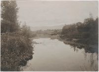
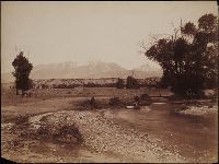
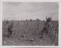
9. Photographs of farmland and scenery in the Bitter Root Valley, Montana [graphic].
- Published / Created:
- ca. 1900.
- Call Number:
- WA Photos 175
- Image Count:
- 16
- Abstract:
- Photographs of trails, rivers, and open farmland in the Bitter Root Valley, including views of Hellgate Canyon in winter, two men floating railroad ties down Lolo Creek, and Mr. O.D. Wheeler and his wife in their camp tent near Ross' Fork
- Description:
- Manuscript captions on mounts.
- Subject (Geographic):
- Montana and Bitterroot River Valley (Mont.)
- Subject (Topic):
- Farms
- Found in:
- Beinecke Rare Book and Manuscript Library > Photographs of farmland and scenery in the Bitter Root Valley, Montana [graphic].