Search
You Searched For
Search Results
- Creator:
- Maury, Matthew Fontaine, 1806-1873
- Published / Created:
- 1849-[1856?]
- Call Number:
- 11cfk 1850A-1
- Container / Volume:
- BRBL_00767
- Image Count:
- 2
- Resource Type:
- Maps, Atlases & Globes
- Found in:
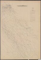
- Beinecke Rare Book and Manuscript Library > Wind and current chart of the North Pacific [cartographic material] / by M.F. Maury, A.M. Lieut. U.S. Navy, Superint'dt. of U.S.N. Observatory ; compiled from materials in the Bureau of Ordnance and Hydrography, Commodore Lewis Warrington ; drawn by P.M. Lardner Gibbon, U.S.N. ; tracks projected by Lieut. A.W. Johnson, U.S. Navy.
- Creator:
- Maury, Matthew Fontaine, 1806-1873
- Published / Created:
- 1849-[1856?]
- Call Number:
- 11cfk 1850A-1
- Container / Volume:
- BRBL_00767
- Image Count:
- 10
- Resource Type:
- Maps, Atlases & Globes
- Found in:
- Beinecke Rare Book and Manuscript Library > Wind and current chart of the North Pacific [cartographic material] / by M.F. Maury, A.M. Lieut. U.S. Navy, Superint'dt. of U.S.N. Observatory ; compiled from materials in the Bureau of Ordnance and Hydrography, Commodore Lewis Warrington ; drawn by P.M. Lardner Gibbon, U.S.N. ; tracks projected by Lieut. A.W. Johnson, U.S. Navy.
- Creator:
- United States. Hydrographic Office
- Published / Created:
- 1854
- Call Number:
- 57 1854
- Container / Volume:
- BRBL_00302
- Image Count:
- 1
- Resource Type:
- Maps, Atlases & Globes
- Found in:
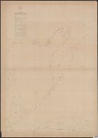
- Beinecke Rare Book and Manuscript Library > Western shore of the Bay of Yedo / surveyed by order of Commodore M.C. Perry U.S.N. by Lieut. Wm. L. Maury and other officers of the Japan Expedition 1854 ; drawn by Edward Sels ; engraved by Selmar Siebert.
- Creator:
- United States. General Land Office
- Published / Created:
- 1879
- Call Number:
- 847 1879
- Container / Volume:
- BRBL_00625
- Image Count:
- 1
- Resource Type:
- Maps, Atlases & Globes
- Found in:
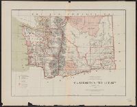
- Beinecke Rare Book and Manuscript Library > Washington Territory / compiled from the official records of the General Land Office and other sources by C. Roeser, Principal Draughtsman, General Land Office.
- Creator:
- Geological Survey of California
- Published / Created:
- 1873
- Call Number:
- 844cbf 1873
- Container / Volume:
- BRBL_00613
- Image Count:
- 2
- Resource Type:
- Maps, Atlases & Globes
- Found in:
- Beinecke Rare Book and Manuscript Library > Topographical map of central California : together with a part of Nevada / C.F. Hoffmann, principal topographer ; V. Wackenreuder, J.T. Gardner, A. Craven, A.D. Wilson, field assistants.
- Creator:
- Geological Survey of California
- Published / Created:
- 1873
- Call Number:
- 844 1873
- Container / Volume:
- BRBL_00602
- Image Count:
- 4
- Resource Type:
- Maps, Atlases & Globes
- Found in:
- Beinecke Rare Book and Manuscript Library > Topographical map of central California : together with a part of Nevada / C.F. Hoffmann, principal topographer ; V. Wackenreuder, J.T. Gardner, A. Craven, A.D. Wilson, field assistants.
- Creator:
- Geographical Surveys West of the 100th Meridian (U.S.)
- Published / Created:
- [1877]
- Call Number:
- 837gfc W27 1877
- Container / Volume:
- BRBL_00595
- Image Count:
- 2
- Resource Type:
- Maps, Atlases & Globes
- Found in:
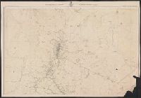
- Beinecke Rare Book and Manuscript Library > Topographical map of Washoe mining region / U.S. Geological Surveys West of the 100th Meridian ; Lieut. T.W. Symons, Dr. F. Kampf, field astronomy & triangulation ; Anton Karl, field topography.
- Creator:
- Viele, Egbert L. (Egbert Ludovicus), 1825-1902
- Published / Created:
- 1874
- Call Number:
- 771 N49 1874
- Container / Volume:
- BRBL_00488
- Image Count:
- 5
- Resource Type:
- Maps, Atlases & Globes
- Found in:
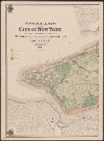
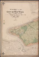
- Beinecke Rare Book and Manuscript Library > Topographical atlas of the City of New York including the annexed territory, showing original water courses and made land / prepared under the direction of Egbert L. Viele ; Eugene Quackenbush ; Julius Bien photo lith.
- Creator:
- Viele, Egbert L. (Egbert Ludovicus), 1825-1902
- Published / Created:
- 1874
- Call Number:
- 771 N49 1874
- Container / Volume:
- BRBL_00488
- Image Count:
- 5
- Resource Type:
- Maps, Atlases & Globes
- Found in:
- Beinecke Rare Book and Manuscript Library > Topographical atlas of the City of New York including the annexed territory, showing original water courses and made land / prepared under the direction of Egbert L. Viele ; Eugene Quackenbush ; Julius Bien photo lith.