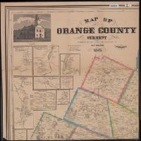
1. Map of Orange County, Vermont / from surveys under the direction of H.F. Walling ; engraved Creator: Walling, Henry Francis, 1825-1888 Published / Created: 1858, c1856. Call Number: 763 Or1 1858 Container / Volume: BRBL_00452 Image Count: 4 Resource Type: Maps, Atlases & Globes Description: 1 map on 4 sheets, each 72 x 71 cm. or smaller. Publisher: Baker & Tilden, Subject (Geographic): Orange County (Vt.)--Maps Subject (Name): Baker & Tilden and H.F. Walling's Map Establishment Subject (Topic): Buildings--Vermont--Orange County--Pictorial works and Real property--Vermont--Orange County--Maps Found in: Beinecke Rare Book and Manuscript Library > Map of Orange County, Vermont / from surveys under the direction of H.F. Walling ; engraved, printed, colored & mounted at H.F. Walling's map establishment.