
You Searched For
1 - 6 of 6
Search Results

1. (IDAHO & WASHINGTON) [Anon.] [Untitled map of northwestern Idaho and northeastern Washington].
- Published / Created:
- undated
- Call Number:
- WA MSS S-2962
- Collection Title:
- Northern Pacific Railway Company maps and drawings
- Container / Volume:
- Box 1 | Map 11
- Image Count:
- 1
- Resource Type:
- Maps, Atlases & Globes
- Subject (Geographic):
- Idaho and Washington (State)
- Subject (Name):
- Northern Pacific Railway Company
- Subject (Topic):
- Railroads
- Found in:
- Beinecke Rare Book and Manuscript Library > (IDAHO & WASHINGTON) [Anon.] [Untitled map of northwestern Idaho and northeastern Washington].

2. (MONTANA & IDAHO) [Anon.] [Untitled map of far northwestern Montana and a part of the Idaho panhandle.]
- Published / Created:
- undated
- Call Number:
- WA MSS S-2962
- Collection Title:
- Northern Pacific Railway Company maps and drawings
- Container / Volume:
- 3 (Roll) | Map 24
- Image Count:
- 1
- Resource Type:
- Maps, Atlases & Globes
- Abstract:
- Map depicting the the region along the Kootenai and Clark Rivers, near the Montana-Idaho border. Lake Pend Oreille, Idaho is a lower left. Routes of the Great Northern and Northern Pacific railroads are shown.
- Description:
- Scale 1/2=1 mile.
- Subject (Geographic):
- Idaho and Montana
- Subject (Name):
- Northern Pacific Railway Company
- Subject (Topic):
- Railroads
- Found in:
- Beinecke Rare Book and Manuscript Library > (MONTANA & IDAHO) [Anon.] [Untitled map of far northwestern Montana and a part of the Idaho panhandle.]

3. (MONTANA) Roberts, E. J. Montana Extension. The Saint Paul, Minneapolis and Manitoba Ry. Co. Scale 12 miles to 1 inch.
- Creator:
- Roberts. E.J
- Published / Created:
- 1887 August
- Call Number:
- WA MSS S-2962
- Collection Title:
- Northern Pacific Railway Company maps and drawings
- Container / Volume:
- Box 1 | Map 33
- Image Count:
- 2
- Resource Type:
- Maps, Atlases & Globes
- Description:
- Scale 12 miles to 1 inch. On verso: "Route map - St. P.M. & M.Ry. Mont. Extn. Minot to Butte ... "
- Subject (Geographic):
- Fort Berthold Indian Reservation (N.D.), Montana, North Dakota, and Yellowstone River (Mont.)
- Subject (Name):
- Northern Pacific Railway Company and St. Paul, Minneapolis & Manitoba Railway Company
- Subject (Topic):
- Railroads
- Found in:
- Beinecke Rare Book and Manuscript Library > (MONTANA) Roberts, E. J. Montana Extension. The Saint Paul, Minneapolis and Manitoba Ry. Co. Scale 12 miles to 1 inch.

4. (MONTANA) [Anon.] Map of a Portion of Montana Territory.
- Published / Created:
- 1886
- Call Number:
- WA MSS S-2962
- Collection Title:
- Northern Pacific Railway Company maps and drawings
- Container / Volume:
- Box 1 | Map 31
- Image Count:
- 1
- Resource Type:
- Maps, Atlases & Globes
- Description:
- Scale 1"=6 miles.
- Subject (Geographic):
- Flathead Lake (Mont.), Missouri River, and Montana
- Subject (Name):
- Northern Pacific Railway Company
- Subject (Topic):
- Railroads
- Found in:
- Beinecke Rare Book and Manuscript Library > (MONTANA) [Anon.] Map of a Portion of Montana Territory.

5. (WASHINGTON) [Anon.] Sketch of Country North of Spokane Wash. Helena Mont.
- Published / Created:
- 1891 September 10
- Call Number:
- WA MSS S-2962
- Collection Title:
- Northern Pacific Railway Company maps and drawings
- Container / Volume:
- Box 1 | Map 40
- Image Count:
- 1
- Resource Type:
- Maps, Atlases & Globes
- Description:
- Scale 1 in. = 2780 ft. Map depicts the city of Spokane, all existing railroad lines, topographical detail, townships, smelters, etc.
- Subject (Geographic):
- Spokane (Wash.) and Washington (State)
- Subject (Name):
- Northern Pacific Railway Company
- Subject (Topic):
- Railroads
- Found in:
- Beinecke Rare Book and Manuscript Library > (WASHINGTON) [Anon.] Sketch of Country North of Spokane Wash. Helena Mont.
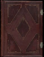
6. Oregon and the Pacific Northwest
- Creator:
- Davidson, I. G. (Isaac Grundy), 1845-1922
- Published / Created:
- ca. 1879.
- Call Number:
- WA Photos 400
- Container / Volume:
- Volume B
- Image Count:
- 44
- Abstract:
- Two versions of a viewbook, each with a different binding, that consist of photographs along the Columbia River, as well as images of Idaho, Oregon, and Washington, created by Isaac Grundy Davidson and compiled by printer George H. Himes, both from Portland, Oregon, ca. 1879. One volume bound in wood and ebony, and the other volume bound in leather. Several images relate to the construction of the Northern Pacific Railroad and to the Oregon Railway and Navigation Company, General overviews of the Columbia River include views of the Lower Cascades and Upper Cascades, as well as a copy photograph from a painting. Views along the Columbia River in Washington include Beacon Rock (referred to as Castle Rock), Gibraltar Rock, Cape Horn, and Cape Disappointment at the mouth of river, as well as a view of Bradford Island in Oregon, Images of Idaho along the Clark Fork River include views of Cabinet Gorge and of the communities of Clark Fork and Cabinet, as well as images of railway construction by the Northern Pacific Railroad Company that consist of a trestle bridge under construction at Clark Fork and railway grading at Big Bluff. Other images of Idaho include the military compound at Fort Coeur d'Alene (which became Fort Sherman), Coeur d'Alene Lake, and locations along the Snake River, Images of Oregon include views of rock formations consisting of Rooster Rock and Twin Rocks; views of waterfalls that include Bridal Veil Falls, Latourell Falls, and Multnomah Falls; views of a train of the Oregon Railway and Navigation Company along the Umatilla River and Crested Butte; views of Meacham Creek and Meacham Creek Canyon; and views of the Oregon cities of Astoria and Portland, Photographs of Washington include several views of the Spokane Falls on the Spokane River; several views of Mount Rainier (identified as Mount Tacoma); overviews of Seattle that show Puget Sound; a view of North Fork Canyon of the Puyallup River; and a view of a railroad trestle near Riparia on the Snake River, and The volume with leather binding includes two additional images that consist of a view of the breakers at Cape Disappointment and a copy photograph of the painting by maritime artist Cleveland Rockwell that depicts of the mouth of the Columbia River
- Description:
- The complete title of the volume is “Oregon and the Pacific Northwest. Glimpses of pretty spots along the valley of the Columbia River from Northern Montana to the Pacific Ocean. Scenery along the line of the Northern Pacific Railroad, showing the new trans-continental route in process of construction.”, The ebony and wood bound volume includes statement on the title page, “Bound in Oregon woods and Alaska cedar, prepared by the Oregon Furniture Manufacturing Company.”, Photographic prints mounted on boards with letterpress captions below each print., Captions in several negatives., and The leather bound volume includes a receipt laid in from the Cadmus Book Shop, New York, to Edward Eberstadt, 1923.
- Subject (Geographic):
- Northwest, Pacific, Astoria (Or.), Beacon Rock (Wash.), Bradford Island (Or.), Bridal Veil Falls (Or.), Cabinet (Idaho), Cape Disappointment State Park (Wash.), Clark Fork (Idaho : Town), Clark Fork (Mont. and Idaho), Coeur d'Alene Lake (Idaho), Columbia River, Fort Sherman (Idaho), Idaho, Latourell Falls (Or.), Meacham Creek (Or.), Meacham Creek Canyon (Or.), Multnomah Falls (Or.), Oregon, Portland (Or.), Puget Sound (Wash.), Puyallup River (Wash.), Rainier, Mount (Wash.), Riparia (Wash.), Seattle (Wash.), Snake River (Wyo.-Wash.), Spokane Falls (Wash. : Waterfall), Umatilla River (Or.), and Washington (State)
- Subject (Name):
- Davidson, I. G. 1845-1922. (Isaac Grundy),, Himes, George H., 1844-1940., Rockwell, Cleveland, 1837-1907., Northern Pacific Railway Company, Oregon Furniture Manufacturing Company., and Oregon Railway and Navigation Company
- Subject (Topic):
- Railroads
- Found in:
- Beinecke Rare Book and Manuscript Library > Oregon and the Pacific Northwest