Search
You Searched For
Search Results
- Creator:
- Lewis, Meriwether, 1774-1809
- Published / Created:
- undated
- Call Number:
- WA MSS 303
- Collection Title:
- Lewis and Clark Expedition maps and receipt, ca. 1803-1810
- Container / Volume:
- Box 1 | Folder 1
- Image Count:
- 2
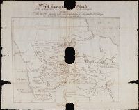
- Alternative Title:
- Topogr[aphical] Sketch of the Missouri
- Description:
- ] Sketch of the Missouri and Upper Mississippi
- Found in:
- Beinecke Rare Book and Manuscript Library > Soulard's Map of 1795
- Creator:
- Clark, William, 1770-1838
- Published / Created:
- [ca. 1814]
- Call Number:
- Zc10 814Le
- Collection Title:
- Missouri : thence across the Rocky mountains and down the river Columbia to the Pacific Ocean ; performed
- Image Count:
- 1
- Resource Type:
- Maps, Atlases & Globes
- Subject (Geographic):
- Missouri River.
- Found in:
- Beinecke Rare Book and Manuscript Library > Fortification
- Creator:
- Clark, William, 1770-1838.
Lewis, Meriwether, 1774-1809
- Published / Created:
- 1805?
- Call Number:
- WA MSS 303
- Collection Title:
- Lewis and Clark Expedition maps and receipt, ca. 1803-1810
- Container / Volume:
- Box 1 | Folder 25v
- Image Count:
- 1
- Found in:
- Beinecke Rare Book and Manuscript Library > Area of the junction of the Medicine (Sun) and Missouri rivers and sketches of the falls of the Missouri, route about June-July 1805
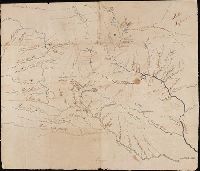
- Creator:
- Clark, William, 1770-1838.
Lewis, Meriwether, 1774-1809
- Published / Created:
- 1805?
- Call Number:
- WA MSS 303
- Collection Title:
- Lewis and Clark Expedition maps and receipt, ca. 1803-1810
- Container / Volume:
- Box 1 | Folder 25r
- Image Count:
- 1
- Found in:
- Beinecke Rare Book and Manuscript Library > Area of the junction of the Musselshell and Missouri rivers, route about May 20, 1805 [and] Sketches of falls of the Missouri, route about June-July 1805
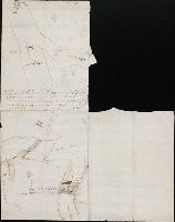
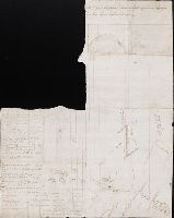
- Creator:
- Lewis, Meriwether, 1774-1809
- Published / Created:
- undated
- Call Number:
- WA MSS 303
- Collection Title:
- Lewis and Clark Expedition maps and receipt, ca. 1803-1810
- Container / Volume:
- Box 1 | Folder 2
- Image Count:
- 2
- Found in:
- Beinecke Rare Book and Manuscript Library > The Upper Mississippi system, and the Missouri system as far as the Mandans
- Creator:
- Clark, William, 1770-1838
Lewis, Samuel, 1753 or 4-1822
- Published / Created:
- [ca. 1814]
- Call Number:
- Zc10 814Le
- Collection Title:
- Missouri : thence across the Rocky mountains and down the river Columbia to the Pacific Ocean ; performed
- Image Count:
- 2
- Resource Type:
- Maps, Atlases & Globes
- Subject (Geographic):
- Missouri River
- Found in:
- Beinecke Rare Book and Manuscript Library > A map of Lewis and Clark's track, across the western portion of North America fom the Mississippi to the Pacific Ocean; by order of the Executive of the United States . In 1804, 5 & 6