Search
You Searched For
Search Results
- Published / Created:
- Undated
- Call Number:
- 1973 Folio 56
- Collection Title:
- The American pilot, containing the navigation of the sea coast of North America, from the Streights
- Image Count:
- 1
- Resource Type:
- Maps, Atlases & Globes
- Found in:
- Beinecke Rare Book and Manuscript Library > A chart of South Carolina and Georgia
- Creator:
- Jefferys, Thomas, d. 1771
- Call Number:
- 1977 Folio 96
- Collection Title:
- The West-India atlas: or, A compendious description of the West-Indies: illustrated with forty
- Image Count:
- 1
- Resource Type:
- Maps, Atlases & Globes
- Found in:
- Beinecke Rare Book and Manuscript Library > Jamaica from the latest surveys; improved and engraved by Thomas Jefferys geographer to the king
- Creator:
- Jefferys, Thomas, d. 1771
- Call Number:
- 1977 Folio 96
- Collection Title:
- The West-India atlas: or, A compendious description of the West-Indies: illustrated with forty
- Image Count:
- 1
- Resource Type:
- Maps, Atlases & Globes
- Found in:
- Beinecke Rare Book and Manuscript Library > South part of St. Domingo, of Hispaniola, by Thos Jeffreys geographer to his Majesty
- Call Number:
- 1977 Folio 78
- Collection Title:
- A New and accurate chart of the West-India Islands and coast, with the gulf passage through the New
- Image Count:
- 1
- Resource Type:
- Maps, Atlases & Globes
- Found in:
- Beinecke Rare Book and Manuscript Library > A plan of Fort St. Louis harbour on the south side of Hispaniola, pl. 31.
- Creator:
- Bennett, John
Sayer, Robert, 1725-1794
- Call Number:
- 1977 Folio 78
- Collection Title:
- A New and accurate chart of the West-India Islands and coast, with the gulf passage through the New
- Image Count:
- 1
- Resource Type:
- Maps, Atlases & Globes
- Found in:
- Beinecke Rare Book and Manuscript Library > A new general chart of the West Indies from the latest marine journals and surveys. Regulated and ascertained by astronomical observations
- Creator:
- Jefferys, Thomas, d. 1771
- Call Number:
- 1977 Folio 96
- Collection Title:
- The West-India atlas: or, A compendious description of the West-Indies: illustrated with forty
- Image Count:
- 1
- Resource Type:
- Maps, Atlases & Globes
- Found in:
- Beinecke Rare Book and Manuscript Library > The harbour of Bluefields.
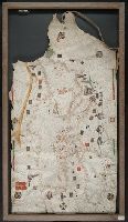
- Creator:
- Roselli, Petrus, active 1446-1468, cartographer
- Published / Created:
- [approximately 1450-1475]
- Call Number:
- Art Storage 49cea 1425
- Image Count:
- 2
- Resource Type:
- cartographic image
- Found in:
- Beinecke Rare Book and Manuscript Library > Portolan chart of the Mediterranean Sea and the Black Sea
- Creator:
- Freducci, Conte di Ottomano, active 1497-1539, cartographer
- Published / Created:
- [1536?]
- Call Number:
- Covers 49 +1536
- Image Count:
- 6
- Resource Type:
- cartographic image
- Found in:
- Beinecke Rare Book and Manuscript Library > Composite atlas of portolan charts produced by Conte di Ottomano Freducci
- Creator:
- Nicolay, Nicolas de, 1517-1583
- Published / Created:
- [1576]
- Call Number:
- Taylor 139
- Collection Title:
- Lart de navigver de M. Pierre de Medine Espagnol : contenant toutes les reigles, secrets
- Image Count:
- 1
- Found in:
- Beinecke Rare Book and Manuscript Library > Novveav monde
- Creator:
- Volčić, Vicko Dimitrije, 1563-1607, cartographer
- Published / Created:
- [1601]
- Call Number:
- Manuscript 49cea 1601
- Image Count:
- 2
- Resource Type:
- cartographic image
- Found in:
- Beinecke Rare Book and Manuscript Library > [Portolan chart of the Mediterranean Sea].