
You Searched For
1 - 27 of 27
Search Results

1. Aiguiade de Port o Rico
- Creator:
- Gibson, J. (John)
- Call Number:
- 1973 Folio 67
- Collection Title:
- The West-India pilot: containing piloting directions for Port Royal and Kingston harbours in
- Image Count:
- 1
- Subject (Geographic):
- Atlantic Ocean --Maps --Early works to 1800, Puerto Rico --Maps --Early works to 1800, and West Indies --Maps --Early works to 1800
- Subject (Topic):
- Harbors --Atlantic Coast (North America) --Maps --Early works to 1800, Nautical charts --Atlantic Coast (North America) --Early works to 1800, Nautical charts --Caribbean Area --Early works to 1800, Nautical charts --West Indies --Early works to 1800, Pilot guides --Atlantic Coast (North America) --Early works to 1800, Pilot guides --Caribbean Area --Early works to 1800, and Pilot guides --West Indies --Early works to 1800
- Collection Created:
- London : Printed for the author and sold by S. Hooper ..., MDCCLXXI [1771]
- Found in:
- Beinecke Rare Book and Manuscript Library > Aiguiade de Port o Rico

2. Chart of the Bay of Honduras
- Call Number:
- 1973 Folio 67
- Collection Title:
- The West-India pilot: containing piloting directions for Port Royal and Kingston harbours in
- Image Count:
- 1
- Subject (Geographic):
- Atlantic Ocean --Maps --Early works to 1800, Central America --Maps --Early works to 1800, and Honduras --Maps
- Subject (Topic):
- Harbors --Atlantic Coast (North America) --Maps --Early works to 1800, Nautical charts --Atlantic Coast (North America) --Early works to 1800, Nautical charts --Caribbean Area --Early works to 1800, Nautical charts --West Indies --Early works to 1800, Pilot guides --Atlantic Coast (North America) --Early works to 1800, Pilot guides --Caribbean Area --Early works to 1800, and Pilot guides --West Indies --Early works to 1800
- Collection Created:
- London : Printed for the author and sold by S. Hooper ..., MDCCLXXI [1771]
- Found in:
- Beinecke Rare Book and Manuscript Library > Chart of the Bay of Honduras

3. Island of Old Providence
- Call Number:
- 1973 Folio 67
- Collection Title:
- The West-India pilot: containing piloting directions for Port Royal and Kingston harbours in
- Image Count:
- 1
- Subject (Geographic):
- Atlantic Ocean --Maps --Early works to 1800, Central America --Maps --Early works to 1800, Providence Island (Colombia) --Maps, and Santa Catalina Island (Colombia)
- Subject (Topic):
- Harbors --Atlantic Coast (North America) --Maps --Early works to 1800, Nautical charts --Atlantic Coast (North America) --Early works to 1800, Nautical charts --Caribbean Area --Early works to 1800, Nautical charts --West Indies --Early works to 1800, Pilot guides --Atlantic Coast (North America) --Early works to 1800, Pilot guides --Caribbean Area --Early works to 1800, and Pilot guides --West Indies --Early works to 1800
- Collection Created:
- London : Printed for the author and sold by S. Hooper ..., MDCCLXXI [1771]
- Found in:
- Beinecke Rare Book and Manuscript Library > Island of Old Providence

4. Plan de la Rade du Port Paix
- Call Number:
- 1973 Folio 67
- Collection Title:
- The West-India pilot: containing piloting directions for Port Royal and Kingston harbours in
- Image Count:
- 1
- Subject (Geographic):
- Atlantic Ocean --Maps --Early works to 1800, Santo Domingo (Dominican Republic) --Maps --Early works to 1800, and West Indies --Maps --Early works to 1800
- Subject (Topic):
- Harbors --Atlantic Coast (North America) --Maps --Early works to 1800, Nautical charts --Atlantic Coast (North America) --Early works to 1800, Nautical charts --Caribbean Area --Early works to 1800, Nautical charts --West Indies --Early works to 1800, Pilot guides --Atlantic Coast (North America) --Early works to 1800, Pilot guides --Caribbean Area --Early works to 1800, and Pilot guides --West Indies --Early works to 1800
- Collection Created:
- London : Printed for the author and sold by S. Hooper ..., MDCCLXXI [1771]
- Found in:
- Beinecke Rare Book and Manuscript Library > Plan de la Rade du Port Paix

5. Plan du Cap Francois
- Call Number:
- 1973 Folio 67
- Collection Title:
- The West-India pilot: containing piloting directions for Port Royal and Kingston harbours in
- Image Count:
- 1
- Subject (Geographic):
- Atlantic Ocean --Maps --Early works to 1800, Cap-Francais (Haiti), and West Indies --Maps --Early works to 1800
- Subject (Topic):
- Harbors --Atlantic Coast (North America) --Maps --Early works to 1800, Nautical charts --Atlantic Coast (North America) --Early works to 1800, Nautical charts --Caribbean Area --Early works to 1800, Nautical charts --West Indies --Early works to 1800, Pilot guides --Atlantic Coast (North America) --Early works to 1800, Pilot guides --Caribbean Area --Early works to 1800, and Pilot guides --West Indies --Early works to 1800
- Collection Created:
- London : Printed for the author and sold by S. Hooper ..., MDCCLXXI [1771]
- Found in:
- Beinecke Rare Book and Manuscript Library > Plan du Cap Francois

6. Plan du cul de sac de Leogane ou le Port au Prince
- Call Number:
- 1973 Folio 67
- Collection Title:
- The West-India pilot: containing piloting directions for Port Royal and Kingston harbours in
- Image Count:
- 1
- Subject (Geographic):
- Atlantic Ocean --Maps --Early works to 1800, Haiti --Maps --Early works to 1800, and West Indies --Maps --Early works to 1800
- Subject (Topic):
- Harbors --Atlantic Coast (North America) --Maps --Early works to 1800, Nautical charts --Atlantic Coast (North America) --Early works to 1800, Nautical charts --Caribbean Area --Early works to 1800, Nautical charts --West Indies --Early works to 1800, Pilot guides --Atlantic Coast (North America) --Early works to 1800, Pilot guides --Caribbean Area --Early works to 1800, and Pilot guides --West Indies --Early works to 1800
- Collection Created:
- London : Printed for the author and sold by S. Hooper ..., MDCCLXXI [1771]
- Found in:
- Beinecke Rare Book and Manuscript Library > Plan du cul de sac de Leogane ou le Port au Prince
7. Plan du port de Gouadaquini now called Jekil Sound in the province of Georgia in North America
- Call Number:
- 1973 Folio 67
- Collection Title:
- The West-India pilot: containing piloting directions for Port Royal and Kingston harbours in
- Image Count:
- 1
- Subject (Geographic):
- Atlantic Ocean --Maps --Early works to 1800, Georgia --Maps --Early works to 1800, Jekyll Island (Ga.) --Maps, and Saint Simons Island (Ga.) --Maps
- Subject (Topic):
- Harbors --Atlantic Coast (North America) --Maps --Early works to 1800, Nautical charts --Atlantic Coast (North America) --Early works to 1800, Nautical charts --Caribbean Area --Early works to 1800, Nautical charts --West Indies --Early works to 1800, Pilot guides --Atlantic Coast (North America) --Early works to 1800, Pilot guides --Caribbean Area --Early works to 1800, and Pilot guides --West Indies --Early works to 1800
- Collection Created:
- London : Printed for the author and sold by S. Hooper ..., MDCCLXXI [1771]
- Found in:
- Beinecke Rare Book and Manuscript Library > Plan du port de Gouadaquini now called Jekil Sound in the province of Georgia in North America
8. Plan of Black River on the Mosquito Shore
- Creator:
- Bowen, Thomas, d. 1790
- Published / Created:
- 1773
- Call Number:
- 1973 Folio 67
- Collection Title:
- The West-India pilot: containing piloting directions for Port Royal and Kingston harbours in
- Image Count:
- 1
- Subject (Geographic):
- Atlantic Ocean --Maps --Early works to 1800, Central America --Maps --Early works to 1800, and Mosquitia (Nicaragua and Honduras) --Maps --Early works to 1800
- Subject (Topic):
- Harbors --Atlantic Coast (North America) --Maps --Early works to 1800, Nautical charts --Atlantic Coast (North America) --Early works to 1800, Nautical charts --Caribbean Area --Early works to 1800, Nautical charts --West Indies --Early works to 1800, Pilot guides --Atlantic Coast (North America) --Early works to 1800, Pilot guides --Caribbean Area --Early works to 1800, and Pilot guides --West Indies --Early works to 1800
- Collection Created:
- London : Printed for the author and sold by S. Hooper ..., MDCCLXXI [1771]
- Found in:
- Beinecke Rare Book and Manuscript Library > Plan of Black River on the Mosquito Shore
9. Plan of Blewfield's Harbour on the island of Jamaica
- Call Number:
- 1973 Folio 67
- Collection Title:
- The West-India pilot: containing piloting directions for Port Royal and Kingston harbours in
- Image Count:
- 1
- Subject (Geographic):
- Atlantic Ocean --Maps --Early works to 1800, Jamaica --Maps --Early works to 1800, and West Indies --Maps --Early works to 1800
- Subject (Topic):
- Harbors --Atlantic Coast (North America) --Maps --Early works to 1800, Nautical charts --Atlantic Coast (North America) --Early works to 1800, Nautical charts --Caribbean Area --Early works to 1800, Nautical charts --West Indies --Early works to 1800, Pilot guides --Atlantic Coast (North America) --Early works to 1800, Pilot guides --Caribbean Area --Early works to 1800, and Pilot guides --West Indies --Early works to 1800
- Collection Created:
- London : Printed for the author and sold by S. Hooper ..., MDCCLXXI [1771]
- Found in:
- Beinecke Rare Book and Manuscript Library > Plan of Blewfield's Harbour on the island of Jamaica
10. Plan of Blewfields Harbour on the Mosquito Shore
- Creator:
- Bowen, Thomas, d. 1790
- Call Number:
- 1973 Folio 67
- Collection Title:
- The West-India pilot: containing piloting directions for Port Royal and Kingston harbours in
- Image Count:
- 1
- Subject (Geographic):
- Atlantic Ocean --Maps --Early works to 1800, Central America --Maps --Early works to 1800, and Mosquitia (Nicaragua and Honduras) --Maps --Early works to 1800
- Subject (Topic):
- Harbors --Atlantic Coast (North America) --Maps --Early works to 1800, Nautical charts --Atlantic Coast (North America) --Early works to 1800, Nautical charts --Caribbean Area --Early works to 1800, Nautical charts --West Indies --Early works to 1800, Pilot guides --Atlantic Coast (North America) --Early works to 1800, Pilot guides --Caribbean Area --Early works to 1800, and Pilot guides --West Indies --Early works to 1800
- Collection Created:
- London : Printed for the author and sold by S. Hooper ..., MDCCLXXI [1771]
- Found in:
- Beinecke Rare Book and Manuscript Library > Plan of Blewfields Harbour on the Mosquito Shore
11. Plan of Cape Nichola Mole at the n.w. end of the island of Hispaniola
- Call Number:
- 1973 Folio 67
- Collection Title:
- The West-India pilot: containing piloting directions for Port Royal and Kingston harbours in
- Image Count:
- 1
- Subject (Geographic):
- Atlantic Ocean --Maps --Early works to 1800, Hispaniola --Maps --Early works to 1800, and West Indies --Maps --Early works to 1800
- Subject (Topic):
- Harbors --Atlantic Coast (North America) --Maps --Early works to 1800, Nautical charts --Atlantic Coast (North America) --Early works to 1800, Nautical charts --Caribbean Area --Early works to 1800, Nautical charts --West Indies --Early works to 1800, Pilot guides --Atlantic Coast (North America) --Early works to 1800, Pilot guides --Caribbean Area --Early works to 1800, and Pilot guides --West Indies --Early works to 1800
- Collection Created:
- London : Printed for the author and sold by S. Hooper ..., MDCCLXXI [1771]
- Found in:
- Beinecke Rare Book and Manuscript Library > Plan of Cape Nichola Mole at the n.w. end of the island of Hispaniola
12. Plan of Carthagena Harbour and city
- Creator:
- Bayly, J
- Published / Created:
- 1771
- Call Number:
- 1973 Folio 67
- Collection Title:
- The West-India pilot: containing piloting directions for Port Royal and Kingston harbours in
- Image Count:
- 1
- Subject (Geographic):
- Atlantic Ocean --Maps --Early works to 1800, Cartagena (Colombia) --Maps, Central America --Maps --Early works to 1800, and Colombia --Maps --Early works to 1800
- Subject (Topic):
- Harbors --Atlantic Coast (North America) --Maps --Early works to 1800, Nautical charts --Atlantic Coast (North America) --Early works to 1800, Nautical charts --Caribbean Area --Early works to 1800, Nautical charts --West Indies --Early works to 1800, Pilot guides --Atlantic Coast (North America) --Early works to 1800, Pilot guides --Caribbean Area --Early works to 1800, and Pilot guides --West Indies --Early works to 1800
- Collection Created:
- London : Printed for the author and sold by S. Hooper ..., MDCCLXXI [1771]
- Found in:
- Beinecke Rare Book and Manuscript Library > Plan of Carthagena Harbour and city
13. Plan of Lucia Harbour on the north side of Jamaica
- Call Number:
- 1973 Folio 67
- Collection Title:
- The West-India pilot: containing piloting directions for Port Royal and Kingston harbours in
- Image Count:
- 1
- Subject (Geographic):
- Atlantic Ocean --Maps --Early works to 1800, Jamaica --Maps --Early works to 1800, and West Indies --Maps --Early works to 1800
- Subject (Topic):
- Harbors --Atlantic Coast (North America) --Maps --Early works to 1800, Nautical charts --Atlantic Coast (North America) --Early works to 1800, Nautical charts --Caribbean Area --Early works to 1800, Nautical charts --West Indies --Early works to 1800, Pilot guides --Atlantic Coast (North America) --Early works to 1800, Pilot guides --Caribbean Area --Early works to 1800, and Pilot guides --West Indies --Early works to 1800
- Collection Created:
- London : Printed for the author and sold by S. Hooper ..., MDCCLXXI [1771]
- Found in:
- Beinecke Rare Book and Manuscript Library > Plan of Lucia Harbour on the north side of Jamaica
14. Plan of Mantica Bay on the north side of Jamaica
- Call Number:
- 1973 Folio 67
- Collection Title:
- The West-India pilot: containing piloting directions for Port Royal and Kingston harbours in
- Image Count:
- 1
- Subject (Geographic):
- Atlantic Ocean --Maps --Early works to 1800, Jamaica --Maps --Early works to 1800, and West Indies --Maps --Early works to 1800
- Subject (Topic):
- Harbors --Atlantic Coast (North America) --Maps --Early works to 1800, Nautical charts --Atlantic Coast (North America) --Early works to 1800, Nautical charts --Caribbean Area --Early works to 1800, Nautical charts --West Indies --Early works to 1800, Pilot guides --Atlantic Coast (North America) --Early works to 1800, Pilot guides --Caribbean Area --Early works to 1800, and Pilot guides --West Indies --Early works to 1800
- Collection Created:
- London : Printed for the author and sold by S. Hooper ..., MDCCLXXI [1771]
- Found in:
- Beinecke Rare Book and Manuscript Library > Plan of Mantica Bay on the north side of Jamaica
15. Plan of Port Antonio on the north-east side of Jamaica
- Call Number:
- 1973 Folio 67
- Collection Title:
- The West-India pilot: containing piloting directions for Port Royal and Kingston harbours in
- Image Count:
- 1
- Subject (Geographic):
- Atlantic Ocean --Maps --Early works to 1800, Jamaica --Maps --Early works to 1800, and West Indies --Maps --Early works to 1800
- Subject (Topic):
- Harbors --Atlantic Coast (North America) --Maps --Early works to 1800, Nautical charts --Atlantic Coast (North America) --Early works to 1800, Nautical charts --Caribbean Area --Early works to 1800, Nautical charts --West Indies --Early works to 1800, Pilot guides --Atlantic Coast (North America) --Early works to 1800, Pilot guides --Caribbean Area --Early works to 1800, and Pilot guides --West Indies --Early works to 1800
- Collection Created:
- London : Printed for the author and sold by S. Hooper ..., MDCCLXXI [1771]
- Found in:
- Beinecke Rare Book and Manuscript Library > Plan of Port Antonio on the north-east side of Jamaica
16. Plan of Port Royal harbour Rattan
- Call Number:
- 1973 Folio 67
- Collection Title:
- The West-India pilot: containing piloting directions for Port Royal and Kingston harbours in
- Image Count:
- 1
- Subject (Geographic):
- Atlantic Ocean --Maps --Early works to 1800, Jamaica --Maps --Early works to 1800, and West Indies --Maps --Early works to 1800
- Subject (Topic):
- Harbors --Atlantic Coast (North America) --Maps --Early works to 1800, Nautical charts --Atlantic Coast (North America) --Early works to 1800, Nautical charts --Caribbean Area --Early works to 1800, Nautical charts --West Indies --Early works to 1800, Pilot guides --Atlantic Coast (North America) --Early works to 1800, Pilot guides --Caribbean Area --Early works to 1800, and Pilot guides --West Indies --Early works to 1800
- Collection Created:
- London : Printed for the author and sold by S. Hooper ..., MDCCLXXI [1771]
- Found in:
- Beinecke Rare Book and Manuscript Library > Plan of Port Royal harbour Rattan
17. Plan of Vera Cruz
- Creator:
- Gibson, J. (John)
- Call Number:
- 1973 Folio 67
- Collection Title:
- The West-India pilot: containing piloting directions for Port Royal and Kingston harbours in
- Image Count:
- 1
- Subject (Geographic):
- Atlantic Ocean --Maps --Early works to 1800, Mexico, Gulf of --Maps --Early works to 1800, and Veracruz-Llave (Mexico : State) --Maps
- Subject (Topic):
- Harbors --Atlantic Coast (North America) --Maps --Early works to 1800, Nautical charts --Atlantic Coast (North America) --Early works to 1800, Nautical charts --Caribbean Area --Early works to 1800, Nautical charts --West Indies --Early works to 1800, Pilot guides --Atlantic Coast (North America) --Early works to 1800, Pilot guides --Caribbean Area --Early works to 1800, and Pilot guides --West Indies --Early works to 1800
- Collection Created:
- London : Printed for the author and sold by S. Hooper ..., MDCCLXXI [1771]
- Found in:
- Beinecke Rare Book and Manuscript Library > Plan of Vera Cruz
18. Plan of port of St. Fernando de Omoa near Honduras
- Call Number:
- 1973 Folio 67
- Collection Title:
- The West-India pilot: containing piloting directions for Port Royal and Kingston harbours in
- Image Count:
- 1
- Subject (Geographic):
- Atlantic Ocean --Maps --Early works to 1800, Central America --Maps --Early works to 1800, and Honduras --Maps
- Subject (Topic):
- Harbors --Atlantic Coast (North America) --Maps --Early works to 1800, Nautical charts --Atlantic Coast (North America) --Early works to 1800, Nautical charts --Caribbean Area --Early works to 1800, Nautical charts --West Indies --Early works to 1800, Pilot guides --Atlantic Coast (North America) --Early works to 1800, Pilot guides --Caribbean Area --Early works to 1800, and Pilot guides --West Indies --Early works to 1800
- Collection Created:
- London : Printed for the author and sold by S. Hooper ..., MDCCLXXI [1771]
- Found in:
- Beinecke Rare Book and Manuscript Library > Plan of port of St. Fernando de Omoa near Honduras
19. Plan of the Bay of Matanzas
- Creator:
- Gibson, J. (John)
- Call Number:
- 1973 Folio 67
- Collection Title:
- The West-India pilot: containing piloting directions for Port Royal and Kingston harbours in
- Image Count:
- 1
- Subject (Geographic):
- Atlantic Ocean --Maps --Early works to 1800, Cuba --Maps --Early works to 1800, Matanzas Bay (Cuba) --Maps --Early works to 1800, and West Indies --Maps --Early works to 1800
- Subject (Topic):
- Harbors --Atlantic Coast (North America) --Maps --Early works to 1800, Nautical charts --Atlantic Coast (North America) --Early works to 1800, Nautical charts --Caribbean Area --Early works to 1800, Nautical charts --West Indies --Early works to 1800, Pilot guides --Atlantic Coast (North America) --Early works to 1800, Pilot guides --Caribbean Area --Early works to 1800, and Pilot guides --West Indies --Early works to 1800
- Collection Created:
- London : Printed for the author and sold by S. Hooper ..., MDCCLXXI [1771]
- Found in:
- Beinecke Rare Book and Manuscript Library > Plan of the Bay of Matanzas
20. Plan of the entrance into Cape Fear harbour, North Carolina
- Call Number:
- 1973 Folio 67
- Collection Title:
- The West-India pilot: containing piloting directions for Port Royal and Kingston harbours in
- Image Count:
- 1
- Subject (Geographic):
- Atlantic Ocean --Maps --Early works to 1800, Fear, Cape (N.C.) --Maps, and North Carolina --Maps --Early works to 1800
- Subject (Topic):
- Harbors --Atlantic Coast (North America) --Maps --Early works to 1800, Nautical charts --Atlantic Coast (North America) --Early works to 1800, Nautical charts --Caribbean Area --Early works to 1800, Nautical charts --West Indies --Early works to 1800, Pilot guides --Atlantic Coast (North America) --Early works to 1800, Pilot guides --Caribbean Area --Early works to 1800, and Pilot guides --West Indies --Early works to 1800
- Collection Created:
- London : Printed for the author and sold by S. Hooper ..., MDCCLXXI [1771]
- Found in:
- Beinecke Rare Book and Manuscript Library > Plan of the entrance into Cape Fear harbour, North Carolina
21. Plan of the fortification now finishing in the port of St. Fernando de Omoa
- Creator:
- Bayly, J
- Call Number:
- 1973 Folio 67
- Collection Title:
- The West-India pilot: containing piloting directions for Port Royal and Kingston harbours in
- Image Count:
- 1
- Subject (Geographic):
- Atlantic Ocean --Maps --Early works to 1800, Central America --Maps --Early works to 1800, and Honduras --Maps
- Subject (Topic):
- Harbors --Atlantic Coast (North America) --Maps --Early works to 1800, Nautical charts --Atlantic Coast (North America) --Early works to 1800, Nautical charts --Caribbean Area --Early works to 1800, Nautical charts --West Indies --Early works to 1800, Pilot guides --Atlantic Coast (North America) --Early works to 1800, Pilot guides --Caribbean Area --Early works to 1800, and Pilot guides --West Indies --Early works to 1800
- Collection Created:
- London : Printed for the author and sold by S. Hooper ..., MDCCLXXI [1771]
- Found in:
- Beinecke Rare Book and Manuscript Library > Plan of the fortification now finishing in the port of St. Fernando de Omoa
22. Plan of the harbour and city of Havanah
- Creator:
- Bayly, J
- Call Number:
- 1973 Folio 67
- Collection Title:
- The West-India pilot: containing piloting directions for Port Royal and Kingston harbours in
- Image Count:
- 1
- Subject (Geographic):
- Atlantic Ocean --Maps --Early works to 1800, Cuba --Maps --Early works to 1800, Havana (Cuba) --Maps --Early works to 1800, and West Indies --Maps --Early works to 1800
- Subject (Topic):
- Harbors --Atlantic Coast (North America) --Maps --Early works to 1800, Nautical charts --Atlantic Coast (North America) --Early works to 1800, Nautical charts --Caribbean Area --Early works to 1800, Nautical charts --West Indies --Early works to 1800, Pilot guides --Atlantic Coast (North America) --Early works to 1800, Pilot guides --Caribbean Area --Early works to 1800, and Pilot guides --West Indies --Early works to 1800
- Collection Created:
- London : Printed for the author and sold by S. Hooper ..., MDCCLXXI [1771]
- Found in:
- Beinecke Rare Book and Manuscript Library > Plan of the harbour and city of Havanah
23. Plan of the harbour of Port Royal in the island of Jamaica
- Call Number:
- 1973 Folio 67
- Collection Title:
- The West-India pilot: containing piloting directions for Port Royal and Kingston harbours in
- Image Count:
- 1
- Subject (Geographic):
- Atlantic Ocean --Maps --Early works to 1800, Jamaica --Maps --Early works to 1800, and West Indies --Maps --Early works to 1800
- Subject (Topic):
- Harbors --Atlantic Coast (North America) --Maps --Early works to 1800, Nautical charts --Atlantic Coast (North America) --Early works to 1800, Nautical charts --Caribbean Area --Early works to 1800, Nautical charts --West Indies --Early works to 1800, Pilot guides --Atlantic Coast (North America) --Early works to 1800, Pilot guides --Caribbean Area --Early works to 1800, and Pilot guides --West Indies --Early works to 1800
- Collection Created:
- London : Printed for the author and sold by S. Hooper ..., MDCCLXXI [1771]
- Found in:
- Beinecke Rare Book and Manuscript Library > Plan of the harbour of Port Royal in the island of Jamaica
24. Plan of the harbour of St. Juan de Port o Rico
- Creator:
- Gibson, J. (John)
- Call Number:
- 1973 Folio 67
- Collection Title:
- The West-India pilot: containing piloting directions for Port Royal and Kingston harbours in
- Image Count:
- 1
- Subject (Geographic):
- Atlantic Ocean --Maps --Early works to 1800, Puerto Rico --Maps --Early works to 1800, and West Indies --Maps --Early works to 1800
- Subject (Topic):
- Harbors --Atlantic Coast (North America) --Maps --Early works to 1800, Nautical charts --Atlantic Coast (North America) --Early works to 1800, Nautical charts --Caribbean Area --Early works to 1800, Nautical charts --West Indies --Early works to 1800, Pilot guides --Atlantic Coast (North America) --Early works to 1800, Pilot guides --Caribbean Area --Early works to 1800, and Pilot guides --West Indies --Early works to 1800
- Collection Created:
- London : Printed for the author and sold by S. Hooper ..., MDCCLXXI [1771]
- Found in:
- Beinecke Rare Book and Manuscript Library > Plan of the harbour of St. Juan de Port o Rico
25. Plan of the town harbour of Puerto Vello
- Creator:
- Gibson, J. (John)
- Call Number:
- 1973 Folio 67
- Collection Title:
- The West-India pilot: containing piloting directions for Port Royal and Kingston harbours in
- Image Count:
- 1
- Subject (Geographic):
- Atlantic Ocean --Maps --Early works to 1800 and Panama --Maps --Early works to 1800
- Subject (Topic):
- Harbors --Atlantic Coast (North America) --Maps --Early works to 1800, Nautical charts --Atlantic Coast (North America) --Early works to 1800, Nautical charts --Caribbean Area --Early works to 1800, Nautical charts --West Indies --Early works to 1800, Pilot guides --Atlantic Coast (North America) --Early works to 1800, Pilot guides --Caribbean Area --Early works to 1800, and Pilot guides --West Indies --Early works to 1800
- Collection Created:
- London : Printed for the author and sold by S. Hooper ..., MDCCLXXI [1771]
- Found in:
- Beinecke Rare Book and Manuscript Library > Plan of the town harbour of Puerto Vello
26. References for the plan of the city and suburbs of Carthagena
- Creator:
- Gibson, J. (John)
- Call Number:
- 1973 Folio 67
- Collection Title:
- The West-India pilot: containing piloting directions for Port Royal and Kingston harbours in
- Image Count:
- 1
- Subject (Geographic):
- Atlantic Ocean --Maps --Early works to 1800 and Cartagena (Colombia) --Maps
- Subject (Topic):
- Harbors --Atlantic Coast (North America) --Maps --Early works to 1800, Nautical charts --Atlantic Coast (North America) --Early works to 1800, Nautical charts --Caribbean Area --Early works to 1800, Nautical charts --West Indies --Early works to 1800, Pilot guides --Atlantic Coast (North America) --Early works to 1800, Pilot guides --Caribbean Area --Early works to 1800, and Pilot guides --West Indies --Early works to 1800
- Collection Created:
- London : Printed for the author and sold by S. Hooper ..., MDCCLXXI [1771]
- Found in:
- Beinecke Rare Book and Manuscript Library > References for the plan of the city and suburbs of Carthagena
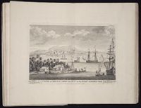
27. View of Truxillo Bay and city on the coast of Honduras
- Creator:
- Bowen, Thomas, d. 1790
- Published / Created:
- 1774 September 6
- Call Number:
- 1973 Folio 67
- Collection Title:
- The West-India pilot: containing piloting directions for Port Royal and Kingston harbours in
- Image Count:
- 1
- Subject (Geographic):
- Atlantic Ocean --Maps --Early works to 1800, Central America --Maps --Early works to 1800, and Honduras --Maps
- Subject (Topic):
- Harbors --Atlantic Coast (North America) --Maps --Early works to 1800, Nautical charts --Atlantic Coast (North America) --Early works to 1800, Nautical charts --Caribbean Area --Early works to 1800, Nautical charts --West Indies --Early works to 1800, Pilot guides --Atlantic Coast (North America) --Early works to 1800, Pilot guides --Caribbean Area --Early works to 1800, and Pilot guides --West Indies --Early works to 1800
- Collection Created:
- London : Printed for the author and sold by S. Hooper ..., MDCCLXXI [1771]
- Found in:
- Beinecke Rare Book and Manuscript Library > View of Truxillo Bay and city on the coast of Honduras