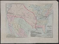
1. Map of the American colonies and adjacent country as known in 1776 / compiled by permission of the Creator: Asher & Adams Published / Created: [1875] Call Number: 71 1776E Container / Volume: BRBL_00687 Image Count: 1 Resource Type: Maps, Atlases & Globes Found in: Beinecke Rare Book and Manuscript Library > Map of the American colonies and adjacent country as known in 1776 / compiled by permission of the American Geographical Society, New York from works in their possession and presented to its patrons by the Baltimore and Ohio Railroad Co. ; drawn, engraved
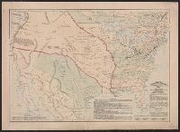
2. Map of the American colonies and adjacent country as known in 1776 / compiled by permission of the Creator: Asher & Adams Published / Created: [1875?] Call Number: 71 1776F Container / Volume: BRBL_00365 Image Count: 1 Resource Type: Maps, Atlases & Globes Found in: Beinecke Rare Book and Manuscript Library > Map of the American colonies and adjacent country as known in 1776 / compiled by permission of the American Geographical Society, New York from works in their possession and presented to its patrons by the Baltimore and Ohio Railroad Co. ; drawn, engraved
3. Map of the American colonies and adjacent country as known in 1776 / compiled by permission of the Creator: Asher & Adams Published / Created: [1875] Call Number: 71 1776E Container / Volume: BRBL_00365 Image Count: 1 Resource Type: Maps, Atlases & Globes Found in: Beinecke Rare Book and Manuscript Library > Map of the American colonies and adjacent country as known in 1776 / compiled by permission of the American Geographical Society, New York from works in their possession and presented to its patrons by the Baltimore and Ohio Railroad Co. ; drawn, engraved