Skip to search
Skip to main content
Skip to first result
Search
You Searched For
Subject (Topic)
Railroads--Pennsylvania--Maps
Search Results
Published / Created:
1857
Call Number:
774 1857
Container / Volume:
BRBL_00498
Image Count:
1
Resource Type:
Maps, Atlases & Globes
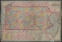
Description:
Counties differentiated by color.
Publisher:
R.L. Barnes, no. 7 Hart's building, Sixth Street, above Chestnut,
Subject (Geographic):
New Jersey--Maps and Pennsylvania--Maps
Subject (Name):
Barnes, Rufus L
Subject (Topic):
Maps shelf, Railroads--New Jersey--Maps, and Railroads--Pennsylvania--Maps
Found in:
Beinecke Rare Book and Manuscript Library > A new county map of Pennsylvania and adjoining states showing the route of the rail roads, &c.
Creator:
Published / Created:
[1910?]
Call Number:
754gme 1910A
Container / Volume:
BRBL_00420
Image Count:
1
Resource Type:
Maps, Atlases & Globes
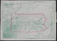
Description:
Includes mileage charts of railways.
Publisher:
The Company,
Subject (Name):
Buffalo, Rochester, and Pittsburgh Railway Company and Buffalo, Rochester, and Pittsburgh Railway Company--Maps
Subject (Topic):
Railroads--New York (State)--Maps and Railroads--Pennsylvania--Maps
Found in:
Beinecke Rare Book and Manuscript Library > Buffalo, Rochester and Pittsburgh Railway and connections / Rand McNally & Co.
Creator:
Published / Created:
1867
Call Number:
774G 1867
Container / Volume:
BRBL_00501
Image Count:
1
Resource Type:
Maps, Atlases & Globes
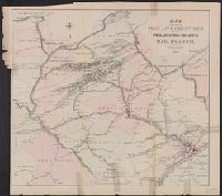
Description:
Shows coal and oil regions from Lake Ontario through much of West Virginia; most of New York State is shown, though without geological detail. Also shows locations of steel works, foundries, etc.
Publisher:
Jacob Haehnlen [lithographer],
Subject (Geographic):
Pennsylvania--Maps
Subject (Topic):
Canals--Pennsylvania--Maps, Coal--Pennsylvania--Maps, Iron industry and trade--Pennsylvania--Maps, and Railroads--Pennsylvania--Maps
Found in:
Beinecke Rare Book and Manuscript Library > Iron, railroad, canal and coal map of Pennsylvania, &c. : showing the relative position of the various anthracite and bituminous coal fields, the railroads, canals and navigable waters by which they are connected forming their respective avenues to market
Creator:
Published / Created:
1876
Call Number:
774gme 1876
Container / Volume:
BRBL_00501A
Image Count:
1
Resource Type:
Maps, Atlases & Globes
Publisher:
The Company],
Subject (Geographic):
Pennsylvania--Maps
Subject (Name):
Philadelphia & Reading Railroad Co
Subject (Topic):
Railroads--Pennsylvania--Maps
Found in:
Beinecke Rare Book and Manuscript Library > Map showing the main line and branches of the Philadelphia and Reading Rail Road Co. / Wm. Lorenz, chf. engr., March 1st, 1876.
Creator:
Published / Created:
1918
Call Number:
774 1918
Container / Volume:
BRBL_00498
Image Count:
2
Resource Type:
Maps, Atlases & Globes
Alternative Title:
Pennsylvania automobile road map.
Description:
Includes indexes.
Publisher:
Rand McNally & Co.,
Subject (Geographic):
Pennsylvania--Maps
Subject (Topic):
Railroads--Pennsylvania--Maps and Roads--Pennsylvania--Maps
Found in:
Beinecke Rare Book and Manuscript Library > The Rand McNally new commercial atlas map of Pennsylvania ; Pennsylvania automobile road map.